Posted on — Leave a comment

How Traditional Ecological Knowledge Is Transforming Climate Action and Restoring Indigenous Lands

The following blog post is a summary of the article “When Indigenous Knowledge and Climate Science Meet, Good Things Happen” by Katie O’Reilly, published in Sierra magazine on March 17, 2026. To read the original article, click here. To access the second volume of the Status of Tribes and Climate Change Report, click here.
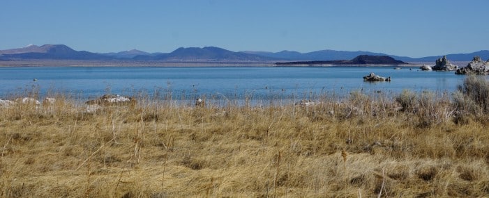
Mono Lake in California is home to the Mono Lake Kutzadika’a Tribe and is facing strain due to the City of Los Angeles draining the basin for water. Photograph courtesy of Ashley Gries and the Status of Tribes and Climate Change Report Volume 2.

Mike Durglo Jr. is the climate coordinator for the Confederated Salish and Kootenai Tribes (CSKT) in Montana, and has deep personal and historical connections to the land. His memories of visiting his grandparents and hearing his father speak fluent Salish are tied to a deeper history shaped by federal policies. The General Allotment Act of 1887 disrupted Indigenous land stewardship by dividing tribal lands and opening them to outside settlement. This led to a loss of both land and essential resources, including the tribes’ bison herds, which had sustained them culturally and physically. In 2022, a major step toward restoration occurred when management of the bison range was returned to the Confederated Salish and Kootenai Tribes. Today, the land now known as the CSKT Bison Range once again supports thriving populations of bison and other wildlife, symbolizing both ecological and cultural renewal.
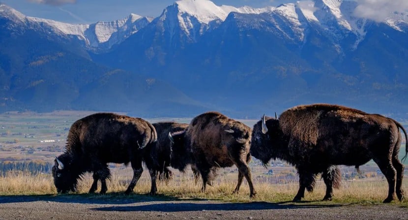
Bison grazing in the CSKT Bison Range in Montana. Photograph courtesy of Matthew Hamon and Sierra magazine.

Tribal leaders are combining traditional ecological knowledge, or TEK, with modern climatology to address environmental challenges and climate change. This knowledge system is rooted in generations of close observation and emphasizes a relationship with nature based on respect and reciprocity. Rather than treating the environment as a resource to control, it is regarded as a living relative that requires care and balance. This perspective informs decisions about wildlife management, habitat restoration, and sustainable harvesting. Efforts have included restoring species such as trumpeter swans and peregrine falcons, as well as actively managing key animals and ecosystems. Technological tools, including a solar powered mesonet station, support these efforts by providing data that guide forest management, biodiversity initiatives, and climate adaptation strategies.

The development of climate action plans within the tribes reflects a blend of elder wisdom and scientific collaboration. Durglo worked with elders who shared insights about environmental changes, including the shifting conditions for traditional plants. These perspectives shaped strategies that honor both cultural values and ecological realities. Collaboration with other Indigenous nations and institutions has expanded the reach of these approaches, highlighting the importance of community and spiritual relationships in climate work. National recognition has grown through reports that document Indigenous contributions, including practices like cultural burning that enhance resilience and biodiversity. Efforts to integrate traditional ecological knowledge into federal policy further demonstrate its value, as seen in a Department of the Interior handbook that aligns Indigenous and Western methods. This integration reflects a broader vision of cooperation, where different knowledge systems work together to navigate shared environmental challenges.

#TraditionalEcologicalKnowledge #TEK #IndigenousWisdom #STACCReport #ClimateAction #LandStewardship #Sustainability #WetlandWednesday #TheSwampSchool
Posted on — Leave a comment

North Carolina’s Weird and Wonderful: Carolina Gopher Frog

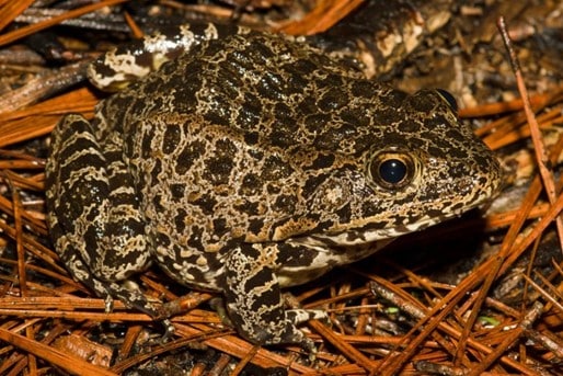
Adult Carolina gopher frog, Lithobates capito. Photograph courtesy of Kevin Stohlgren and Herps of NC.

As another April comes to a close, so does another Frog Month celebration. While Frog Month celebrates frogs and toads all around the world, it’s time to bring the celebration back to North Carolina. Therefore, it is only fitting that this month’s edition of North Carolina’s Weird and Wonderful feature an amphibian: the Carolina Gopher Frog, Lithobates capito. This incredibly secretive frog is hard to find in the wild and, in North Carolina, only occurs in the Sandhills and southeastern Coastal Plain. While it shares many physical traits with toads, gopher frogs are considered members of the “true frog” group, Lithobates. This species varies in coloration, ranging from pale gray or tan to even nearly black with many dark spots.

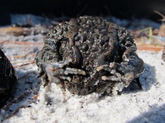
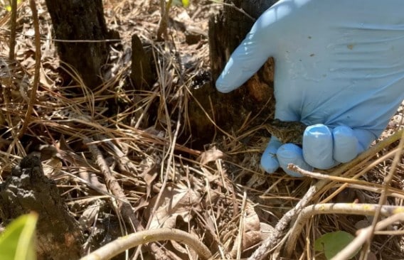
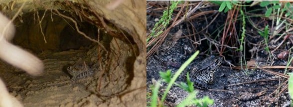
A gopher frog in a gopher tortoise burrow on the left, and a gopher frog resting in front of a stump hole on the right. Left photograph courtesy of Jonathan Mays, right photograph courtesy of Charles Dymock, and both photos courtesy of the Gopher Tortoise Council.

Gopher frogs (or Carolina Gopher frogs, as they’re known here in NC) are rare amphibians to come across. Pine savannas with sandy soils, especially turkey oak-longleaf pine plant communities, are their preferred habitat. Part of what makes this particular ecosystem such a great place for gopher frogs is that it is host to ephemeral ponds from the winter through spring. As these vernal pools are temporary and not connected to other water bodies, they do not contain fish, and thus are perfect, predator-free places in which gopher frogs can breed and lay eggs. The other aspect of pine savannas that makes them the perfect habitat for gopher frogs is the sandy soil, which is great for burrowing. Gopher frogs get their name from the fact that they are fossorial, meaning they live underground. In South Carolina and points south, they inhabit the burrows of gopher tortoises, which also inhabit turkey oak-longleaf pine savanna plant communities further south. In North Carolina, though, gopher tortoises are not present, so our gopher frogs make do with stump holes, crayfish burrows, and burrows made by other animals. 

A gopher frog exhibiting defensive posturing. Photograph courtesy of the Gopher Tortoise Council.

Part of what makes gopher frogs so weird and wonderful is their terrestrial behavior: they only enter water to breed. Thus, their physical attributes are more toad-like to accommodate a less-watery lifestyle: drier skin and prominent warts. The dry skin helps hold in moisture, which is crucial for a fossorial amphibian. When threatened, gopher frogs arch their backs and cover their face with their hands. Researchers hypothesize that this is to protect their face while exposing the toxins that they secrete from their warts. These toxins make them an unpleasant snack for predators that may otherwise be tempted to eat them. While not seen very often, they can be heard calling during the breeding season, which is from mid-February through mid-April. The call is a deep snore or growl, and gopher frogs sometimes emit calls while fully submerged underwater. 

A juvenile gopher frog, raised in a head start program, released into the wild. Photograph courtesy of Gena Lyons and the U.S. Fish and Wildlife Service.

Unfortunately, gopher frogs are threatened or endangered throughout their entire southeastern range. This is due primarily to the destruction of their habitat due to agricultural and development pressures in the region. In addition, severe droughts result in ephemeral pools either not lasting for the full breeding season or not forming at all, denying gopher frogs places to breed. But all is not lost: federal, state, and private organizations, including the U.S. Fish and Wildlife Service, North Carolina Wildlife Resources Commission, North Carolina Aquariums, and the Amphibian Foundation, to name a few, have formed head start programs for gopher frogs. In these programs, gopher frogs are raised from the egg stage to froglet and then released into the habitat their ancestors were collected from, or into brand-new wetland habitat constructed especially for them. Individuals can help by working to conserve turkey oak-longleaf pine savanna habitat and to restore habitat that has been lost. The next time you find yourself in the pine savannas of the southeastern coastal plain, keep your eyes peeled for crayfish burrows and stump holes. You never know, there may be a gopher frog or two hanging out below ground. 

#EarthDay #FrogMonth #CarolinaGopherFrog #AmphibianHeadStartPrograms #USFWS #NCWRC #NCAquariums #AmphibianFoundation #WetlandWednesday #NCWeirdandWonderful #TheSwampSchool

Posted on — Leave a comment

How Trees Built Stronger Communities: The Story of Tree City USA

To learn more about how Tree City USA has been evolving and changing communities for good, check out the Arbor Day Foundation’s article celebrating the fifty-year milestone.

On this Earth Day, we’re looking back in time to 1976, which was a banner year for our country, as the United States celebrated its 200th anniversary. It was also a good year for our nation’s trees. Why? Because the Arbor Day Foundation, in partnership with the U.S. Forest Service and the National Association of State Foresters, launched the Tree City USA program. This program had one goal: to raise awareness about the value of community trees. In doing so, the Arbor Day Foundation felt that this would improve the health of communities of all sizes and bring people together. Fifty years later, what started in 42 cities and towns in 16 states has spread to all fifty states, with 48% of the U.S. population living in a designated Tree City. 

To become a Tree City, you need four things: a dedicated tree board or department, an ordinance for tree care, annual funds set aside for tree maintenance, and a city-wide Arbor Day observance. These four cornerstones ensure that a community’s commitment to its trees doesn’t simply fizzle out, but is continuous over time. This is important, because research has shown that the more trees a city or town has, the cooler the local air temperatures are. Incorporating more tree canopy can offset the warming effect buildings and paved surfaces have. In addition, trees are great stormwater infrastructure assets: they store large amounts of water in their tissues; slow rainfall down by intercepting raindrops as they fall; and stabilize the soil, preventing soil runoff and increasing groundwater recharge. Finally, Tree Cities across the country report an increase in community engagement: locals coming out to participate in tree plantings, support regular tree maintenance, and engage with educational opportunities about trees. Patrick Hayes, Parks & Recreation Superintendent for the City of Clay Center in Kansas, says that being a Tree City “has created a sense of pride and care for the community that you can see as you pass through our town.” 

The Tree City USA program is growing: today, there are 3,587 Tree Cities, with applications being accepted by the Arbor Day Foundation every fall and winter. Towns and cities that want to apply must meet all four of the cornerstones through activities that they organize and complete between January 1st and December 31st. The Arbor Day Foundation hopes that, as more people realize trees contribute more than aesthetic value to their community, more communities will take the plunge and decide to join the ranks of Tree City USA. 

#EarthDay #TreeCityUSA #UrbanForestry #CommunityTrees #GreenCities #WetlandWednesday #TheSwampSchool

Posted on — Leave a comment

Phase 1 ESA ASTM E1527-21 v. ASTM E2247-23: What’s the difference?

ASTM standards play a central role in environmental due diligence, and two of the most important in the Phase I Environmental Site Assessment (ESA) landscape are ASTM E1527-21 and ASTM E2247-23. While both standards are designed to support environmental risk evaluation and protect stakeholders in real estate transactions, they serve different purposes and audiences. Understanding their differences is essential for students and professionals looking to build a well-rounded foundation in environmental assessment. 

ASTM E1527-21 is the current standard practice for conducting Phase I ESAs to satisfy the requirements of the All Appropriate Inquiries (AAI) rule under CERCLA, the Comprehensive Environmental Response, Compensation, and Liability Act, also known as Superfund. In practical terms, it is the gold standard for evaluating potential environmental contamination on commercial properties. The standard emphasizes identifying Recognized Environmental Conditions (RECs), along with Controlled RECs (CRECs) and Historical RECs (HRECs). These defined terms provide a structured framework for categorizing environmental risks. The process also includes thorough historical research, site reconnaissance, regulatory database reviews, and interviews with knowledgeable parties. Because of its rigor and consistency, E1527-21 is widely relied upon by environmental consultants, lenders, attorneys, and developers. 

In contrast, ASTM E2247-23 is tailored specifically for forestland and rural property assessments. While it shares the same underlying goal, identifying environmental risks, it adapts the Phase I ESA approach to account for the unique characteristics of large, undeveloped, or sparsely developed tracts of land. One of the most notable distinctions is that E2247-23 does not use the REC, CREC, or HREC terminology found in E1527-21. Instead, it relies more heavily on the environmental professional’s judgment to identify and describe potential environmental concerns without fitting them into predefined categories. This makes the standard more flexible and better suited to properties where traditional commercial or industrial risk classifications may not apply. 

The differences extend to methodology as well. E1527-21 is highly structured and prescriptive, reflecting the complexity and higher risk typically associated with commercial and industrial properties. It requires detailed file reviews, standardized terminology, and a comprehensive evaluation process designed to meet regulatory expectations. E2247-23, on the other hand, is more risk-based and adaptable. It often emphasizes the use of aerial imagery, government records, and historical land use patterns, while allowing for scaled reconnaissance efforts depending on property size and accessibility. 

Another important distinction is the intended user base. E1527-21 is essential for those involved in commercial real estate transactions and liability protection under CERCLA. E2247-23 is particularly valuable for professionals working in forestry, conservation, agriculture, and rural land management, where properties can span thousands of acres and present very different environmental considerations. 

For students, this distinction presents an opportunity rather than a choice. Those who have already taken a course focused on E1527-21 will benefit greatly from also studying E2247-23. The latter expands on core due diligence principles while introducing a different analytical mindset, one that relies less on rigid classifications like RECs and more on professional judgment and context. This broader perspective strengthens a student’s ability to assess a wider variety of property types. 

At the same time, E2247-23 stands on its own as a valuable course. Even without prior exposure to E1527, students can gain a strong understanding of environmental due diligence concepts while learning how to apply them in real-world rural and forestland scenarios. 

Ultimately, mastering both standards provides a more comprehensive perspective on environmental site assessments. As the industry continues to evolve and encompass a wider range of property types, professionals who understand both E1527-21 and E2247-23 will be better equipped to navigate diverse challenges and deliver high-quality, defensible assessments. 

#Phase1ESA #ASTM #CERCLA #EnvironmentalDueDiligence #WetlandWednesday #TheSwampSchool
Posted on — Leave a comment

Making Your Yard Frog Friendly

Spring has sprung, which means the frogs and toads are springing, too, and tadpoles will soon be here. Toads and frogs are great assets to have in your home’s green spaces, because a single frog or toad can consume hundreds of troublesome garden pests in a single day, such as slugs, mosquitoes, and weevils. In addition, there’s nothing like spending time outside when they strike up the band and begin to call. So, if you’re thinking you might want to start attracting more amphibian friends to your yard, keep reading. 

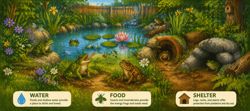
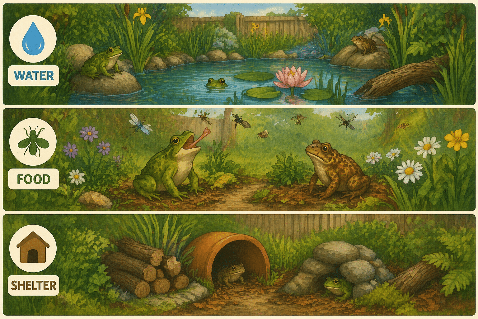
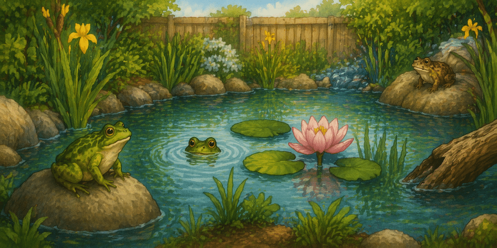
First things first: water. Since amphibians need water as part of their life cycle, you will need to provide some low-to-the-ground water sources for them. This can be as simple as burying a large plant saucer into the ground, or as elaborate as constructing a mini pond or wetland ecosystem in a portion of your yard. Whichever way you choose, make sure you have provided ways for frogs and toads to easily get into and out of the water. While frogs are better swimmers, toads are not, and all will benefit from being able to safely enter and exit their new watering hole. Be sure to use rainwater, not tap water, as amphibians are incredibly sensitive to chemicals that may be present in the water flowing from your faucets. Some people create elaborate rainwater collection systems in their yards and gardens, where overflow from rain barrels and gutters gathers in small ponds and wetlands that provide suitable habitat for amphibians. 

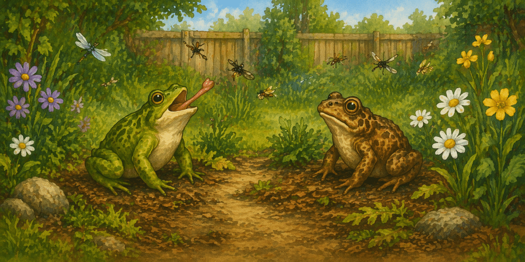
Once their water source has been taken care of, the next step is making sure your yard has plenty of food for them to eat. Now wait a minute, you may be thinking, wasn’t the whole point of having frogs and toads in my yard preventing pests? Well, once the toads and frogs have polished off the pesky mosquitoes and slimy slugs, they will need something else to fill their bellies. If there’s no other food available, they won’t stick around, and your pest problems will come back. So, do some research and find the closest native plant nursery in your area. Plan a visit and be sure to talk to the staff for guidance on what plants would do best in your particular region. Native plants support far more species of insects than non-native ornamentals, thus resulting in more food for amphibians to eat. As a bonus, if you get a variety of plants that will bloom at different times during the growing season, you will provide a continuous food source for pollinators, like butterflies and bees, and will attract more songbirds to your yard, too. 

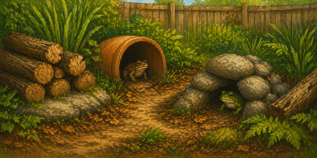
Finally, frogs and toads need shelter, someplace to hide during the heat of the day. Constructing toad houses out of broken terracotta pots is a popular DIY craft, but log piles and brush piles are great places for amphibians to hide, too. In addition, letting some of those native plants grow big and bushy will provide ample cover; if you created a miniature wetland system, try adding some wetland plants around the edges to provide your new frog and toad friends with some privacy. Mixing things up by planting shrubs alongside herbaceous plants provides some height, which some frog species will take advantage of during the breeding season. 

Once you have assembled all the pieces of your amphibian habitat, water, food, and shelter, consider applying for a Certified Wildlife Habitat certification from the National Wildlife Federation. The NWF website is full of information on how to make your yard or garden more wildlife friendly, in addition to guidance on how to create habitats at workplaces, schools, and places of worship. As April is Frog Month and Native Plant Month, now is the perfect time to begin the rewarding process of transforming your backyard into an amphibian oasis. 

#FrogMonth #NativePlantMonth #Amphibians #SavetheFrogsandToads #CertifiedWildlifeHabitat #NationalWildlifeFederation #BackyardHabitat

Posted on — Leave a comment

Why the Regulatory Briefing Matters More Than Ever

For professionals who work in wetlands, streams, permitting, land development, and environmental compliance, regulatory change is not background noise. It shapes how projects are planned, how risks are evaluated, and how decisions are made in the field.

That is why the Regulatory Briefing exists.

The Regulatory Briefing is designed for people who need more than headlines. It is a practical, professional resource that explains what is changing in the regulatory world, why it matters, and how those changes may affect real projects. Instead of leaving readers to sort through public notices, guidance documents, district announcements, court decisions, and agency memos on their own, the briefing pulls those developments together and puts them into context.

What makes the Regulatory Briefing valuable is not simply that it reports developments. It explains the connections between them.

That matters because regulatory work rarely changes in one clean, isolated step. A new report standard may alter how field data is collected. A shift in agency interpretation may change how those facts are viewed later in the permitting process. A revised permit condition may affect whether a project stays on a streamlined track or gets pushed into a more complicated review.

A good example is the Corps’ recent rollout of new Aquatic Resource Delineation Report resources. In August 2025, the U.S. Army Corps of Engineers announced recommended minimum standards, data collection quality standards, and a template intended to improve the consistency and completeness of ARDRs and make reviews more efficient.

At first glance, that may sound like a narrow technical update. It is anything but narrow.

An ARDR is not supposed to make the final legal call on whether a feature is jurisdictional. Its primary role is to document the presence, extent, and characteristics of aquatic resources. But the Corps’ recommended standards make clear that delineation reports can include information highly relevant to later jurisdictional analysis, including flow regime, physical indicators, and site conditions that help inform how aquatic features relate to downstream waters.

That is where the connection to WOTUS becomes so important.

Since Sackett, the question of what qualifies as a water of the United States has become even more dependent on carefully documented, site-specific facts. EPA’s current WOTUS implementation materials note that the agencies announced a proposed rule in November 2025 intended to clarify the definition and fully implement the Supreme Court’s decision. In practical terms, that keeps attention focused on the factual record supporting jurisdictional decisions.

In other words, ARDRs and WOTUS are deeply interconnected. The delineation report may not be the jurisdictional determination itself, but it often supplies the foundation for later discussions about connectivity, aquatic resource classification, and regulatory significance. If that record is incomplete, unclear, or out of step with current expectations, the effects can show up later in the process through added questions, review delays, or disputes over how a site should be treated.

This is exactly the kind of connection the Regulatory Briefing is built to cover. It does not just say that a new ARDR template was released. It explains why that matters in a post-Sackett world and why technical documentation choices may now carry greater downstream consequences than many practitioners realize.

The same is true for developments involving Nationwide Permits. On January 8, 2026, the Corps published its final action reissuing 56 existing nationwide permits and one new permit, with the 2026 NWPs taking effect on March 15, 2026. But that national action is only part of the story. Corps divisions and districts may impose regional conditions, and those conditions can materially affect how the permits function in practice.

That is the type of issue many busy professionals miss until it is already affecting a project. A permit that appears straightforward at the national level may become more restrictive once regional conditions are applied. Notification thresholds, documentation requirements, and impact limitations can all shift depending on location. The difference between a manageable permitting pathway and a difficult one may come down to details that never make mainstream news.

The Regulatory Briefing helps readers catch those developments early and understand their practical consequences.

Just as important, it helps reduce the time burden of staying informed. Most environmental professionals do not have hours each week to monitor agency websites, compare new notices to prior guidance, and figure out what changes are actually meaningful. The briefing does that work for them, delivering timely analysis in a format that is clear, useful, and grounded in the realities of consulting and permitting practice.

That is also why the Regulatory Briefing is not just for attorneys or policy specialists. It is for wetland scientists, project managers, consultants, engineers, developers, and anyone whose work depends on understanding where regulatory expectations are heading next.

The value of subscribing is simple. It helps you stay ahead of developments that can affect scope, schedule, cost, and strategy. It helps you see how technical delineation expectations connect to bigger jurisdictional questions. And it helps you recognize when a seemingly small policy change may actually signal a much larger shift in how agencies are approaching aquatic resources and permitting.

In a field where the details matter and the consequences of missing a change can be expensive, staying current is not optional.

The Regulatory Briefing exists to make that easier and more useful.

Subscribe to the Regulatory Briefing today and stay informed on the regulatory changes that matter most. From ARDR expectations to WOTUS interpretations to new permit conditions, you will get clear, practical insight to help you plan smarter, respond faster, and avoid costly surprises.

Posted on — Leave a comment

North Carolina’s Weird and Wonderful: Belted Kingfisher

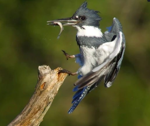
Spring has sprung here in North Carolina, which means pollen, pollen, and more pollen. Tis the time of year when everything appears as if it was swiped with a yellow highlighter. It’s also the time of year when the breeding season of this month’s weird and wonderful focus ramps up: enter the belted kingfisher, Ceryle alcyon. This visually distinctive bird can be found alongside waterbodies in our state, and while they are solitary for most of the year, they form monogamous pairs during the breeding season, which lasts from late March in warmer climates through July. Around the size of a pigeon, these birds are a powder blue color on top, with a white underbelly and blue breast band. Female belted kingfishers also have a wide, rust-colored band on their bellies. The bushy crest present on top of their large head and thick, sharp bill make this bird a recognizable sight to people enjoying our state’s lakes and rivers, though many people first realize belted kingfishers are in the area when they hear the loud, eerie rattle emitted by both males and females. 

Belted kingfisher, Ceryle alcyon. Photo courtesy of Evelyn Garcia and Audubon

Belted kingfishers, as their name implies, feast on fish that they catch in clear bodies of water. The water needs to be clear so they can see the fish from above; once they have spotted a fish near the surface, they dive, eyes fully closed, and grab it with their bill. Upon returning to their perch with their meal, they bash it against the perch before swallowing it head first. These birds have also been known to hover over the surface of the water, searching for prey, before quickly diving down to catch their prize. Fish are not the only item on the menu: belted kingfishers also eat crayfish, amphibians, reptiles, young birds, insects, mollusks, and even small mammals. Essentially, if they can swallow it, they will catch it and eat it. The skeletons, mollusk shells, insect exoskeletons, and other indigestible pieces are later regurgitated as pellets, similar to the pellets of owls and other large birds of prey. 

Individual belted kingfishers will establish territories that run parallel to the shoreline of lakes, rivers, and large streams. When an intruder is spotted, a belted kingfisher may fly back and forth across the water while emitting their trademark rattling call, or they may land on a nearby perch and bob their body up and down while elevating their crest to scare them off. When breeding season begins, males and females cease being solitary and form monogamous pairings; however, these pairings do not last beyond a single mating season. When the next breeding season rolls around, they will find different mates. As part of the courtship process, a male belted kingfisher will present a fish he has caught to a female who has landed nearby, and she may eat the fish he presents. 

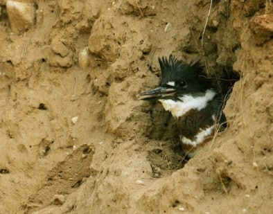
Female belted kingfisher emerging from her burrow. Photo courtesy of Jack Bartholmai and Kickapoo Valley Reserve

One of the weird and wonderful traits of this species is that they do not nest in trees. Instead, they nest in burrows! Both the male and female take turns excavating a tunnel that stretches from 3-6 feet long. It is during this task that their thick, sturdy bill comes in handy as a digging tool. Belted kingfishers need vertical banks in which to dig their tunnels, which is why some water bodies without tall vertical banks may have several kingfishers that feed there, but do not nest there. The tunnels slope upwards to prevent rainwater from pooling inside, and throughout the incubation process, the undigested skeletal remains, mollusk shells, and other refuse regurgitated by the parents provide some insulation. The eggs are pure white and glossy, and a female will lay a clutch ranging from 5-8 eggs. After about 24 days, the eggs hatch, and both parents feed the chicks, starting off their diet with partially digested fish but progressing to whole fish by the time the chicks leave the nest a month later. Belted kingfisher chicks have their own weirdly wonderful trait: their stomach contents are highly acidic, which allows them to digest bones, scales, shells, and other typically indigestible bits until they are ready to leave the nest. Following their departure, their parents will continue to feed them for about three weeks. Due to the warmer climate, belted kingfishers in North Carolina may be able to raise two broods each year. Once their young have grown up and left to establish their own territories, their parents will split and return to their solitary lifestyle. 

Once hunted to prevent them from eating fish in hatcheries and trout streams, belted kingfisher populations today are steady, and the species is of low conservation concern. They are sensitive to site disturbance, though, and may abandon their territories if there is too much human activity in the direct vicinity. So, if you are feeling like braving the pollen dust storm and accompanying allergies to visit one of our state’s beautiful lakes, rivers, and streams this spring, you might be fortunate enough to watch a belted kingfisher flitting about the banks and water, hunting for prey. These carnivorous birds are truly a weirdly wonderful sight to behold. 

#BeltedKingfisher #NCWildlife #NorthCarolinaWeirdandWonderful #WetlandWednesday #TheSwampSchool
Posted on — Leave a comment

From Space, a Warning: Doñana’s Marshlands Are Shrinking

The following blog post is a summary of the article “Could one of Europe’s most important wetlands really vanish? Satellites show it may happen in our lifetime” by Samantha Matthewson, published on Space.com on February 20, 2026. To read the original article, click here. To read the research paper referenced within the original article and this blog post, click here.

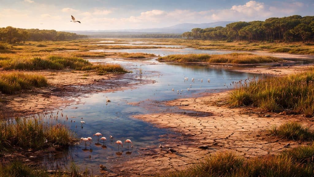
Doñana National Park in southwestern Spain is one of Europe’s most valuable wetland ecosystems, but recent satellite observations suggest it is steadily shrinking and could disappear within a human lifetime. The park plays a vital role in supporting biodiversity and serves as an important stopover and breeding site for migratory birds traveling between Europe and Africa. Researchers used high-resolution imagery from the European Space Agency’s Sentinel-2 satellites to examine changes in the marshland over time. In satellite images, the wetlands appear as patches of dark blue and violet that indicate shallow water across the floodplain. However, long-term analysis of these patterns reveals a clear decline in the park’s surface water. Scientists warn that if the current trend continues, the marsh could become effectively dry in roughly sixty years.

The research team, led by scientists from the University of Seville, combined satellite observations with machine learning methods to more accurately distinguish water from vegetation and dry soil. This approach enabled them to reconstruct how the marsh has changed over the past two decades and to model how it may evolve under future climate conditions. Their analysis shows that since 2005 the wet surface area, total water volume, and average depth of the marsh have all declined. The losses became more severe after 2010, when regional temperatures rose and rainfall decreased. Based on projected climate scenarios, the marsh could reach a critical tipping point within several decades. Depending on future climate patterns and conservation efforts, that threshold could occur in as little as forty-five years or as long as one hundred seventy-five years.

While climate change is an important driver of the marsh’s decline, human activity is also accelerating the problem. Doñana relies heavily on groundwater, yet aquifers in the surrounding region have been depleted by intensive agriculture, ineffective wastewater reuse, and the presence of illegal wells. As groundwater levels fall, less water reaches the wetland, worsening the effects of drought and rising temperatures. Even years with heavier rainfall now appear insufficient to restore the marsh to its previous condition. The consequences of losing such a system would extend far beyond southern Spain because wetlands help regulate water availability and provide critical habitat for migrating species. Researchers emphasize that stronger groundwater regulation, closing illegal wells, and improving water management could still slow or partially reverse the decline, but the satellite data provides a clear warning that Doñana’s future is increasingly uncertain.

#Wetlands #DoñanaNationalPark #NatureConservation #Biodiversity #EarthScience #WetlandWednesday #TheSwampSchool
Posted on — Leave a comment

ASTM E2247 and Phase I Environmental Site Assessments for Forestland and Rural Property

Environmental due diligence is a routine part of commercial real estate transactions, but rural and forested landscapes present a different set of challenges. Large property sizes, limited historical records, and a wide range of past land uses can make environmental risk more difficult to evaluate.

To address these unique conditions, the ASTM E2247 standard was developed specifically for Phase I Environmental Site Assessments (ESAs) conducted on forestland and rural property. This standard provides guidance for identifying potential environmental risks associated with rural land transactions.

For professionals involved in forestry, conservation, agriculture, land investment, or rural real estate, understanding the basics of ASTM E2247 is an important first step in managing environmental liability.

Why Environmental Due Diligence Matters for Rural Land

At first glance, rural property often appears environmentally untouched. However, many forest and agricultural lands have complex land-use histories that can introduce environmental concerns.

Over time, rural properties may have hosted activities such as:

  • Timber harvesting operations
  • Agricultural production and pesticide use
  • Fuel storage for farming or logging equipment
  • Informal dumping areas or burn pits
  • Historic industrial uses like sawmills

Because these activities are not always well documented, environmental due diligence helps buyers, lenders, and land managers better understand the environmental history of a property before completing a transaction.

What is ASTM E2247?

ASTM E2247 is the industry standard that outlines how to conduct a Phase I Environmental Site Assessment for forestland and rural properties. It adapts the traditional Phase I ESA process so it can be applied effectively in rural environments where property records may be incomplete and land use histories may extend back generations.

The goal of a Phase I ESA is to identify Recognized Environmental Conditions (RECs) — indications that hazardous substances or petroleum products may be present on a property.

Identifying these conditions early helps parties involved in a land transaction evaluate potential environmental liability before moving forward.

Why Rural Environmental Assessments Can Be More Complex

Conducting environmental assessments on forestland or rural property often involves challenges that are not commonly encountered on smaller commercial sites.

For example, rural properties may:

  • Cover hundreds or thousands of acres
  • Have limited historical documentation
  • Contain abandoned structures or historic activity areas
  • Include agricultural or forestry practices spanning decades

Environmental professionals must often combine records research, field observations, and local knowledge to better understand how the land has been used over time.

Who Should Understand ASTM E2247?

While Phase I ESAs are typically performed by environmental professionals, many other groups benefit from understanding how environmental due diligence works in rural land transactions.

These include:

  • Foresters and forestland managers
  • Rural land brokers and real estate professionals
  • Conservation organizations and land trusts
  • Environmental consultants
  • Attorneys and lenders involved in land transactions

For anyone involved in buying, selling, financing, or managing rural land, awareness of environmental risks can help prevent unexpected liabilities later.

A Growing Area of Environmental Due Diligence

Interest in timberland investment, conservation properties, and rural land acquisition has increased significantly in recent years. As a result, environmental due diligence for rural property has become more important than ever.

ASTM E2247 provides a framework for evaluating environmental risks in these landscapes, helping professionals conduct assessments that are both credible and defensible. Overview of 2247

However, applying the standard effectively requires understanding how traditional Phase I ESA methods are adapted for rural environments.

Final Thoughts

Environmental due diligence for forestland and rural property is an evolving area of practice. While the ASTM E2247 standard provides a structured approach, each property presents its own unique history and potential environmental considerations.

For professionals involved in rural land transactions, gaining a deeper understanding of how Phase I Environmental Site Assessments apply to these landscapes can be an important step toward managing environmental risk and making informed decisions.

Posted on — Leave a comment

Where Things Stand: EPA & Army Corps “Updated Definition of WOTUS” Rulemaking (February 2026)

As of February 25, 2026, there is no final rule published in the Federal Register for the EPA and Army Corps rulemaking commonly described as the “Updated Definition of ‘Waters of the United States’” (WOTUS).

That is the clean answer.

Despite significant anticipation — and significant public engagement — the agencies remain in a post-comment, pre-finalization phase.

In other words: the proposal has closed for comment, but there is no documentary evidence of a final rule.

What Is Confirmed

On November 20, 2025, EPA and the Army Corps published a proposed rule titled:

Updated Definition of “Waters of the United States”

The proposal includes:

  • FR Doc: 2025-20402
  • RIN: 2040-AG44
  • Docket: EPA-HQ-OW-2025-0322
  • Comment deadline: January 5, 2026

The public response was substantial. The Regulations.gov docket reflects:

  • 219,729 comments received
  • 14,829 comments posted

That is not a modest rulemaking record. That is a regulatory endurance event.

The comment period officially closed on January 5, 2026. As of February 25, 2026:

  • There is no final rule published.
  • There is no final rule posted to Federal Register Public Inspection.
  • There is no OIRA review pending for a Final Rule stage under RIN 2040-AG44.
  • There is no Unified Agenda update moving the rule beyond Proposed Rule stage.

OIRA concluded review of the Proposed Rule stage on November 7, 2025. Since then, no public signals indicate the rule has entered final review.

In plain terms: the most defensible public-facing status is post-comment development inside EPA/Army.

What That Means

In a typical significant rulemaking, the next “status flip” becomes visible through one of the public tripwires — a Public Inspection posting, a Final Rule entry in the Federal Register, an OIRA Final Rule stage submission, or a final package posted in the docket.

None of those downstream signals are present as of February 25, 2026.

That strongly suggests the agencies are doing the quiet work that happens after comments close:

  • Reviewing the administrative record
  • Drafting and clearing responses to comments
  • Revising regulatory text
  • Preparing economic and technical analyses
  • Running internal and interagency clearance steps

In other words: a lot can be happening — but nothing that is verifiable has surfaced publicly yet.

The Broader Context: Fragmented Implementation

Overlaying this rulemaking is the ongoing litigation environment affecting the January 2023 rule and the September 2023 conforming amendments. EPA’s own litigation update explains that implementation differs across states due to court orders.

In practical terms, some states are operating under the January 2023 rule (as amended), while others are operating under the pre-2015 regulatory regime (as informed by Sackett).

This fragmented posture increases both the urgency and complexity of finalizing — and later implementing — any new WOTUS definition. It also increases implementation risk.

What to Watch Next

If you’re tracking this rule closely, the most reliable public signals usually appear in this order:

  1. Federal Register Public Inspection (often the earliest public signal of a final posting)
  2. Federal Register Final Rule entry matching the title and/or RIN 2040-AG44 (publication date and effective date)
  3. OIRA/Reginfo “Pending Review” listing for a Final Rule stage submission
  4. Regulations.gov docket EPA-HQ-OW-2025-0322 updates (final package, response-to-comments, final analyses)
  5. EPA and USACE hub pages for formal announcements and fact sheets once published

Until one of those appears, there is no final rule — and no effective date.

The Real Takeaway for Environmental Managers

The absence of a final rule does not mean stability. It means continued uncertainty layered on top of an already fragmented implementation landscape.

Surface water connection interpretation remains central. Documentation standards remain critical. And jurisdictional consistency remains variable across states — even before a new final action is released.

Whatever is ultimately published will still operate within the constraints of Sackett. The legal boundary is set. The policy mechanics are still moving.

Stay Ahead of the Shift

This is exactly why we created the Regulatory Intelligence Briefing. Each month, we analyze active rulemakings, litigation posture, Federal Register signals, OIRA movements, and the field-level implications for documentation and defensibility.

Not just what changed — but what it means for exposure and implementation decisions.

If you are responsible for regulatory interpretation, permitting risk, or jurisdictional strategy, staying reactive is not a strategy. Staying informed — with context — is.

Stay current.
Stay defensible.
Stay ahead.