Posted on — Leave a comment

Italy Enters a New Era as a Forest Nation

The following blog post is a summary of the press release “Forests in Municipalities” by the Programme for the Endorsement of Forest Certification (PEFC) and PFEC Italia, National Union of Mountain Municipalities, Communities and Entities (UNCEM), and Legambiente. To read the original press release, which is in Italian, click here.

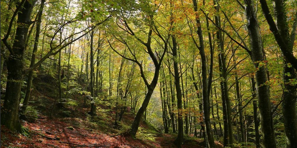
Italy has become a true forest nation, with woodlands now covering more than 100,000 square kilometers, or over one-third of the country’s land area. For the first time in centuries, forests occupy more land than Italy’s utilized agricultural areas, reflecting decades of farmland abandonment and natural forest expansion. The report introduces a municipality-by-municipality analysis of forest resources through the new Forest Cover Index, which compares woodland area to each municipality’s total land area while also examining population trends, economic activity, and land use. Marcetelli, located in the province of Rieti, ranks as Italy’s most heavily forested municipality, with 98.4 percent of its territory covered by woods. Gubbio, in the province of Perugia, contains the country’s largest total forest area, with more than 26,800 hectares of woodland, highlighting the remarkable diversity of Italy’s forest landscapes.

The findings reveal that Italy’s forests are distributed very unevenly across the country, with more than three-quarters of all woodland concentrated in mountain municipalities. Nearly half of Italy’s municipalities contain little or no forest, while just a small number of heavily wooded communities account for a significant share of the nation’s total forest resources. These mountain forests play an essential role in protecting biodiversity, storing carbon, reducing flood risks, and supporting clean water supplies for the entire country. The research also challenges the long-standing belief that forested communities are economically isolated or in permanent decline. Many municipalities with extensive forest cover have experienced positive migration trends, competitive local economies, and growing opportunities that combine sustainable forestry, tourism, agriculture, and environmental stewardship.

The report presents forests as valuable natural infrastructure capable of delivering lasting environmental, social, and economic benefits when managed sustainably. It emphasizes that careful planning, responsible forest management, and certification programs can strengthen local economies while preserving biodiversity and improving resilience to climate change. One of the strongest examples is Marcetelli, where ecosystem services provided by its forests are estimated to generate nearly 8 million euros in value each year through benefits such as air purification, groundwater recharge, erosion control, carbon storage, flood mitigation, and forest products. Local leaders view these findings as an opportunity to develop new policies that reward communities for protecting forests while creating sustainable economic opportunities in rural and mountain regions. Overall, the study concludes that Italy’s forests should be viewed not simply as remnants of abandoned rural landscapes but as strategic assets that can support conservation, strengthen local communities, and contribute to the country’s long-term environmental and economic future.

#PEFC #PEFCItalia #ForestNation #Italy #UNCEM #Legambiente #NaturalResources #Forestry #NaturalInfrastructure #WetlandWednesday #TheSwampSchool

Posted on — Leave a comment

EPA’s WOTUS Rule Hits Another Round of Review

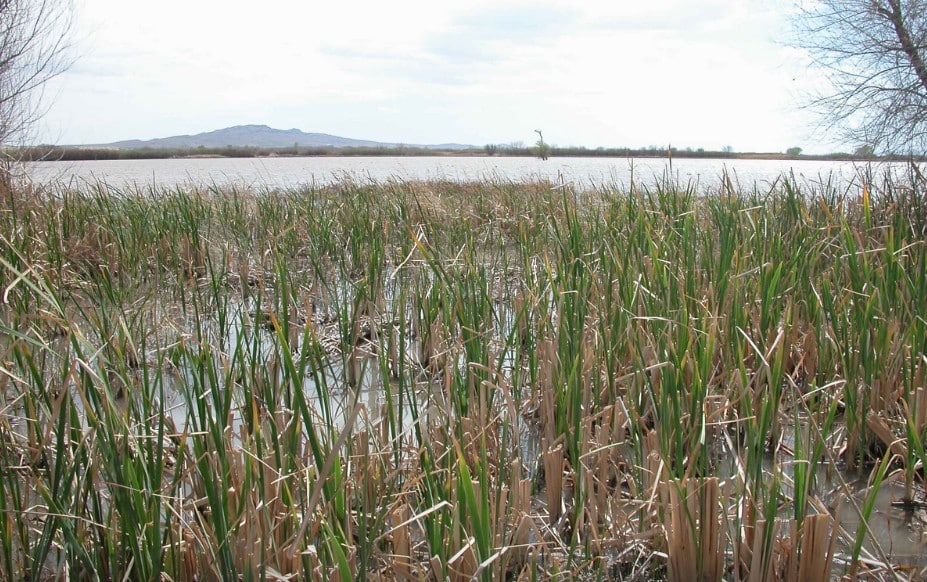
Cattail marsh in the Bosque del Apache National Wildlife Refuge in New Mexico. Photograph courtesy of Sue Major Holmes, the Associated Press, and E&E News by Politico.

Just when it looked like the latest “Waters of the United States” rulemaking was moving toward a final rule, the Environmental Protection Agency (EPA) appears to be taking another step back. According to reporting by Miranda Willson of GREENWIRE and E&E News by POLITICO, the EPA has sent a supplemental proposed rule to the White House for review. The article reports that the EPA sent the proposed supplement to its WOTUS definition for review on Tuesday, signaling that the administration is amending some part of the original proposal released in November 2025. ([Willson and E&E News by POLITICO][1])

That is significant. The November 2025 proposal was presented as an effort to provide a clearer, more durable definition of WOTUS following the Supreme Court’s decision in Sackett v. EPA. The EPA and the U.S. Army Corps of Engineers (USACE) said the proposed rule was intended to clarify federal jurisdiction under the Clean Water Act, improve predictability, and respect the role of states and Tribes in managing local water resources. The comment period for that proposal closed on January 5, 2026. Now, only months later, the agencies appear to be preparing a supplement.

Why This Matters

A supplemental proposal does not necessarily mean the EPA is abandoning its original approach. It may mean the agency is trying to clarify, revise, or strengthen part of the rule before it becomes final. But for landowners, developers, consultants, engineers, and regulators, the practical message is simple: the WOTUS uncertainty is not over.

The Clean Water Act definition of WOTUS determines which wetlands, streams, ditches, ponds, and other aquatic features may require federal permits. That definition affects wetland delineations, jurisdictional determinations, project planning, mitigation requirements, enforcement risk, and real estate development decisions. When the rule changes, the risk profile changes; when the rule is delayed, uncertainty remains.

The Likely Pressure Points

The biggest unresolved issue appears to be how the agencies will define and apply terms from the Sackett decision, especially “relatively permanent” waters and wetlands with a “continuous surface connection.” The November 2025 proposal attempted to narrow and clarify federal jurisdiction by focusing on waters that are relatively permanent and wetlands that are directly connected to those waters. The EPA’s own materials state that the proposal would define several key terms, including “relatively permanent,” “continuous surface connection,” “tributary,” “ditch,” “prior converted cropland,” and “waste treatment system.”

Those terms sound simple, but they are difficult to apply in the field. For example, what does “relatively permanent” mean for a stream that flows during the wet season but dries out later in the year? How should the Army Corps evaluate a wetland that has surface water connection during part of the year, but not at the time of inspection? What evidence should be used to decide whether a surface connection exists? How should regional differences in rainfall, evapotranspiration, and hydrology be handled?

These are not minor technical questions. They are the questions that determine whether a feature is federally jurisdictional.

The Wet Season Problem

One of the most important issues to watch is the “wet season” concept. The November 2025 proposal discussed waters that flow year-round or at least during the wet season. That approach creates an immediate practical problem: the wet season is not the same everywhere, and it does not always line up neatly with the day a field inspection occurs.

In some parts of the country, the wet season may be obvious. In other regions, especially arid or highly seasonal areas, it may be more complicated. Even in the eastern United States, a stream or wetland may respond to rainfall, groundwater, soil saturation, or evapotranspiration on a delayed schedule. That means the agencies may need to be more precise about how field staff, consultants, and regulators should document wet-season flow or surface connection. If they do not, the final rule could invite the same kind of inconsistent application and litigation that has followed prior WOTUS rules.

This May Be About Legal Durability

The EPA has repeatedly stated that the goal is a durable WOTUS rule that follows the Supreme Court’s direction in Sackett. That is easier said than done. The agencies must write a rule narrow enough to satisfy the Supreme Court’s limits on federal authority, but clear enough for field implementation. They also need to explain their reasoning well enough to survive the next round of litigation.

That may be why a supplemental proposal is now in play. The supplement could provide additional explanation, revise a definition, respond to comments, or reopen a specific issue for public input. Until the text is released, we do not know exactly what the EPA is changing. But the fact that the rule has gone back to the White House for review suggests the agencies are still working through important details.

What This Means for Current Projects

For now, project teams should be careful about assuming that the November 2025 proposal represents the final rule. It does not. Until a final rule is published and effective, current jurisdictional decisions still need to be made under the applicable existing regulatory framework and current agency guidance. For projects involving wetlands, streams, ditches, or uncertain aquatic features, the safest approach is to document field conditions carefully and avoid relying on broad assumptions about what the final WOTUS rule will say. That is especially true for projects involving:

  • Seasonal streams
  • Wetlands near ditches or tributaries
  • Wetlands with intermittent surface connections
  • Prior converted cropland
  • Roadside or agricultural ditches
  • Older wetland delineations or jurisdictional determinations
  • Sites where the presence or absence of surface water connection is disputed

The proposed rule may eventually narrow federal jurisdiction, but the details will matter. A small change in the definition of “relatively permanent” or “continuous surface connection” could make a significant difference on the ground.

The Practical Takeaway

The EPA may still be heading toward a narrower post-Sackett WOTUS rule, but the path to finalizing that rule appears less settled than officials suggested when the November 2025 proposal was released. For consultants and developers, this is a reminder that WOTUS is still a moving target. The key is not just watching the headlines. The key is watching the technical language. The next version of the proposal may tell us how the EPA and the Army Corps intend to handle the hard field questions: wet-season flow, surface connections, tributaries, ditches, and the evidence needed to support a jurisdictional determination.

Until then, the best advice is simple: document the site conditions, preserve the record, and be cautious about making final jurisdictional assumptions based on a rule that is still under revision.

[1] Willson, Miranda. EPA heads back to the drafting board on WOTUS rule. GREENWIRE and E&E News by POLITICO. https://www.eenews.net/articles/trump-admin-prepares-tweaks-to-wotus-rule/. Accessed on July 2, 2026.

#WOTUS #EPA #USACE #CleanWaterAct #Wetlands #WetlandDelineation #EnvironmentalConsulting #EnvironmentalScience #RegulatoryUpdate #WaterResources #WetlandWednesday #TheSwampSchool

Posted on — Leave a comment

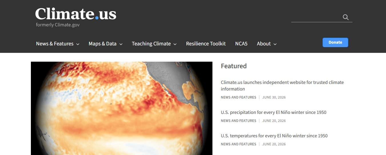
Climate.us Launches to Restore Public Access to Climate.gov Data

On June 23, 2026, the independent website Climate.us launched. A year in the making, the website’s creators sought to create a replacement for the now-defunct Climate.gov website, which was shut down in June of 2025. Climate.us is the brainchild of former members of the team behind the National Oceanic and Atmospheric Administration’s Climate.gov website, who recognized that the public was losing access to valuable scientific information when the old site ceased to exist. While much of the data is still technically accessible, Climate.us staff explain that it is often very hard to find now, especially by members of the public who may not be as familiar with where to look. By locating all the data themselves and making it easy to access on their Global Climate Dashboard, they hope this new website will continue to provide data that scientists, educators, farmers, and the general public have used for years. 

Their Global Climate Dashboard is designed to look very similar to the one on the old website, hopefully making it easy for people to pick up where they left off in their research. On that dashboard you can find El Niño and La Niña data, information on sea levels, glaciers, surface temperatures, incoming sunlight, and much more. Searching through their Maps & Data yields drought information, precipitation statistics, air temperature information, and other vital climate data.  In addition, Climate.us also has a Teaching Climate section, which offers a collection of over 700 free, ready-to-use resources that have been rigorously reviewed by educators and scientists alike. With materials that can be used from secondary through higher education, teachers can now more easily find resources to use in their classrooms. 

Climate.us is not a government owned and operated website, but is operated by an independent nonprofit organization. One-third of its initial funding came from over 2,500 small donations from people who wanted to make sure there would be a place for all the Climate.gov data to be available for future generations. Over 80 scientists have volunteered to act as subject matter experts, and the website team is led by the former program manager for Climate.gov. So, for anybody who missed being able to access climate data from one place, check out Climate.us, whose mission statement is “Keeping trusted climate information up to date and easy to find.”

#ClimateUS #ClimateData #ClimateScience #Education #EnvironmentalEducation #NOAA #ScienceResources #WetlandWednesday #TheSwampSchool
Posted on — Leave a comment

North Carolina’s Weird and Wonderful: Pointy-Lobed Firefly

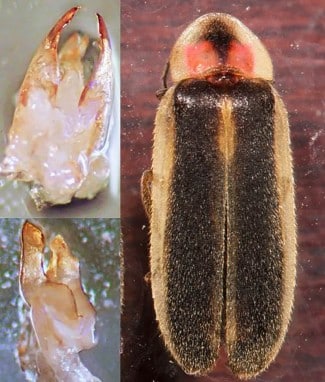
Adult male pointy-lobed firefly, Photinus acuminatus. Photo courtesy of James E. Lloyd and the Xerces Society.

Well, it’s the end of June, which means summer is finally here! And nothing screams summer more than chasing fireflies across the yard at dusk. North Carolina is a really special state because we have over forty species of lightning bugs! Of course, both of those names are misnomers, because fireflies are not actually flies, and lightning is not involved in their lovely glow. These insects are actually beetles, but while most beetles typically have a hard exoskeleton, lightning bugs are soft-bodied beetles, and thus are more sensitive to both drying out and succumbing to pesticides. While the most common firefly in our state is probably the common eastern firefly, also known as the Big Dipper Firefly, this month’s weird and wonderful focus is going to be on a far lesser known relative: the Pointy-Lobed Firefly, Photinus acuminatus. 

Adult male pointy-lobed firefly, right, collected in southern Ohio in 2019. The pointy lobes on its aedeagus, left, confirmed this specimen to be a pointy-lobed firefly. Photograph courtesy of Laura S. Hughes and the Ohio Biological Survey, Inc.

The pointy-lobed firefly is an incredibly rare insect, not only in North Carolina, but across its historic range in the Southeastern United States. This species was originally described in the 1950s from a single male specimen collected in the Pisgah region of North Carolina and a single female specimen collected from Florida. Similar in appearance to the little gray firefly, Photinus marginellus, the pointy-lobed firefly has dark elytra (the hard outer wings of beetles) with a pale, wide outer border. The dark central marking on the dorsal (top) side of their pronotum, which is the hard, protective sclerite that covers and protects the insect’s head and first thoracic segment, reaches the pronotum’s base. This dark marking has two red or pink spots on either side. In living specimens, these spots tend to be a deeper red, and the pale, wide border of the elytra are a brighter, light yellow in color. The name pointy-lobe comes from the lateral lobes on male pointy-lobe fireflies’ aedeagus, aka genitalia. In fact, the examination of the male genitalia is required for accurately identifying whether a specimen is a member of this species or not. That sounds pretty weird to me! 

Pointy-lobed fireflies, like their more common cousins, are bioluminescent. Within their abdomen is a special organ called a photophore, and it is within that organ that a chemical reaction producing light takes place. Fireflies combine oxygen with the chemical luciferin in the presence of the luciferase enzymes, and this reaction results in light production. Pointy-lobed fireflies emit their flashes of light from June-July. The males have a flash pattern of a single, bright flash that lasts about 100 milliseconds. These short flashes are emitted at about 2 second periods, with females issuing a short response flash at around a 300-millisecond delay. The larvae of all members of the Lampyridae family, which is the insect group that contains all firefly species, are predaceous, so entomologists assume that pointy-lobed larvae are as well, in addition to being bioluminescent. Larvae of species in the Photinus genus tend to be subterranean (meaning they live underground) and specialize in eating earthworms. How weird and wonderful is that? 

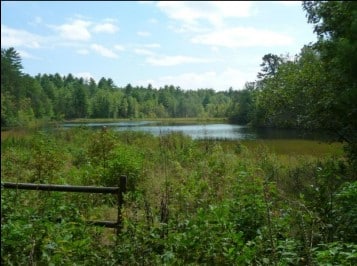
Shrubby wetland habitat in upstate South Carolina where the pointy-lobed firefly has been documented in the past. Photograph courtesy of Richard Joyce and the Xerces Society.

Little is known about the specifics of this species’ life history, as most of the recorded localities are known only from single collected specimens captured at each spot. Within the past twenty years, living pointy-lobed fireflies have only been documented at a single site in South Carolina and a single site in Ohio. However, entomologists suspect there are small populations throughout the southeast, with the historic range potentially spreading into the Midwest. One of the wonderful traits of the pointy-lobed firefly is that it appears to live in shrubby wetland habitats, such as bogs, fens, and swamps. All the more reason to conserve these habitats, in my book! Unfortunately, as these habitats are filled in and destroyed to make way for more housing and commercial developments, the already tiny populations of the pointy-lobed firefly are at an increased risk of completely disappearing. 

In addition, as alluded to at the beginning of this blog, fireflies are even more susceptible to pesticides than other insects, including pesticides that are used to target nuisance or invasive species. While pesticides tend to be sprayed above ground, they can soak into the soil, affecting the larval form of the pointy-lobed firefly. Pesticides applied to alfalfa and other grasses raised for livestock end up in the manure, which, if applied to pastures, meadows, and yards as compost, can poison the soil and eliminate the existing firefly population.  Finally, light pollution disrupts the mating displays of the males and the responses of the females, making it harder for two to find each other and mate. Keeping porch lights and other outside lights turned off from dusk until dawn is the best way to prevent light pollution around your home, but you can also swap out your existing bulbs for yellow bulbs, as that wavelength falls along the edge of light wavelengths that insects can discern. Some yellow bulbs even come with a “bug light” label, helping you figure out which one is best, and LED bulbs, being more energy efficient than incandescent bulbs, are the way to go. 

Landing page for the Xerces Society’s Firefly Atlas website. Courtesy of Firefly Atlas and the Xerces Society.

If the plight of the pointy-lobed firefly, and all firefly species, has inspired you to learn more, check out the Xerces Society for Invertebrate Conservation. This organization is dedicated to educating people about invertebrates’ role in the natural world and conserving crucial habitat for threatened and endangered species. To figure out where the pointy-lobed firefly and other rare, threatened, and endangered firefly species are, the Xerces Society has created a Firefly Atlas. This is a citizen science project aimed at tracking and conserving threatened firefly species in North America. The hope is that more data will enable critical habitats to become identified and protected. So, as dusk approaches and your backyard fireflies emerge, think of the pointy-lobed firefly, trying its best to hang on in ever-shrinking wetland habitat in an increasingly illuminated world.

#PointyLobedFirefly #Lightningbug #Fireflies #FireflyConservation #FireflyAtlas #XercesSociety #NorthCarolinasWeirdandWonderful #WetlandWednesday #TheSwampSchool
Posted on — Leave a comment

The River That Shaped a Nation

The following blog post is a summary of the article “The History of America Flows Through the Hudson River, and the Country’s Aquatic Superhighway Is on the Rebound” by Rebecca Taylor, published in Smithsonian Magazine in December 2025. To read the original article, click here.

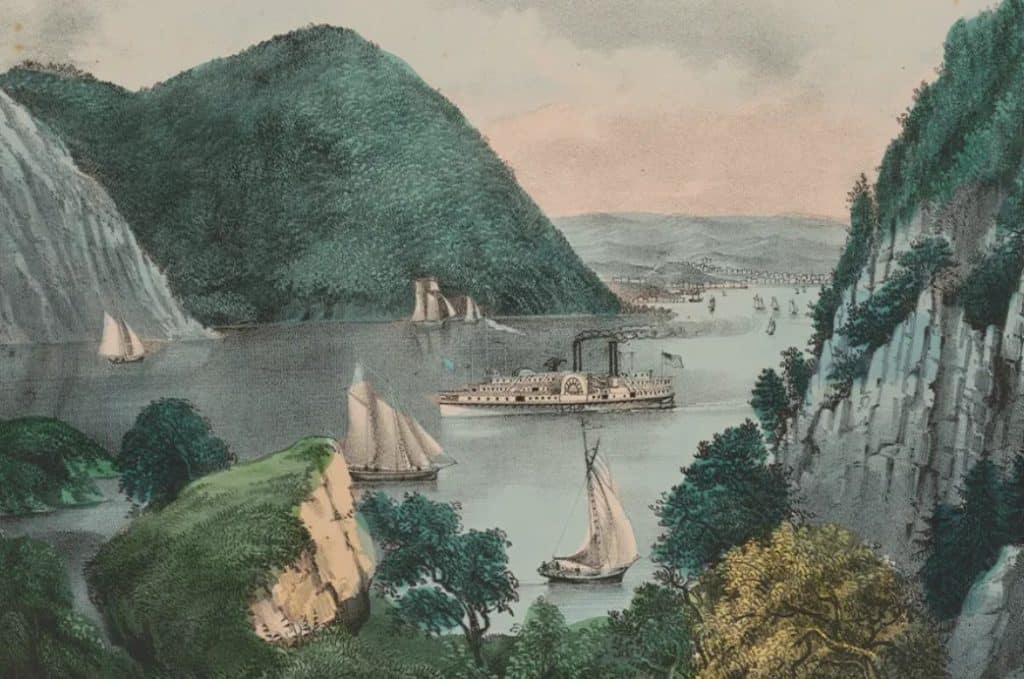
A print by Currier & Ives featuring the Crow’s Nest, a mountain along the west bank of the Hudson River, circa mid-to-late 19th century. Print courtesy of Smithsonian Magazine and the Library of Congress.

The Hudson River has played a central role in American history, culture, and geography for thousands of years. Long before European exploration, Native American communities traveled its waters and relied on its abundant fish populations. Formed by glaciers during the last Ice Age, the river stretches 315 miles through New York and functions as a tidal estuary, causing its current to reverse direction several times each day. Its unique characteristics and strategic location made it an important transportation route and natural landmark. Throughout history, the river has inspired artists, writers, naturalists, and political leaders who recognized its beauty and significance.

The Hudson River became deeply connected to the development of the United States through exploration, trade, warfare, and cultural expression. Henry Hudson explored the river in 1609, and during the American Revolution it served as a critical corridor linking different regions of the continent. Many notable figures, including George Washington, Sojourner Truth, Ulysses S. Grant, and Washington Irving, lived, worked, or drew inspiration from the river and its valley. The region also became famous through the Hudson River School of painters, whose landscapes celebrated its scenic grandeur. During the nineteenth century, the river supported growing industries, transportation networks, and tourism, helping to shape both the economy and identity of the nation.

Despite its importance, the Hudson River suffered severe environmental damage during the twentieth century as industrial pollution contaminated its waters. General Electric Company plants released large quantities of toxic chemicals into the river, contributing to widespread ecological decline and making the Hudson a national symbol of environmental degradation. Public activism, landmark legal victories, and stronger environmental laws eventually led to major cleanup efforts, including one of the largest federal dredging projects in United States history. These restoration initiatives have produced significant improvements, allowing species such as bald eagles, ospreys, sturgeons, and great blue herons to recover. Although conservation challenges remain, the river’s remarkable recovery demonstrates the impact of sustained environmental protection and public commitment.

#AmericanHistory #OnThisRiver #EnvironmentalHistory #HudsonRiver #RiverThatShapedANation #WetlandWednesday #TheSwampSchool
Posted on — Leave a comment

What Happens When a River Gets Its Floodplain Back?

The following blog post is a summary of the article “Why this tribe is buying up hundreds of acres of farmland–and flooding it” by John Ryan, published by NPR on May 3, 2026. To read the original article or listen to the story, click here.

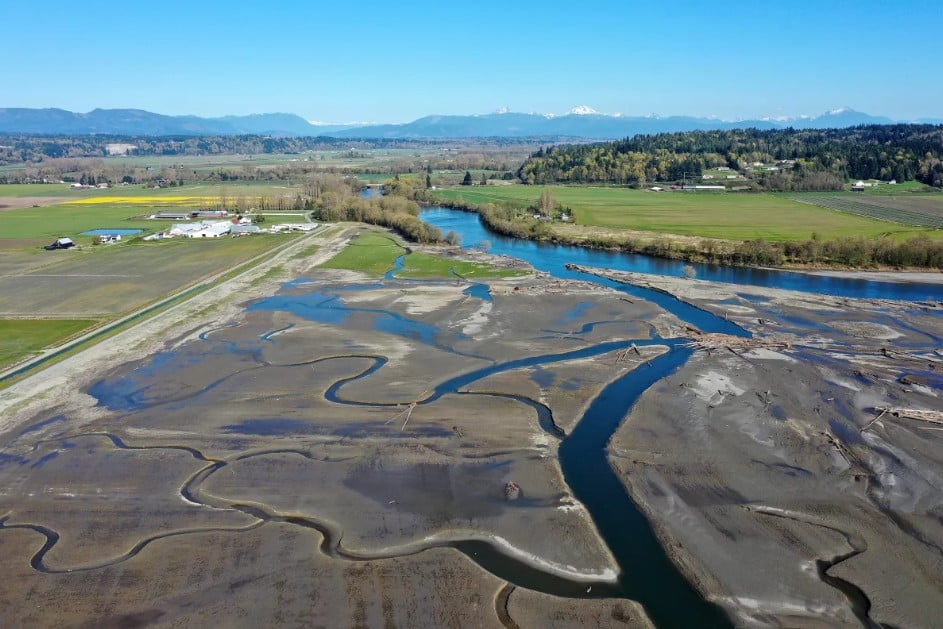
Newly restored marshland, on the right, is separated from farmland by a brand new, larger levee on the left. Photograph courtesy of Megan Farmer and KUOW NPR.

The Stillaguamish Tribe has transformed former farmland at the mouth of the Stillaguamish River into a large tidal marsh by removing two miles of earthen levee that had blocked river and tidal waters for more than a century. The project created a 230-acre wetland that now allows the river to reconnect with its floodplain, restoring conditions that are important for fish and wildlife. Tribal leaders view the effort as a crucial step in rebuilding habitat for Chinook salmon, a species that has declined dramatically throughout Puget Sound and is listed as threatened. The tribe has spent years purchasing land within its traditional territory and has acquired about 2,000 acres for habitat restoration. Although tribal members retained fishing rights under the 1855 Treaty of Point Elliott, they now find themselves buying back land in order to restore the salmon populations that have long been central to their culture and way of life.

The newly restored wetland, known as zis a ba 2, is already showing signs of ecological recovery. Birds such as dunlins have begun using the area in large numbers, suggesting that the marsh is quickly becoming productive habitat. Restoration crews prepared the site before breaching the levee by digging channels that would help tidal flows reshape the landscape, and they uncovered ancient clam shell middens that revealed centuries of human presence. Natural processes accelerated the transformation when major floods swept through the region, bringing sediment, driftwood, and other materials that help build healthy marsh ecosystems. Tribal biologists believe these restored floodplains not only support salmon but also reduce the destructive force of floodwaters by giving rivers more room to spread out during storms.

The restoration effort also highlights ongoing tensions between habitat recovery and agricultural land use. Farmers in the region depend on levees to protect cropland, homes, and nearby communities from flooding, and many worry about losing productive farmland. Local farmer Tyler Breum supports salmon restoration but emphasizes that farmland is limited and essential for food production. He has advocated for repairs to aging levees near his property, noting that failures could threaten hundreds of residents and cause significant damage. At the same time, the tribe has demonstrated that restoration and flood protection can coexist by constructing a stronger, taller setback levee before removing the old one. Looking ahead, both tribal leaders and scientists agree that thousands more acres of habitat may need to be restored if Chinook salmon are to recover, raising hopes that future generations might once again be able to make a living from the waters their ancestors depended on.

#EnvironmentalRestoration #FloodplainManagement #SalmonRecovery #HabitatRestoration #ClimateResilience #Conservation #WetlandRestoration #WetlandWednesday #TheSwampSchool
Posted on — Leave a comment

Small Island, Big Impact: Floating Wetlands Come to Boston

The following blog post is a summary of the article “Floating wetlands bring back Boston’s natural landscape lost to development” by Bianca Garcia, published by the NPR Boston affiliate WBUR on May 20, 2026. To read the original article and listen to the radio program, click here.

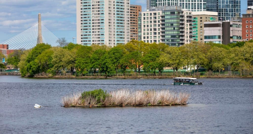
The newly constructed floating wetland in Boston’s Fort Point Channel. Photograph courtesy of Robin Lubbock and WBUR.

Boston’s Fort Point Channel is now home to a newly constructed floating wetland that appeared in less than a week through a collaboration between Save the Harbor/Save the Bay, the real estate development firm Alexandria, and the Scottish company Biomatrix Water. The 1,400-square-foot structure was built from recycled pipes, stainless steel, compost, and native plants, creating what its designers describe as a giant floating planting basket. Although it currently resembles a muddy raft with sparse vegetation, the project is intended to develop into a thriving habitat for local wildlife. Salt-tolerant New England plants have already been installed, and organizers expect mussels, clams, sponges, fish, and zooplankton to gradually populate the ecosystem. Supporters hope the project will encourage greater public interest in Boston’s waterfront while demonstrating new approaches to environmental restoration.

The floating wetland is designed to recreate “edge habitat,” the natural transition zone between land and water that largely disappeared when Boston’s shoreline was reshaped by landfill and seawalls. Historically, these wetlands provided important ecological services by supporting wildlife, reducing flooding, and filtering pollutants from the water. Restoring similar environments has become increasingly important as climate change contributes to rising sea levels, stronger storms, and ecosystem disruptions. The Fort Point venture is one of more than 200 floating wetlands Biomatrix has installed worldwide, though this particular project is notable because it must withstand the challenges of a saltwater environment. Project leaders view it as a practical example of how urban areas can reintroduce natural systems into heavily developed landscapes.

The Charles River Conservancy’s floating wetland. Photograph courtesy of Robin Lubbock and WBUR.

The effort builds on lessons learned from a floating wetland that has operated seasonally in the Charles River since 2020. Research conducted there found that algae-eating zooplankton were more abundant among the wetland’s underwater roots, suggesting that such installations can provide valuable habitat and potentially help absorb excess nutrients. While experts agree that floating wetlands alone cannot solve major water quality problems, they believe these projects can deliver localized environmental benefits and contribute to broader restoration efforts. Future plans include expanding floating wetland networks in Boston through projects in Broad Canal and near the Museum of Science. Organizers expect the Fort Point Channel wetland to become much more vibrant by next summer as plants spread, wildlife settles in, and birds begin using the area for nesting.

#FloatingWetland #Boston #UrbanNature #WildlifeHabitat #GreenInfrastructure #NatureBasedSolutions #BiomatrixWater #SavetheHarborSavetheBay #WetlandWednesday #TheSwampSchool
Posted on — Leave a comment

North Carolina’s Weird and Wonderful: Diamondback Terrapin

Adult diamondback terrapin, Malaclemys terrapin, basking on a log. Photograph courtesy of James Richards and the U.S. Fish and Wildlife Service.

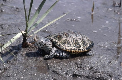
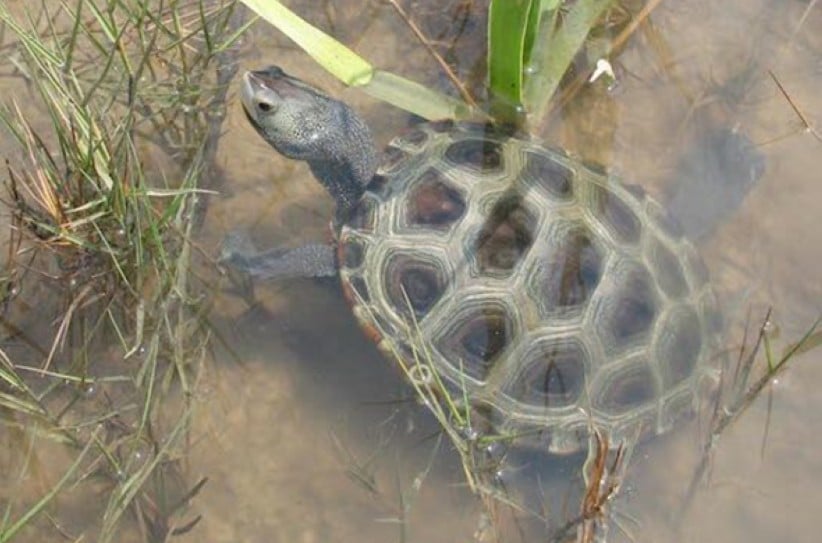
Another Turtle Month has come to a close, which means this month’s weird and wonderful focus has to shine a spotlight on a turtle: the diamondback terrapin, to be exact. This aquatic turtle occupies the salt marshes along the North Carolina coast, sounds, and tidal channels. Neither a fully freshwater nor a fully saltwater aquatic turtle, this weird and wonderful species, Malaclemys terrapin, needs brackish water habitat to survive. On the smaller side, diamondback terrapins range in size from 4 to 9 inches long, with females tending to be larger than males. Their carapace can vary in color from gray, brown, or black, and each scute has prominent concentric growth rings. In older individuals, these rings may be worn smooth and may not be as textured as they are in younger turtles. In addition to their unique shells, the skin of the head, neck, and legs of these turtles is often white or gray and covered in black spots, speckles, or lines.

Adult diamondback terrapin in a salt marsh. Photograph courtesy of Ken Taylor and the NC Wildlife Resources Commission.

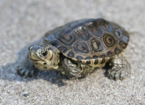
Diamondback terrapins are carnivorous and feast primarily on mollusks, crustaceans, and other invertebrates that inhabit the saltwater marshes. In particular, this species loves to munch on periwinkle snails. From April to June, female terrapins will nest in places above the high tide line and lay anywhere from two to twelve oval-shaped eggs. The hatchlings will emerge in August or September, but sometimes they hang out in the nest over the winter and do not leave until the following spring. During the warm spring and summer months adult diamondback terrapins are often observed sunning themselves on mudflats.

Diamondback terrapin hatchling. Photograph courtesy of Jeff Hall and the NC Wildlife Resources Commission.

Diamondback terrapins were historically valued for their meat: terrapin soup was a popular delicacy among the elite in urban centers along coastal areas, such as Charleston, South Carolina. Their population plummeted as a result of over harvesting; today, while collecting them for food is illegal, the species is still in peril. Crab traps are particularly deadly, as many are left abandoned, and once a terrapin swims into one, they are unable to get out and drown. In addition, many are still illegally collected for the wildlife trafficking trade, and a large portion of their historical habitat has been degraded or outright destroyed for development.

Adult diamondback terrapin swimming in a salt marsh. Photograph courtesy of Andrew Gosse and the NC Wildlife Resources Commission.

However, all is not lost! In recent years it has been made more apparent how beneficial salt marshes are to coastal communities, as they act as hurricane buffers and floodwater control measures. Thus, many salt marshes have been restored, leading to more habitat for diamondback terrapins. On the crab trap front, crabbers can buy special inserts for their traps that prevent terrapins from entering, but allow legal-sized crabs to get through. While many people along the coast might only be interested in the ocean and sandy beaches, the next time you are out that way, pay more attention to the mudflats amongst the salt marshes. You might see a diamondback terrapin or two basking or looking for delicious periwinkle snails.

Posted on — Leave a comment

How States Can Protect Clean Water After Sackett

Last week on May 13, 2026, the Waterkeeper Alliance, in partnership with the Center for Water Security and Cooperation, published a report detailing how states could protect their clean water in a post-Sackett II world. The Supreme Court, in their 2023 decision on the Sackett II case, significantly limited the definition of protected waters at the federal level. As a result, many waterbodies lost federal protection, and are now vulnerable to increased pollution or outright destruction. As the Protecting Clean Water at the State Level After Sackett report explains, states can step up to the plate and fill in the gaps when it comes to protecting clean water within their borders. 

Many states are home to shared waters, meaning portions or all of their waters fall within the same watershed as waters from other states. Thus, what happens to waters within one state’s boundaries affects the waters within another state. This report argues that states should follow the same approach when it comes to water protections, as that ensures consistency in water quality and public health. If one state has looser restrictions on clean water policy than another, this can result in pollution in one state causing issues in a state downstream. 

This report established a framework of regulations that Waterkeeper Alliance and CWSC explain can offset the impacts of the Sackett II decision at the state level. They examined current laws in Arkansas, Mississippi, Missouri, and Tennessee, which are all located in the lower Mississippi River basin, and identified recommendations for how each state’s laws could be strengthened to follow their proposed framework of legal protections for clean water. The authors of the report hope that stakeholders at both the local and state levels will follow these recommendations, with the goal of protecting clean water for their communities for generations to come. For anybody who wants to learn more about how their local and state governments can work towards protecting clean water for their citizens, this report is an excellent stepping stone in that direction.

#CleanWater #WaterProtection #SackettII #WaterkeeperAlliance #CWSC #EnvironmentalPolicy #ProtectOurWaters #CleanWaterForAll #MississippiRiver #WaterJustice #WetlandWednesday #TheSwampSchool
Posted on — Leave a comment

Interior Department Repeals Federal Public Lands Conservation Rule

The following blog post is a summary of the article “Trump administration cancels rule that made conservation a use of public lands” by Matthew Brown, published by the Associated Press on May 11, 2026. To read the original article, click here.

Photograph courtesy of the U.S. Bureau of Land Management.

The Interior Department is repealing a 2024 rule that had placed conservation efforts on equal footing with industrial development on federal public lands. The rule, introduced during President Joe Biden’s administration, allowed public lands managed by the Bureau of Land Management to be leased for environmental restoration projects in the same way land could be leased for drilling and other industrial purposes. President Donald Trump’s administration argued that the policy created unnecessary restrictions that could limit access to land used for energy production, logging, mining, and grazing. Interior Secretary Doug Burgum maintained that the rule threatened economic activity on hundreds of thousands of acres of public land and could negatively affect industries that depend on consistent land access. The repeal reflects the administration’s broader effort to reduce regulations and expand the use of taxpayer-owned lands for resource extraction and commercial development.

Supporters of the original conservation rule believed it addressed long-standing concerns that environmental protection had become secondary to industrial use within the Bureau of Land Management. Advocates pointed to the agency’s responsibilities under the Federal Lands Policy Management Act of 1976, arguing that conservation deserved a more prominent role in land management decisions. Environmental organizations warned that eliminating the rule could weaken protections for clean drinking water, wildlife habitats, and damaged ecosystems. Bobby McEnaney of the Natural Resources Defense Council criticized the repeal and argued that it would reduce accountability for corporations that leave environmental damage behind on public lands. Although conservation leases existed in limited forms before the Biden administration, the 2024 rule created the first dedicated program specifically focused on restoration and environmental stewardship.

Industry groups and Republican lawmakers strongly opposed the conservation policy and pushed for its repeal from the beginning. Critics argued that the Biden administration’s rule violated the Bureau of Land Management’s long-standing “multiple use” mandate by giving too much emphasis to land restoration and limiting opportunities for productive land use. Representatives from the oil and natural gas industry welcomed the repeal and said it would provide more clarity and predictability for companies investing in domestic energy production. The Bureau of Land Management oversees vast public land holdings across Western states such as Alaska, Nevada, Utah, and Wyoming, along with underground mineral reserves that include coal and lithium deposits. Since returning to office, the Trump administration has pursued several actions designed to expand fossil fuel production on federal lands while also rolling back restrictions adopted during the final months of the Biden administration.

#PublicLands #Conservation #EnvironmentalPolicy #LandManagement #EnergyPolicy #WildlifeProtection #NaturalResources #WetlandWednesday #TheSwampSchool