Posted on — Leave a comment

Wetland Wednesday: Can You Crack the Hydric Soil Challenge?

Your next field adventure starts below the surface.

Grab your virtual field kit and explore Below the Surface, our free hydric soil adventure from The Swamp School.

Travel across the map, investigate soil profiles, and follow the evidence. Your mission: identify the hydric soil indicators the evidence supports, then defend your call.

The app uses the latest USDA/NRCS Field Indicators of Hydric Soils in the United States, Version 9.3. Practice with the current indicator guidance, explore the built-in field guide, and sharpen your memory with photo flashcards.

Free to play. No student account required.

Ready for another adventure? Visit swampschool.org and find our Choose Your Adventure interactives, including The Friday Deadline and The Closing Clock. Make decisions through a wetland project or Phase I environmental assessment, and reach the end to receive a $100 coupon toward eligible Swamp School classes.

Bring your curiosity. Then challenge a colleague to compare field calls!

Posted on — Leave a comment

What the Corps Wants Applicants to Know About Wetland Reviews

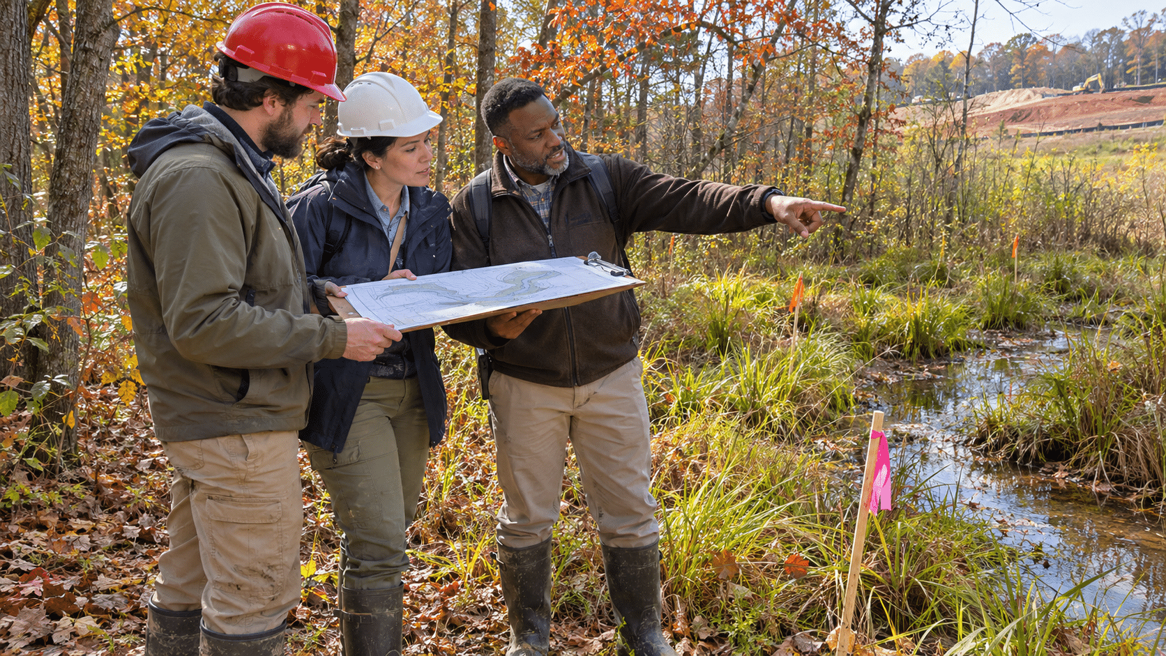
Three professionals in hard hats review a site plan in a wetland area during autumn, with a construction site visible in the distance.

WOTUS changes, review backlogs, and practical lessons from a Wilmington District discussion.

You have the fieldwork. You have the plans. You have submitted the application.

Now the project team wants a date.

When will the Corps respond? Does the project need a jurisdictional determination? Will the town accept anything else? What happens if the wetland rules change while everyone is waiting?

These questions were at the center of a public meeting hosted by the North Carolina Association of Environmental Professionals (NCAEP) on November 5, 2026, at Stantec’s office on Jones Franklin Road in Raleigh, with representatives of the U.S. Army Corps of Engineers’ Wilmington District.

The discussion offered a candid look at the pressures facing reviewers and applicants alike. Staff acknowledged delays, explained what makes applications harder to process, and described changes they hope will improve coordination.

Here are the takeaways for environmental professionals, landowners, engineers, and developers.

Another WOTUS rule may arrive in spring 2027

Corps staff said headquarters was projecting a new “waters of the United States,” or WOTUS, rule for spring 2027.

That is a planning estimate. Staff did not present a confirmed release date, an effective date, or the final details of the rule.

They also acknowledged a familiar challenge: agency personnel and the people preparing applications need to understand how a new rule will work, often with limited time to prepare.

Staff discussed training and outreach once more information becomes available. For anyone planning work around wetlands and streams, the spring projection is something to watch. It is not a basis for assuming what the final requirements will be.

The backlog is substantial, but it is moving

Corps representatives reported approximately 601 pending jurisdictional determinations in the Wilmington District, down from 742 in recent months.

That reduction represents progress. It also leaves a considerable workload.

The same staff must handle permits, jurisdictional reviews, compliance matters, and other responsibilities. Administration priorities, including certain energy and transportation projects, also influence which work receives attention.

To distribute assignments, projects may go to a regional review team or someone outside the applicant’s usual field office.

That can be frustrating when a consultant has already spent time explaining a complicated site to another project manager. Staff encouraged applicants to flag cases where reassignment could disrupt substantial prior coordination so the office could evaluate how to proceed.

For applicants, keeping a clear record of earlier discussions can help preserve continuity when a project changes hands.

Start by identifying the decision you need

Several documents commonly discussed as “wetland approvals” answer different questions.

A wetland delineation identifies where wetlands occur and establishes their boundaries.

A delineation concurrence documents the Corps’ agreement with aquatic-resource boundaries without resolving whether those resources are federally jurisdictional.

An approved jurisdictional determination, or AJD, provides the Corps’ formal determination of whether jurisdictional waters are present or absent and the extent of federal jurisdiction.

A preliminary jurisdictional determination, or PJD, allows an applicant to pursue permitting while setting aside the jurisdictional question and treating the identified resources as jurisdictional for that process.

An AJD is not a permit authorizing construction or filling. Likewise, agreement with a wetland boundary does not necessarily establish whether the wetland is federally regulated.

Staff encouraged applicants to discuss which review serves the project’s needs. Some permit applications can proceed without a separate jurisdictional determination.

An AJD can be valuable when federal jurisdiction affects project design, mitigation costs, investment decisions, or the ability to proceed. It also requires more review than a delineation concurrence.

Before requesting a document, the project team should be able to explain what decision depends on it.

“Best in, first out” puts application quality in focus

One phrase from the meeting deserves attention: “best in, first out.”

Staff explained that a well-supported application that can be resolved efficiently may move ahead of an older submission requiring substantial follow-up.

Applicants cannot control agency staffing. They can make their submissions easier to understand and verify.

The Corps highlighted several useful practices:

  • Provide clear maps showing aquatic resources and proposed impacts.
  • Include complete field documentation and photographs that explain site conditions.
  • Use consistent project names so reviewers can connect current work with earlier actions.
  • Give attachments descriptive filenames.
  • Explain each impact in plain language.

For example, a stream crossing may involve a culvert, temporary dewatering, riprap, and bank stabilization. Describing those components helps a reviewer understand what will happen and how the impact quantities relate to the plans.

A reviewer who can follow the project from the map to the data to the impact table has fewer questions to send back.

Explain the design decisions behind the impacts

The mitigation discussion began before anyone talked about buying credits.

Staff emphasized the full sequence: avoid impacts, minimize those that cannot be avoided, and then address compensation for remaining unavoidable impacts.

An application should explain how the design reached that point.

Was a road shifted away from a wetland? Was a retaining wall used to reduce the grading footprint? Were slopes adjusted? Can the construction schedule accommodate environmental restrictions?

These decisions may already be familiar to the design team. They still need to appear in the application.

A clear narrative helps the Corps document its review without reconstructing months of design work through emails and information requests.

Coordinate species and historic-resource reviews early

Corps representatives also discussed information about listed species, habitat, and historic resources.

They asked consultants to provide useful supporting information while coordinating with the Corps on the scope of its review. Depending on the project and applicable requirements, that scope may differ from the entire development site.

Staff explained that independent coordination with other agencies can create additional work when it addresses a different area from the one relevant to the Corps’ action.

An early conversation can help establish what information is needed and how consultation should proceed. Staff also asked applicants to provide access to relevant U.S. Fish and Wildlife Service project information when submitting applications.

The practical lesson is to establish the review approach before different participants begin working from different assumptions.

RRS improvements are still underway

The Regulatory Request System, or RRS, remains the Corps’ submission platform.

Staff acknowledged technical frustrations and described ongoing work to improve coordination with North Carolina’s joint application process. The goal is to reduce duplicate entries and improve information exchange between federal and state systems.

They encouraged specific feedback about problems that affect preparation or review.

A useful comment identifies the step, explains what happens, and describes the extra work it creates. Participants also discussed opportunities for consultants who frequently use the system to help test improvements.

Local approvals can depend on federal paperwork

Participants raised concerns about municipalities withholding building permits or certificates of occupancy while applicants wait for AJDs.

Corps representatives explained that a local requirement does not obligate the Corps to issue a determination on the municipality’s schedule. They offered to discuss documentation needs directly with local governments.

The discussion did not settle whether any particular local requirement is valid. Corps guidance recognizes that applicants may request AJDs to satisfy state or local authorization requirements, while also describing agency discretion and its general practice of honoring requests. Regulatory Guidance Letter 16-01 provides additional background.

When a project is stalled, the first step is to identify the exact document being requested and the concern it is intended to resolve.

Is the question about federal jurisdiction? Wetland boundaries? Compliance with an approved plan? An earlier permit?

Those questions may involve different documents, different professionals, and different paths forward.

More conversation before submission, and more outreach afterward

Staff encouraged pre-application coordination for projects with questions that would benefit from discussion before a full submission.

They also acknowledged that arranging those conversations has sometimes taken too long and discussed improving responsiveness.

Corps representatives expressed interest in more regular outreach through meetings, newsletters, and virtual presentations as new information becomes available.

That continued communication will matter as applicants work through the current backlog, adapt to the application system, and prepare for another possible WOTUS change.

For your next project meeting, consider putting three questions on the agenda: What decision do we need? What information supports it? Who needs to act next?

This article summarizes comments made during the November 5, 2026, public NCAEP meeting with Wilmington District staff. Projections and processing practices discussed at the meeting may change. The discussion did not establish new regulatory requirements or decide individual projects.

What question would you like the Corps to address at a future outreach meeting? Share it in the comments.

Posted on — Leave a comment

North Carolina’s Weird and Wonderful: Venus Fly Trap

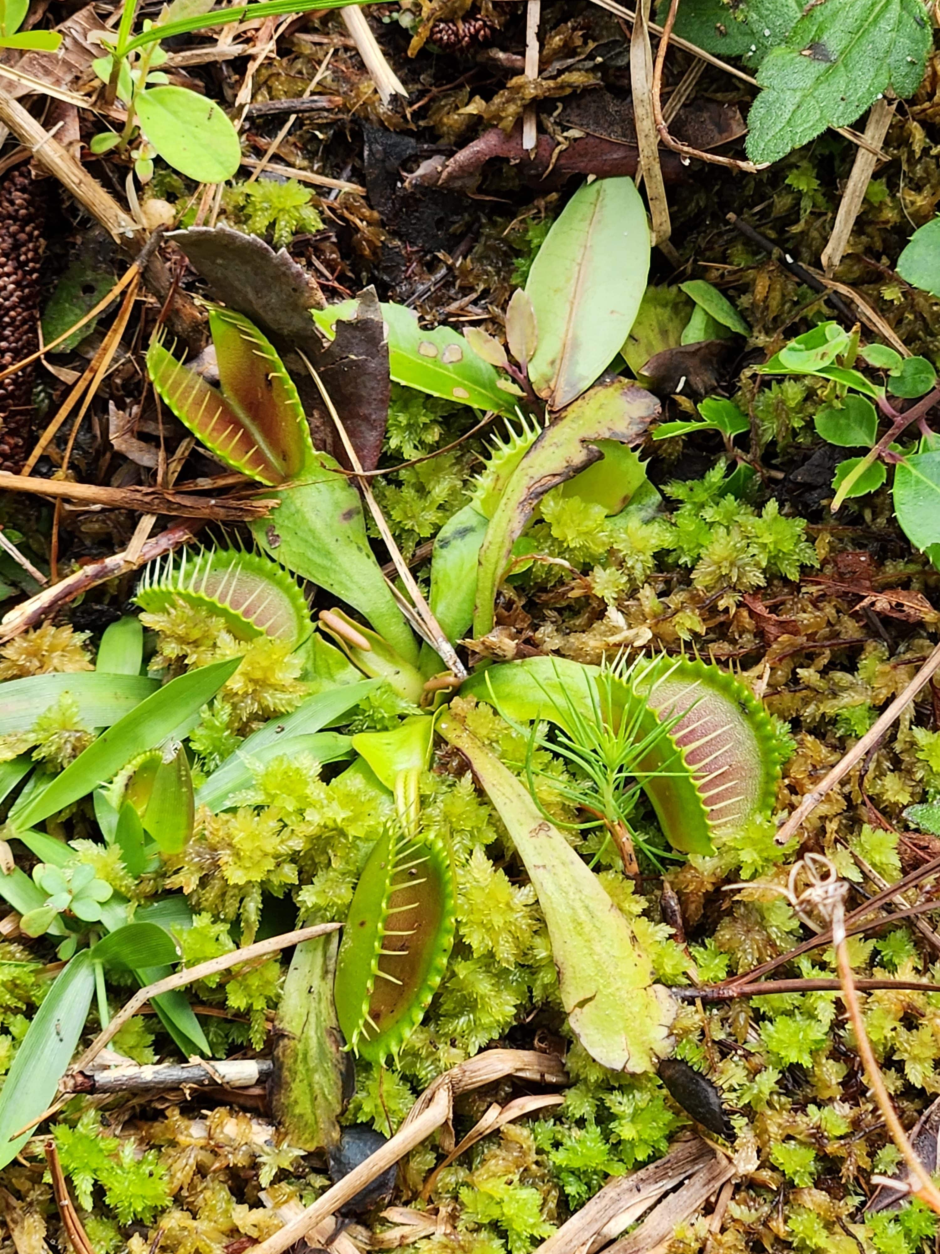
Close-up of a Venus flytrap among moss and dead leaves, showing characteristic hinged traps with serrated inner teeth ready to catch prey.

It’s Halloween Eve, which means it’s time for another Halloween edition of North Carolina’s Weird and Wonderful! In years past, I have celebrated the two-toed amphiuma alongside the then-seventy-years old horror classic, The Creature from the Black Lagoon, which I thought was a particularly clever combo. Last year I profiled the jack-o-lantern mushroom, a glowing treasure in North Carolina’s forests. This year, I have decided to take inspiration from another classic film celebrating a big anniversary, its 40th, Little Shop of Horrors, and the plant species that inspired the most important character, Audrey II: the Venus fly trap, Dionaea muscipula. 

Venus fly traps are only found in a small coastal region of southeastern North Carolina and northeastern South Carolina, in a radius of around 60-100 miles around Wilmington, North Carolina, growing in wet savannas and sandhill seepages. The soils tend to be sandy and acidic, and the overall habitat is greatly influenced by fire. The fly traps themselves require high-light conditions, with wildfires keeping the savannas and seepages from getting too overgrown with shrubs and trees that would block out the light and crowd out the fly traps. While indigenous communities were undoubtedly aware of the fly traps’ existence, the western scientific community was first introduced to them in 1759, when North Carolina colonial Governor Arthur Dobbs wrote about them in his diary. A few years later in 1768 live specimens were transported across the pond to England by royal botanist William Young. He collected his specimens in Brunswick County, North Carolina, and they ended up in London, where members of the Royal Society took a keen interest. One member, John Ellis, ended up writing about the botanical curiosity in a letter to Carolus Linneaus himself. 

Illustrations from John Ellis’ 1770 publication Directions for bringing over seeds and plants, from the East-Indies and other distance countries, in a state of vegetation. Within this treatise he included a description for a recently discovered plant species from the New World: the Venus fly-trap. Illustration courtesy of the Royal College of Surgeons of England.

Now, unlike the imposing Audrey II, the Venus fly trap is actually a very small plant consisting of a rosette of leaves that are usually fully reclined, or at least partially reclined, with the trap portion sitting at 45°-60° angles when undisturbed. The “stem” is a rhizome, and is fully below ground with the rest of the fibrous root system. The leaves consist of two parts: a broad petiole, which resembles a leaf-like stem, that radiates outward from the center of the plant; and a leaf blade that consists of two clamshell-like halves, which comprises the trap portion, at the very end of the leaf. The adaxial, aka upper, surface of the trap is often pinkish or reddish in color, which is thought to attract insects and get them to land, though this surface in many traps can range in color from pale green and yellow to deep red. The pressure of an insect landing on the adaxial surface triggers the two clamshell halves to quickly shut, turning into a clam-shaped claw with the food item trapped inside. Once they have snapped shut around a bug, the traps will remain sealed shut for 5-7 days while digestion takes place. After the food has been fully digested, the trap will open again, and will be ready to catch another morsel. Sometimes you can even see the dried out, chitinous exoskeletons left behind in a trap after digestion is complete, which is pretty weird and wonderful, if you ask me. Each trap is capable of capturing and digesting prey up to three times, after which the trap loses its eating ability. If a trap captures a very large prey item, that will bring about the demise of that particular leaf; new leaves, and subsequently, new traps, are continuously produced throughout the growing season. In addition to capturing and eating insects and arachnids, Venus fly traps also photosynthesize like their non-carnivorous plant neighbors. The nutrients gained from the unfortunate little bugs and spiders that find themselves ensnared help make up for the poor nutrient content in the soil in their native habitat. 

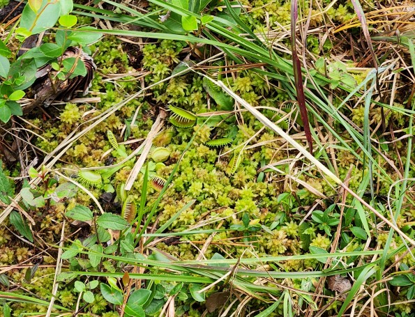
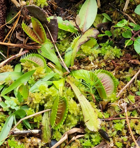
Dionaea muscipula, the Venus fly trap, nestled in its native habitat in Carolina Beach State Park, New Hanover County, North Carolina. Photograph courtesy of the author.

So, how exactly do the leaves shut so quickly? Time for some weird and wonderful science! There have been many hypotheses proposed, since the time of Charles Darwin, on how Venus fly traps actually work. If the leaves take too long to close, the plant risks the prey item escaping before it can be captured and digested. Older theories from Darwin’s time suggested that the fly traps might contain muscles or nerves, like animals. That idea has since been debunked. What is known for sure is that there are three highly sensitive trigger hairs present on each lobe of the leaf, and when mechanically stimulated, the lobes will close together in 0.3 seconds. A study published in 2008 in Plant Physiology discovered that touching the trigger hairs activates mechanosensitive ion channels in the plant cells, which induce action potentials within those cells. As a result of that action potential, which is a change in voltage across the cell due to the movement of positive ions across the cell membrane, the cells within the two lobes change in shape, curvature, and volume. These changes result in the rapid closure of the two lobes together. More recently, a study published in Science found that cell walls within the two lobes softened when the trigger hairs were activated, with the researchers hypothesizing that this action releases stored stress and causes the lobes to bend and close. Other researchers hypothesize that it is the movement of water into and out of the cells within the lobes that causes the trap to shut so quickly. What is clear is that more research still needs to happen to understand how these weirdly wonderful plants are able to trap their prey.

Dionaea muscipula, the Venus fly trap, in its native habitat in Carolina Beach State Park, New Hanover County, North Carolina. Photograph courtesy of the author.

Some of the energy gained through eating insects is used to produce the flower, which is a white, five-petaled, and cluster-like and is perched on top of a single stalk that emerges from May and remains through June. If you visit Carolina Beach State Park or Green Swamp Preserve in North Carolina, or the Lewis Ocean Bay Heritage Preserve in South Carolina during those months, you might get luck and see the Venus fly trap in full bloom. Tiny beetles and sweat bees are the primary pollinators, with tiny, black, pear-shaped seeds resulting from successful pollination. These seeds will automatically begin to germinate if dispersed on suitable substrate, and it takes about 3-4 years for a plant to mature. It is estimated that the plants can survive for a quarter of a century if they are in suitable habitat and are not influenced by stressors.

Unfortunately, stressors appear to be all around, in the form of habitat destruction, habitat degradation, and poaching. As urban and suburban sprawl continues, more savanna and sandhill seep habitats are under threat of being outright destroyed for development, or degraded due to nearby development and environmental stressors, including longer droughts, longer periods of time without wildfire, and more intense fires when they do occur. In addition, humans have always been fascinated with Venus fly traps, and many people unfortunately collect them illegally from the wild to add to their personal collection and to propagate and sell to other carnivorous plant enthusiasts. But all is not lost! The Venus Fly Trap Champions is a group based in North Carolina that seeks to protect Venus fly trap habitat, when possible, by helping landowners when they find them on their property and by relocating wild populations to safer locations when staying put is not an option. Together with their partners, which include the North Carolina Botanical Garden, the North Carolina Wildlife Resources Commission, and the U.S. Fish and Wildlife Service, among others, their mission is to educate the public about these awesome plants in their backyard, protect and restore prime habitat, locate previously unknown populations, and move Venus fly traps to safer areas in order to keep those genetics in play. The hope is that there will always be sustainable wild populations of Venus fly traps in the Carolinas, and that more people will work towards protecting them and their habitat for years to come. So, this Halloween, as you sit back to celebrate forty years of a carnivorous plant with a penchant for people, take a moment to also celebrate the charismatic Venus fly trap. This weird and wonderful botanical curiosity needs all the thoughts, prayers, musical numbers, and help it can get.

Posted on — Leave a comment

Two Minutes to Build Your Wetland Field Skills

Two field researchers crouch by a marsh, examining a clump of soil and roots while the man points to it as the woman takes notes nearby.

Introducing Swamp School Field Briefs—free, practical lessons delivered Tuesdays and Thursdays.

Where should you place a vegetation plot? Why can plant cover total more than 100%? What is the difference between identifying a wetland and determining federal jurisdiction?

These are small questions with practical consequences. They influence what you observe, what you record, and how clearly you explain your findings.

You may have encountered them in a course, worked through them on a project, or wished you could ask an instructor while standing beside a soil pit.

Our new Swamp School Field Briefs series gives these questions a place of their own.

One topic. Two minutes. Something you can use.

Each Field Brief explores one specific wetland topic in about two minutes.

You’ll find a clear takeaway, a practical example, a common mistake to watch for, and a short question to help you apply the idea. Sources are included so you can explore the subject further.

The lessons are designed for a quick read before a field day, between projects, or whenever you want to revisit a concept.

What will we cover?

Wetland plants: Representative sampling, plant cover, indicator ratings, and evaluating the surrounding community.

Hydric soils: Reading Munsell colors, identifying the matrix, and describing contrasting soil features.

Hydrology: Looking below the surface, recognizing evidence of past water, and considering rainfall when interpreting site conditions.

Regulations: Understanding the purpose and scope of delineations, jurisdictional determinations, and other regulatory documents.

Field methods: Writing useful notes, taking photographs with context, and connecting observations to conclusions.

Start with a question you’ve had in the field

Our opening lessons include:

  • Where Should You Place Your Vegetation Plot?
  • Why Plant Cover Can Add Up to More Than 100%
  • What Does “10YR 4/2” Actually Mean?
  • No Standing Water? Check Below the Surface.

The Start Here post introduces the series and provides a growing topic index. As lessons are published, you’ll be able to explore related subjects and return to earlier briefs.

For new practitioners—and experienced teams

If you are new to wetland work, use the series to build familiarity with individual skills.

If you have years of experience, use it to revisit a difficult concept or start a discussion with a newer colleague. Supervisors can share a relevant brief before a field assignment and discuss the practice question with their team.

These short lessons complement the detailed instruction and field practice offered through Swamp School courses.

Join us Tuesdays and Thursdays

Field Briefs are free. Subscribe to The Swamp School on Substack and enable Field Briefs in your subscription preferences to receive the lessons.

What question has made you pause during wetland fieldwork? Leave a comment. Your question could become a future Field Brief.

Marc Seelinger, SPWS
Founder, The Swamp School

Posted on — Leave a comment

A Two-Acre Turning Point? What the Bipartisan American Affordability and Jobs Act Could Mean for Wetlands

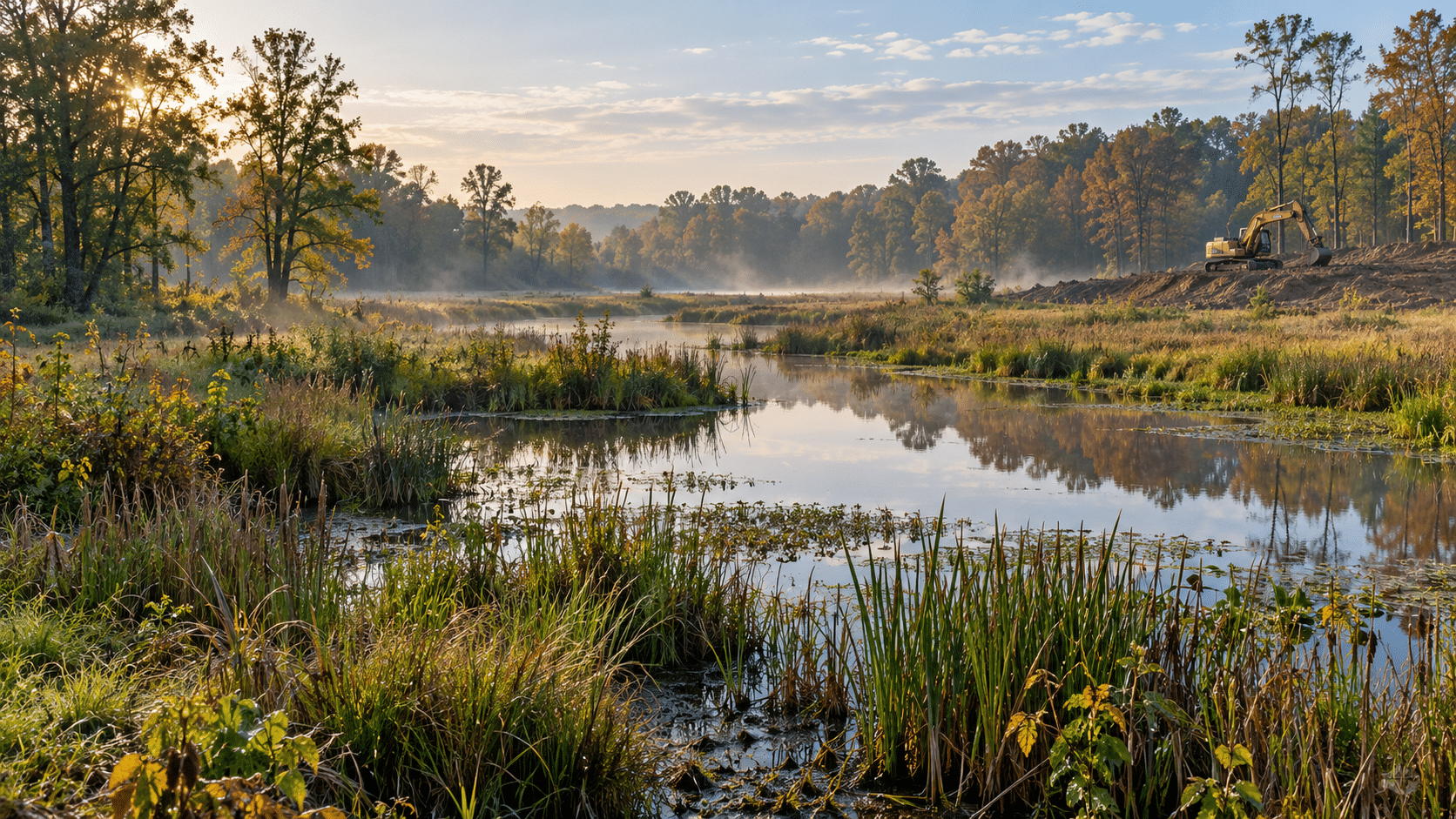
Dawn scene of a wetland with still water, grasses, and trees, a construction excavator on a dirt hill to the right.

September 30, 2026 | Washington, D.C.

A proposed federal permitting bill could substantially change how the United States authorizes wetland impacts, even without rewriting the definition of “waters of the United States.”

The Bipartisan American Affordability and Jobs Act of 2026 would change several important parts of the Clean Water Act, including nationwide permits, state water quality certifications, EPA oversight, and challenges to permit decisions.

The legislation was introduced September 30, 2026, as S. 5653. It remains a proposal, so the changes discussed here depend on what Congress ultimately passes.

For wetland scientists, landowners, engineers, and environmental consultants, the central issue is straightforward: a wetland could remain federally jurisdictional while becoming substantially easier to impact through the permitting process.

WOTUS and permitting answer different questions

Wetland regulation involves two separate questions.

First, is the wetland a water of the United States, commonly called WOTUS? That determines whether the Clean Water Act applies.

Second, if the wetland is jurisdictional, what authorization is needed to discharge dredged or fill material into it?

The bill’s Clean Water Act provisions focus heavily on that second question. They do not directly establish a new definition of WOTUS or a new continuous surface connection test.

Section 1201 would, however, change where challenges to federal WOTUS definitions are heard by adding those agency actions to the Clean Water Act’s direct federal appeals court review provisions.

For practitioners, this distinction matters. A broader permitting pathway does not make a wetland non-jurisdictional. Delineation and jurisdictional analysis would still be essential to determining which requirements apply.

Less than two acres would receive special treatment

One of the most consequential provisions appears in Section 1204.

For general-permit decisions, the bill would direct the Army Corps of Engineers to consider the effects of a discharge of dredged or fill material into less than two acres of navigable waters to be a minimal adverse environmental effect.

That is a significant policy choice. Congress would establish an acreage-based conclusion about environmental effects rather than leave the entire determination to agency evaluation.

The precise wording matters: the attached text says less than two acres, not two acres or less.

The bill would also require the Corps to maintain nationwide permits for qualifying activities associated with five specified permits:

Nationwide permitActivity category
NWP 12Oil or natural gas pipeline activities
NWP 14Linear transportation projects
NWP 43Stormwater management facilities
NWP 57Electric utility line and telecommunications activities
NWP 58Utility line activities for water and other substances

For this requirement, the bill uses a threshold of less than two acres for each “single and complete project,” incorporating specified regulatory definitions.

This would not create a blanket exemption allowing anyone to fill any wetland smaller than two acres. The provision concerns discharges, general permitting, specified activity categories, and project definitions. Permit conditions and other applicable requirements would still need to be evaluated.

The potential consequence is nevertheless substantial: more impacts could move through general permitting rather than a more extensive individual-permit process.

An acreage threshold cannot describe every wetland’s value

From a wetland science perspective, acreage provides useful information, but it does not fully describe function.

A small wetland may occupy an important position in a watershed, provide habitat, retain floodwater, or intercept pollutants. Its importance depends on its characteristics and location, as well as its size.

The bill’s proposed threshold raises an important question: Should a discharge into less than two acres be treated as minimally adverse because of acreage alone?

There is also a cumulative-effects concern. Numerous individually small impacts can add up across a watershed.

For linear infrastructure, how the incorporated “single and complete project” definitions apply to individual crossings would deserve close attention. A threshold applied to separate qualifying crossings is different from one applied to the entire length of a pipeline or utility corridor.

These are practical implementation questions with consequences for both project planning and aquatic resource protection.

General-permit review would focus on water quality

Section 1204 would also narrow the Corps’ analysis when determining environmental effects under the general-permit provisions.

The Corps would be directed to consider only the effects of dredged or fill discharges on compliance with defined water quality requirements.

That would constrain the ability to weigh wetland functions as independent considerations in that determination. Wildlife habitat, flood storage, and other functions would not necessarily receive separate consideration simply because they are environmentally important.

Some of those functions may relate to applicable water quality requirements. The concern is that the proposed statutory test would be narrower than a broader evaluation of wetland ecological effects.

My assessment is that this could simplify general-permit decisions while reducing the range of wetland values those decisions expressly address.

States and Tribes would face tighter certification limits

Section 1202 would substantially revise Section 401 water quality certification.

The bill would limit certification to compliance with specifically defined water quality requirements. It would also require a certifying authority to support a denial with clear and convincing evidence that no modification or reasonable condition could allow certification without violating those requirements.

Conditions would face similar scrutiny. The authority would need clear and convincing evidence that they are necessary, the least burdensome means of ensuring compliance, and consistent with the federal license or permit requirements.

For applicants, this could provide greater predictability and stronger grounds to challenge conditions.

For states and Tribes, it would narrow discretion and increase the evidentiary burden supporting their decisions.

The bill also establishes application procedures and review deadlines, including a maximum nine-month review period for specified interstate natural gas and electric transmission projects. Those projects would receive special treatment focused on direct point source discharges.

These changes concern federal Section 401 certification. They should not be read as automatically eliminating separate state wetland, buffer, stormwater, or other permitting requirements.

Permit programs could operate on longer cycles

The bill would extend the maximum term of Section 404 general permits from five years to ten years. It expressly preserves the ability to modify a general permit during its term or renewal.

Section 1203 would also extend the statutory maximum term for NPDES permits issued under approved state programs from five years to ten years.

Longer terms could reduce administrative workload and give applicants greater continuity. They could also mean longer intervals between routine program reconsideration.

For wetland professionals, the practical question would be how agencies use their remaining authority to respond to changing conditions during those longer permit terms.

EPA oversight and court remedies would be restricted

The proposal would limit EPA’s Section 404(c) authority to prohibit or restrict disposal sites to the period between submission of a complete permit application and issuance of the permit. That amendment would apply to applications submitted after enactment.

This would give applicants more certainty about when EPA could intervene, while removing that authority outside the specified window.

Section 1205 would also generally establish a 150-day deadline for challenges to Section 404 permits and general-permit verifications, unless a shorter deadline applies.

Even when a court finds a permitting decision unlawful, the bill would sharply restrict its ability to halt the authorized activity. The court would generally need to find an imminent and substantial danger to human health or the environment for which no other equitable remedy is available.

That matters for wetlands because correcting a permit decision after filling has occurred may not restore the resource that was lost.

What wetland professionals should take away

The legislation could change the consequences of a jurisdictional finding without changing the finding itself.

A wetland could remain WOTUS, yet its proposed impacts could qualify for a broader general-permit pathway, face narrower certification conditions, and receive stronger protection against later permit disruption.

Consultants would still need accurate delineations, defensible jurisdictional documentation, clear impact calculations, and careful analysis of project boundaries. They would also need to explain the difference between a jurisdictional determination, a permit authorization, and compliance with other applicable laws.

Faster and more predictable permitting is a legitimate goal. The scientific question is whether the proposed shortcuts preserve meaningful evaluation of wetland functions and cumulative losses.

For those who work in wetlands, this bill deserves attention alongside the continuing WOTUS debate. Which waters are protected and how impacts to those waters are authorized are equally important parts of the regulatory picture.

#Wetlands #CleanWaterAct #WetlandPermitting #EnvironmentalRegulations #WetlandWednesday #TheSwampSchool

Posted on — Leave a comment

Nature as Medicine: The Science Behind Feeling Better Outdoors

It is a truth universally acknowledged that spending time in natural spaces makes people feel better. This phenomenon has been studied in the scientific community since the 1980s, but many cultures around the world have recognized the importance of spending time in nature for centuries. Forest bathing, a form of purposeful relaxation that involves immersing oneself in nature, is a tradition with a rich history in Japan and South Korea. In North American, Indigenous Peoples across many tribes believed that one had to balance their life with their place in nature in order to be wholly healthy in mind, body, and spirit. For decades, researchers have found that people who spend more time in nature are less stressed, are more relaxed and calm, and suffer from less depression and anxiety than people who spend little to no time in nature. The question scientists are looking to answer now is, why? 

Researchers have been tackling this question from numerous angles and viewpoints, as was explained in a National Wildlife Federation article by Katarina Zimmer published on June 24, 2026.  One theory is the stress reduction theory, proposed in 1991 by health scientist Roger Ulrich and his colleagues. Their theory is that, while there may indeed be an inborn tendency for humans to seek out and respond positively to and within natural settings, each person’s response to nature is built around their cultural and individual experiences in nature. Individuals who rely on natural ecosystems for their source of income or sustenance may have more complicated feelings about that natural space, but might feel less anxious in a different natural setting. People who feel safe and secure in neighborhoods with well-manicured lawns might feel stressed in wild areas, or even in neighborhoods with wooded lots or native plant gardens that are more untamed in appearance.  

Another theory is the attention restoration theory, which was first posited in the 1980s by psychologists Rachel and Stephen Kaplan. They hypothesize that our brains spend much of their time on concentrating, planning, and executing tasks, which build up over time, and lead to feelings of anxiety, depression, and stress. Spending time in nature lets our brains calm down by gently captivating us in ways that do not require a lot of brain activity. Listening to rushing water or watching a snail slowly patrol along a fern frond do not require our brains to do very much at all; instead, people are able to be mentally engaged enough to be captivated by what they see, but not so much that their brains become overloaded. 

Throughout all the different hypotheses and theories that have been tossed out over the years, the one constant has been that nature has been shown to provide more and more benefits, from pain management, to increasing creativity, to even increasing individuals’ satisfaction with their own social life, even if they interact with natural spaces by themselves. This is why medical professionals are starting to prescribe spending time in nature to their patients. Several U.S. states have park prescription programs, where partnerships between medical facilities and local parks create opportunities for patients and their families to more easily take advantage of and spend more time in nature. While further study is needed to fully pinpoint why, exactly, nature has a positive effect on people, it seems that humans need natural spaces for our health and wellbeing as much as nature needs humans for its wellbeing.

#NatureAndWellness #MentalHealth #GetOutside #NationalParkRX #EnvironmentalEducation #WetlandWednesday #TheSwampSchool

Posted on — Leave a comment

Ecobot’s Lee Lance Joins Swamp School LIVE! on October 29th

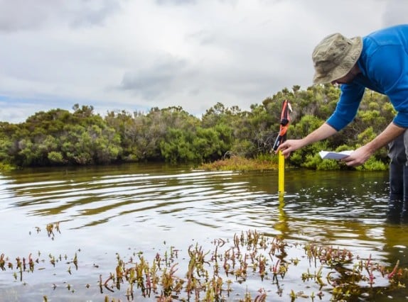
Field researcher in a blue shirt and hat uses a yellow water-quality probe in shallow mangrove estuary, taking notes beside the water.

Thursday, October 29, 2026, at 1 PM Eastern

A day in the wetlands can generate a lot of information: vegetation lists, soil descriptions, hydrology observations, photographs, and boundary locations. Getting those observations into an organized, accurate report is another part of the job.

For our next Swamp School LIVE!, we’re excited to welcome Lee Lance, co-founder and CEO of Ecobot, for a conversation about how technology is changing that workflow.

Lee will join Marc Seelinger of The Swamp School to discuss Ecobot’s features and how wetland scientists can use them in the field and back at the office. We also plan to include a live screen demonstration so you can see how field observations become project deliverables.

What will we cover?

We’ll explore practical questions that come up during wetland delineation and reporting:

  • How does Ecobot move information from a field sample point to a completed wetland data form?
  • What works when you are out of cell service?
  • How can AI-assisted plant identification and hydric soil suggestions support field work?
  • What can software catch during quality review, and what still requires and experienced scientist?
  • How can maps, photographs, and observations help document continuous surface connection?
  • What should a small consulting firm know before adopting a new field data system?

We’ll also ask Lee about Ecobot’s precipitation analysis tools, reporting capabilities, and what is coming next.

Throughout the conversation, we’ll focus on how these tools support the decisions wetland scientists make. A completed form is only useful when the observations and reasoning behind it are sound. We want to hear how Ecobot helps users preserve that connection between the fieldwork and the finished report.

Bring your questions

This is a live conversation, and you can participate through our call-in and chat Q&A. Whether you already use Ecobot, are considering it, or simply want to understand where wetland field technology is heading, this is an opportunity to ask questions directly.

Call-in number: (919)-297-2540

Mark your calendar for October 29 at 1 PM Eastern and join us for Swamp School LIVE!
The recording will also be posted on YouTube and Substack for those who cannot attend live.

#Ecobot #DataCollection #WetlandDelineation #SwampSchoolLIVE #WetlandWednesday #TheSwampSchool

Posted on — Leave a comment

Watching Logs Rot

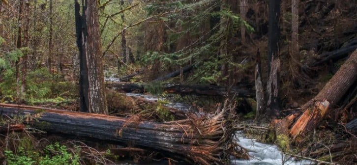
Forest scene with fallen logs across a small rushing stream, surrounded by green trees and undergrowth.

It turns out, watching a log break down is a lot more interesting than it sounds, though it does take several decades for a plot twist. In the Andrews Experimental Forest, located within the Willamette National Forest in Oregon, researchers have been studying the role of dead plant matter, specifically dead trees, within an ecosystem. Until the 1980s, it was the tradition that dead snags and fallen logs were removed from managed forests, because they were believed to increase the spread of plant pathogens and wildfires. Removing all those dead trees was costly, though, and ecologists were starting to wonder what purpose, if any, those dead trees would serve if left to their own devices. So, beginning in 1985, dead trees were left where they fell, so scientists could start looking into how they were decomposing, how nutrients were moving from the tree into the ecosystem, and what factors controlled how fast a log decomposed into mulch.

The first result was monetary in nature. Leaving fallen trees in place, instead of carting equipment into the forest, cutting up the tree, and carting the same equipment, plus the tree, back out of the forest saved Willamette National Forest upwards of $10 million a year. When it came to studying the logs, in the beginning, the logs were biopsied every year. This involved meticulously cutting out a cross section, or cookie, from the log; labeling and photographing it; and then separating and drying out the different kinds of wood present in the cookie and weighing each portion. As the years went by, the researchers leading the study started to spread out their log sampling. Now in its fourth decade, the research has already shown some large differences in the rates of decay amongst both different species of tree and amongst the different forms of wood. Earlier on, ecologists learned that fallen logs leached large amounts of organic matter, and that mushrooms were transporting huge amounts of nutrients from logs to the forest floor. 

More recently, scientists at the Andrews Experimental Forest were able to observe how fire would affect log decomposition when a wildfire burned through a portion of the study area in 2023. Afterwards, the research project ended up with three study areas of unburned logs, and three study areas full of burned logs, which created the “perfect study experimental design”, as one of the lead researchers, Dr. Jacob Bukoski, stated in a Sierra article published on August 20, 2026. He and a colleague, Dr. Georgia Seyfried, thought that charred logs wouldn’t be as biologically active as the uncharred ones in the unburnt study areas. It turns out, the opposite is true, which now has the scientists thinking, why is that the case? While funding issues in recent years have made it harder for scientists to continue some of the long-term studies conducted at the Andrew Experimental Forest, the hope is they will have many more decades to answer that question, and all the subsequent questions that have come from forty-plus years of watching logs rot.

#ForestEcology #LongTermResearch #Ecosystems #WetlandWednesday #TheSwampSchool

Posted on — Leave a comment

North Carolina’s Weird and Wonderful: The Winter Stoneflies

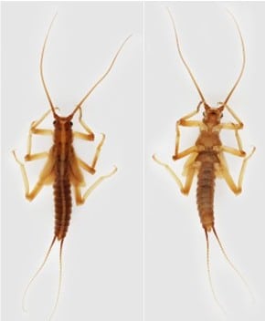
Dorsal and ventral view of a winter stonefly nymph in the Taeniopterygidae family. Photographs courtesy of Macroinvertebrates.org

Fall is finally here in North Carolina, though with temperatures reaching the nineties, it still feels like summer. While many insects are battening down the hatches and preparing for winter, some are just getting started. This month’s Weird and Wonderful focus is on one such group of insects: the winter stoneflies, Family Taeniopterygidae. Stoneflies, which comprise the insect Order Plecoptera, are an important group of macroinvertebrates (creatures without a backbone that are large enough to be seen with the naked eye) because their presence or absence within streambeds as nymphs is an indicator of how clean the water is. Winter stoneflies are a unique group because they emerge from the aquatic, nymph form into their terrestrial, adult form during the winter months.  

So, what exactly is a stonefly? I’m glad you asked! Adult stoneflies are soft-bodied insects and are not very brightly colored, instead ranging from dull grays to dull browns. Most adult species have four membranous wings on their dorsal (back) side that lie flat when at rest, and the adults are capable of flying from one spot to another over short distances. Some species of stoneflies have been documented exhibiting abdominal drumming, which are vibrations that they produce by their abdomen against the substrate. It is thought that this drumming behavior is a way for adult stoneflies to communicate and find each other in order to mate, which is a pretty weird and wonderful feature, if you ask me. Adult stoneflies only live for a couple weeks and spend most of that time engaged in mating and, for the females, subsequently laying eggs in streams, often the very same streams they themselves emerged from.  Life cycle studies performed on members of the Taeniepterygidae family show that most species take one full year to go from egg to nymph, and then to adult. 

Many people are more interested in the nymph stage of stonefly development, which is fully aquatic. Most stoneflies within the Taeniopterygidae family are herbivores and/or detritivores as nymphs, meaning they feed primarily on submerged vegetation and/or decomposing organic matter. Winter stonefly nymphs in this family can be found in permanent streams in the North Carolina mountains, piedmont, and coastal plain, though not all species can be found across all those regions. The nymphs are often found on submerged leaf packets, submerged plants and tree roots, and other accumulated debris within streams.  

In terms of pollution tolerance, there is a wider range within the winter stonefly family, with some species being able to survive in waterbodies with lower dissolved oxygen, while others require faster moving streams that are of higher water quality. Overall, though, stoneflies are some of the most intolerant stream macroinvertebrates when it comes to water pollution. Too many chemicals, not enough oxygen, and even too much sediment present within the water is enough to make a stream inhospitable for winter stonefly nymphs to survive. 

As previously mentioned, winter stoneflies, and the rest of the stoneflies within Order Plecoptera, are important biological indicators of water quality. When combined with the presence or absence of mayflies (Ephemeroptera) and caddisflies (Trichoptera), these insect orders form the “EPT” index. Insects within these three orders typically need water that is free of chemical and sediment pollutants and has a high oxygen content.  Essentially, the more species of these three insect orders that are found in a stream, the cleaner the water tends to be. Thus, being able to accurately identify a stonefly from a caddisfly or a mayfly, and then being able to identify it to the genus and species level, is a very important skill set that stream biologists and entomologists focusing on EPT species must develop. Workshops teaching that skill set often involve preparing collections of nymphs and adult forms and identifying them with the use of dissection microscopes and specialized taxonomic keys. 

In addition to their importance as water quality indicators, stonefly larvae are important sources of food for many freshwater fish. There are many great field guides for EPT species out there geared specifically towards anglers, because fishermen pay close attention to the hatching times for stonefly species throughout the year. The nymphs are used as live bait, particularly for large sport fish such as trout and bass. For those of you who feel the urge to go and play in your neighborhood stream, take a gander at the North Carolina Department of Environmental Quality’s Benthic Monitoring Data map. There, you can see what water quality ratings different water bodies within the state have, based on what macroinvertebrate species were found there during sampling. The cleaner the stream, the more EPT species and other stream macroinvertebrate species were found there during sampling. Stoneflies, weird and wonderful creatures of two worlds, while small and often overlooked, are an extremely important part of our state’s ecosystem. 

#Stoneflies #WinterStoneflies #Plecoptera #EPTIndex #BenthicMacroinvertebrates #StreamHealth #NCDEQ #NorthCarolinasWeirdandWonderful #WetlandWednesday #TheSwampSchool

Posted on — Leave a comment

North Carolina Reaches Historic $590 Million PFAS Settlement

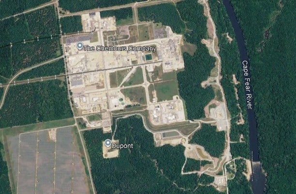
Aerial view of a chemical plant complex with white buildings and road grid, adjacent to the Cape Fear River, with nearby solar panels and dense forest nearby.

On September 10, 2026, North Carolina Attorney General Jeff Jackson and North Carolina Department of Environmental Quality (NCDEQ) Secretary Reid Wilson announced that a $590 million dollar deal had been reached between the state of North Carolina and eleven of its local governments and DuPont and Chemours over PFAS contamination in the state. This is the largest total environmental damages monetary recovery in North Carolina’s history, with a portion of the funds being used to create a $135 million reserve fund from DuPont and their sister company Corteva. The money in that fund is meant to ensure that Chemours continues working to comply with a 2019 consent order to stop discharging contaminants into the Cape Fear River and air from its Fayetteville Works facility. Earlier in 2026, the EPA and Chemours reached a deal totally only $90 million dollars for environmental projects across three different states, with no guarantee that North Carolina would see any of those funds. That deal was reached without consulting the North Carolina Attorney General’s Office or the North Carolina Department of Environmental Quality, and Attorney General Jackson, Secretary Reid, and North Carolina Governor Josh Stein filed comments in court opposing that deal. 

DuPont began operations at the Fayetteville Works chemical plant in the 1970s, and it was around 1980 that they started dumping PFAS into southeastern North Carolina. PFAS were regularly released into the air, soil, and into the Cape Fear River, which provides drinking water for 500,000 residents in the southeastern portion of our state. In addition, water from the Cape Fear is used to irrigate crops and water livestock; thus, forever chemicals, as they are commonly known, were present in the water and food for thousands of North Carolinians over several decades. In late 2016, a group of North Carolina researchers published a study that showed there were exceptionally high levels of PFAS in the Cape Fear River. Shortly after those results were published, NCDEQ filed an emergency injunction in early 2017 to stop Chemours, the current chemical company operating the Fayetteville Works plant, from dumping any more PFAS from the plant. Two years later, in 2019, Chemours was forced, via a landmark consent order, to cease releasing their wastewater into the Cape Fear; control their emissions of PFAS, particularly GenX, in the air; and begin providing water filtration devices to North Carolina residents with contaminated drinking water. In addition, Chemours had to actively work to reduce current PFAS levels within the Cape Fear River, address all sources of chemical contamination at the Fayetteville Works facility, and pay a $12 million civil penalty. 

The September 2026 settlement with DuPont/Chemours guarantees that $455 million will go to the state and the 11 local governments that joined the deal. Of that, the majority of the funds, $380 million, will be divided amongst the 11 local governments; the remaining $75 million will be allocated to the state. All the money will be paid out over a period of 10 to 15 years, with $55 million of the state’s portion going into the Emergent Contaminant Mitigation Fund. If, at any point in time, Chemours becomes unable to pay for their continued obligations under the 2019 consent order and the 2026 settlement, North Carolina can dip into the $135 million reserve fund. That way affected North Carolinians will continue to be able to receive the help they need in recovering from the decades of contamination. Thus far, Chemours is holding up its end of the bargain: they have provided clean water to approximately 10,500 families whose wells were contaminated; stopped discharging contaminated wastewater into the Cape Fear River; and have constructed and installed various means of preventing further contamination of water, soil, and air in the region. While this settlement is reason to celebrate, there are still several more ongoing cases in North Carolina that have yet to reach a conclusion. Nevertheless, this historic settlement is a major step forward in holding polluters accountable for the damage they have done to our state.

#PFAS #WaterQuality #NorthCarolina #EnvironmentalRegulations #CapeFearRiver #EnvironmentalJustice #NCDEQ #NCDOJ