
Posted on — Leave a comment

Italy Enters a New Era as a Forest Nation

The following blog post is a summary of the press release “Forests in Municipalities” by the Programme for the Endorsement of Forest Certification (PEFC) and PFEC Italia, National Union of Mountain Municipalities, Communities and Entities (UNCEM), and Legambiente. To read the original press release, which is in Italian, click here.
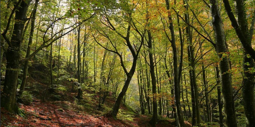
Italy has become a true forest nation, with woodlands now covering more than 100,000 square kilometers, or over one-third of the country’s land area. For the first time in centuries, forests occupy more land than Italy’s utilized agricultural areas, reflecting decades of farmland abandonment and natural forest expansion. The report introduces a municipality-by-municipality analysis of forest resources through the new Forest Cover Index, which compares woodland area to each municipality’s total land area while also examining population trends, economic activity, and land use. Marcetelli, located in the province of Rieti, ranks as Italy’s most heavily forested municipality, with 98.4 percent of its territory covered by woods. Gubbio, in the province of Perugia, contains the country’s largest total forest area, with more than 26,800 hectares of woodland, highlighting the remarkable diversity of Italy’s forest landscapes.

The findings reveal that Italy’s forests are distributed very unevenly across the country, with more than three-quarters of all woodland concentrated in mountain municipalities. Nearly half of Italy’s municipalities contain little or no forest, while just a small number of heavily wooded communities account for a significant share of the nation’s total forest resources. These mountain forests play an essential role in protecting biodiversity, storing carbon, reducing flood risks, and supporting clean water supplies for the entire country. The research also challenges the long-standing belief that forested communities are economically isolated or in permanent decline. Many municipalities with extensive forest cover have experienced positive migration trends, competitive local economies, and growing opportunities that combine sustainable forestry, tourism, agriculture, and environmental stewardship.

The report presents forests as valuable natural infrastructure capable of delivering lasting environmental, social, and economic benefits when managed sustainably. It emphasizes that careful planning, responsible forest management, and certification programs can strengthen local economies while preserving biodiversity and improving resilience to climate change. One of the strongest examples is Marcetelli, where ecosystem services provided by its forests are estimated to generate nearly 8 million euros in value each year through benefits such as air purification, groundwater recharge, erosion control, carbon storage, flood mitigation, and forest products. Local leaders view these findings as an opportunity to develop new policies that reward communities for protecting forests while creating sustainable economic opportunities in rural and mountain regions. Overall, the study concludes that Italy’s forests should be viewed not simply as remnants of abandoned rural landscapes but as strategic assets that can support conservation, strengthen local communities, and contribute to the country’s long-term environmental and economic future.

#PEFC #PEFCItalia #ForestNation #Italy #UNCEM #Legambiente #NaturalResources #Forestry #NaturalInfrastructure #WetlandWednesday #TheSwampSchool

Posted on — Leave a comment

Phase 1 ESA ASTM E1527-21 v. ASTM E2247-23: What’s the difference?

ASTM standards play a central role in environmental due diligence, and two of the most important in the Phase I Environmental Site Assessment (ESA) landscape are ASTM E1527-21 and ASTM E2247-23. While both standards are designed to support environmental risk evaluation and protect stakeholders in real estate transactions, they serve different purposes and audiences. Understanding their differences is essential for students and professionals looking to build a well-rounded foundation in environmental assessment. 

ASTM E1527-21 is the current standard practice for conducting Phase I ESAs to satisfy the requirements of the All Appropriate Inquiries (AAI) rule under CERCLA, the Comprehensive Environmental Response, Compensation, and Liability Act, also known as Superfund. In practical terms, it is the gold standard for evaluating potential environmental contamination on commercial properties. The standard emphasizes identifying Recognized Environmental Conditions (RECs), along with Controlled RECs (CRECs) and Historical RECs (HRECs). These defined terms provide a structured framework for categorizing environmental risks. The process also includes thorough historical research, site reconnaissance, regulatory database reviews, and interviews with knowledgeable parties. Because of its rigor and consistency, E1527-21 is widely relied upon by environmental consultants, lenders, attorneys, and developers. 

In contrast, ASTM E2247-23 is tailored specifically for forestland and rural property assessments. While it shares the same underlying goal, identifying environmental risks, it adapts the Phase I ESA approach to account for the unique characteristics of large, undeveloped, or sparsely developed tracts of land. One of the most notable distinctions is that E2247-23 does not use the REC, CREC, or HREC terminology found in E1527-21. Instead, it relies more heavily on the environmental professional’s judgment to identify and describe potential environmental concerns without fitting them into predefined categories. This makes the standard more flexible and better suited to properties where traditional commercial or industrial risk classifications may not apply. 

The differences extend to methodology as well. E1527-21 is highly structured and prescriptive, reflecting the complexity and higher risk typically associated with commercial and industrial properties. It requires detailed file reviews, standardized terminology, and a comprehensive evaluation process designed to meet regulatory expectations. E2247-23, on the other hand, is more risk-based and adaptable. It often emphasizes the use of aerial imagery, government records, and historical land use patterns, while allowing for scaled reconnaissance efforts depending on property size and accessibility. 

Another important distinction is the intended user base. E1527-21 is essential for those involved in commercial real estate transactions and liability protection under CERCLA. E2247-23 is particularly valuable for professionals working in forestry, conservation, agriculture, and rural land management, where properties can span thousands of acres and present very different environmental considerations. 

For students, this distinction presents an opportunity rather than a choice. Those who have already taken a course focused on E1527-21 will benefit greatly from also studying E2247-23. The latter expands on core due diligence principles while introducing a different analytical mindset, one that relies less on rigid classifications like RECs and more on professional judgment and context. This broader perspective strengthens a student’s ability to assess a wider variety of property types. 

At the same time, E2247-23 stands on its own as a valuable course. Even without prior exposure to E1527, students can gain a strong understanding of environmental due diligence concepts while learning how to apply them in real-world rural and forestland scenarios. 

Ultimately, mastering both standards provides a more comprehensive perspective on environmental site assessments. As the industry continues to evolve and encompass a wider range of property types, professionals who understand both E1527-21 and E2247-23 will be better equipped to navigate diverse challenges and deliver high-quality, defensible assessments. 

#Phase1ESA #ASTM #CERCLA #EnvironmentalDueDiligence #WetlandWednesday #TheSwampSchool

Posted on — Leave a comment

ASTM E2247 and Phase I Environmental Site Assessments for Forestland and Rural Property

Environmental due diligence is a routine part of commercial real estate transactions, but rural and forested landscapes present a different set of challenges. Large property sizes, limited historical records, and a wide range of past land uses can make environmental risk more difficult to evaluate.

To address these unique conditions, the ASTM E2247 standard was developed specifically for Phase I Environmental Site Assessments (ESAs) conducted on forestland and rural property. This standard provides guidance for identifying potential environmental risks associated with rural land transactions.

For professionals involved in forestry, conservation, agriculture, land investment, or rural real estate, understanding the basics of ASTM E2247 is an important first step in managing environmental liability.

Why Environmental Due Diligence Matters for Rural Land

At first glance, rural property often appears environmentally untouched. However, many forest and agricultural lands have complex land-use histories that can introduce environmental concerns.

Over time, rural properties may have hosted activities such as:

  • Timber harvesting operations
  • Agricultural production and pesticide use
  • Fuel storage for farming or logging equipment
  • Informal dumping areas or burn pits
  • Historic industrial uses like sawmills

Because these activities are not always well documented, environmental due diligence helps buyers, lenders, and land managers better understand the environmental history of a property before completing a transaction.

What is ASTM E2247?

ASTM E2247 is the industry standard that outlines how to conduct a Phase I Environmental Site Assessment for forestland and rural properties. It adapts the traditional Phase I ESA process so it can be applied effectively in rural environments where property records may be incomplete and land use histories may extend back generations.

The goal of a Phase I ESA is to identify Recognized Environmental Conditions (RECs) — indications that hazardous substances or petroleum products may be present on a property.

Identifying these conditions early helps parties involved in a land transaction evaluate potential environmental liability before moving forward.

Why Rural Environmental Assessments Can Be More Complex

Conducting environmental assessments on forestland or rural property often involves challenges that are not commonly encountered on smaller commercial sites.

For example, rural properties may:

  • Cover hundreds or thousands of acres
  • Have limited historical documentation
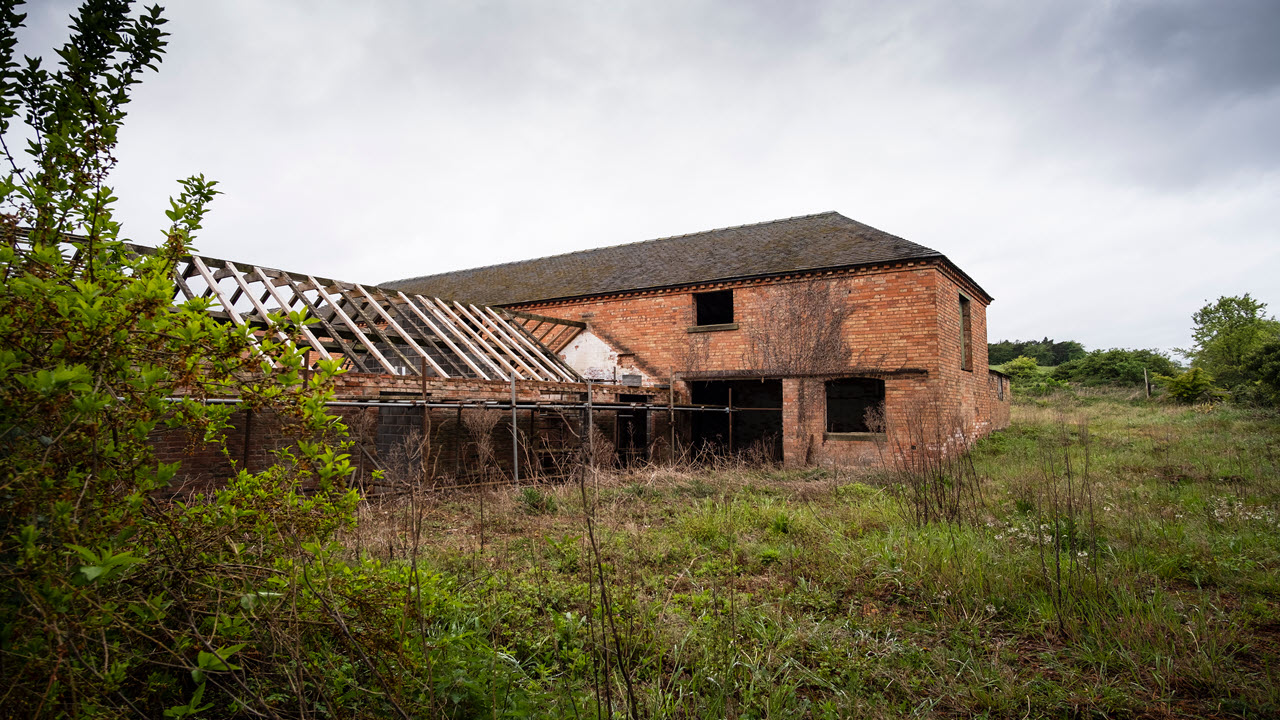
  • Contain abandoned structures or historic activity areas
  • Include agricultural or forestry practices spanning decades

Environmental professionals must often combine records research, field observations, and local knowledge to better understand how the land has been used over time.

Who Should Understand ASTM E2247?

While Phase I ESAs are typically performed by environmental professionals, many other groups benefit from understanding how environmental due diligence works in rural land transactions.

These include:

  • Foresters and forestland managers
  • Rural land brokers and real estate professionals
  • Conservation organizations and land trusts
  • Environmental consultants
  • Attorneys and lenders involved in land transactions

For anyone involved in buying, selling, financing, or managing rural land, awareness of environmental risks can help prevent unexpected liabilities later.

A Growing Area of Environmental Due Diligence

Interest in timberland investment, conservation properties, and rural land acquisition has increased significantly in recent years. As a result, environmental due diligence for rural property has become more important than ever.

ASTM E2247 provides a framework for evaluating environmental risks in these landscapes, helping professionals conduct assessments that are both credible and defensible. Overview of 2247

However, applying the standard effectively requires understanding how traditional Phase I ESA methods are adapted for rural environments.

Final Thoughts

Environmental due diligence for forestland and rural property is an evolving area of practice. While the ASTM E2247 standard provides a structured approach, each property presents its own unique history and potential environmental considerations.

For professionals involved in rural land transactions, gaining a deeper understanding of how Phase I Environmental Site Assessments apply to these landscapes can be an important step toward managing environmental risk and making informed decisions.

Posted on — Leave a comment

2026 Nationwide Permit Proposal Update

The U.S. Army Corps of Engineers has launched the reissuance process for its Nationwide Permits (NWPs), which authorize categories of activities under Section 404 of the Clean Water Act and Section 10 of the Rivers and Harbors Act of 1899 that result in no more than minimal adverse environmental effects. This process, conducted every five years, ensures that permits remain relevant and effective. The current NWPs are scheduled to expire on March 14, 2026. As part of the reissuance, the Corps published proposed changes in the Federal Register on June 18, 2025, initiating a 30-day public comment period that ends July 18, 2025. 

The proposal includes the reissuance of all current NWPs with modifications, the introduction of one new permit, and the decision not to reissue another due to pending litigation. In addition to changes to the permits themselves, revisions are proposed to the General Conditions, as well as to Sections D and F of the NWPs. These updates are designed to improve clarity, ensure environmental protections, and maintain regulatory consistency across jurisdictions. 

Stakeholders have voiced concern that the 30-day comment window is too brief to meaningfully evaluate the extensive documentation, including dozens of permits, detailed decision documents, and 32 general conditions. Many have called the period “unrealistically short” and inadequate for providing thoughtful feedback on the environmental and procedural impacts of the proposed changes. These concerns highlight the need for broader engagement and potentially an extension of the comment period to facilitate more comprehensive input. 

One of the more debated aspects of the proposal is General Condition 23(d), which includes a relatively new requirement for the purchase of mitigation credits in certain cases involving minimal stream bed impacts (> 3/100 ac.)  While some commenters argue this results in unexpected costs that may outweigh environmental benefits, others defend the provision. One such commenter acknowledged the financial burden but emphasized that the requirement is “a measured and scientifically supported policy” aimed at preventing incremental yet cumulative degradation of aquatic ecosystems. They further argued that environmental mitigation is not a penalty but a responsibility, describing it as a “necessary and reasonable balance between infrastructure development and environmental stewardship.” 

Some Districts like New Orleans, Louisiana are playing a more tailored role in this process through changes to Section F – District Engineer’s Decision. The state has issued its own Federal Register notice, with the New Orleans District seeking comments on proposed regional conditions specific to Louisiana’s needs. Division engineers have the authority to add regional conditions to ensure that activities authorized under the NWPs result in no more than minimal environmental effects. The New Orleans District is also encouraging feedback on whether additional regional conditions are needed to further support environmental protection at the local level. 

Stay tuned for our Webinar on August 7th, where we will cover the 2026 Nationwide Permit Proposal in detail, discuss regional implications, and explore how stakeholders can engage meaningfully during the review process. 

Posted on — 1 Comment

Waters of the State: Comparing State and Territorial Regulations to Federal WOTUS Standards

Navigating the complexities of water regulations across the United States can be challenging, particularly given the varying approaches states and territories take in comparison to federal Waters of the United States (WOTUS) standards. Recent shifts in federal guidelines, including key Supreme Court rulings like the Sackett II decision and subsequent guidance from the U.S. Army Corps of Engineers (USACOE) and the Environmental Protection Agency (EPA), highlight the importance of understanding these differences. This post explores how each state and territory defines and regulates waters within their jurisdictions relative to federal requirements.

States and Territories Exceeding Federal WOTUS Regulations

These states and territories have chosen to implement regulations that provide broader protection than federal standards, often including protections for isolated wetlands, ephemeral streams, and smaller water bodies.

States:

  • California: Under the Porter-Cologne Water Quality Control Act, California defines “waters of the state” broadly to include all surface and groundwater, ensuring protection beyond federal standards. The act regulates discharges through NPDES permits and WDRs, mandating the prevention of water degradation and committing the state to maintain the highest reasonable water quality.
  • Colorado: Colorado uses state policies to regulate wetlands no longer covered federally, defining “waters of the state” to include all streams, rivers, lakes, and wetlands, with a focus on ephemeral streams and isolated wetlands.
  • Connecticut: Connecticut empowers municipalities to extensively regulate wetlands and watercourses, with House Bill 7174 (introduced March 6, 2025) aiming to strengthen protections for wetlands, watercourses, riparian buffers, and address habitat preservation and development impacts.
  • Delaware: Delaware extensively protects tidal and non-tidal wetlands, including isolated wetlands, recognizing past losses from unregulated activities. The state’s policy emphasizes preserving wetlands to protect the environment, economy, recreation, and flood control, while respecting private property rights.
  • Florida: Florida strengthens protections through the Environmental Resource Permit program and Section 404(g) authority, requiring permits for activities like well construction, development, and work near wetlands to ensure environmental protection and compliance.
  • Hawaii: Maintains stringent regulations protecting all waters within state boundaries, focusing on ecosystem preservation, water quality, and biodiversity.
  • Illinois: Illinois is advancing legislation to protect waters impacted by federal rollbacks, with the Interagency Wetland Policy Act of 1989 aiming to safeguard isolated wetlands and prevent overall wetland loss by regulating state agency actions.
  • Indiana: Indiana exceeds Clean Water Act (CWA) standards by applying specific water quality standards to surface waters in both the Great Lakes and Mississippi River systems. The state classifies its waters into three categories and conducts triennial reviews as required by Section 303(c) of the CWA. Indiana’s standards, approved by the EPA, are more tailored and region-specific than the federal baseline.
  • Maine: Maine provides strong regulatory oversight for ecologically important wetlands through federal, state, and local management, primarily under the Clean Water Act, the 1988 Natural Resources Protection Act, and local zoning laws.
  • Maryland: Maryland broadly protects all surface and groundwater, including isolated wetlands and streams, through its Wetlands and Waterways Protection Program, regulating activities like draining and dredging to prevent loss and degradation.
  • Massachusetts: Massachusetts exceeds federal standards by extensively regulating waters near wetlands, rivers, and coasts through the Wetlands Protection Act and local laws, requiring permits for any alterations to protected areas.
  • Michigan: Utilizes the Michigan Wetlands Protection Act to regulate a comprehensive range of wetlands, lakes, rivers, and ponds, having also assumed Section 404(g) authority. Under Part 303, wetlands in Michigan are regulated if they are near or connected to the Great Lakes, Lake St. Clair, or inland water bodies, or if they are over 5 acres in size. Smaller, isolated wetlands may also be regulated if deemed critical to preserving the state’s natural resources by EGLE, with proper notice to the property owner.
  • Minnesota: Minnesota ensures broad wetland protection through mandatory mitigation for all impacts, balancing agricultural drainage with preservation under laws like the Wetland Conservation Act, and supporting diverse wetland types beyond federal requirements.
  • New Jersey: New Jersey protects waters under the Freshwater Wetlands Protection Act and Section 404(g) authority, aiming to balance private property rights with the public benefits of preserving inland waterways and freshwater wetlands.
  • New York: New York protects smaller wetlands and important habitats beyond federal standards under the Freshwater Wetlands Act, aiming to preserve natural benefits while supporting economic, social, and agricultural development.
  • Ohio: Ohio extensively protects isolated wetlands through a rigorous permitting process administered by the Ohio EPA, ensuring state-level oversight following reduced federal protections after the 2001 SWANCC decision.
  • Oregon: Oregon operates a state-managed removal-fill permit system that protects wetlands, lakes, rivers, and streams beyond federal standards. Most projects moving over 50 cubic yards of material in these areas require a permit, with stricter regulations for sensitive areas like Essential Salmonid Habitat and Scenic Waterways. The system safeguards ecological functions and applies to activities like building docks, land development, stream bank stabilization, and dredging.
  • Pennsylvania: Pennsylvania’s Clean Streams Law, guided by Chapter 105 regulations, protects streams, rivers, lakes, ponds, and wetlands. It regulates pollution, sewage, industrial discharges, and mining impacts to safeguard water quality for public health, aquatic life, industry, and recreation, while also enforcing penalties and supporting local pollution control efforts.
  • Rhode Island: Rhode Island protects freshwater wetlands, isolated wetlands, and coastal waters through state-specific regulations. The plan emphasizes climate change adaptation and environmental justice, aligning with the RIDEM Strategic Plan for FY24–26, and calls for integrating climate science and equity considerations into all environmental decisions.
  • Vermont: Vermont enforces strong wetland regulations focused on buffer zones and habitat integrity for lakes, rivers, streams, and ponds. Recent updates enhance clarity, public engagement, and transparency by refining wetland classification, improving map accessibility, and introducing new public notice requirements for wetland determinations and changes.
  • Virginia: Virginia provides robust protections for tidal and non-tidal wetlands, significantly exceeding federal coverage to ensure environmental resilience.
  • Washington: Washington maintains strong ecological protections for all state waters, independent of federal rules. Despite a recent U.S. Supreme Court decision narrowing federal wetland protections, Washington’s stricter environmental laws ensure continued safeguards for wetlands, endangered species, and tribal lands.

Territories:

  • American Samoa, District of Columbia, Guam, Northern Mariana Islands, Puerto Rico, and U.S. Virgin Islands all exceed federal standards, broadly defining jurisdictional waters to include coastal and inland wetlands, streams, and marine habitats.

States and Territories Aligning with Federal WOTUS Regulations

These states adhere closely to federal definitions and restrictions, often limiting their regulatory authority to federally defined waters. They frequently utilize definitions directly aligned with or identical to federal WOTUS guidelines, which can leave certain waters unprotected following federal rollbacks.

States:

  • Alabama, Alaska, Arizona, Arkansas, Georgia, Idaho, Indiana, Iowa, Kansas, Kentucky, Louisiana, Mississippi, Missouri, Montana, Nebraska, Nevada, New Hampshire, New Mexico, North Carolina, North Dakota, Oklahoma, South Carolina, South Dakota, Tennessee, Texas, Utah, West Virginia, Wisconsin, Wyoming.

Territories:

  • Currently, no major U.S. territory strictly aligns with federal standards, as all have chosen broader protective measures.

Understanding the Implications

The divergence in regulatory approaches among states and territories carries significant environmental and practical implications. States exceeding federal protections are positioned to better conserve biodiversity, maintain water quality, and mitigate impacts from floods and climate change through comprehensive environmental management strategies.

In contrast, states aligning strictly with federal standards may face increased environmental risks. The recent USACOE and EPA guidance memo (March 12, 2025), responding to the 2023 Supreme Court Sackett II decision, further narrowed federal wetland definitions, reducing federal protections significantly. As a result, states not extending beyond these federal guidelines risk substantial ecological losses, diminished biodiversity, and reduced capacity for climate adaptation and resilience.

Overall, these developments highlight the growing importance of state-level environmental leadership and policy innovation in safeguarding water resources. Stakeholders, policymakers, and communities must remain informed and engaged to advocate for effective water resource management tailored to local ecological and societal needs.

Posted on — Leave a comment

March 14, 2024, National Pi Day (or is it PIE?)

Archimedes (287-212 BC) was one of the greatest mathematicians and was the first person to calculate the value of π (pi), which is the ratio of the circumference of a circle to its diameter (C=2πr). The national holiday, yes, national holiday, was declared on March 12, 2009, by the U.S. Congress, and is celebrated on 3/14, which are the first three numbers of the never-ending irrational value of π. (Another fun fact is that Albert Einstein was born on March 14th, which is another good reason to celebrate the day.) Pi day is now celebrated by math geeks all around the circumference of the world with deals at some participating restaurants. Of course, it is also a great excuse to eat all the pie you can on this special day.

However, to wetland delineators, the word pi also congers up the acronym PIE, or the first three letters of the stream classification: Perennial, Intermittent, and Ephemeral. These three terms apply to streams and were defined in 1982 by two gentlemen that go by the names of Hedman and Osterkamp. Most recently, in 2020, President Trump, for the Waters of the U.S. (WOTUS) rules, further defined these terms for classification of “waters” that are jurisdictional by lawyers’ terms.

What is the technical definition of these three terms, you ask?

Technically, the word perennial is an adjective that means lasting or existing for a long or infinite time, and that endures or is continually recurring. As such, these streams are flowing continually throughout the major portion of the year, sometimes even in drought conditions. A perennial stream is a “stream that has flowing water year-round during a typical year. The water table is located above the streambed for most of the year. Groundwater is the primary source of water for stream flow. Runoff from precipitation is a supplemental source of water for stream flow.” (http://www.virginiaplaces.org/watersheds/perennial.html)

The term intermittent is also an adjective that means coming and going at intervals: not continuous. An intermittent stream, as compared to a perennial stream, is a “stream that has flowing water during certain times of the year, when groundwater provides water for stream flow. During dry periods, intermittent streams may not have flowing water. Runoff from precipitation is a supplemental source of water for stream flow.” (http://www.virginiaplaces.org/watersheds/perennial.html)

Ephemeral, on the other hand, means lasting for a short time. An ephemeral stream is a stream that “has flowing water only during or for a short duration after precipitation events in a typical year. In many states, this term refers to streambeds that are located above the water table year-round and streams where groundwater is not a source of water for the stream.” (http://www.virginiaplaces.org/watersheds/perennial.html)

As mentioned above, the WOTUS (Waters of the U.S.) rules defined PIE streams as either jurisdictional or non-jurisdictional. The current WOTUS rules do not mention PIE, only “relatively permanent” waters. Of course, this leads us to question, which of these streams are “relatively” permanent. What is the term relative to? That is a question for another article.

Regardless, wishing you a HAPPY PI (PIE) DAY! Celebrate by having a piece of pie!

Posted on — Leave a comment

Natural Shorelines

The Swamp Stomp

Volume 19, Issue 8

After studying the effects of Hurricane Irene on the Outer Banks of NC, scientists faced some surprising data.  The surprising part was that so little information was available on the resilience of coastlines. Environmental Scientist at the University of North Carolina at Chapel Hill, Rachel Gittman, was quoted saying, “The more I researched, the more I realized that we just don’t know very much. So much policy and management are being made without the underlying science.” (1) Scientists understood the physics, but it was never put in a form the policymakers could easily understand. 

As Gittman was studying the shorelines, she noted that concrete walls were out weathered by the marshes. Irene damaged 76% of bulkheads surveyed, while no damage to other shoreline protection options was detected. However, in terms of habitat loss statistics, 30 to 50 percent of wetlands have already been lost, 19 percent of mangroves were lost from 1980–2005, and 75 percent of the world’s coral reefs are now rated as threatened. (3) 

Almost all money, historically, to protect the coastline has been spent on “gray infrastructure.” These include bulkheads, levees, seawalls, and rock revetments.  However, as research on “green” coastal protection is measured in the long term, this is beginning to change. It has become clear that living shorelines are a great defense against storms and surges.   

“Living shorelines” is a term used to define shoreline protection allowing for natural coastal processes to remain through the strategic placement of plants, stone, sand fill, and other structural and organic materials. (4) Yet the value of these ecosystems considered as “green infrastructure” is still not fully accepted or understood by policymakers, and these valuable ecosystems continue to be lost and degraded. Wetlands across the U.S. and the world continue to disappear at a rapid rate due to global warming, increased populations, and infrastructure. 

Storm responses suggest that marshes with and without sills are more durable than hard structures and may protect shorelines from erosion better than bulkheads in a Category 1 storm. Wetlands, i.e. marshes, coral reefs, and mangroves, prevented $625 million of damage during Irene from flooding although 60-90 percent of protective wetlands had been previously lost.  Coastal and marine ecosystems, particularly coral reefs and mangroves can reduce exposure to wind and waves, and they provide natural protection. Coral reefs are the most effective system for flood control. They form natural sea walls where nature intended and, thus, reduce wave energy up to 97%. Reviving reefs and mangrove ecosystems are also more cost-effective than artificial breakwater construction and maintenance.   

After Hurricane Irene, the vegetation in marshes was reduced, but the vegetation only took a year to replenish and become even thicker, and denser than prior to Irene.  However, scientists are now finding that a sill (a berm that is in front of the seaside edge) will bear the brunt of wave energy and will also trap sediment, so the grasses thrive. The marsh floor is sometimes built up as a result.  The sills are green protection and made of hard materials like rock, shells and stone or concrete.  

Along the San Francisco shoreline, restoration is taking on the most novel structure called horizontal levees.  Instead of a vertical wall, horizontal levees are mudflats, marshes, and grasslands that are broad and rise from the edge of the water sometimes hundreds of meters back onto land.  These types of levees are 40% of the cost of a traditional levee.   

NOAA has recently taken living shorelines to the center stage of its coastal resilience plan. 

Some of the recent legislation is: 

  • San Francisco Bay Clean Water, Pollution Prevention and Habitat Restoration Measure passed  in 2016 which allocates $25 million a year for 20 years,  
  • The Living Shorelines Act which designates $20 million in grants to living shoreline work,  
  • North Carolina’s Coastal Resources Commission has approved an easier way to get a living shoreline permit, now comparable to the permit required for a bulkhead, and  
  • Maryland has a strong law requiring property owners to prove the need for a bulkhead as opposed to a living shoreline.  

“Benefit-cost analysis” policy now favors investment in natural infrastructure and coastal restoration may be getting some well-deserved attention. This emphasis should result in federally funded projects in Florida, Puerto Rico and the Gulf Coast. The importance of coastal resilience and natural shorelines will guide development worldwide. “When this happens, it will mark a moment when society realizes nature is not a luxury. It is the future.” (1) 

Sources:

(1) Rowan Jacobsen, “Beyond Seawalls,” Scientific American, Vol. 320 Number 4, April 2019. 

(2) Gittman, Rachel K., “Marshes with and without Sills Protect Estuarine Shorelines from Erosion Better Than Bulkheads during a Category 1 Hurricane,” Ocean and Coastal Management, Vol. 102, Part A, Pages 94-102; December 2014. 

(3) Beck, M.W., Lange, G.M. “Managing Coasts with Natural Solutions: Guidelines for Measuring and Valuing the Coastal Protection Services of Mangroves and Coral Reefs,” World Bank, January 2016. 

(4) Living Shorelines Academy: www.livingshorelinesacademy.org 

Posted on — Leave a comment

Water Usage and Reservoirs

The Swamp Stomp

Volume 19, Issue 5

Water is the single most important chemical required for life on Earth. Animals and plants are both dependent on it and can only survive a matter of days without it. There are many theories as to how water appeared on our planet. It could have come from space as part of the original nebula of gases expanding out after the big bang, possibly from comets and asteroids colliding with our planet, or maybe it was always here and was released from the ground as our planet cooled enough to retain the water. Perhaps, it was a combination of many factors. Whatever the original source, the Earth’s water supply is now essentially constant, with no new water being made or destroyed, just recirculated as part of the hydrologic cycle.

As the population of the world continues growing exponentially, the demand for water for humans, agriculture, and industry is also growing exponentially. Building dams has often been the answer when people need more water. However, the impact of dams on the water supply is unsustainable.

The history of population growth in Las Vegas is a perfect example. Many decades ago the city was growing tremendously and the population was expected to reach 400,000 by the year 2000, so a pipeline was built to Lake Mead above the Hoover Dam in Nevada. This, in turn, created a false sense of abundance of water and the population grew almost four times higher than what was predicted.

Dams give communities a false sense of security because they cover up the natural phenomena of droughts that often occur in the heat of the summer. People don’t feel the impact of the droughts, so their water usage remains constant, rather than considering rationing. In a similar way, the city of New Orleans was built behind a levee. While the levee can sustain small floods, it could not hold off a large storm like Katrina. The city was built on a floodplain and the levees created a false sense of protection from floods.

The US began constructing dams after World War II and construction in the US reached its peak during the 1960s.  Currently, though, the rate for decommissioning dams now exceeds the rate of new dam construction.

A previous article in the Swamp Stomp mentioned some of the drawbacks of building dams on rivers, such as the effects on water quality, and increased contamination, but a “dam-building boom” is happening in developing countries today. Western funding agencies are pushing the construction of dams in underdeveloped countries although the social and environmental impacts may outweigh the benefits.

Building dams in the Middle East has caused disastrous shortages downriver in many countries. Dams on the Euphrates River in Turkey have cause water shortages in Iraq and Syria. Dams on the Colorado River impact downstream cities in Mexico, leaving a dry riverbed in some cases.  Many years, the Colorado never even reaches the ocean. The cause and effect of such impacts are obvious. People in wealthy countries don’t envision the repercussions of their actions on others that are outside their realm of thought.

Climate change is also affecting the Earth’s water supply.  Rising sea levels could mean that saltwater could intrude into groundwater and our drinking supplies, especially in low-lying coastal areas, making the water undrinkable. Flooding due to extreme rainfall would cause sewers to overflow, also contaminating our fresh drinking water resources. These are just a few of the effects of climate change on our water supply.

The irony is that with 70% of the Earth covered in water, there really is no shortage of water. The problem is that 97% of it is salt water, and of the 3% that is freshwater, 2% is locked up in glaciers and in the polar ice caps.

The alternative seems simple enough: conserve water. Water saved by installing water-efficient fixtures and appliances in the home and in industry can reduce water use by 20%.  Just finding and repairing leaks in homes and in municipal distribution systems, could increase the water supply by 900 billion gallons a year, equivalent to the annual consumption for 11 million homes.

One example of how conservation can help can be seen in the cities of Phoenix, Los Angeles, San Diego, and Albuquerque. They would not be able to sustain their increasing populations without current reservoirs, however, due to conservation measures; the usage of water in the Southwest has remained flat since the 1980s, regardless of the rising populations.

Besides conservation, another method for easing water shortages is to capture and retain more rainwater. Captured rainwater is a great source of clean water that can be used for many things like watering lawns and gardens, washing, and toilet flushing, not to mention drinking water.

Seventy percent of freshwater used globally is used for irrigation. This usage that can have a tremendous impact on our water supply especially since it has been shown that half of the water used in irrigation doesn’t even get to the crops. Newer sprinkler and drip-irrigation technology uses much less water and reduces the “non-beneficial” consumption by 54% and 76% respectively.

Dams and reservoirs are not a bad solution, but the social, environmental, and economic costs and benefits should be evaluated for their long-term effects. As the population continues to rise, global warming will continue to impact our water cycle, and dams will continue to be built. There really is no one solution to this problem but unless people take a more active role in conservation and invest themselves in protecting the world’s water supply, some day, the faucets may just run dry.

1. Gies, Erica, “Do Dams Increase Water Use?,” Scientific American, Feb. 18, 2019, https://www.scientificamerican.com/article/do-dams-increase-water-use/

2. Nicklow, John W., Water Encyclopedia. http://www.waterencyclopedia.com/Da-En/Dams.html

Posted on — Leave a comment

Dams and Rivers – Maybe not a Good Fit

The Swamp Stomp

Volume 19, Issue 4

Rivers and streams are an integral part of the hydrologic cycle of water that occurs throughout the world, transporting rainwater from river basins upstream, to locations downstream and ultimately to the oceans. Along the way, they support fish and wildlife habitats, provide us with drinking water and irrigation, and help provide recreation and other useful functions. When a dam is built on one of them, for whatever reason, the equation changes. There are many obvious and but also sometimes subtle changes to ecosystems. For example, the increased transmission of malaria has been directly linked to dam construction in reservoirs in Southeast Asia and Africa.

Through 2015, dams have disrupted the flow of water to more than half of Earth’s major rivers with approximately 57,000 large dams being built. Millions of people worldwide have been displaced by the construction of dams, in the name of flood mitigation, hydroelectric power, water storage, and recreation.

The loss of forests, wetlands, and wildlife through inundation is one obvious effect of dams. Another effect is that by eliminating the natural flooding of an area we are affecting its ecological balance and this can cause major shifts in species diversity or even the possible loss of a species as in the case of the Tellico Dam project in Tennessee and the endangered Snail Darter.

A contamination problem that is pervasive in reservoirs is the accumulation of high levels of mercury in fish. Mercury is harmless in its organic form, occurring naturally in soils, but decomposing organic matter can transform this mercury into a toxic form called methylmercury. Methylmercury passes up the food chain and becomes dangerously concentrated. Levels of methylmercury in large fish at the top of the food chain can be high, and human consumption of these fish can cause central nervous system poisoning.

Dams affect the deposition of sediment downstream and within the reservoir. The sediment that would normally flow downriver now gets piled behind the dam. The disruption of the natural flow and deposition of sediment downstream leads to increased erosion of the riverbanks and streambeds for hundreds of kilometers downstream from the dam.  Silt from floodwaters deters erosion of delta wetlands and is instrumental in the dispersal of organic nutrients from the outflow of rivers. Without the floodwaters making their way to these natural landforms, the salinity can increase downstream. This has a severe impact on delicate eco-structures of estuarine and coastal wetland ecosystems.

Large temperature changes within a dam reservoir can affect many species of aquatic plankton, invertebrates, mollusks and fish that are extremely sensitive to even mild thermal changes. The water temperature regime of these large reservoirs is altered from its natural state behind the dams. Water channels downstream are also affected as water is released from the dam. Sensitive organisms must either adapt, relocate or die.

An additional concern with the impact of dams on the environment is degraded water quality.  Organics that would normally get washed downstream get built up behind the structure and consume large amounts of oxygen when they decompose. This can result in algal blooms. Rivers that are dammed don’t have the natural transport of sediment that is critical to having a healthy organic riverine channel.

Fish migration depends on a steady flow of a river to guide them to their spawning grounds. Dams can increase the time it takes for migration. While fish ladders and elevators have been installed in some dam structures, getting to them can be devastatingly tedious.

Dams transform the upstream, free-flowing river ecosystem to an artificial, stagnant pond in the reservoir. The changes in temperature, chemical composition, dissolved oxygen levels, and physical properties are not viable to the plants and animals that originally evolved with the river system. Reservoirs host non-native, and invasive species as a result.

Today, many dams that were once at the epicenter of a community’s livelihood that is now old, unsafe or no longer serving their intended purposes and is being removed to restore ecological balance. Trying to weigh the need for developing additional water resources while conserving the environment will continue to impact future generations.

Source:

1. “Environmental Impact of Dams”, International Rivers https://www.internationalrivers.org/environmental-impacts-of-dams 

2. “Problems and Benefits of Building a Dam,” Education Center Online. 2019 http://www.educationcenteronline.org/articles/Engineering-Careers/Problems-and-Benfits-of-Building-a-Dam.html

3. “The Downside of Dams: Is the Environmental Price of Hydroelectric Power Too High?”   Scientific American. https://www.scientificamerican.com/article/how-do-dams-hurt rivers/

4. “How Dams Impact Rivers,” American Whitewater, https://www.americanwhitewater.org/content/Wiki/stewardship:dam_impacts

Posted on — Leave a comment

For Utility Companies, 2019 Could Prove Interesting.

The Swamp Stomp

Volume 19, Issue 3

The demand for electricity has been continuously rising for the past 100 years.  Today, however, the demand is flat, and utilities are having to rethink their growth plans.  The US utility sector was originally built around the idea of perpetual growth in the industry. Now the utility companies are realizing that this may not be the case.

A decrease in energy usage should be good news because it means people are either finding cheaper, more efficient ways to use electricity or they are using less.  Either way, that’s a win-win for the environment. At the same time though, utility companies are slowly watching their revenues dry up.  The original models for the utility industry will have to change with the times. Utilities need to devise new ways to earn revenue, mostly through services, not products, as they have in the past.

The costs involved in the production of renewable energy are getting cheaper every year, and natural gas production is higher than it has ever been. U.S. natural gas exports at the beginning of 2018 were twice the 2017 average. Huge amounts of natural gas are being produced by extraction from shale and other sedimentary rock formations. With the abundance of relatively cheap, clean-burning natural gas, burning coal to produce electricity is no longer a competitive alternative, a big change from the past.

What this means for the future of the utility companies is still not clear. There are two kinds of utility companies, government-owned and Investor-Owned Utility Companies or (IOUs).  The IOUs are not permitted to make money on the actual selling of electricity. They make their money by earning a rate-of-return on power plants and the infrastructure that goes along with it. IOUs are struggling now because their infrastructure investments have dried up, along with their profits and the interests of stakeholders. Future profits are no longer guaranteed.

Utilities are trying to adapt by merging and diversifying into larger conglomerates.   Duke Energy bought Piedmont Natural Gas and has diversified its business by spinning off a company to transport natural gas.  Southern Company is taking a similar strategy, buying wind and solar plants across the country.

The U.S. uses 20% of the total electricity of the world, second only to China, while its per capita consumption is almost triple the consumption of China.  In 2017, U.S. consumption of energy came from many sources.  Over the decade 2004-2014, the largest increases in an electrical generation came from natural gas, wind, and solar. Power generation from coal and petroleum has decreased while other electricity sources have either remained constant or decreased.

These days, consumers are expecting more from their utility companies. They expect easy-to-use online interfaces, data about individual usage, and the option to buy energy from alternative energy sources. Self-production of electrical energy from solar panels is a popular option for many.  Consumers are also becoming much smarter about their energy consumption.  Homes are being equipped with upgrades such as Nest thermostats, solar panels, and LED light bulbs that help keep personal electricity costs under control.

With renewable energy sources becoming more financially competitive and energy-saving technology at our fingertips, utility companies must continue to adapt or face a bleak future.

1. Roberts, David, “After rising for 100 years, electricity demand is flat. Utilities are freaking out,” Vox, February 27, 2018. David Roberts
https://www.vox.com/energy-and-environment/2018/2/27/17052488/electricity-demand-utilities, 

2. Hoium, Travis, “Why Consolidation is the Name of the Game In the Utility Space”. The Motley Fool. June 4, 2016.  https://www.fool.com/investing/2016/06/04/why-consolidation-is-the-name-of-the-game-in-the-u.aspx

3. “Natural Gas Explained,” US Energy Information Administration. December 11, 2018. https://www.eia.gov/energyexplained/index.cfm?page=natural_gas_home

5. “Energy Dominance,” Department of Energy, Year in Review, https://www.energy.gov/department-energy-year-review-2018