A day in the life of a wetland scientist

In the field, the wetland scientist engages in a variety of specialized tasks, including soil sampling to identify hydric soils, conducting thorough vegetation surveys, and assessing wetland hydrology through both direct and indirect means. These activities require a keen eye for detail, extensive knowledge of wetland ecosystems, and the ability to work effectively in challenging outdoor conditions. Additionally, the role involves meaningful interactions with local communities, landowners, and regulatory bodies, emphasizing the importance of wetlands in ecological balance and sustainable land use.

The day of a wetland scientist is not just about fieldwork; it also involves critical analysis and documentation back at the office or lab. Here, the scientist delves into data interpretation, report writing, and consultation with environmental experts, ensuring that their findings contribute to broader conservation efforts and comply with environmental regulations. The narrative also emphasizes the importance of continuous learning and professional development in the field of wetland science. This commitment to staying abreast of the latest research, technological advancements, and regulatory changes is vital for effective wetland management and protection.

  • Early Morning Research and Preparation: The scientist’s day begins with reviewing satellite images, wetland delineation protocols, and local environmental regulations. They ensure that all their equipment, including soil coring tools and water quality kits, is ready for the day.
  • Travel to the Wetland Site: The journey to the wetland site might be an adventure, often traversing through less-traveled paths. The scientist plans their route, considering the day’s objectives and the logistics of reaching the site.
  • Initial Site Assessment: Upon arrival at the wetland, the scientist conducts an initial survey, looking for visible indicators of wetland boundaries and making preliminary notes.
  • Detailed Wetland Delineation Work: The morning is spent in intense fieldwork, including soil sampling, vegetation identification, and hydrology assessment, to accurately delineate the wetland boundaries.
  • Fun and Exploratory Lunch Break: By midday, it’s time for a well-deserved break. The scientist often takes this opportunity to explore local eateries, enjoying the chance to discover unique and interesting restaurants in the area. This lunch break becomes a mini-adventure, offering a delightful pause from the fieldwork and a chance to savor the local cuisine.
  • Post-Lunch Delineation and Data Collection: After lunch, the scientist returns to the field, possibly revisiting certain areas for additional verification or moving to new sections for further delineation.
  • Community Interaction and Educational Outreach: The afternoon may also include interactions with local communities, landowners, or educational groups, discussing the day’s findings and the importance of wetland conservation.
  • Return to Base for Analysis and Reporting: Back at their office or lab, the scientist analyzes the collected data, begins processing samples, and starts drafting reports based on the day’s delineation work.
  • Consultations and Collaborations: The scientist might consult with environmental agencies or collaborate with colleagues, ensuring that the delineation aligns with regulatory standards and contributes to broader environmental research.
  • Evening Review, Planning, and Networking: The day concludes with a review of the work done, updating project files, and perhaps participating in professional networking activities, staying connected with the wider scientific community.
  • Continued Learning and Research: The scientist spends time in the evening catching up on the latest research in wetland ecology and planning for future professional development opportunities.
  • Relaxation and Personal Time: Finally, the scientist unwinds, reflecting on the day’s work and the culinary adventure they enjoyed at lunch, recharging for the next day’s challenges.

The Swamp School Announces Keap Certified Partnership

ANGIER, N.C., December 19, 2023 (GLOBE NEWSWIRE) – We are thrilled to announce we are teaming up with Keap to help serious entrepreneurs grow. As a Keap Certified Partner, The Swamp School, LLC can provide an exceptional level of consulting, training, and implementation services by joining this community of experts focused on helping small businesses grow.

Keap’s Certified Partner Program provides powerful solutions for small businesses such as web development, copywriting, marketing consultations, and many other professional services. This powerful combination has allowed Keap and its Partners to be dominant forces in the small business success movement.

“The Swamp School has undergone an intensive training program and passed our in-depth qualification standards to become certified,” said Ankur Bhatnagar, VP of partner programs at Keap. “We don’t certify just anyone who wants to join our community – Certified Partners meet our exceedingly high standards to ensure our small business customers are working with only the best. Today we congratulate and proudly welcome The Swamp School to our thriving community of Keap Certified Partners who are helping more small businesses every day get organized and grow.

To learn more about The Swamp School, visit https://swampschool.org/.

ABOUT THE SWAMP SCHOOL, LLC

Based in Angier, North Carolina, The Swamp School offers post-secondary/college classes and webinars in wetland assessment, delineation and design, and other topics relating to the management of wetlands. The classes are designed to help environmental professionals enhance their skills and expand their business.

ABOUT KEAP PARTNER PROGRAMS

For more than 20 years, Keap has helped liberate and empower small business entrepreneurs so they can strengthen their families, communities, and the global economy. Keap pioneered the sales and marketing automation software market with its Keap family of products, services to help small business owners market their businesses effectively, and expert coaching. Headquartered in Chandler, Arizona, the company is on a mission to simplify growth for 1 million entrepreneurs worldwide by 2030. Keap is funded by Goldman Sachs, Bain Capital Ventures, Mohr Davidow Ventures, and Signal Peak Ventures.

###
For media inquiries, contact Rivers Agency:
publicrelations@riversagency.com
919-932-9985

Streamflow Duration Assessment Methods (SDAMs)

The U.S. Army Corps of Engineers (USACE) has developed the Streamflow Duration Assessment Methods (SDAMs), currently in their interim phase, to enhance the management and protection of water resources. This interim phase, reflecting a period of testing and refinement, is crucial for ensuring the accuracy and effectiveness of these methods.

Understanding the Interim Phase of SDAMs

The interim phase of the SDAMs, is a dynamic period where the methods are being field-tested, evaluated, and improved. This phase allows for the incorporation of feedback from various stakeholders, including environmental scientists, water resource managers, and policy makers.

The Role and Importance of SDAMs

Streamflow Duration Assessment Methods are essential for classifying streams based on the duration and frequency of their flow. This classification is vital for:

  1. Environmental Conservation: Assessing the impact of streamflow on aquatic ecosystems.
  2. Water Resource Management: Informing decisions related to water rights, usage, and allocation.
  3. Land Development: Guiding development projects to minimize adverse effects on water resources.
  4. Regulatory Compliance: Aiding in adherence to environmental regulations, such as the Clean Water Act in the U.S.

Implementation Strategies During the Interim Phase

During this interim phase, USACE employs various strategies:

  • Pilot Studies: Conducting field tests in diverse geographical locations to understand the method’s applicability.
  • Stakeholder Feedback: Actively seeking input from users to refine the methods.
  • Data Collection and Analysis: Gathering and analyzing extensive data to validate and improve the methods.
  • Technological Integration: Incorporating advanced technologies such as remote sensing and hydrological modeling.

Challenges and Future Outlook

The interim phase faces challenges like dealing with the impacts of climate change and the need for robust data. Looking ahead, the focus will likely be on:

  • Refining Models: Enhancing the precision and reliability of the methods.
  • Climate Adaptation: Incorporating climate change projections more comprehensively.
  • Expanding Collaboration: Increasing engagement with a broader range of stakeholders.

The U.S. Army Corps of Engineers’ (USACE) Streamflow Duration Assessment Methods (SDAMs) play a significant role in determinations related to the Waters of the United States (WOTUS). WOTUS is a term used in U.S. federal environmental regulations that defines the bodies of water that fall under the jurisdiction of the Clean Water Act (CWA). Understanding this relationship is crucial for environmental protection, water resource management, and compliance with federal laws.

The Role of SDAMs in WOTUS Determinations

  1. Defining Jurisdictional Waters: SDAMs are instrumental in determining whether a particular stream or water body falls under the category of WOTUS. By assessing the duration and frequency of streamflow, these methods help to classify streams as perennial, intermittent, or ephemeral, which is a key factor in WOTUS determinations.
  2. Environmental Regulation Compliance: The classification of water bodies as WOTUS has significant implications for environmental regulation, particularly in terms of permitting, pollution control, and habitat protection under the CWA.
  3. Impact on Land Use and Development: SDAMs influence decisions on land use and development. Projects near water bodies classified as WOTUS might require additional permits and environmental assessments to ensure compliance with the CWA.
  4. Protection of Aquatic Ecosystems: By aiding in the identification of WOTUS, SDAMs contribute to the protection of aquatic ecosystems, especially those dependent on certain streamflow conditions.

Challenges and Complexities in WOTUS Determinations

  1. Changing Definitions and Regulations: The definition of WOTUS has been subject to changes and legal challenges over the years, affecting how SDAMs are applied in regulatory contexts.
  2. Interagency Collaboration: WOTUS determinations often require collaboration between the USACE, the Environmental Protection Agency (EPA), and other federal and state agencies, necessitating a harmonized approach to streamflow assessment.
  3. Site-Specific Assessments: SDAMs need to be adaptable to various geographical and climatic conditions, as streamflow characteristics can vary significantly across different regions.
  4. Incorporating Climate Change Impacts: With changing climate patterns, the assessment of streamflow duration may become more complex, affecting WOTUS determinations over time.

Conclusion

The USACE’s Streamflow Duration Assessment Methods, in their critical interim phase, represent a significant step forward in sustainable water resource management. As these methods evolve, they will play an increasingly important role in protecting and managing water resources effectively for future generations. The ongoing development and refinement during this interim phase, while challenging, are essential for the creation of reliable and universally applicable streamflow assessment tools.

The Streamflow Duration Assessment Methods are deeply intertwined with the determinations of Waters of the United States. They provide a scientific and systematic approach to classifying water bodies, which is fundamental for regulatory compliance, environmental protection, and informed decision-making in land development. As environmental policies and climate conditions continue to evolve, the role of SDAMs in WOTUS determinations remains a key aspect of sustainable water resource management.

Medicinal Wetland Plants

Photo: Judy Biss

Some of you might remember the 1992 movie, Medicine Man, starring Sean Connery, where he conducts research into a “cure for cancer” derived from native flowers.  The science of medicines derived from plants and other natural sources is not just the stuff of Hollywood movie studios, though.  Numerous medical treatments have been known for hundreds of years and have been used by indigenous peoples to treat everything from hives to headaches and much more.

Many common wetland plants have known medicinal properties.  Here are just a few of the many species you may encounter and what they could do for you in a pinch.  Some are so helpful that companies have produced commercial products based on the active ingredients found in these plants.

While the following plants are all relatively safe, it needs to be pointed out that this list is provided for informational purposes only and is not to be construed as safe for all, and that you should consult your doctor before attempting any of these remedies on your own.
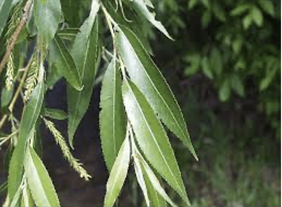
Black WillowSalix Nigra L. EMP – OBL

https://greatplainsnursery.com

Willow bark extract is very similar in its analgesic action to quinine; the active ingredient is salicin which forms salicylic acid which is found in a number of herbal remedies used throughout the world, some dating as far back as the Stone Age. The willow first became known to Native Americans, who were in need of a fever-reducing agent and used willow bark tea as a remedy. The bark is anodyne, anti-inflammatory, antiperiodic, antiseptic, astringent, diaphoretic, diuretic, febrifuge, hypnotic, sedative, tonic. It has been used in the treatment of gonorrhea, ovarian pains and nocturnal emissions. It is taken internally in the treatment of rheumatism, arthritis, gout, inflammatory stages of auto-immune diseases, diarrhea, dysentery, feverish illnesses, neuralgia and headache. The bark can be used as a poultice on cuts, wounds, sprains, bruises, swellings etc.

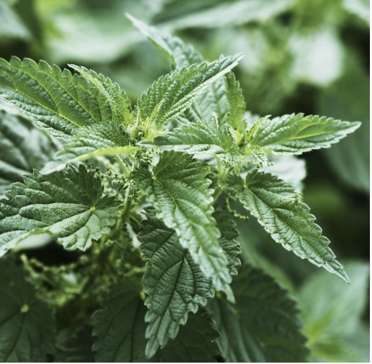
Stinging Nettle – Urtica Dioica L.  EMP – FACU

t3.gstatic.com

Urtica dioica, often known as common nettle, burn nettle, stinging nettle or nettle leaf, or just a nettle or stinger, is an herbaceous perennial flowering plant in the family Urticaceae.

Nettles are a highly revered, nutritious spring green, eaten steamed or in soups and stir-fries. The sting disappears when the leaves are cooked or dried. The greens and tea of nettles are high in minerals, vitamins, and chlorophyll, namely Vitamin A and C and calcium, potassium, magnesium, and iron.  The leaves and seeds are used medicinally in teas and foods for allergies, arthritis, and as a kidney tonic. Russians are using the leaves in alcohol for cholecystitis (inflammation or the gall bladder) and hepatitis.
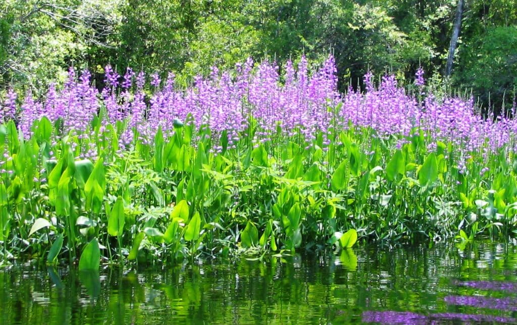
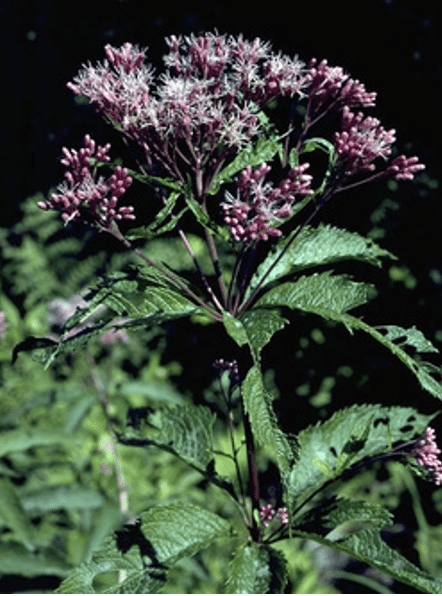
Spotted Joe-Pye WeedEutrochium maculatum L. EMP – FACW

W.D. Bransford @ Lady Bird Johnson Wildflower Center

Native Americans used the tea made from the whole plant of as a diuretic for dropsy, painful urination, gout, kidney infections, and rheumatism. The root tea was once used for fevers, colds, chills, sore womb after childbirth, diarrhea, liver and kidney ailments, and a wash for rheumatism. Its name was derived from “Joe Pye”, a 19th century Caucasian who used the root to induce sweating in typhus fever.

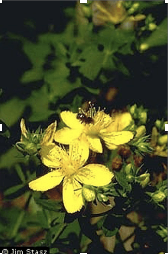
Common St. John’s Wort – Hypericum perforatum L. EMP – FAC

Jim Stasz @ USDA-NRCS PLANTS

Fresh flowers used in tea, tincture, or olive oil, was once a popular domestic medicine for treatment of external ulcers, wounds (especially those with severed nerve tissue), sores, cuts, bruises, etc. The tea is a folk remedy for bladder ailments, depression, dysentery, diarrhea, and worms. Contains the biologically active compounds choline, pectin, rutin, sitosterol, hypericin, and pseudohypericin. Recent studies (1988) have found that hypericin and pseudohypericin have potent anti-retroviral activity, without serious side effects. They are also being researched as an AIDS treatment.

Warning: Taken internally or externally, hypericin may cause photodermatitis (skin burns) on sensitive persons exposed to light.

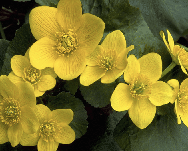
Yellow marsh marigold – Caltha palustris L. EMP – OBL

www.wildflower.org

Marsh marigold roots were used by Native Americans to treat colds and sores, to induce vomiting, to protect against love charms, and as an aid in childbirth. A tea made from its leaves was also believed to relieve constipation.

Ojibwas mixed tea with maple sugar to make a cough syrup that was popular with colonists; this syrup was used as a folk antidote to snake venom. The plant contains anemonin and protoanemonin – both have marginal antitumor activity.

Warning: Sniffing bruised stems induced sneezing. Intoxication has resulted from the use of the raw leaves in salads or using the raw flower buds as substitutes for capers. Do not confuse with American White or False Hellebore, which is toxic. While parts of the plant are used medicinally, handling the plant can cause skin irritation, and uncooked parts are toxic to human consumption. This is due to irritant yellow oil called protoanemonin.

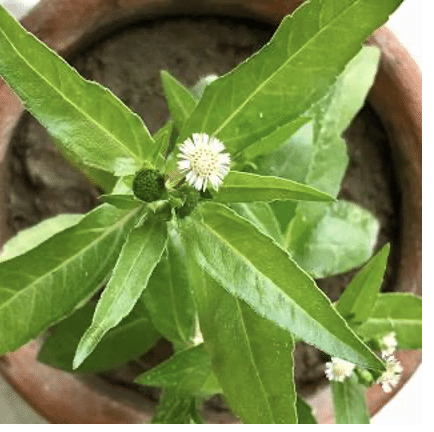
False daisy – Eclipta prostata L. EMP – FAC

False daisy is native to parts of North America where it has been collected in Massachusetts, and recently in Connecticut. False daisy is used in Chinese and Ayurvedic medicine against liver disease and to restore hair growth. The leaves contain nicotine which acts as an insecticide. It has been used in herbal medicine worldwide. In some parts of this country, it is considered a weed, and, in some areas, it is considered an endangered species. 

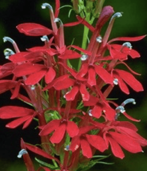
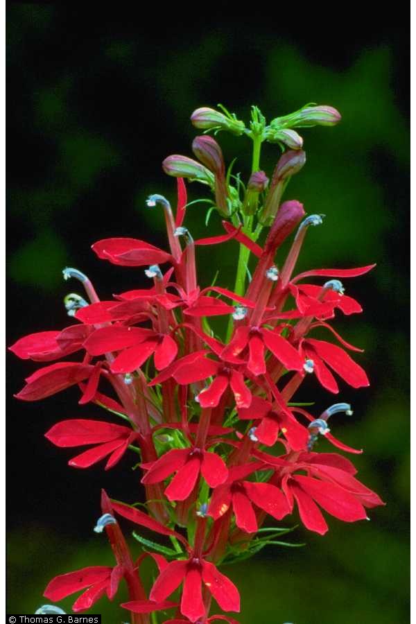
Cardinal Flower – Lobelia cardinalis L.  EMP – FAC

Thomas G. Barnes @ USDA-NRCS PLANTS

Native Americans used the root tea for stomachaches, syphilis, typhoid, worms, and an ingredient of “love potions”. Leaf tea was used for colds, croup, nosebleeds, fevers, headaches, and rheumatism. This plant was considered a substitute for Indian-tobacco, Lobelia inflata L., but with weaker effects; it was rarely used.

Warning: Potentially toxic; degree of toxicity unknown.

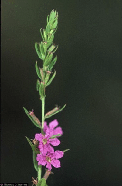
Purple Loosestrife – Lythrum salicaria L. EMP – FACW

Tea made from whole flowering plant (fresh or dried) is a European folk remedy for diarrhea, intestinal problems, and dysentery; gargle for sore throats; douche for leucorrhea, and as a cleansing wash for wounds and treatment of bacterial infections.

They also use it for swelling and as a drying agent. Women use it for menstrual problems.

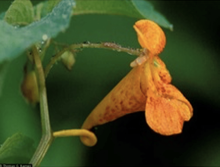
Jewelweed – Impatiens capensis   EMP – FACW

Thomas G. Barnes @ USDA-NRCS  PLANT

Jewelweed has a long history of use in Native American medicine. When applied topically, sap from the stem and leaves is said to relieve itching and pain from a variety of ailments, including hives, poison ivy, stinging nettle, and other skin sores and irritations. The sap has also been shown to have anti-fungal properties and can be used to treat athlete’s foot. Thomas G. Barnes @ USDA-NRCS  PLANT

Crushed leaves or mucilaginous stem juice that is harvested before flowering can be applied on recent poison-ivy rash. A 1957 study found it effective, in 2-3 days, in treating 108 of 115 patients. Some people swear by the leaf tea as a poison-ivy rash preventative; others rub on the frozen tea, in the form of ice cubes, as a remedy. The poultice is also a folk remedy for bruises, burns, cuts, eczema, insect bites, sores, sprains, warts, and ringworm.  

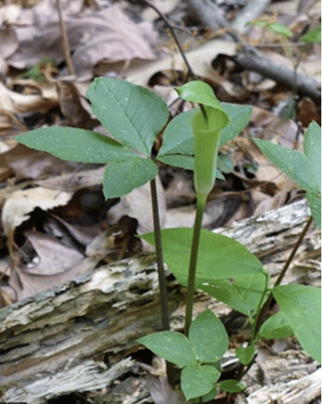
Jack in the Pulpit – Arisaema triphyllum L.  EMP – FAC

Jeff McMillian @ USDA-NRCS PLANTS Database

Native Americans used the dried, aged root for colds and dry coughs, and to build blood. Externally, the root was poulticed for rheumatism, scrofulous sores, boils, abscesses, and ringworm. Dried root tea was used as an expectorant, diaphoretic, and purgative, and for asthma, bronchitis, colds, cough, laryngitis, and headaches. Externally, for rheumatism, boils, and swelling from snakebites. The Chinese used related species to treat snakebites.

Warning: Intensely irritating. Calcium oxalate crystals found in whole fresh herb.

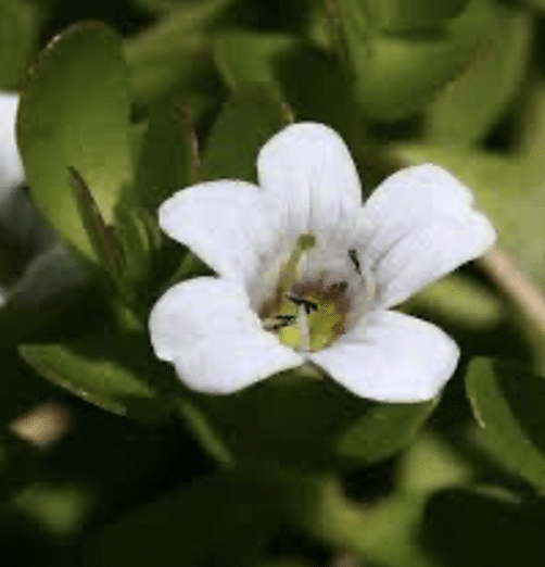
Herb of grace/Water Hyssop – Bacopa monnieri L. EMP – OBL

© Shirley Denton

Hyssop has astringent, emmenagogue (stimulating menstrual flow), relaxant, diuretic, and wound-healing properties. It stimulates mucus production, and is helpful in soothing sore throats, and coughs. It has also been known to help against asthma. Because it also relaxes muscle, it is helpful in aiding digestive problems. Its antibacterial properties make hyssop a good vermifuge (expels intestinal parasites). Hyssop essential oil has medicinal properties, but has also been linked to epileptic seizures, and should be taken with precaution.
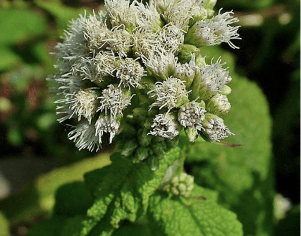
BonesetEupatorium perfoliatum EMP – FACW

Image credit: Wikimedia Commons

Boneset leaf tea was once used to induce sweating in fevers, flu, and colds; also used for malaria, rheumatism, muscular pains, spasms, pneumonia, pleurisy, gout, etc. Leaves were poulticed onto tumors. West German research suggests nonspecific immune system-stimulating properties, perhaps vindicating historical use in flu epidemics.

Warning: Emetic and laxative in large doses. May contain controversial and potentially liver-harming pyrrolizidine alkaloids.

References:

http://edibleandmedicinalplants.weebly.com­­­­­­

https://www.ncbi.nlm.nih.gov › pmc › articles › PMC9385301

https://sites.google.com › ccam › useful-plants-in-vi-habitats

https://www.botanicgardens.org/blog/top-10-medicinal-plants

The Swamp School Receives Eligibility for Scholarship Funding From the mikeroweWORKS Foundation

December 12, 2023 — The Swamp School is excited to announce a new opportunity for students enrolled in the wetland delineation training program, made possible by the mikeroweWORKS Foundation. In line with the Foundation’s mission to promote hard work and skilled labor, this initiative opens the door for dedicated individuals pursuing careers in environmental science and wetland conservation.

Eligibility for the mikeroweworks.org scholarship has now been extended to include students of The Swamp School, providing a unique opportunity for those passionate about wetland preservation and environmental stewardship. This inclusion reflects the Foundation’s recognition of the crucial role that wetland delineation plays in environmental protection and sustainability.

Students enrolled in The Swamp School’s program are encouraged to apply for this scholarship, which aims to support those who demonstrate a strong work ethic, commitment to their vocational education, and a dedication to their field of study. The scholarship will not only provide financial assistance but reinforce the importance of skilled technical professionals in environmental sciences.

For more information on the scholarship application process, eligibility criteria, and deadlines, students are advised to visit the mikeroweWORKS Foundation’s website at mikeroweworks.org. Additionally, inquiries about the wetland delineation training program should be directed to The Swamp School.

This collaboration between the mikeroweWORKS Foundation and The Swamp School marks a significant step toward fostering the next generation of skilled environmental professionals, ensuring the preservation and responsible management of vital wetland ecosystems.

Contact:
mikeroweworks.org
swampschool.org

About Mike Rowe and the mikeroweWORKS Foundation

Mike Rowe is an Emmy award-winning TV host, producer, narrator, podcaster, spokesman, best-selling author, recording artist, and America’s leading advocate for the skilled trades. The creator and host of Discovery Channel’s “Dirty Jobs,” Mike has traveled to every state on multiple occasions and worked alongside hundreds of Americans in more than 350 different vocations. As the CEO of the mikeroweWORKS Foundation, he has awarded nearly $7 million dollars in work-ethic scholarships and led a national effort to reintroduce shop classes into high schools.

About The Swamp School – SwampSchool.org

Based in Angier, North Carolina, The Swamp School is a pioneer in delivering comprehensive online and in-person educational experiences tailored for professionals and technicians in the field of wetland science and management. Since its inception in 2002, The Swamp School has been exclusively dedicated to fostering growth and expertise in environmental professionals who are as committed to conservation and stewardship.

History Emerges at Jordan Lake, North Carolina

North Carolina has been in a drought for a few months, and it is starting to show in the state’s waterways. At Jordan Lake, local residents and out-of-towners are enjoying a rare glimpse into the history buried beneath the water’s surface. Before the lake was constructed by the Army Corps of Engineers, it was a large valley, and humans lived there beginning around 10,000 years ago. In 1982, the Corps began filling it up, and the project was completed in 1983. What many people do not realize is that, prior to the start of excavation work in 1970, there were whole towns in New Hope Valley, as it was once called, full of homes, churches, and farmsteads. While the region had very rich soil that created great farming conditions, the New Hope Valley was prone to flooding, and, after the area was decimated by a hurricane in 1945, the federal government decided to turn it into a reservoir.

Photo Courtesy of the U.S. Army Corps of Engineers

From 1963-1970, the communities in New Hope Valley were abandoned, as the government bought the land and locals were forced to leave their homes, farms, and even graveyards behind. Seaforth, Pea Ridge, and Farrington are just a few of the small towns that were wiped off of the map, but in November of this year these ghost towns began to emerge. Historians flocked to the site, along with the descendants of the people who used to live there, to catch a glimpse of and document the decaying structures and artifacts. The history and physical location of those communities has yet to be studied in an archaeological context. Before the reservoir was filled, archaeological excavations were performed to record the history and salvage any artifacts deemed historically significant. But those excavations, which started in 1978 and ended a year later, were less concerned with the modern villages and were more concerned with the prehistoric context.

Photo Courtesy of WRAL News

Today, descendants of the farmers and landowners forced to leave New Hope Valley are interested in documenting what they can of their more recent past. If this drought continues, there could be the potential for cultural resource management (CRM) work at Jordan Lake. The North Carolina Department of Natural and Cultural Resources, and their private CRM partners, may be able to map out the location of structures, roadways, and even cemeteries. Contacting the descendant communities to get their oral histories and any written or photographic evidence of how the towns used to look can help piece together what has been lost. Our heritage and culture are wrapped up in our homes, wrapped up in where we are from; at Jordan Lake, some forgotten communities are emerging, if only for a short time. We should not let this fleeting treasure trove of history go to waste.

Photo Courtesy of WRAL News

The Ivory-Billed Woodpecker: Ghost of the Southern Swamps

Ivory Billed Woodpecker

The Ivory-Billed Woodpecker, Campephilus principalis, has long been an enigma wrapped in the moss-draped mystery of the southern United States’ bottomland hardwood forests and swamp lands. Once roaming the vastness of the southeastern forests, it was a bird so distinctive and majestic that its presence was deemed a spectacle of the wild. Known for its striking black and white plumage and a bill as white as ivory, it was not only the largest woodpecker in America but also one of the most iconic avian species ever to grace the forests. However, extensive habitat destruction and hunting have led it to the brink of extinction, and possibly beyond.

Natural History and Significance

The Ivory-Billed Woodpecker was an inhabitant of the primeval forests of the Southeast, relying on vast tracts of old-growth woods where dead or dying trees provided the large insect larvae that constituted its primary diet. These woodpeckers played a critical role in the ecosystem, not only as predators that helped control insect populations but also as ecosystem engineers. Their large nesting cavities, excavated in the trunks of ancient trees, became nurseries for their own young and provided shelter for a plethora of other species.

The cultural significance of the Ivory-Billed Woodpecker is multifaceted. It has been a symbol of the wilderness, a muse for bird watchers and naturalists, and a poignant emblem of loss and the consequences of environmental disregard. The bird’s remarkable size and beauty, coupled with its elusiveness, have etched it into the folklore and heart of the American South.

Image by Arthur A. Allen, Courtesy of the Cornell Lab of Ornithology.

Decline and Presumed Extinction

The decline of the Ivory-Billed Woodpecker was a gradual process accelerated by human actions. The early 20th century was an era of unregulated logging, which decimated the extensive hardwood forests that were the habitat of the Ivory-Billed Woodpecker. These operations did not only reduce the amount of available food but also removed the large, old trees essential for nesting. Furthermore, the bird’s distinctive markings and size made it a target for trophy hunters and collectors, exacerbating its plight.

By the mid-20th century, the species was so rare that it was presumed to be extinct. The last universally accepted sighting was in the 1940s, in the Singer Tract of Louisiana, a large area of old-growth forest that was subsequently logged. The loss of the Ivory-Billed Woodpecker has been a profound one, signaling not only the disappearance of a species but also serving as a harsh reminder of the delicate balance of ecosystems and the far-reaching impact of human activity on the natural world.

Contested Sightings and Conservation Efforts

Over the years, there have been reports and rumors of sightings of the Ivory-Billed Woodpecker, sparking hope that the species may yet cling to existence. The most notable of these was in 2004 when a team of ornithologists from the Cornell Lab of Ornithology reported sightings in the Big Woods region of Arkansas. This announcement triggered a wave of excitement and controversy, as subsequent searches yielded no definitive proof, such as clear photographs or videos, leaving many skeptical.

Despite the lack of conclusive evidence, these reports have fueled a variety of conservation efforts aimed at preserving the habitats that could potentially support a remnant population of the bird. Organizations and government entities have implemented measures to protect large tracts of forestland that could be suitable for the Ivory-Billed Woodpecker, hoping to create a safe haven for these birds if they do indeed still exist. These efforts have also benefited a multitude of other species that share these ecosystems, illustrating a silver lining to the ongoing quest to find the Ivory-Billed Woodpecker.

Reflections on Conservation and the Future

The story of the Ivory-Billed Woodpecker is a poignant narrative that underscores the urgency of conservation. It demonstrates that once a species is pushed to the brink of extinction, the chances of recovery are often slim and fraught with challenges. It also highlights the importance of protecting habitats before they are degraded to the point of being unable to support their native species.

The potential survival of the Ivory-Billed Woodpecker offers a symbol of hope and a call to action. It is a reminder that nature can be resilient if given the chance and that the protection of the environment is an investment in the future of all species, including humans. Whether or not the Ivory-Billed Woodpecker still flits among the shadowed trees of southern swamps, the efforts to save it have ignited a broader conservation movement that continues to grow in importance as we face the ongoing challenges of habitat loss, climate change, and biodiversity decline.

The Ivory-Billed Woodpecker’s legacy is a complex tapestry woven from strands of awe at the natural world, sorrow for what has been lost, and determination to prevent similar fates for other species. The debate over its existence continues to inspire both professional and amateur conservationists to keep searching, keep studying, and most importantly, keep protecting the wild places that remain. Whether it still exists as a living species or has moved beyond the veil into the realm of legend, the Ivory-Billed Woodpecker will forever serve as an icon of the wild and a beacon for conservation. It reminds us of the fragility of life, the consequences of neglect, and the ever-present possibility of redemption through dedicated environmental stewardship.

Image by Arthur A. Allen, Courtesy of the Cornell Lab of Ornithology

Making Way for Coastal Wetlands: A Look at Sea Level Rise and Urban Development

U.S. Fish and Wildlife Service

Coastal wetlands provide invaluable ecological and economic services for our coastal communities. To keep pace with sea level rise, these habitats need space to migrate upland. This may present a challenge in some highly urbanized areas. A recent study that calculated open and developed land near wetlands along the Southeastern coast of the United States sheds light on the fate of coastal wetlands at a regional scale, and provides context for improved coastal resilience efforts.

By Mary Schoell • February 12, 2019

Borchert, Sinéad M., et al. “Coastal Wetland Adaptation to Sea Level Rise: Quantifying Potential for Landward Migration and Coastal Squeeze.” Journal of Applied Ecology 1, no. 12 (2018): DOI:10.1111/1365-2664.13169

Approximately 39% of the U.S. population lives in coastal counties, which means that coastal wetlands and nearby communities intimately coexist. A coastal wetland can be defined as an ecosystem that undergoes tidal fluctuations, and includes habitats such as salt marshes, mangrove forests, and salt flats. These habitats provide a wide range of ecosystem services, or benefits to humans, such as flood protection from storm surges, land erosion control, improved water quality, and biodiversity of fish and shellfish species.

However, both development along the coast and anthropogenic climate change have made coastal wetlands particularly vulnerable. Under normal conditions, wetlands can naturally keep pace with changing sea levels. In a process called accretion, plants trap sediment, which increases the elevation of the wetland’s surface. However, due to climate change, higher rates of sea level rise are projected to “drown” many coastal wetland ecosystems. This means that sea levels could rise faster than a wetland’s natural accretion rate. For this reason, the retreat of these habitats upland into higher elevations is recognized as a way for tidal saline wetlands to survive in response to sea level rise. Available, undeveloped land in higher elevations is needed for migration to occur. This can prove difficult in urbanized areas along the coast.

In a recent paper published in the Journal of Applied Ecology, researchers from the United States Geological Survey (USGS) quantified areas along the Gulf Coast of the U.S. where wetland retreat could and could not occur due to development. Using land elevation and tidal data, they determined current coastal wetland boundaries and then calculated the amount of upland area that would potentially become wetlands by the year 2100 under three different future sea level rise scenarios (specifically, 0.5, 1.0, and 1.5 meters). They completed this assessment for 39 different estuaries, from Texas to southwestern Florida.

To assess differences in land use, researcher Sinéad Borchert and her team first used the U.S. Fish and Wildlife Service’s National Wetlands Inventory data to identify coastal wetland habitat. Next, they classified areas of urban development within the projected wetland migration zones using two different datasets: an urban growth model called SLEUTH (Slope, Land use, Excluded, Urban, Transportation, and Hillshade) and the USGS’s National Land Cover Database. Using both habitat and elevation data provides a more accurate prediction of flooding zones at a regional level. Modeling such a comprehensive dataset has rarely been done in the past.

This study reinforces the idea that topography and coastal development dictate the fate of coastal wetland habitat. The results show that low-sloping coastal areas of Louisiana and southern Florida have the highest potential for landward wetland migration. However, wetlands will have to retreat over a larger area to reach higher elevations in these locations.

Urban development in these low-sloping, low-lying areas, such as in Miami, poses the greatest threat to coastal wetlands when sea levels rise. Instead of encouraging wetland growth, we can instead expect areas of high urbanization areas to promote increasing infrastructure development like concrete walls to combat sea level rise. This will result in shoreline “hardening”, or a greater disconnect between coastal wetlands and their upland environment, and ultimately wetland loss.

With the threat of rising sea levels, the need for communication between ecologists, economists, and town planners in coastal communities is more important than ever. This study offers a finer look at areas in the southeastern U.S. that can provide adequate space for coastal wetlands to keep up with sea level rise. It also highlights areas where development will stand in the way of wetland migration – or in other words, potential areas of future wetland loss. Identifying these regions can better direct conservation efforts to places of high priority.

Developing along the coast comes at a great cost in the long term. Losing coastal wetlands means losing ecosystems that protect us from storms, clean our water, and provide habitat for marine species that fishing industries heavily rely on. The results from this study can facilitate more informed and detailed management plans that promote the preservation of coastal wetland migration areas, and ultimately the invaluable ecosystem services that wetlands provide for coastal communities.

Parks Protect the Climate Too

One more reason to protect natural spaces and public lands

By Ben Jealous

September 11, 2023

I recently had the chance to speak at The Economist‘s sustainability conference, and I asked how many people in the audience spend time in our national parks. Hands shot up everywhere. Then I asked them to keep their hands up if they enjoy visiting parks on Labor Day weekend. Hands disappeared, heads shook no, and people chuckled.

So many of us want to get outside and enjoy nature, but we don’t want to wait in traffic for hours trying to get into a park. Demand for the national parks exceeds supply and, as the Sierra Club’s former executive director Carl Pope pointed out to me, Labor Day weekend traffic jams at our parks illustrate this perfectly. People across the rainbow of humanity that is America really want to visit the country’s wild places.

Historically, protecting natural spaces and establishing parks has been job number one for the Sierra Club. In 1890, John Muir led the movement to protect 750,000 acres in the Sierra Nevada as Yosemite National Park. Two years later, the Sierra Club was born. From our role in the creation and protection of parks like Grand Canyon and Grand Teton to our contribution to the passage of the Wilderness Act, which has protected 112 million acres of public land from reckless development, the Sierra Club has been—and will always be—an influential advocate for natural spaces.

Now we must double the number of parks in this country. And I don’t just mean the 425 National Park Service sites but also other federally managed places and state and local parks too. We want to ensure that every person, no matter where they live, can explore and enjoy our natural spaces.

This work goes far beyond the causes of conservation and access to the outdoors. We created parks to save souls (“places to play in and pray in,” as Muir wrote). Today we need them to preserve our collective future.

To avoid irreparable harm to the planet, we need to reduce climate-killing carbon dioxide in the atmosphere dramatically and quickly. Beyond ending our addiction to fossil fuels, one of the best nature-based ways to do this is to preserve natural spaces—especially where mature and old-growth trees act as carbon sponges.

Our national goal is to protect 30 percent of US lands and waters by 2030 to slow climate decay and biodiversity loss. Right now, only about 12 percent is protected. We must safeguard more land in the next seven years than we have in the past 100.

The benefits go beyond preserving wildlife habitats and providing more clean air and water. We can measure them in dollars.

The National Park Service says that for every dollar Congress invests in national parks, $10 is returned to the economy. And communities where we establish public lands as parks will be more resilient to the extreme weather that accompanies climate decline.

As we save more natural spaces, we must discard practices that have too often left out Indigenous communities. Since long before this was a country, Indigenous people have stewarded the landscapes they have called home. Co-management agreements like the one for Bear Ears National Monument recognize that Native knowledge is essential to the long-term protection of our lands and waters (see “Unraveling Manifest Destiny“).

As I write this, the Sierra Club is training state leaders across the country to accelerate the implementation of the Inflation Reduction Act. When President Biden signed it one year ago, the massive investment in growing America’s economy in such a visionary way earned him comparisons to President Franklin Delano Roosevelt. Leading our nation in doubling the size of protected lands would earn him comparisons to another Roosevelt. The Sierra Club’s job at this moment is the same as it was for our founder: to make the case in a way that can neither be ignored nor denied.

Ben Jealous is the executive director of the Sierra Club. | Photo by Ian Martin

Chattahoochee River Restoration

In 2011, Batson-Cook, assisted by Scott Bridge Co., was chosen to build the world’s longest urban whitewater course in Columbus, Ga., through the Chattahoochee River Restoration project. The project both enhanced the river’s local environment and created a state-of-the-art whitewater facility.

Photo courtesy Batson-Cook Co

The Columbus, Ga., project won the top award in the water and environmental project category.

Contractors hired divers to survey the river and help determine its “true” channel, which helped builders determine where underwater structures, such as boulders, should be placed in order to achieve the designer’s intent for both the river’s natural bank restoration as well as the whitewater course. The project team’s biggest challenge was removing two dams that were more than 100 years old—the Eagle & Phenix Dam and the City Mills Dam—that were built in the late 1800s to provide power to the now-abandoned textile mills located along the river. To take out the structures, crews drilled holes down through the top of the dams and placed dynamite topped with crushed gravel and then more dynamite. Once blasted, the team used heavy equipment to manually dismantle the rest of the structure. Also, the project team recontoured the river bed to create whitewater courses; changed the contour of the river’s flow for the whitewater rapids; and constructed a habitat pool for fish and wildlife.

The breaching of the 130-year-old Eagle and Phenix Dam, removal of the City Mills Dam, and formation of natural habitat pools, construction of a boat launch, viewing terrace, and pedestrian bridge unleashed the potential of the river and community, dramatically improving the local downtown experience, providing new economic opportunities, attracting new residents and businesses, and boosting tourism. Dozens of new in-river features provide over two miles of world class whitewater kayaking and rafting. Numerous bank improvements allow for better tourist access and observation areas. In addition, the project created habitat for the endangered Shoal Spider Lilly and native Shoal Bass, an important game fish only found in the southeastern U.S.

The Chattahoochie River Conservancy played a large part in reclaiming this magnificent river.

“The dams built along the Chattahoochee River have done immense damage to the ecosystem. By removing the dams no longer serving a purpose to the community, we are able to restore sections of the river to a state that closely resembles pre-dam habitat. These restored sections may be small (3-10 miles) but are immensely valuable in the fight to restore the Chattahoochee River. In impounded areas where dam removal is not an option, we partner with the Department of Natural Resources, Georgia Power, and the US Army Corps of Engineers to improve the habitat within the reservoirs and reduce the impacts of invasive species.

https://www.chattahoocheeriverconservancy.org/our-work.html

All told, the Chattahoochee River Restoration project helped restore this once highly-disturbed river back to its natural and unrestricted flow and transformed it into a thing of beauty for the community that will also be attracting numerous visitors and recreationists.

References

https://www.batson-cook.com/portfolio/chattahoochee-river-restoration

https://www.enr.com/articles/12209-chattahoochee river-restoration-churns-up-whitewater-attraction

https://mcglaughlinwhitewater.com/projects/chattahoochee-river-restoration