
The following blog post is a summary of the article “WET Expands to Southwest Florida” by Dr. Paul Gray and Audubon Florida, published on June 4, 2026. To read the original article, which originally appeared in Audubon’s State of the Everglades Spring 2026 Report, click here.
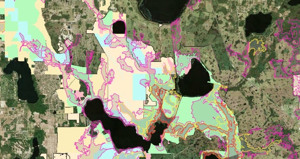
Image courtesy of Audubon Florida and Dr. Paul Gray.
Audubon’s Wetland Evaluation Tool (WET) is an interactive, GIS-based mapping resource that helps identify locations where surface water can be stored naturally while also highlighting opportunities for wetland restoration and aquifer recharge. After demonstrating its value in the Central Florida Water Initiative and the Lake Okeechobee watershed, the tool is now being expanded into Southwest Florida. The expansion reflects a growing need for innovative approaches to water management in one of Florida’s fastest developing regions. As development continues to reshape the landscape, natural systems that once captured and stored water have been replaced by roads, pavement, and extensive drainage networks. The WET is intended to help restore some of the landscape’s natural ability to retain water and improve long-term watershed resilience.
Historically, Florida’s wetlands, floodplains, and soils provided a natural buffer against both floods and drought by storing water during wet periods and gradually releasing it over time. Modern drainage infrastructure is designed to move water off the landscape quickly, reducing this natural storage capacity and increasing the severity of drought conditions. Rapid stormwater releases can also create environmental problems by abruptly changing salinity levels, carrying excess nutrients into waterways, and contributing to harmful blue-green algae blooms. These challenges are becoming more significant as Southwest Florida experiences increased coastal flooding alongside more frequent and intense wildfires. The continuing loss of wetlands has made restoring natural water storage systems an increasingly important priority for the region.
The need for improved water management is underscored by the estimated loss of more than 30,000 acres of wetlands in Collier and Lee counties since 1996. By expanding the WET into Southwest Florida, Audubon aims to provide local governments, water management districts, and private landowners with a practical tool for identifying the most effective locations for restoration projects. The mapping system can help guide investments toward projects that offer the greatest benefits for water storage, aquifer recharge, and ecosystem health. It will also play an important role in shaping the Corkscrew Watershed Initiative restoration plan by helping prioritize projects throughout the watershed. These efforts are expected to strengthen the long-term health of the region’s wetlands while supporting important natural areas such as Audubon’s Corkscrew Swamp Sanctuary.
#AudubonFlorida #WetlandEvaluationTool #WetlandRestoration #StormwaterManagement #NatureBasedSolutions #WetlandWednesday #TheSwampSchool