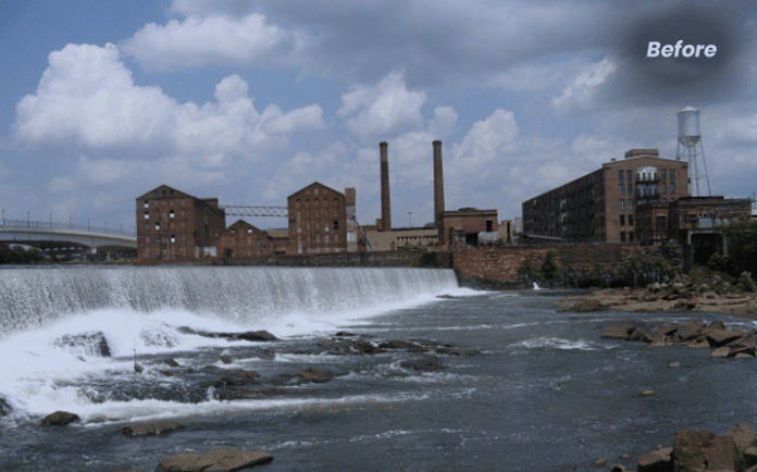
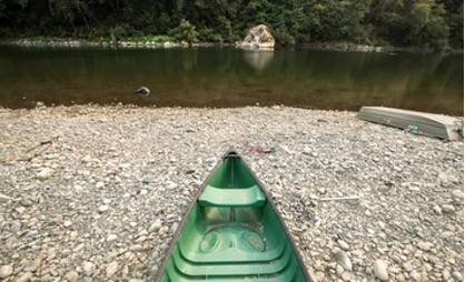
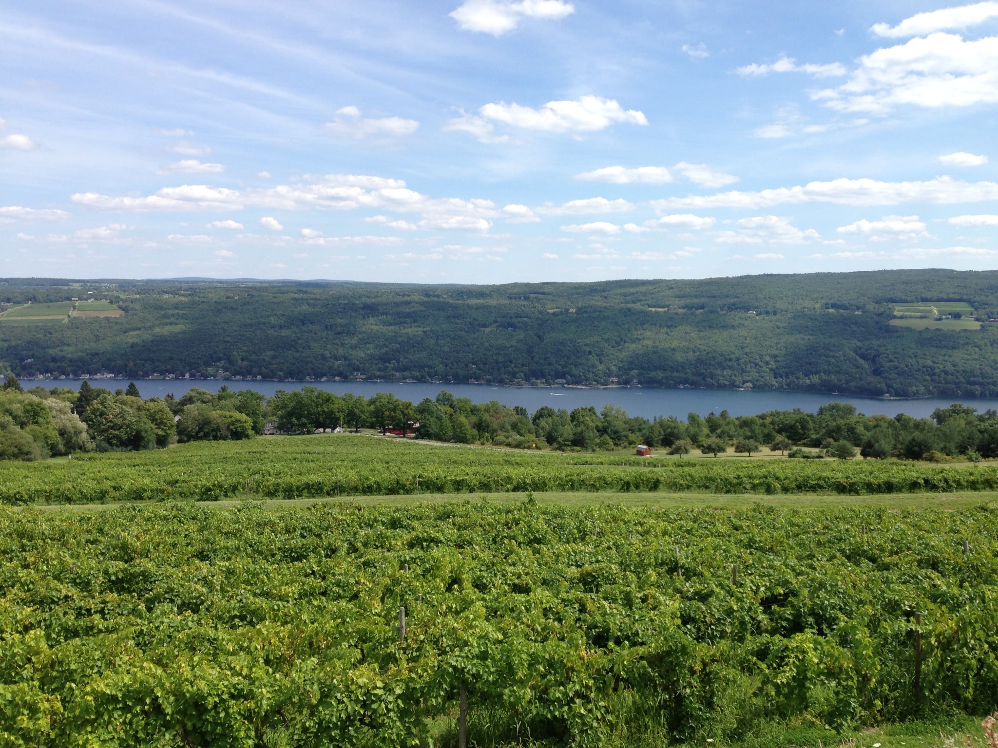
In 2011, Batson-Cook, assisted by Scott Bridge Co., was chosen to build the world’s longest urban whitewater course in Columbus, Ga., through the Chattahoochee River Restoration project. The project both enhanced the river’s local environment and created a state-of-the-art whitewater facility.
Photo courtesy Batson-Cook Co
The Columbus, Ga., project won the top award in the water and environmental project category.
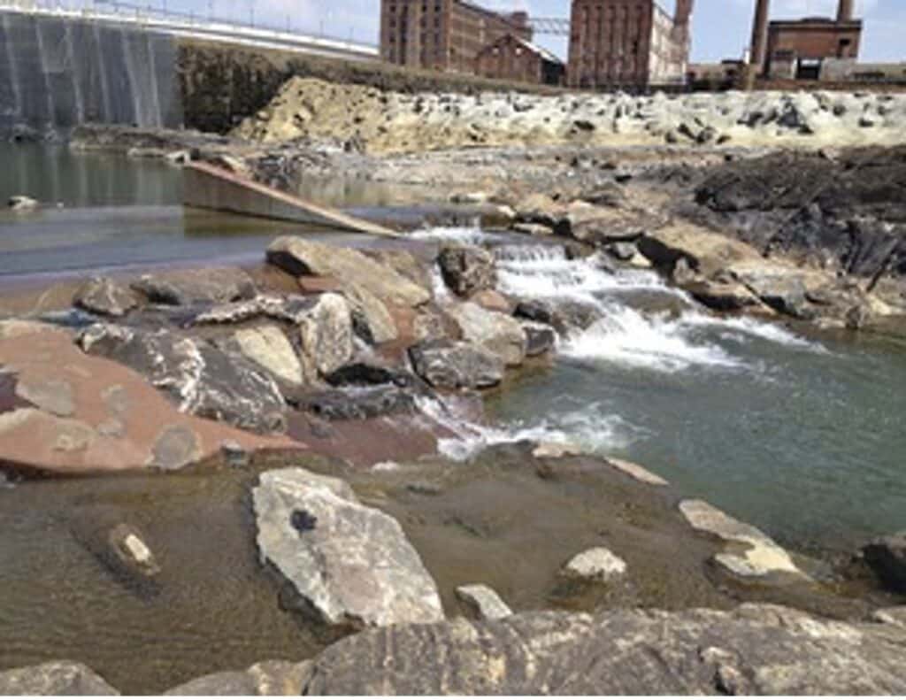
Contractors hired divers to survey the river and help determine its “true” channel, which helped builders determine where underwater structures, such as boulders, should be placed in order to achieve the designer’s intent for both the river’s natural bank restoration as well as the whitewater course. The project team’s biggest challenge was removing two dams that were more than 100 years old—the Eagle & Phenix Dam and the City Mills Dam—that were built in the late 1800s to provide power to the now-abandoned textile mills located along the river. To take out the structures, crews drilled holes down through the top of the dams and placed dynamite topped with crushed gravel and then more dynamite. Once blasted, the team used heavy equipment to manually dismantle the rest of the structure. Also, the project team recontoured the river bed to create whitewater courses; changed the contour of the river’s flow for the whitewater rapids; and constructed a habitat pool for fish and wildlife.
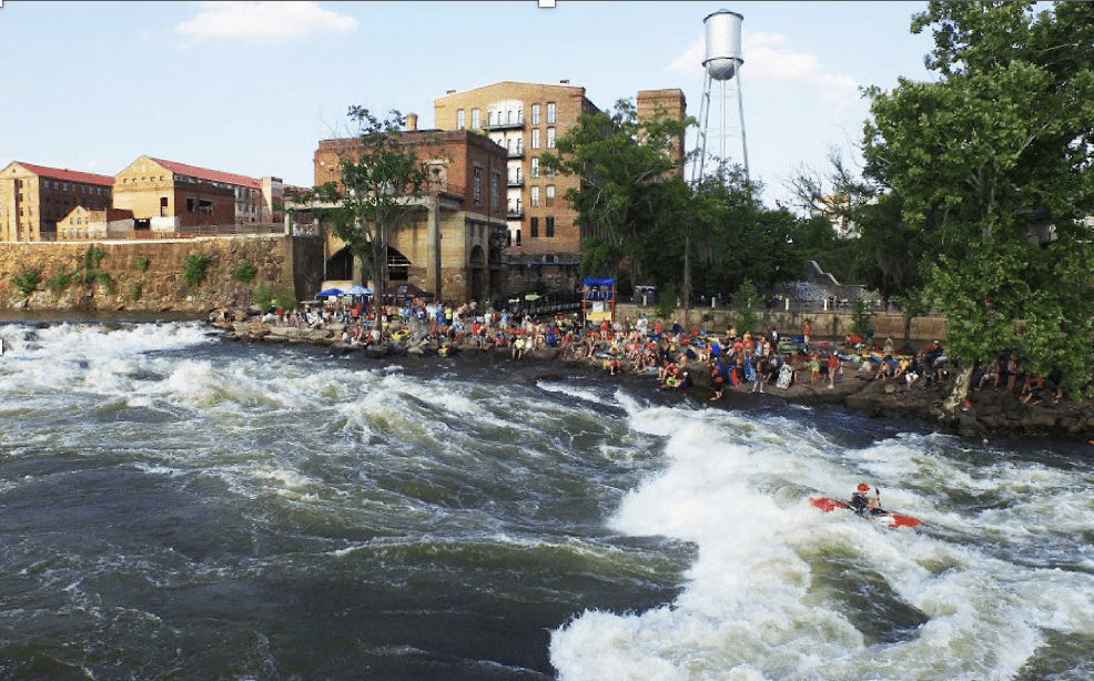
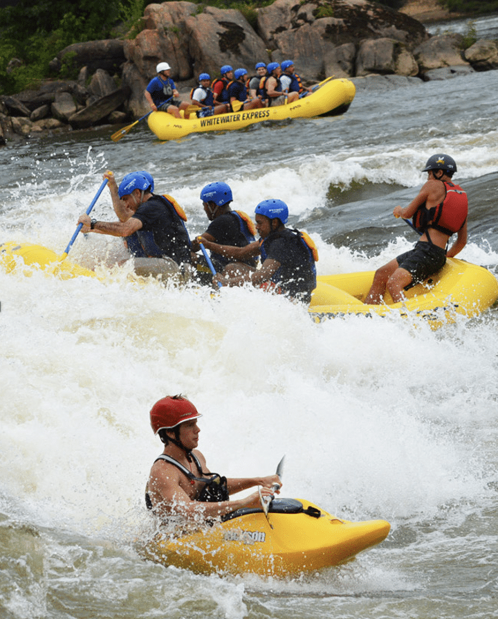
The breaching of the 130-year-old Eagle and Phenix Dam, removal of the City Mills Dam, and formation of natural habitat pools, construction of a boat launch, viewing terrace, and pedestrian bridge unleashed the potential of the river and community, dramatically improving the local downtown experience, providing new economic opportunities, attracting new residents and businesses, and boosting tourism. Dozens of new in-river features provide over two miles of world class whitewater kayaking and rafting. Numerous bank improvements allow for better tourist access and observation areas. In addition, the project created habitat for the endangered Shoal Spider Lilly and native Shoal Bass, an important game fish only found in the southeastern U.S.
The Chattahoochie River Conservancy played a large part in reclaiming this magnificent river.
“The dams built along the Chattahoochee River have done immense damage to the ecosystem. By removing the dams no longer serving a purpose to the community, we are able to restore sections of the river to a state that closely resembles pre-dam habitat. These restored sections may be small (3-10 miles) but are immensely valuable in the fight to restore the Chattahoochee River. In impounded areas where dam removal is not an option, we partner with the Department of Natural Resources, Georgia Power, and the US Army Corps of Engineers to improve the habitat within the reservoirs and reduce the impacts of invasive species.“
All told, the Chattahoochee River Restoration project helped restore this once highly-disturbed river back to its natural and unrestricted flow and transformed it into a thing of beauty for the community that will also be attracting numerous visitors and recreationists.
As global environmental concerns continue to escalate, the field of wetland science has become increasingly significant. The year 2024 projects a fascinating era for wetland scientists, where their expertise is not only sought after but also crucial for the health of our planet. These scientists are on the front lines of conservation, research, and policy-making, dealing with issues from climate change mitigation to habitat protection and biodiversity conservation.
The Demand for Wetland Scientists in 2024
The job outlook for wetland scientists in 2024 remains robust and growing. With a heightened global focus on environmental sustainability and wetland conservation, wetland scientists are in high demand. Their skills are crucial for:
Assessing Wetland Health: Evaluating the conditions of wetlands, identifying stress factors, and implementing conservation strategies.
Regulatory Compliance: Ensuring that construction, development, and land use comply with environmental laws and regulations, particularly those that protect wetland areas.
Climate Change Mitigation: Understanding the role of wetlands in carbon sequestration and their impact on global climate patterns.
Restoration Projects: Working on the restoration of degraded wetland areas to their natural state, a vital component in preserving biodiversity and maintaining ecosystem services.
Research and Education: Conducting research on wetland ecosystems and disseminating knowledge to stakeholders, policymakers, and the public.
Education and Skill Development
The path to becoming a wetland scientist often begins with a degree in environmental science, ecology, biology, or a related field. As the discipline grows, so does the complexity of the skill set required. In 2024, successful wetland scientists will likely need:
Advanced degrees for higher-level positions.
Strong background in GIS (Geographic Information Systems) and remote sensing technology.
Proficiency in data analysis and modeling software.
In-depth understanding of local, national, and international environmental laws.
Soft skills such as project management, communication, and stakeholder engagement.
Specialization in wetland science through certifications like the Professional Wetland Scientist (PWS) certification by the Society of Wetland Scientists can also enhance job prospects.
Industry Trends Influencing Job Prospects
Several trends are shaping the job market for wetland scientists in 2024:
Green Infrastructure Projects: The push for sustainable development includes the creation of urban wetlands for stormwater management, requiring wetland scientists for design and monitoring.
Policy and Advocacy: International treaties and national policies focusing on wetland preservation are expanding the role of wetland scientists in policy advisement and implementation.
Private Sector Engagement: Increased corporate responsibility and sustainability goals mean more private companies are hiring wetland scientists for environmental impact assessments and sustainability planning.
Geographical Hotspots for Wetland Science Jobs
Certain regions will likely emerge as hotspots for wetland science careers:
Coastal areas affected by sea-level rise and increased storm activity.
Urban centers implementing green infrastructure initiatives.
Countries with significant wetland biodiversity, such as Brazil, Indonesia, and the Congo Basin, where conservation efforts are critical.
Challenges and Opportunities
The road ahead for wetland scientists is not without its challenges:
Funding Constraints: Economic downturns and shifting political landscapes can impact funding for environmental initiatives and research.
Technological Advancements: Keeping up with rapid technological changes in data collection and analysis is necessary.
Interdisciplinary Collaboration: Working with professionals from other fields, such as urban planners and engineers, is essential for comprehensive wetland management.
Conversely, these challenges bring opportunities:
Innovative Solutions: There’s a growing need for innovative approaches to wetland conservation and restoration, which can lead to new job roles and specializations.
Public Engagement: Increasing public awareness of wetland benefits can lead to more community-based wetland projects, expanding the roles of educators and citizen science coordinators.
International Cooperation: As wetlands are a global concern, there are opportunities for work in international conservation and policy.
Conclusion: A Positive Outlook with a Note of Urgency
The job outlook for wetland scientists in 2024 is generally positive. The urgency to address environmental challenges ensures that wetland scientists will remain in demand. However, it’s a field that requires constant learning and adaptability to new research, technologies, and evolving environmental policies.
For those aspiring to enter the field or continue their wetland science careers, the time is ripe for action. As guardians of one of the world’s most precious resources, wetland scientists not only have the opportunity to pursue a career with significant growth prospects but also to make a tangible difference in the health of our planet.
In mid-October of this year, the U. S. Fish and Wildlife Service announced that they will be delisting 21 species from the Endangered Species Act. This follows the Fish and Wildlife Service’s September 2021 proposal of 23 species that they were seeking to delist. Were these species removed because their populations rebounded? Nope. They went extinct, though two of the originally proposed 23 species, a Hawaiian perennial herb and the ivory-billed woodpecker, are in a limbo state while the service analyzes more data. What stood out about this list was the taxonomy of the species: most are birds and mussels. The Hawaiian Islands were hit especially hard, as eight out of the ten bird species were only found there. Habitat destruction, diseases, and invasive predators decimated the populations by the mid-1900s. By the time they were placed on the Endangered Species List, it was already too late. According to the American Bird Conservancy, all but one of the species was already extinct by then, and efforts to capture and breed the remaining members of the Po’ouli species failed. The same is true for the eight freshwater mussel species, with ranges throughout the southeastern United States. They were listed as endangered around the same time they were last seen in the wild. Martha Williams, the Director of U.S. Fish and Wildlife, stated that she hoped this would help the public recognize the importance of starting conservation efforts earlier. The Endangered Species Act turned 50 years old this year, and during that time it has been credited with saving 99% of the listed species from extinction.
You may ask, what is the big deal about a bunch of birds and mussels? Birds, and many of the species native to Hawaii, often act as pollinators. Many also spread the seeds and control pest species of insect. Some plant species are now struggling, because their main pollinators and seed dispersal agents are no longer present. If those plants are unable to adapt to this change in their environment, they too may eventually go extinct. On Hawaii the loss of those species is even more devastating because of their cultural significance to the indigenous people. As for why you should care about a bunch of freshwater mussels, our question for you is: do you want clean water or dirty water? Mussels filter the water in the rivers and streams in which they live. A tank full of water with mud and algae will be noticeably cleaner a few hours after mussels are placed inside. Today, though, in many rivers and streams, it is not just algae or mud that the mussels are filtering out: it is also chemicals from fertilizers, production plants, and medications that people have flushed down their toilets. These chemicals are not only dangerous for us but are also dangerous for the mussels. These creatures are incredibly sensitive to contaminants, so it does not take much to throw a population out of whack. On top of the increasing levels of pollution in our waterways, most species of mussel need species of fish in order to reproduce. An adult mussel will lure a fish towards it, and when it is close enough the mussel releases hundreds or even thousands of mussel larvae. The fish carry them around until they are big enough to survive on their own. The problem is that mussel species often only have a handful or even a single fish species with which they engage in this parasitic relationship. Due to water pollution, overharvesting, warming waters, and the damming of waterways, fish populations are also on the decline.
What should be taken away from this delisting is that the species that are protected are not being protected for frivolous reasons, but oftentimes have an impact on resources that impact humans. Conservation actions should be taken earlier to give individual species a better chance. As their populations grow, our natural resources improve and grow as well, and can be sustainably utilized for generations to come.
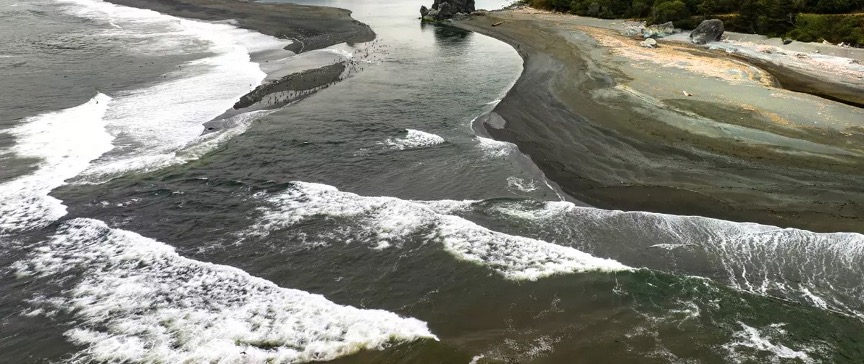
At first, the dead floated downstream a few at a time. Then they came by the hundreds, and then the thousands.
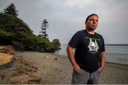
For mile after mile, the Klamath River was filled with tens of thousands of dead salmon. As Annelia Hillman paddled a canoe with a friend one September day 21 years ago, her heart sank when she saw the carcasses floating past. She and other members of the Yurok Tribe say they will never forget the stench of death.
“It’s like seeing your family perish in front of you,” Hillman said. “I would compare it to a massacre, really, in terms of the emotions and the trauma that it has caused for us.”
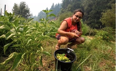
Annelia Hillman, a traditional food coordinator for the Yurok Tribe, picks vegetables in a community garden on the Klamath River. (Brian van der Brug / Los Angeles Times)
The grief drove Hillman, then 27, to begin protesting to demand change. The mass fish kill of 2002, estimated at up to 70,000 salmon, became a defining event for a generation of young Native activists — a moment that showed the river ecosystem was gravely ill, and badly in need of rescuing.
Water diversions for agriculture had dramatically shrunk river flows. And the Klamath’s hydroelectric dams, which had long blocked salmon from reaching their spawning areas, had degraded the water quality, contributing to toxic algae blooms and disease outbreaks among the fish.
At first, when Indigenous leaders demanded that dams be removed, their chances of success seemed remote at best. But after more than two decades of persistent efforts, including protests at company shareholder meetings,demonstrations on the river and complicated negotiations, the four dams along the California-Oregon border have finally started to be dismantled. One small dam has already been removed, and three more are slated to come down next year.
Chinook salmon swim at the Iron Gate Fish Hatchery below the dam on the Klamath River. (Brian van der Brug / Los Angeles Times)
For members of the Yurok, Karuk and other tribes who have been immersed in the struggle for much of their lives, the undamming of the Klamath represents an opportunity to heal the ecosystem and help fish populations recover by opening up hundreds of miles of spawning habitat. They say the coming changes hold promise for them to strengthen their ancestral connection to the river and keep their fishing traditions alive.
“This river is our lifeline. It’s our mother. It’s what feeds us. It’s the foundation to our people, for our culture,” Hillman said. “Seeing the restoration of our river, our fisheries, I think is going to uplift us all.”
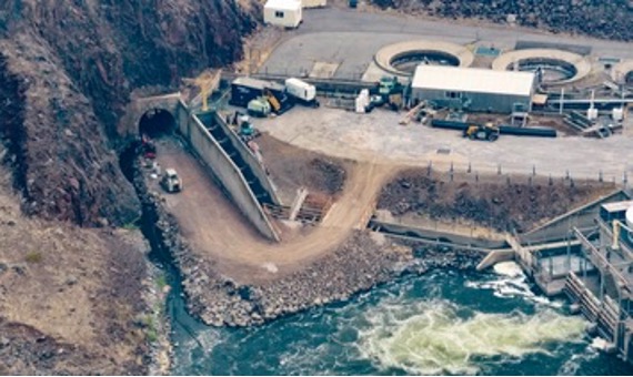
Work on the dam removal project began in June. The smallest dam, Copco No. 2, was torn down by crews using heavy machinery. The other three dams are set to be dismantled next year, starting with a drawdown of the reservoirs in January.
“The scale of this is enormous,” said Mark Bransom, CEO of the nonprofit Klamath River Renewal Corp., which is overseeing dam removal and river restoration efforts. “This is the largest dam removal project ever undertaken in the United States, and perhaps even the world.”
The $450-million budget includes about $200 million from ratepayers of PacifiCorp, who have been paying a surcharge for the project. The Portland-based utility — part of billionaire Warren Buffett’s conglomerate Berkshire Hathaway — agreed to remove the aging dams after determining it would be less expensive than trying to bring them up to current environmental standards.
The dams were used purely for power generation, not to store water for cities or farms.
“The reason that these dams are coming down is that they’ve reached the end of their useful life,” Bransom said. “The power generated from these dams is really a trivial amount of power, something on the order of 2% of the electric utility that previously owned the dams.”
An additional $250 million came through Proposition 1, a bond measure passed by California voters in 2014 that included money for removing barriers blocking fish on rivers.
A tunnel, left, at Iron Gate Dam, where modifications are underway. The tunnel will be used to drain the lake early next year. (Brian van der Brug/Los Angeles Times
Crews hired by the contractor Kiewet Corp. have been working on roads and bridges to prepare for the army of excavators and dump trucks.
“We have thousands of tons of concrete and steel that make up these dams that we have to remove,” Bransom said. “We’ll probably end up with 400 to 500 workers at the peak of the work.”
During a visit in August, Bransom stood on a rocky bluff overlooking Iron Gate Dam, where crews were working on a water drainage tunnel.
There won’t be major dam-wrecking explosions, he said, but workers plan to blast open some dam tunnels to move out tons of accumulated sediment from the reservoirs. As the water is drained, crews working on boats will also spray fire hoses to wash away muddy silt and send it downstream.
In addition to tearing down the dams, the project involves restoring about 2,200 acres of reservoir bottom to a natural state.
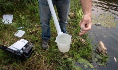
A Klamath River Renewal Corp. biologist takes water samples. (Brian van der Brug/Los Angeles Times
In recent years, workers have collected nearly 1 billion seeds from native plants along the Klamath and sent seeds to farms to be planted and harvested. That has produced nearly 13 billion seeds — 26 tons in all — which will be planted once the reservoirs are drained.
The aim is for native vegetation to regrow across the watershed while fish begin to access 420 miles of spawning habitat in the river and its tributaries.
“Nature knows what it wants to do. So what we’re really trying to do here is work with Mother Nature to create conditions that will allow for river healing and for restoration of balance here,” Bransom said. “We can offer a light touch to help nudge things in the right direction.”
Fed by Cascade Range snowmelt, the Klamath River takes shape among lakes and marshes along the California-Oregon border and winds through steep mountainous terrain before ending its journey among redwood forests on the Pacific Coast.
For the Yurok, the fight to remove dams is the latest in a series of struggles over the river’s management and the preservation of their way of life.
Susan Masten, a leading advocate for tearing down the dams, recalls a time in 1978 that the Yurok call the “Salmon Wars,” when federal agents descended on the reservation to enforce a ban on fishing.
Just five years earlier, the U.S. Supreme Court had affirmed the tribe’s fishing rights in a landmark case involving Masten’s uncle, Raymond Mattz. But federal officials had ordered a halt to tribal fishing on the Klamath even as other fishing continued along the coast.
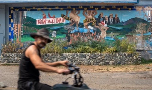
A man rides past an “Undam the Klamath” mural on the Orleans Market in Orleans. (Brian van der Brug / Los Angeles Times)
The Yurok, who sought to defend their fishing rights and tribal sovereignty, faced off with officers in riot gear holding billy clubs and M-16 rifles. Many residents feared for their lives, Masten said.
Masten recalled seeing officers drag a woman away by her hair as tribe members protested on a riverbank. Another time, she said, agents twisted her grandfather’s arm behind his back.
The tensions eventually subsided when the marshals left, and the Yurok successfully asserted their rights to continue fishing. But they saw other threats in the declining fish populations — and the four hydroelectric dams that were built without tribal consent between 1912 and the 1960s.
Former Yurok tribal chairperson Susan Masten stands on a boat on the Klamath River. (Brian van der Brug/Los Angeles Times)
“I really didn’t think that I would see dam removal in my lifetime,” Masten said.
Masten, who is 71, spoke while drifting across the estuary in a motorboat near the river’s mouth. As the surf crashed against a barrier of sand, pelicans, cormorants and ospreys soared over the dark water.
“Everything that’s around here is connected to this river,” Masten said. “And so for us to ensure the future for our children, we need to ensure that this river is here and that it’s healthy, and that the ecosystem is healthy, because it’s the heartbeat of our people. It’s the lifeway of our people.”
Masten lives in her ancestral village of Rek-woi, or Requa, in a home on a bluff overlooking the river’s mouth. Once the dams come down, she said, she expects to see the fish thrive and the entire ecosystem flourish.
“The river has a way to heal itself, and it can heal itself very quickly if it’s allowed to do so,” Masten said. “I’m excited that my grandchildren will be able to benefit from it.”
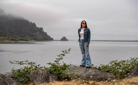
Yurok tribal attorney Amy Bowers Cordalis, a leader of the Indigenous conservation group Ridges to Riffles, stands beside the boat ramp in the village of Requa near the mouth of the Klamath River. (Brian van der Brug / Los Angeles Times)
Masten’s niece, Amy Bowers Cordalis, is a lawyer for the tribe who focuses on the Klamath River and was involved in negotiating agreements involving California, Oregon and PacifiCorps to enable dam removal.
“We kept pushing and pushing,” Bowers Cordalis said. “We all came together and figured out a way to remove dams.”
She stood by a boat ramp that in August typically would be bustling with families hauling out their nets and fish. But the ramp was mostly deserted.
The tribe’s leaders took the rare step of canceling subsistence fishing this year to protect the dwindling salmon population, a decision that mirrored the shutdown of commercial fishing along the coast.
Several years ago, Bowers Cordalis also worked on the Yurok Tribe’s declaration of the river as a legal “person” under tribal law, a step intended to provide greater protections.
One key problem, she said, is that the dams have allowed nutrient-filled agricultural runoff to fester in lakes, feeding algae blooms. When the river isn’t safe for bathing, it prevents the tribe’s members from carrying out ceremonies that involve entering the water.
An idle canoe sits on the shore at a fishing camp along the Klamath River. (Brian van der Brug / Los Angeles Times)
Tearing down the dams is a first step in “a new era of healing,” Bowers Cordalis said. She said she hopes to eventually get back the flourishing river with abundant fish that her great grandmother saw a century ago.
From the river behind her, a salmon flew into the air, its scales shimmering, and landed in the water with a plop. Then another salmon jumped.
“A big run just went through!” a man called out from a boat.
Bowers Cordalis said it was encouraging to see that some salmon, even with their population so low, were making it upstream to spawn.
“We have so much hope that this river will restore itself,” Bowers Cordalis said. “Dam removal is just the beginning. Dam removal is the end of colonization of this river.”
Not everyone is happy to see the dams go. In some areas, the removal project has generated heated opposition.
In the community of Copco Lake, some residents live in waterfront homes with boats and docks. Their homes will be left high and dry when the reservoir is drained.
Alan Marcillet, a resident who enjoys kayaking, said most people in the community aren’t looking forward to the disruptive changes.
“It’s just going to be a mud pit,” Marcillet said. “The community will just die. I would think of the hundred people that live up here, perhaps half of them won’t return.”
Two of his neighbors, German and Jeanne Diaz, bought their retirement home overlooking the lake more than two decades ago. Now, their view is about to change dramatically, and they say they’re concerned about whether the mud that’s exposed at the bottom of the reservoir will turn to dust and pollute the air.
“What is it going to do to the community?” German Diaz said. “Are we going to be going through sandstorms for a while?”
Copco Lake resident Geneve Spanauss Harder looks over Western Outdoor News tabloids from the 1970’s at her home. (Brian van der Brug / Los Angeles Times)
The Klamath River Renewal Corp. has been accepting claims from landowners to pay for damages linked to dam removal. But Diaz said he doesn’t plan to apply for that money.
“We’ve already seen property values drop,” Diaz said. “What can we do?”
Other residents said they see the reservoir as beneficial because it attracts wildlife and serves as a water supply for firefighting helicopters.
Geneve Spannaus Harder, an 80-year-old resident whose great grandfather once owned an apple orchard on lands now submerged by the reservoir, said she and many others strongly oppose draining the lake.
“It’s just going to change the whole scenario of the community,” she said. “I don’t think we know what we’re going to get.”
Because of a closed salmon fishing season, none was available at this year’s Yurok Salmon Festival in Klamath. (Brian van der Brug / Los Angeles Times)
This August, when the Yurok Tribe held its annual Klamath Salmon Festival, no salmon was served. Instead, there were tri-tip sandwiches and frybread, and the parade featured a skit about dam removal with participants holding large paper cutouts of fish.
At one stand, people were asked to write a few words on cards about their hopes for the Klamath River’s future. The cards were hung on strings. One read: “I wish for the salmon to recover and run free forever!”
Nearby, T-shirts were being sold with an illustration depicting the undamming. It features a young woman, her eyes covered with ceremonial bluejay feathers, balancing two baskets like the scales of justice as water breaks through a dam and surges into the river.
Young men compete in a Yurok Tribe stick game tournament during the Yurok Salmon Festival. (Brian van der Brug/Los Angeles Times)
The artist, 23-year-old Tori McConnell, said the young woman represents both the people and the river in a state of transition. The tears running down her cheeks are like her prayers, McConnell said, “overflowing into the baskets of justice.”
McConnell, a Yurok Tribe member who is this year’s Miss Indian World, said she is hopeful.
“There’s a lot of work to be done to restore the salmon population,” McConnell said. “But I hope we will see that happen in our lifetime.”
Populations of chinook and coho salmon, as well as other fish, have declined more than 90% in the Klamath over the past century, said Barry McCovey Jr., the Yurok Tribe’s fisheries director.
The dams have been a big factor, he said, and “we have our eyes on righting that wrong.”
But fish populations have also been ravaged by other factors, including gold mining that scarred the watershed, and decades of logging that left denuded areas, releasing fish-harming sediment into the river.
Additionally, fire suppression in forests over the last century and the lack of traditional burning by Indigenous people has left forests primed for catastrophic wildfires, unleashing tainted runoff that becomes “poison to the ecosystem,” McCovey said. “You combine all that together, and then you layer on top of that climate change,” he said.
The Klamath’s water is heavily used to serve agriculture, irrigating crops such as onions and hay. The Yurok Tribe is suing the federal government over decisions that they argue don’t provide the minimum flows required for fish, including threatened coho salmon.
Yurok tribe fisheries biologist Barry McCovey at the mouth of the Klamath River. (Brian van der Brug / Los Angeles Times)
The removal of dams is a pivotal milestone and it comes at a critical time for struggling salmon populations, McCovey said, but recovery isn’t going to happen in a couple of years. “We have to accept that these things take time,” McCovey said.
“I don’t think in my lifetime I’ll ever see a fully recovered Klamath River ecosystem,” he said. “And maybe no one will ever see that. But the goal is to move closer to that.”
McCovey said restoring balance to the ecosystem will take generations, and he is prepared to continue working toward that goal.
In the meantime, he and others have been talking about what they will do once all the dams are gone.
McCovey said he hopes to take a rafting trip, traveling for miles with the current as the river flows freely once again.
Ian James is a reporter who focuses on water in California and the West. Before joining the Los Angeles Times in 2021, he was an environment reporter at the Arizona Republic and the Desert Sun. He previously worked for the Associated Press as a correspondent in the Caribbean and as bureau chief in Venezuela. He is originally from California.
Albert Brave Tiger Lee is a Southern California native, son of Korean immigrants, a father and a staff videographer at the Los Angeles Times. His work spans various mediums of visual story telling and has been in recognized for various disciplines including a National Emmy Award for News and Documentary, RFK Journalism Award, Picture of the Year International, Best of Photojournalism and the Columbia Dart Award.
Louisiana’s Mid-Barataria Sediment Diversion Will Create Up to 27 Square Miles of New Land
NEW ORLEANS —The State of Louisiana’s ground-breaking for the Mid-Barataria Sediment Diversion, the largest single ecosystem restoration project in U.S. history and a monumental milestone decades in the making, will help reconnect the Mississippi River to its surrounding wetlands. The National Wildlife Federation has worked for decades to advance large-scale sediment diversions as the most effective way to rebuild the Mississippi River Delta, creating vital habitat for wildlife and a crucial buffer for coastal communities against increasing threats from storm surge.
Louisiana loses a football field of land every hour and has lost nearly 2,000 square miles in the last century — about the size of the state of Delaware.
To address its land loss crisis, the state has a comprehensive plan to build and sustain coastal wetlands. The Mid-Barataria Sediment Diversion, which will mimic natural land-building processes, is a cornerstone of that plan, and is predicted to restore up to 27 square miles (17,000 acres) of wetlands in the Barataria Basin and is designed to work with other restoration projects in the outfall area, creating the potential for enhancing hundreds of acres of restored wetlands in total.
“The monumental Mid-Barataria Sediment Diversion is the most important project to restore and expand wetlands in the history of the United States, a remarkable achievement that can help begin to turn the tide on Louisiana’s land loss crisis,” said Collin O’Mara, president and CEO of the National Wildlife Federation. “The landmark project will not only rebuild essential habitat for iconic wildlife species that depend on the Bayou State’s globally-significant coastal resources, it will also provide critical protection for vulnerable coastal communities by enhancing the wetland buffer that reduces the velocity and volume of storm surge. Harnessing the power of the Mississippi River itself to build up its delta — as the system did naturally for thousands of years — is the premier example of how we can work with nature to improve outcomes for both people and wildlife alike to combat escalating climate impacts. We commend the state and federal officials across Louisiana and all those involved in the decades of effort culminating in today’s groundbreaking and urge other regions to draw inspiration from this innovative nature-based solution to create a more resilient future for generations to come. We have no time to lose.”
Editor’s Note: Wetland mitigation accounts for a significant annual investment in habitat restoration and protection, but is it a reliable conservation tool? This article concludes that despite the nationwide goal of “no net loss,” the federal compensatory mitigation program may currently lead to a net loss in wetlands acres and functions.
The nation’s 1989 goal of achieving a “no overall net loss” of wetland acres and functions has a significant influence on how the regulatory agencies administer §404 of the Clean Water Act and, in particular, the decisions they make about compensatory mitigation for permitted losses. Each year approximately 47,000 acres of wetland mitigation are required under the §404 program (ELI 2007) to compensate for about 21,000 acres of permitted losses (Martin et al. 2006), a potential gain of 26,000 acres annually. Although the amount of compensatory mitigation required provides a significant buffer in meeting the “no net loss” goal, the required compensation must be implemented on the ground and the restored wetlands must successfully replace lost wetland acres and functions in order to achieve the goal.
The success of wetland mitigation projects can be judged on whether a project meets its administrative and ecological performance measures. Administrative performance refers to the degree to which compensatory mitigation projects meet their permit requirements, such as submitting monitoring reports in a timely manner. Ecological performance refers to meeting ecological standards that ultimately result in a compensatory wetland that replaces lost aquatic resource functions.
In 2001, the National Wetlands Newsletter published Count it by Acre or Function: Mitigation Adds Up to Net Loss of Wetlands (Turner et al. 2001), providing further insight to a National Research Council (NRC) report that found that compensatory mitigation failed to achieve the national policy of no net loss of wetlands. This article reviews recent literature to determine whether or not compensatory mitigation projects required by state and federal agencies are meeting administrative and ecological performance measures. Most of the studies evaluated permittee-responsible (also known as project-specific) mitigation projects. However, some more recent evaluations deal more specifically with wetland mitigation banks.
Administrative Performance
Turner and colleagues’ (2001) seminal review of the success of mitigation implementation found that mitigation projects across the country often fail to comply with their permit conditions. Of 19 reviewed studies, 10 found that the majority of evaluated projects were compliant with permit conditions, while 9 studies found that only 4 to 49% of the projects were fully compliant.
More recent studies have similar findings. Of seven studies evaluating the percent of sites meeting 100% of the required permit conditions, four found that the majority of the projects reviewed complied with all permit conditions (Ambrose and Lee 2004—69%; Cole and Shaffer 2002—60%; Minkin and Ladd 2003—67%; Sudol and Ambrose 2002—55%), while three found that only 18 to 46% of projects complied with all permit conditions (Ambrose et al. 2006—46%; Brown and Veneman 2001—43%; MDEQ 2001—18%). Ambrose and colleagues (2006) found that, on average, permitees met 73% of permit conditions. A 2002 study of compensatory mitigation in New Jersey found that on average mitigation projects met only 48% of their design requirements and permit specifications (Balzano et al. 2002). Monitoring, submission, and long-term maintenance requirements seem to be the criteria that most often go unmet, while vegetation criteria are more frequently achieved (Ambrose et al. 2006, Ambrose and Lee 2004).
A lack of monitoring and oversight of mitigation projects may contribute to low success rates. Cole and Shafer (2002) found that fewer than 10% of permit files reviewed in their Pennsylvania study contained required monitoring reports. In 2005, the U.S. Government Accountability Office (GAO) published a review of the U.S. Army Corps of Engineers’ oversight of compensatory mitigation in a representative sample of Corps districts. The GAO found that the districts performed limited oversight to determine the status of required compensatory mitigation (GAO 2005). The districts did, however, provide somewhat more oversight for mitigation conducted by mitigation banks and in-lieu fee mitigation than for permittee-responsible mitigation. For the 60 mitigation banks that were required to submit monitoring reports, 70% of the files showed that the Corps had received at least one monitoring report. The percentage of the mitigation bank files with evidence that the Corps conducted an inspection ranged from 13 to 78%.
Ecological Performance
Studies of the ecological performance of compensatory mitigation have shown that compensatory wetland projects fail to replace lost wetland acres and functions even more often than they fail in their administrative performance. In fact, permit compliance has been shown to be a poor indicator of whether or not mitigation projects are adequately replacing the appropriate habitat types and ecological functions of wetlands.
Replacing Acres
Several studies have questioned the success of wetland compensatory mitigation in replacing lost wetland acreage. In its comprehensive national study on compensatory mitigation, the NRC re- ported that between 70 to 76% of mitigation required in permits is actually implemented (NRC 2001). A review of mitigation sites in Michigan found that only 29% of the permits implemented the required amount of mitigation (MDEQ 2001). A study in California found that 46% of sites met acreage requirements (Ambrose and Lee 2004). Several other studies have had similar results, suggesting that the §404 program is failing to compensate for lost wetland acres (Balzano et al. 2002, Johnson et al. 2002).
Replacing Functions
In addition to not meeting acreage requirements, mitigation wetlands often do not replace the functions and types of wetlands destroyed due to permitted impacts. Turner and colleagues (2001) found that an average of only 21% of mitigation sites met various tests of ecological equivalency to lost wetlands. Two recent studies compared mitigation sites to impact sites. One found that only 17% of the sites evaluated successfully replaced lost functions (Minkin and Ladd 2003). The other study determined that 29% of the sites were successful in this regard (Ambrose and Lee 2004). The former study also found that 50% of the mitigation sites evaluated were actually non-jurisdictional riparian and upland habitat. Four studies comparing mitigation sites to reference wetlands found that fewer than 50% of the sites evaluated were considered ecologically successful (Ambrose et al. 2006—19%; Johnson et al. 2002—46%; MDEQ 2001—22%; Sudol and Ambrose 2002—16%). Ambrose and colleagues’ statewide study of 143 permit files in California found that 27% of the constructed mitigation did not even meet the jurisdictional definition of a wetland (Ambrose et al. 2006).
Compensatory mitigation as required under §404 may also result in a shift in wetland type. For example, a study of 31 mitigation sites in Indiana found failure rates of 71% for forested mitigation sites, 87% for wet meadow areas, and 42% for shrub areas, but only 17% of the shallow emergent areas and 4% of open water areas were failures (Robb 2001). These results indicate that mitigation may be resulting in the replacement of forested wetland sites with shallow emergent and open water community types. Similar results have been reported in New Jersey, where a study of that state’s mitigation program found that emergent wetlands were the only wetland type that achieved a greater than 1:1 replacement ratio, while forested wetlands were successfully replaced at a ratio 0.01:1 (Balzano et al. 2002). A Pennsylvania study of 23 §404 permits issued from 1986 to 1999 showed that only 45% of the mitigation wetlands were of the same type as the impact sites and that the mitigation had resulted in a shift from wetlands dominated by woody species to less vegetated mitigation wetlands and a replacement of scrub-shrub, emergent, and forested wetlands with open water ponds or uplands (Cole and Shaffer 2002).
Several recent studies of bank sites indicate that banks are generally no more successful at replacing lost acres and functions than permittee-responsible mitigation. A 1999 study reported a net loss of 21,000 acres of wetlands due to inclusion of enhancement and preservation as mitigation methods at bank sites (Brown and Lant 1999). A more recent comprehensive review of 12 mitigation bank sites in Ohio found that 25% of the bank areas studied did not meet the definition of wetlands (Mack and Micacchion 2006). Of the actual wetland acreage, 25% was considered in poor condition, 58% was fair, and 18% was good quality in terms of vegetation as compared to natural reference wetlands. The study also found that amphibian community composition and quality was significantly lower at banks than at natural forest, shrub, or emergent wetlands and that pond-breeding salamanders and forest-dependent frogs were virtually absent from the bank sites. Overall, of the banks studied, three were mostly successful, five were successful in some areas and failed in others, and four mostly failed. A recent study from Florida found that of the 29 banks evaluated, 70% fell within the moderate to optimal range of function. Although the baseline conditions of most sites were in the high functional range, most of the projects relied upon enhancement, rather than restoration, as the mitigation method (Reiss et al. 2007).
Mitigation and Wildlife Habitat
Many compensatory mitigation projects do not include wildlife criteria in their design and performance standards (NRC 2001). Only a handful of studies on compensatory mitigation attempt to address the ability of compensatory mitigation to replace wildlife habitat lost through the §404 program. These studies indicate that compensatory mitigation sites are not effectively replacing lost wildlife habitat. One study reported that over half of the mitigation sites evaluated did not adequately compensate for wildlife habitat services lost due to permitted activities (Ambrose and Lee 2004). Only 41% of the studied sites had successfully replaced wildlife habitat and connectivity, while replacement failed at 38% of sites (25 of these sites were considered extreme failures). In Washington state, 55% of the sites surveyed in one study had only a moderate contribution to wildlife functions (Johnson et al. 2002), while in New Jersey the wildlife suitability assessment criteria achieved the lowest score of all the assessment criteria used to evaluate mitigation sites (Balzano et al. 2002). The New Jersey study reported that, on average, mitigation sites provided limited protective cover, adjacent food sources, and nesting habitat for wildlife and that there were moderate human impediments to wildlife use of the sites.
Conclusion
Although wetland mitigation accounts for a significant annual investment in habitat restoration and protection, it has not, to date, proven to be a reliable conservation tool. Despite the nationwide “no net loss” goal, the federal compensatory mitigation program may currently lead to a net loss in wetlands acres and functions. On the high end, Turner and colleagues (2001) estimated that the §404 program may lead to an 80% loss in acres and functions. The success of compensatory mitigation could be enhanced by improving permit conditions and requiring clearly defined performance standards (Ambrose et al. 2006, NRC 2001, Turner et al. 2001). However, there are currently no national guidelines or models for developing ecological performance standards. Permits should clearly define performance standards that are based on ecological criteria such as community structure, soil, hydrology, amphibian communities, and vegetation (Fennessy et al. 2007). Currently, many permits simply require a certain percentage of herbaceous cover as a criterion for accessing the success of mitigation site because it is easily measured and may quickly reach required thresholds. However, percent herbaceous cover may not be a sufficient surrogate for most wetland functions (Cole and Shafer 2002).
Mitigation success may also be improved by making site selection decisions within the context of a watershed approach (NRC 2001). In 2002, the Corps issued guidance in support of the watershed approach, and draft compensatory mitigation regulations issued jointly by the U.S. Environmental Protection Agency and the Corps in 2006 may codify the approach. Under the watershed approach outlined in the proposed mitigation rule, there also may be opportunities for mitigation to support habitat conservation objectives (Bean and Wilkinson 2008). Improved compliance monitoring would also help to ensure the success of mitigation projects. As a recent GAO study indicates, many Corps districts have limited oversight of compensatory mitigation projects (GAO 2005). Increasing post-implementation monitoring and tying required monitoring periods directly to achieving final performance criteria would improve both the administrative and ecological performance of mitigation sites.
References
Ambrose, R.F. and S.F. Lee. 2004. An Evaluation of Compensatory Mitigation Projects Permitted Under Clean Water Act Section 401 by the Los Angeles Regional Quality Control Board, 1991-2002. California State Water Re- sources Control Board, California.
Ambrose, R.F., J.C. Callaway, and S.F. Lee. 2006. An Evaluation of Compensatory Mitigation Projects Permitted Under Clean Water Act Section 401 by the California State Water Quality Control Board, 1991-2002. Los Angeles Regional Water Quality Control Board, California.
Balzano, S., A. Ertman, L. Brancheau, W. Smejkal, A.S. Greene, M. Kaplan, and D. Fanz. 2002. Creating Indicators of Wetland Status (Quantity and Quality): Freshwater Wetland Mitigation in New Jersey. NJ Department of Environmental Protection, Division of Science, Research, & Technology.
Bean, Michael and Jessica Wilkinson. January 2008. Design of U.S. Habitat Bank- ing Systems to Support the Conservation of Wildlife Habitat and At-Risk Species. Washington, DC: Environmental Law Institute.
Brown, P., and C. Lant. 1999. “The effect of wetland mitigation banking on the achievement of no-net-loss.” Environmental Management 23(3): 333-345.
Brown, S.C. and P.L.M. Veneman. 2001. Effectiveness of compensatory wetland mitigation in Massachusetts, USA, Wetlands, 21(4): 508-518.
Cole, C.A. and D. Shaffer. 2002. “Section 404 Wetland Mitigation and Permit Suc- cess Criteria in Pennsylvania, USA.” 1986-1999. Environmental Management 30(4): 508-515.
Environmental Law Institute. 2007. Mitigation of Impacts to Fish and Wildlife Habitat: Estimating Costs and Identifying Opportunities. Washington, DC
Fennessy, S., A. Rokosch, and J.J. Mack. 2007. Developing Performance Standards for the Assessment of Wetland Mitigation Projects. National Wetlands News- letter. 29(2) 3.
Johnson, P., D.L. Mock, A. McMillan, L. Driscoll, and T. Hruby 2002. Washing- ton State Wetland Mitigation Evaluation Study. Phase 2: Evaluating Success. Washington State Department of Ecology. February 2002. Publication No. 02-06-009
Mack, J.J and M. Micacchion. 2006. An Ecological Assessment of Ohio Mitigation Banks: Vegetation, Amphibians, Hydrology, and Soils. Ohio EPA Technical Report WET/2006-1. Ohio Environmental Protection Agency, Division of Surface Water, Wetland Ecology Group, Columbus, Ohio.
Martin, S., B. Brumbaugh, P. Scodari, and D. Olsen. 2006. Compensatory Miti- gation Practices in the U.S. Army Corps of Engineers. U.S. Army Corps of Engineers, Institute for Water Resources.Working Paper.
Michigan Department of Environmental Quality. 2001. Michigan Wetland Mitiga- tion and Permit Compliance Study. Lansing, MI: Land and Water Management Division.
Minkin, P. and R. Ladd 2003. Success of Corps-Required Mitigation in New Eng- land, USACE New England District
National Research Council. 2001. Compensating for Wetland Losses Under the Clean Water Act, National Academy of Sciences.
Reiss, K.C., E. Hernandez, M.T. Brown. 2007. An Evaluation of the Effectiveness of Mitigation Banking in Florida: Ecological Success and Compliance with Permit Conditions. Florida Department of Environmental Protection #WM881. EPA Grant #CD 96409404-0.
Robb, J.T. 2001. Indiana Wetland Compensatory Mitigation: Area Analysis. EPA Grant #CD985482-010-0 Indiana Department of Environmental Management. June 2001
Sudol, M.F., and R.F. Ambrose. 2002. The U.S. Clean Water Act and habitat re- placement: evaluation of mitigation sites in Orange County, California, USA. Environmental Management 30: 727-734.
Turner, R.E., A.M. Redmond, J.B. Zedler. 2001. “Count It By Acre of Function— Mitigation Adds Up to Net Loss of Wetlands.” National Wetlands Newsletter 23(6).
U.S. Government Accountability Of ce. 2005. Wetlands Protection: Corps of Engineers Does Not Have an Effective Oversight Approach to Ensure That Compensatory Mitigation Is Occurring. Washington, DC: GAO. GAO-05- 898.
On August 29, 2023, the U.S. Environmental Protection Agency (EPA) and the Department of the Army announced a final rule that amends the January 2023 definition of “waters of the United States” (WOTUS). The amendments conform the January 2023 definition to the U.S. Supreme Court’s decision in Sackett and will take effect immediately upon publishing in the Federal Register (likely to happen within two weeks). To read the pre-publication version of the revised final rule, go to Pre-publication Version of the Final Rule – Amendments to the Revised Definition of Waters of the United States (epa.gov).
While exact details are yet to be digested, the gist of the ruling is becoming clear. First, the significant nexus rule has been eliminated; so isolated wetlands are not jurisdictional wetlands, meaning they are not protected under the Clean Water Act. Second, the new rule requires visual evidence of a continuous surface flow between a wetland and navigable water. This part of the rule can get complicated as to what constitutes visual evidence of continuous surface flow. I am sure that this will cause a lot of confusion and some developers will say there is no continuous surface flow and impact the wetland with a permit.
Suffice it to say, this puts wetlands in North and South Carolina in jeopardy. The NC Department of Environmental Quality has estimated about 2.5 million acres of wetland have lost protection in North Carolina and I am sure a similar number in South Carolina. The NC legislature could have continued to protect these wetlands; however, the recently passed Farm Bill eliminated state protection of isolated wetlands.
We all need to brace ourselves for a lot of wetland loss and they are the very resource we need to protect our communities from flooding. I think it is reasonable to expect more communities to get flooded, to have less clean water, and to have reduced climate resilience as well as miss the many other benefits that our wetlands provide.
So go out an explore a wetland (before it gets developed?).
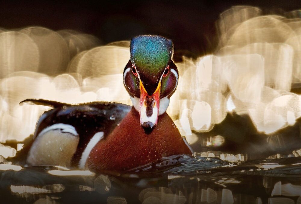
Waterfowl and waterbirds are integral parts of wetland ecosystems. Ducks, geese and other migratory birds deliver more valuable benefits to our environment and to us than we realize.
By Lauren Rae May 22, 2020
As dedicated conservationists, we’re committed to ensuring that waterfowl have the habitats they need to thrive. But what have they done for us, lately? Turns out, it’s a whole lot.
Many of us get unspeakable joy from being near a local wetland at sunset as flocks of birds return from an evening of feeding. Others treasure the family tradition of setting up a blind in the marsh on a brisk autumn morning.
After decades of successful conservation work spanning North America, waterfowl populations are strong, bringing with them endless opportunities for us to enjoy their beauty and bounty.
But there’s more to appreciate about our feathered friends than you may realize. As ambassadors for the ducks, we feel compelled to highlight some of the lesser known and unique services they provide. Allow us to sing (quack and honk) their praises.
Waterfowl help biodiversity with wetland-to-wetland delivery
Waterfowl and waterbirds are integral parts of wetland ecosystems. They’re large-bodied and often airborne, which makes them relatively easy to observe. And they’re mobile; travelling far distances and stopping at multiple wetland sites along the way. Every time they splash down at these migratory pit stops, they leave something behind, like an avian Amazon delivery driver.
Last year, DUC restored more than 50,000 acres (20,200 hectares) of wetlands. When waterfowl visit these newly restored habitats, they can establish biodiversity by introducing plant, invertebrate, amphibian and fish species from other sites. Frog eggs might get transported from pond to pond if they are stuck on a goose’s foot, for example. Insect larvae that survive in a duck’s intestinal tract might get deposited in a wetland far from where it was ingested.
This wetland-to-wetland delivery method works for established ecosystems, too. In the face of climate change, dispersal by waterbirds can help a species shift its range. As conditions get warmer, waterfowl can help other species expand northward to climates where they can continue to be successful. It also helps keep a species’ gene pool diverse, making it easier for the species to avoid inbreeding and adapt to changing environments. Having many types of genes gives species a stronger toolkit for facing adversity. Either way, dispersal by waterbirds can benefit individual species and enhance biodiversity in wetlands.
How birds help with pest problems and invasive species
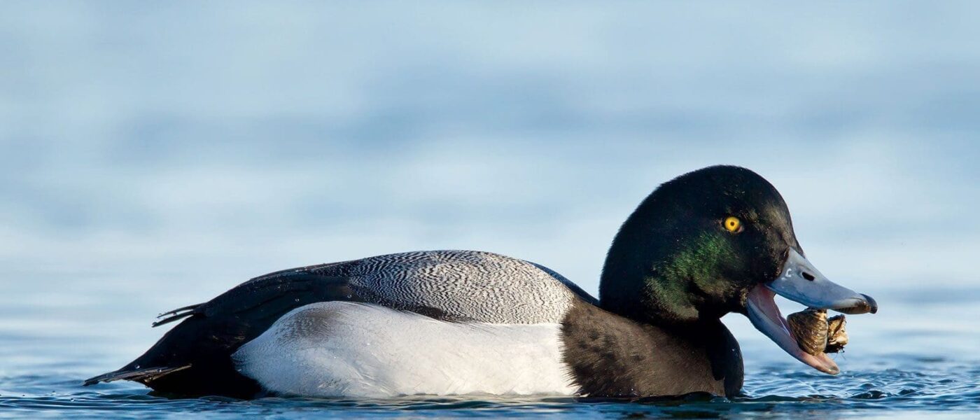
Introduced or invasive species often raise a red flag—and rightfully so. They wreak havoc on natural ecosystems and have major economic consequences. Although they could potentially spread undesirable species to new areas, waterfowl can be of help here, too. For instance, diving ducks like scaup feed on invasive zebra mussels and can decrease their abundance. The same holds true for plant pests. Ducks that winter in flooded rice fields eat the seeds of weeds, giving the farmer a leg-up the following growing season. Ducklings, too, can make a dent in pest populations. They eat a lot of larvae that would otherwise become pesky, biting mosquitoes.
Canada geese are notorious for protecting their nests and goslings during the breeding season. This aggression can benefit other birds nesting nearby, keeping predators—and people—at a safe distance, which helps survival of young birds regardless of their species.
Waterfowl help ecosystems and the economy
Anyone that has a hard time appreciating the many ways waterfowl help ecosystems should know that they contribute financially, too. With all that hunters invest in waterfowling, a single duck is worth $26 in the Canadian economy (not to mention that northern communities have traditionally subsisted on waterfowl harvest and it continues to be a cornerstone of many cultures). And in Iceland, one of the last remaining locations where down from non-domesticated ducks is harvested, eider feathers bring $40 million to retail markets.
The ripple effect of conservation
It’s comforting to know that, whatever our reasons for conserving wetlands, our work on behalf of the ducks supports hundreds of other species, including ourselves.
Peter, Paul, and Mary could very easily have been talking about our country’s wetlands instead of flowers in their 1962 hit, “Where Have All the Flowers Gone.” When wetlands were first forming, thousands of years ago as the ice age ended, the United States was 90% covered with wetlands. Today, coastal and inland wetlands cover only about 5.5% of the United States.
The Ramsar Convention estimates that nearly 90 percent of all the world’s wetlands have disappeared since the 1700s, and those that remain are at risk of disappearing three times faster than forests. In 1989, Congress directed the Department of the Interior to compare the estimated total number of wetland acres in the 1780s and in the 1980s in the areas that now comprise each state. The report, released by the U.S. Fish and Wildlife Service (FWS), was designed as a one-time effort to document historical wetland losses from colonial times through the 1980s. This report is updated every 10 years providing new information based on a statistical analysis of wetlands changes from the 1970s through the 1980s.
As with historical estimates, data on present wetland acreage must be interpreted with caution. For some states, wetlands have been mapped for the entire state by the FWS National Wetlands Inventory. However, for those states where wetlands are not completely mapped or where acreage summaries are not yet compiled, an accurate accounting of wetland acreage is not always available, so the best national or regional data available to determine statewide totals was used. Additionally, the status of wetlands in the United States is constantly changing. It is estimated that, on average , over 60 acres of wetlands have been lost every hour in the lower 48 states during this 200-year time span.
Considerable changes in wetland distribution and abundance have taken place since the 1780s. In the conterminous United States, only an estimated 104 million acres of wetlands remained through the 1980s, representing a 53-percent loss from the original acreage total. If Alaska and Hawaii are counted, an estimated 274 million wetland acres remain.
By all estimates, the national decline in wetlands from the 1780s to the 1980s is dramatic. Losses in particular regions of the country such as the mid-western farm belt states of Illinois, Indiana, Iowa, Michigan, Minnesota, Ohio, and Wisconsin are even more startling. Alaska stands alone as the only state in which wetland resources have not been substantially reduced.
Incomplete baseline data on the wetlands in the United States prevents an accurate appraisal of the “health” of these remaining resources. However, population growth and distribution and agricultural development greatly affect land-use patterns that impact wetlands . Despite increased efforts to conserve wetlands through state and federal legislation, hundreds of thousands of acres have been drained annually. Wetland acreage has diminished to the point where environmental and even socio-economic benefits are now seriously threatened.
The years from the mid-1950s to the mid-1970s were a time of major wetland loss, but since then the rate of loss has decreased. How will climate change and global warming affect wetlands as our country and the rest of the world continue to experience unprecedented heat waves. The fact that the definition of a wetland changes often makes these numbers even harder to predict. The total amount of wetlands can change in an instant depending on the wording of a government document.
Various factors have contributed to the decline in the loss rate of wetlands including implementation and enforcement of wetland protection measures and elimination of some incentives for wetland drainage. Public education and outreach about the value and functions of wetlands, private land initiatives, coastal monitoring and protection programs, and wetland restoration and creation actions have also helped reduce overall wetland losses. Hopefully, this will be enough.
On August 29, 2023 the US EPA and the US Army Corps of Engineers released a pre-publication version of the conforming amendment to the 2023 definition a Waters of the US. I cannot recall ever having seen a “conforming amendment” in all my years working with this issue. In fact, I am not sure it has ever been done before in any circumstance. I expect the next round of challenges to this rule will focus on this.
The final version of this rule is the weakest version of the Waters of the US we have ever had. The amount of wetlands no longer covered by Clean Water Act protections is the lowest it has ever been including the Navigable Waters Protection Rule era. It is also important to note that the Supreme Court Decision that prompted this new rule was a unanimous (9-0) one. All nine justices were in agreement despite popular media decrying it was the right side of the bench that dominated the Decision.
This is a final rule and becomes effective on the date it is published in the Federal Register. There is no public comment period. I am still unclear as to why the agencies are in such a hurry to not regulate wetlands.
Much of the new rule discusses why it is proper to issue a conforming amendment without a public comment period. The rule itself is fairly brief, in that it provides the edits to the existing Biden rule. The rule itself does not merge the two rules together into a single document. They leave that up to you. However, we have done this for you and the total new conforming rule follows. We will also be hosting a webinar on this new rule on September 28, 2023. Hope to see you there!
Title 33 —Navigation and Navigable Waters
Chapter II —Corps of Engineers, Department of the Army, Department of Defense
Part 328 —Definition of Waters of the United States
For the purpose of this regulation these terms are defined as follows:
(a) Waters of the United States means:
(1) Waters which are:
(i) Currently used, or were used in the past, or may be susceptible to use in interstate or foreign commerce, including all waters which are subject to the ebb and flow of the tide;
(ii) The territorial seas; or
(iii) Interstate waters,
(2) Impoundments of waters otherwise defined as waters of the United States under this definition, other than impoundments of waters identified under paragraph (a)(5) of this section;
(3) Tributaries of waters identified in paragraph (a)(1) or (2) of this section that are relatively permanent, standing or continuously flowing bodies of water;
(4) Wetlands adjacent to the following waters:
(i) Waters identified in paragraph (a)(1) of this section; or
(ii) Relatively permanent, standing or continuously flowing bodies of water identified in paragraph (a)(2) or (a)(3) of this section and with a continuous surface connection to those waters.
(5) Intrastate lakes and ponds not identified in paragraphs (a)(1) through (4) of this section that are relatively permanent, standing or continuously flowing bodies of water with a continuous surface connection to the waters identified in paragraph (a)(1) or (a)(3) of this section.
(b) The following are not “waters of the United States” even where they otherwise meet the terms of paragraphs (a)(2) through (5) of this section:
(1) Waste treatment systems, including treatment ponds or lagoons, designed to meet the requirements of the Clean Water Act;
(2) Prior converted cropland designated by the Secretary of Agriculture. The exclusion would cease upon a change of use, which means that the area is no longer available for the production of agricultural commodities. Notwithstanding the determination of an area’s status as prior converted cropland by any other Federal agency, for the purposes of the Clean Water Act, the final authority regarding Clean Water Act jurisdiction remains with EPA;
(3) Ditches (including roadside ditches) excavated wholly in and draining only dry land and that do not carry a relatively permanent flow of water;
(4) Artificially irrigated areas that would revert to dry land if the irrigation ceased;
(5) Artificial lakes or ponds created by excavating or diking dry land to collect and retain water and which are used exclusively for such purposes as stock watering, irrigation, settling basins, or rice growing;
(6) Artificial reflecting or swimming pools or other small ornamental bodies of water created by excavating or diking dry land to retain water for primarily aesthetic reasons;
(7) Waterfilled depressions created in dry land incidental to construction activity and pits excavated in dry land for the purpose of obtaining fill, sand, or gravel unless and until the construction or excavation operation is abandoned and the resulting body of water meets the definition of waters of the United States; and
(8) Swales and erosional features (e.g., gullies, small washes) characterized by low volume, infrequent, or short duration flow.
(c) In this section, the following definitions apply:
(1) Wetlands means those areas that are inundated or saturated by surface or ground water at a frequency and duration sufficient to support, and that under normal circumstances do support, a prevalence of vegetation typically adapted for life in saturated soil conditions. Wetlands generally include swamps, marshes, bogs, and similar areas.
(2) Adjacent means having a continuous surface connection.
(3) High tide line means the line of intersection of the land with the water’s surface at the maximum height reached by a rising tide. The high tide line may be determined, in the absence of actual data, by a line of oil or scum along shore objects, a more or less continuous deposit of fine shell or debris on the foreshore or berm, other physical markings or characteristics, vegetation lines, tidal gages, or other suitable means that delineate the general height reached by a rising tide. The line encompasses spring high tides and other high tides that occur with periodic frequency but does not include storm surges in which there is a departure from the normal or predicted reach of the tide due to the piling up of water against a coast by strong winds such as those accompanying a hurricane or other intense storm.
(4) Ordinary high water mark means that line on the shore established by the fluctuations of water and indicated by physical characteristics such as clear, natural line impressed on the bank, shelving, changes in the character of soil, destruction of terrestrial vegetation, the presence of litter and debris, or other appropriate means that consider the characteristics of the surrounding areas.
(5) Tidal waters means those waters that rise and fall in a predictable and measurable rhythm or cycle due to the gravitational pulls of the moon and sun. Tidal waters end where the rise and fall of the water surface can no longer be practically measured in a predictable rhythm due to masking by hydrologic, wind, or other effects.