Posted on — Leave a comment

Prairie Pothole Duck Habitat Under Threat

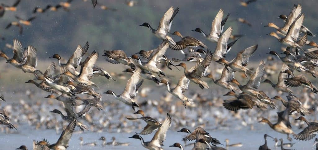
Pintail ducks taking flight in the Prairie Pothole region of the U.S. Photo courtesy of Field & Stream and Adobe.

In July of 2026, the U.S. Fish and Wildlife Service released an online notice stating that it “found it necessary to withdraw the [May 13, 2024] rule” which “established regulations pertaining to wetland easements.” The 2024 rule codified the process of requesting providing drain tile setbacks as part of the National Wildlife Refuge System’s wetland easements program. Subsurface agricultural drainage is a process by which poorly drained, often wetland, soils are drained in an effort to improve the soil’s aeration. This, in turn, can turn land that previously could not be farmed into usable farmland. When drainage happens next to a wetland, it reduces the hydroperiod, resulting in temporary or even permanent damage to the wetland habitat. Drain tile setbacks helped reduce this risk, by requiring drainage to happen a certain distance away from wetlands. In an effort to conserve wetland habitats, the Wetlands Loan Act of 1961 was passed. This act provides funding for the purchase of wetland easements, so that landowners are compensated for turning over wetland habitat to the National Wildlife Refuge System as a conservation easement.

In the Prairie Pothole Region of the United States, prairie pothole wetland habitats are critical breeding grounds for thousands of native ducks. The Wetlands Loan Act provided funding for the Small Wetlands Acquisition Program (SWAP) through the Duck Stamp program; for decades, money coming from the purchase of federal duck stamps was used to fund wetland conservation easements, many in the so-called “Duck Factory of North America”. The National Wildlife Refuge System not only manages the wetlands within the easements, but it also placed restrictions on how nearby land not included in the easements could be used. This was to make sure that changes to the surrounding landscape did not negatively impact the protected wetlands; requiring drain tiles be placed a certain distance away from wetlands was one of the restrictions.

The U.S. Fish and Wildlife Service rescinding the May 2024 drain tile setback rule means that many prairie potholes are at an increased risk of drying up, which in turn could lead to a 20-50% reduction in the duck breeding capacity of these critical habitats. This move has created an outcry amongst conservationists, especially duck hunters, as they have worked for decades to protect prairie potholes and other important breeding grounds for waterfowl and other migratory birds. Ducks Unlimited, an organization dedicated to conserving and restoring wetland habitats across the country, has decried this decision as well, stating that the May 2024 Rule “protects critical waterfowl habitat, provides certainty for landowners-through science-based setback plans, and preserves the integrity of conservation easements that have delivered enormous benefits for wildlife and hunters alike.” When combined with recent rollbacks of the Endangered Species Act’s ability to protect habitat, waterfowl and other migratory bird habitats are at a heightened risk of disappearing. The U.S. Fish and Wildlife Service opened a public comment period on this topic on June 24, 2026, with the commend period ending on August 7, 2026. If you would like to see prairie potholes and other wetland habitat receive continued protections, and would like the May 2024 Rule to remain in place, consider submitting a formal public comment. Public outcry may be the only thing that keeps this waterfowl-rich region protected for future generations of birders, duck hunters, and other conservationists.

#Wetlands #PrairiePotholes #DuckHabitat #Waterfowl #Conservation #USFWS #MigratoryBirds #EnvironmentalPolicy #WetlandConservation #WetlandWednesday #TheSwampSchool
Posted on — Leave a comment

North Carolina’s Weird and Wonderful: Sassafras

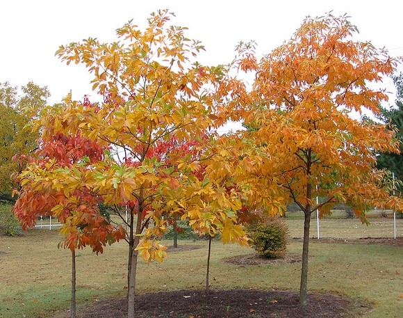
Sassafras albidum tree thicket in the fall. Photo courtesy of P.W. Hatcher and the North Carolina Extension Gardener Plant Toolbox.

Another month is over, which means it’s time for a new edition of North Carolina’s Weird and Wonderful! Over the past few years, July has become a very plant-heavy month for me, primarily due to the Cullowhee Native Plant Conference. Those who know me well can tell you that I’m not a botanist; in fact, I’m pretty sure I told my favorite biology professor in college that botany wasn’t for me. With age comes wisdom, as they say, so I’ve been trying to remedy this rather large gap in knowledge by learning from my colleagues, taking workshops and guided hikes, and, of course, purchasing and reading a lot of field guides (I know there are apps for that now. But the only way you will get me to give up my guidebooks is by prying them from my cold, dead hands). So, in honor of the Cullowhee Native Plant Conference turning over a new leaf and becoming the Southeastern Native Plant Conference, and to increase my botanical knowledge by one species, this month’s weird and wonderful focus is on the sassafras tree, Sassafras albidum. 

Full disclosure: I primarily picked this tree because it is fun to say. Sassafras. What a wonderful word! It is thought that the word “sassafras” comes from the Spanish word “sasafras”, which itself may have been a word that sounded similar to a now-lost-to-time indigenous term for the plant. The sassafras tree is common throughout the Eastern United States and prefers full sun to light shade. Saplings that find themselves shaded out by larger, faster-growing plants will probably die off, but young trees that are able to get a foothold in sunny patches will begin to thrive. A large taproot makes it difficult to transplant a sassafras sapling from one spot to another, and this species has the habit of spreading via suckers to form sassafras thickets.

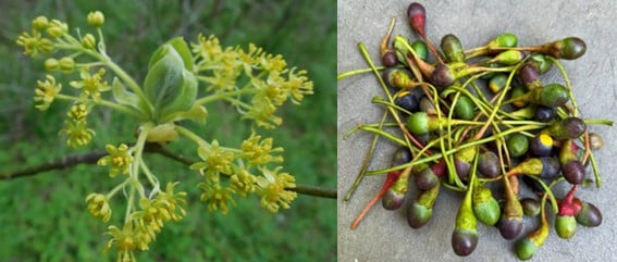
Sassafras tree flowers, left, and the ripe and unripe fruit, right. Photos courtesy of Flower of the Carolina.

In early spring, since this species is dioecious, male and female flowers appear on different trees. Fruits will only form on female trees if there were male trees (and pollinators) somewhere in the vicinity. The fragrant flowers do attract a wide variety of pollinators, including native bees, wasps, and flies, and the foliage is fodder for both the imperial moth caterpillar and the spicebush swallowtail caterpillar. Dead stems, when left standing, provide shelter in which native bees overwinter. The fruits are enjoyed by many birds and mammals, including Eastern bluebirds, wild turkeys, pileated woodpeckers, black bears, and squirrels; the bark and twigs are consumed by several mammals, with beavers, in particular, enjoying all the woody bits sassafras has to offer.

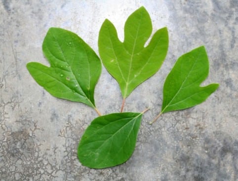
Sassafras tree leaves, demonstrating the left and right-handed mitten leaf shape, the three-fingered leaf shape, and the egg leaf shape. Photo courtesy of the Municipality of Princeton, NJ.

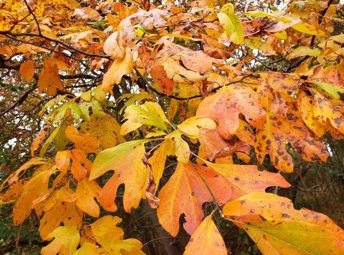
One of the weird and wonderful characteristics of this tree is its leaf shape. Sassafras leaves are often described as mittens, and one could say this tree is ambidextrous, as it produces both right and left-handed mittens. Other leaf shapes include a three-fingered version and a smooth egg shape. In the fall, sassafras leaves turn brilliant shades of red, orange, yellow, and even purple, often standing out amongst the rest of the fall foliage across the autumnal landscape. Mature bark is red-brown in color and was historically used to make a vibrant, orange dye for wool products.

This is where things get a bit weird. The bark, leaves, twigs, and roots of sassafras had been used for medicinal purposes for centuries. Indigenous tribes brewed teas to ease or cure numerous ailments, among them rheumatism, diarrhea, the common cold, fevers, and kidney problems. During the early years of European colonization, sassafras tea was exported out of North America in large quantities, due to the lore surrounding this tree’s extract as a cure-all wonder drug. More recently in time, safrole, the main component in sassafras oil extracted from the bark, was used as a flavoring agent for root beer, chewing gum, and as an additive in Cajun spices. Sounds pretty wonderful, right? Well, in the 1960s, researchers found that safrole, when given to mice and rats both orally and via subcutaneous injection, resulted in the development of liver tumors. As a result, safrole has been deemed a weak hepatocarcinogen for humans, and is banned by the U.S. FDA for use in food. Recent research, though, has shown that safrole has potential as an antimicrobial agent; as a potential herbal supplement for use as an antidiabetic; and as a cytotoxin used to treat cancer cells. The scientists who conducted the study, while optimistic, caution that more work is needed, especially considering the rodent study results from the middle of the 20th century.

Sassafras tree in all its autumnal glory. Photo courtesy of Flower of the Carolina.

So…is safrole good or bad? It’s entirely possible that, like many other plants people assumed had healing properties throughout our past, sassafras didn’t actually contribute anything positive. It’s also plausible that the extract was able to treat some ailments, but might have also caused further illness that was never linked back to sassafras usage at the time. Perhaps whether safrole leans on the side of healing or not has to do with how the sassafras oil is collected from the tree, and then how it is subsequently treated, before being utilized as a flavoring agent or medicinal additive. Whatever the case may be, I would argue that this uncertainty adds to the weird and wonderful mystique surrounding the sassafras tree. Besides, with adorable mittens and gorgeous fall colors that can be forever preserved as a vibrant wool dye, who wouldn’t want this lovely tree in their backyard? 

Posted on — Leave a comment

Southwest Florida Gains Powerful New Tool for Wetland Restoration and Water Management

The following blog post is a summary of the article “WET Expands to Southwest Florida” by Dr. Paul Gray and Audubon Florida, published on June 4, 2026. To read the original article, which originally appeared in Audubon’s State of the Everglades Spring 2026 Report, click here.

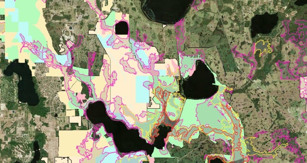
Image courtesy of Audubon Florida and Dr. Paul Gray.

Audubon’s Wetland Evaluation Tool (WET) is an interactive, GIS-based mapping resource that helps identify locations where surface water can be stored naturally while also highlighting opportunities for wetland restoration and aquifer recharge. After demonstrating its value in the Central Florida Water Initiative and the Lake Okeechobee watershed, the tool is now being expanded into Southwest Florida. The expansion reflects a growing need for innovative approaches to water management in one of Florida’s fastest developing regions. As development continues to reshape the landscape, natural systems that once captured and stored water have been replaced by roads, pavement, and extensive drainage networks. The WET is intended to help restore some of the landscape’s natural ability to retain water and improve long-term watershed resilience.

Historically, Florida’s wetlands, floodplains, and soils provided a natural buffer against both floods and drought by storing water during wet periods and gradually releasing it over time. Modern drainage infrastructure is designed to move water off the landscape quickly, reducing this natural storage capacity and increasing the severity of drought conditions. Rapid stormwater releases can also create environmental problems by abruptly changing salinity levels, carrying excess nutrients into waterways, and contributing to harmful blue-green algae blooms. These challenges are becoming more significant as Southwest Florida experiences increased coastal flooding alongside more frequent and intense wildfires. The continuing loss of wetlands has made restoring natural water storage systems an increasingly important priority for the region.

The need for improved water management is underscored by the estimated loss of more than 30,000 acres of wetlands in Collier and Lee counties since 1996. By expanding the WET into Southwest Florida, Audubon aims to provide local governments, water management districts, and private landowners with a practical tool for identifying the most effective locations for restoration projects. The mapping system can help guide investments toward projects that offer the greatest benefits for water storage, aquifer recharge, and ecosystem health. It will also play an important role in shaping the Corkscrew Watershed Initiative restoration plan by helping prioritize projects throughout the watershed. These efforts are expected to strengthen the long-term health of the region’s wetlands while supporting important natural areas such as Audubon’s Corkscrew Swamp Sanctuary.

#AudubonFlorida #WetlandEvaluationTool #WetlandRestoration #StormwaterManagement #NatureBasedSolutions #WetlandWednesday #TheSwampSchool
Posted on — Leave a comment

Climate.us Launches to Restore Public Access to Climate.gov Data

On June 23, 2026, the independent website Climate.us launched. A year in the making, the website’s creators sought to create a replacement for the now-defunct Climate.gov website, which was shut down in June of 2025. Climate.us is the brainchild of former members of the team behind the National Oceanic and Atmospheric Administration’s Climate.gov website, who recognized that the public was losing access to valuable scientific information when the old site ceased to exist. While much of the data is still technically accessible, Climate.us staff explain that it is often very hard to find now, especially by members of the public who may not be as familiar with where to look. By locating all the data themselves and making it easy to access on their Global Climate Dashboard, they hope this new website will continue to provide data that scientists, educators, farmers, and the general public have used for years. 

Their Global Climate Dashboard is designed to look very similar to the one on the old website, hopefully making it easy for people to pick up where they left off in their research. On that dashboard you can find El Niño and La Niña data, information on sea levels, glaciers, surface temperatures, incoming sunlight, and much more. Searching through their Maps & Data yields drought information, precipitation statistics, air temperature information, and other vital climate data.  In addition, Climate.us also has a Teaching Climate section, which offers a collection of over 700 free, ready-to-use resources that have been rigorously reviewed by educators and scientists alike. With materials that can be used from secondary through higher education, teachers can now more easily find resources to use in their classrooms. 

Climate.us is not a government owned and operated website, but is operated by an independent nonprofit organization. One-third of its initial funding came from over 2,500 small donations from people who wanted to make sure there would be a place for all the Climate.gov data to be available for future generations. Over 80 scientists have volunteered to act as subject matter experts, and the website team is led by the former program manager for Climate.gov. So, for anybody who missed being able to access climate data from one place, check out Climate.us, whose mission statement is “Keeping trusted climate information up to date and easy to find.”

#ClimateUS #ClimateData #ClimateScience #Education #EnvironmentalEducation #NOAA #ScienceResources #WetlandWednesday #TheSwampSchool
Posted on — Leave a comment

North Carolina’s Weird and Wonderful: Pointy-Lobed Firefly

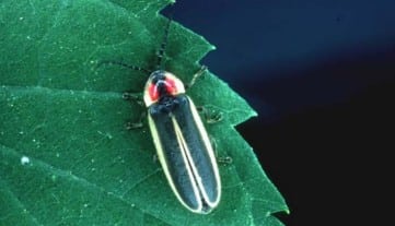
Adult male pointy-lobed firefly, Photinus acuminatus. Photo courtesy of James E. Lloyd and the Xerces Society.

Well, it’s the end of June, which means summer is finally here! And nothing screams summer more than chasing fireflies across the yard at dusk. North Carolina is a really special state because we have over forty species of lightning bugs! Of course, both of those names are misnomers, because fireflies are not actually flies, and lightning is not involved in their lovely glow. These insects are actually beetles, but while most beetles typically have a hard exoskeleton, lightning bugs are soft-bodied beetles, and thus are more sensitive to both drying out and succumbing to pesticides. While the most common firefly in our state is probably the common eastern firefly, also known as the Big Dipper Firefly, this month’s weird and wonderful focus is going to be on a far lesser known relative: the Pointy-Lobed Firefly, Photinus acuminatus. 

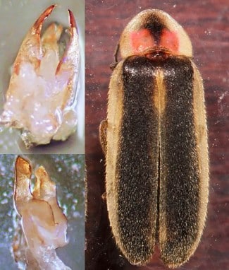
Adult male pointy-lobed firefly, right, collected in southern Ohio in 2019. The pointy lobes on its aedeagus, left, confirmed this specimen to be a pointy-lobed firefly. Photograph courtesy of Laura S. Hughes and the Ohio Biological Survey, Inc.

The pointy-lobed firefly is an incredibly rare insect, not only in North Carolina, but across its historic range in the Southeastern United States. This species was originally described in the 1950s from a single male specimen collected in the Pisgah region of North Carolina and a single female specimen collected from Florida. Similar in appearance to the little gray firefly, Photinus marginellus, the pointy-lobed firefly has dark elytra (the hard outer wings of beetles) with a pale, wide outer border. The dark central marking on the dorsal (top) side of their pronotum, which is the hard, protective sclerite that covers and protects the insect’s head and first thoracic segment, reaches the pronotum’s base. This dark marking has two red or pink spots on either side. In living specimens, these spots tend to be a deeper red, and the pale, wide border of the elytra are a brighter, light yellow in color. The name pointy-lobe comes from the lateral lobes on male pointy-lobe fireflies’ aedeagus, aka genitalia. In fact, the examination of the male genitalia is required for accurately identifying whether a specimen is a member of this species or not. That sounds pretty weird to me! 

Pointy-lobed fireflies, like their more common cousins, are bioluminescent. Within their abdomen is a special organ called a photophore, and it is within that organ that a chemical reaction producing light takes place. Fireflies combine oxygen with the chemical luciferin in the presence of the luciferase enzymes, and this reaction results in light production. Pointy-lobed fireflies emit their flashes of light from June-July. The males have a flash pattern of a single, bright flash that lasts about 100 milliseconds. These short flashes are emitted at about 2 second periods, with females issuing a short response flash at around a 300-millisecond delay. The larvae of all members of the Lampyridae family, which is the insect group that contains all firefly species, are predaceous, so entomologists assume that pointy-lobed larvae are as well, in addition to being bioluminescent. Larvae of species in the Photinus genus tend to be subterranean (meaning they live underground) and specialize in eating earthworms. How weird and wonderful is that? 

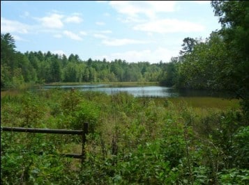
Shrubby wetland habitat in upstate South Carolina where the pointy-lobed firefly has been documented in the past. Photograph courtesy of Richard Joyce and the Xerces Society.

Little is known about the specifics of this species’ life history, as most of the recorded localities are known only from single collected specimens captured at each spot. Within the past twenty years, living pointy-lobed fireflies have only been documented at a single site in South Carolina and a single site in Ohio. However, entomologists suspect there are small populations throughout the southeast, with the historic range potentially spreading into the Midwest. One of the wonderful traits of the pointy-lobed firefly is that it appears to live in shrubby wetland habitats, such as bogs, fens, and swamps. All the more reason to conserve these habitats, in my book! Unfortunately, as these habitats are filled in and destroyed to make way for more housing and commercial developments, the already tiny populations of the pointy-lobed firefly are at an increased risk of completely disappearing. 

In addition, as alluded to at the beginning of this blog, fireflies are even more susceptible to pesticides than other insects, including pesticides that are used to target nuisance or invasive species. While pesticides tend to be sprayed above ground, they can soak into the soil, affecting the larval form of the pointy-lobed firefly. Pesticides applied to alfalfa and other grasses raised for livestock end up in the manure, which, if applied to pastures, meadows, and yards as compost, can poison the soil and eliminate the existing firefly population.  Finally, light pollution disrupts the mating displays of the males and the responses of the females, making it harder for two to find each other and mate. Keeping porch lights and other outside lights turned off from dusk until dawn is the best way to prevent light pollution around your home, but you can also swap out your existing bulbs for yellow bulbs, as that wavelength falls along the edge of light wavelengths that insects can discern. Some yellow bulbs even come with a “bug light” label, helping you figure out which one is best, and LED bulbs, being more energy efficient than incandescent bulbs, are the way to go. 

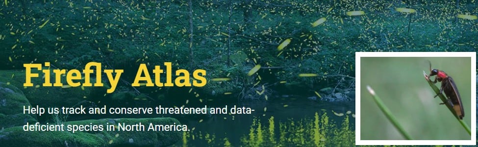
Landing page for the Xerces Society’s Firefly Atlas website. Courtesy of Firefly Atlas and the Xerces Society.

If the plight of the pointy-lobed firefly, and all firefly species, has inspired you to learn more, check out the Xerces Society for Invertebrate Conservation. This organization is dedicated to educating people about invertebrates’ role in the natural world and conserving crucial habitat for threatened and endangered species. To figure out where the pointy-lobed firefly and other rare, threatened, and endangered firefly species are, the Xerces Society has created a Firefly Atlas. This is a citizen science project aimed at tracking and conserving threatened firefly species in North America. The hope is that more data will enable critical habitats to become identified and protected. So, as dusk approaches and your backyard fireflies emerge, think of the pointy-lobed firefly, trying its best to hang on in ever-shrinking wetland habitat in an increasingly illuminated world.

#PointyLobedFirefly #Lightningbug #Fireflies #FireflyConservation #FireflyAtlas #XercesSociety #NorthCarolinasWeirdandWonderful #WetlandWednesday #TheSwampSchool
Posted on — Leave a comment

Small Island, Big Impact: Floating Wetlands Come to Boston

The following blog post is a summary of the article “Floating wetlands bring back Boston’s natural landscape lost to development” by Bianca Garcia, published by the NPR Boston affiliate WBUR on May 20, 2026. To read the original article and listen to the radio program, click here.

The newly constructed floating wetland in Boston’s Fort Point Channel. Photograph courtesy of Robin Lubbock and WBUR.

Boston’s Fort Point Channel is now home to a newly constructed floating wetland that appeared in less than a week through a collaboration between Save the Harbor/Save the Bay, the real estate development firm Alexandria, and the Scottish company Biomatrix Water. The 1,400-square-foot structure was built from recycled pipes, stainless steel, compost, and native plants, creating what its designers describe as a giant floating planting basket. Although it currently resembles a muddy raft with sparse vegetation, the project is intended to develop into a thriving habitat for local wildlife. Salt-tolerant New England plants have already been installed, and organizers expect mussels, clams, sponges, fish, and zooplankton to gradually populate the ecosystem. Supporters hope the project will encourage greater public interest in Boston’s waterfront while demonstrating new approaches to environmental restoration.

The floating wetland is designed to recreate “edge habitat,” the natural transition zone between land and water that largely disappeared when Boston’s shoreline was reshaped by landfill and seawalls. Historically, these wetlands provided important ecological services by supporting wildlife, reducing flooding, and filtering pollutants from the water. Restoring similar environments has become increasingly important as climate change contributes to rising sea levels, stronger storms, and ecosystem disruptions. The Fort Point venture is one of more than 200 floating wetlands Biomatrix has installed worldwide, though this particular project is notable because it must withstand the challenges of a saltwater environment. Project leaders view it as a practical example of how urban areas can reintroduce natural systems into heavily developed landscapes.

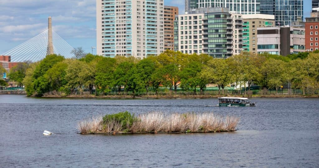
The Charles River Conservancy’s floating wetland. Photograph courtesy of Robin Lubbock and WBUR.

The effort builds on lessons learned from a floating wetland that has operated seasonally in the Charles River since 2020. Research conducted there found that algae-eating zooplankton were more abundant among the wetland’s underwater roots, suggesting that such installations can provide valuable habitat and potentially help absorb excess nutrients. While experts agree that floating wetlands alone cannot solve major water quality problems, they believe these projects can deliver localized environmental benefits and contribute to broader restoration efforts. Future plans include expanding floating wetland networks in Boston through projects in Broad Canal and near the Museum of Science. Organizers expect the Fort Point Channel wetland to become much more vibrant by next summer as plants spread, wildlife settles in, and birds begin using the area for nesting.

#FloatingWetland #Boston #UrbanNature #WildlifeHabitat #GreenInfrastructure #NatureBasedSolutions #BiomatrixWater #SavetheHarborSavetheBay #WetlandWednesday #TheSwampSchool
Posted on — Leave a comment

North Carolina’s Weird and Wonderful: Diamondback Terrapin

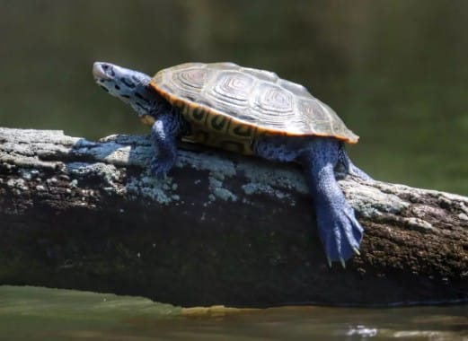
Adult diamondback terrapin, Malaclemys terrapin, basking on a log. Photograph courtesy of James Richards and the U.S. Fish and Wildlife Service.

Another Turtle Month has come to a close, which means this month’s weird and wonderful focus has to shine a spotlight on a turtle: the diamondback terrapin, to be exact. This aquatic turtle occupies the salt marshes along the North Carolina coast, sounds, and tidal channels. Neither a fully freshwater nor a fully saltwater aquatic turtle, this weird and wonderful species, Malaclemys terrapin, needs brackish water habitat to survive. On the smaller side, diamondback terrapins range in size from 4 to 9 inches long, with females tending to be larger than males. Their carapace can vary in color from gray, brown, or black, and each scute has prominent concentric growth rings. In older individuals, these rings may be worn smooth and may not be as textured as they are in younger turtles. In addition to their unique shells, the skin of the head, neck, and legs of these turtles is often white or gray and covered in black spots, speckles, or lines.

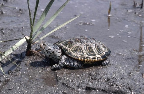
Adult diamondback terrapin in a salt marsh. Photograph courtesy of Ken Taylor and the NC Wildlife Resources Commission.

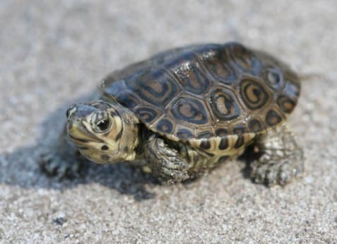
Diamondback terrapins are carnivorous and feast primarily on mollusks, crustaceans, and other invertebrates that inhabit the saltwater marshes. In particular, this species loves to munch on periwinkle snails. From April to June, female terrapins will nest in places above the high tide line and lay anywhere from two to twelve oval-shaped eggs. The hatchlings will emerge in August or September, but sometimes they hang out in the nest over the winter and do not leave until the following spring. During the warm spring and summer months adult diamondback terrapins are often observed sunning themselves on mudflats.

Diamondback terrapin hatchling. Photograph courtesy of Jeff Hall and the NC Wildlife Resources Commission.

Diamondback terrapins were historically valued for their meat: terrapin soup was a popular delicacy among the elite in urban centers along coastal areas, such as Charleston, South Carolina. Their population plummeted as a result of over harvesting; today, while collecting them for food is illegal, the species is still in peril. Crab traps are particularly deadly, as many are left abandoned, and once a terrapin swims into one, they are unable to get out and drown. In addition, many are still illegally collected for the wildlife trafficking trade, and a large portion of their historical habitat has been degraded or outright destroyed for development.

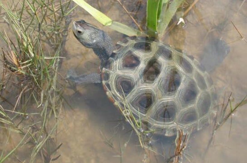
Adult diamondback terrapin swimming in a salt marsh. Photograph courtesy of Andrew Gosse and the NC Wildlife Resources Commission.

However, all is not lost! In recent years it has been made more apparent how beneficial salt marshes are to coastal communities, as they act as hurricane buffers and floodwater control measures. Thus, many salt marshes have been restored, leading to more habitat for diamondback terrapins. On the crab trap front, crabbers can buy special inserts for their traps that prevent terrapins from entering, but allow legal-sized crabs to get through. While many people along the coast might only be interested in the ocean and sandy beaches, the next time you are out that way, pay more attention to the mudflats amongst the salt marshes. You might see a diamondback terrapin or two basking or looking for delicious periwinkle snails.

Posted on — Leave a comment

How States Can Protect Clean Water After Sackett

Last week on May 13, 2026, the Waterkeeper Alliance, in partnership with the Center for Water Security and Cooperation, published a report detailing how states could protect their clean water in a post-Sackett II world. The Supreme Court, in their 2023 decision on the Sackett II case, significantly limited the definition of protected waters at the federal level. As a result, many waterbodies lost federal protection, and are now vulnerable to increased pollution or outright destruction. As the Protecting Clean Water at the State Level After Sackett report explains, states can step up to the plate and fill in the gaps when it comes to protecting clean water within their borders. 

Many states are home to shared waters, meaning portions or all of their waters fall within the same watershed as waters from other states. Thus, what happens to waters within one state’s boundaries affects the waters within another state. This report argues that states should follow the same approach when it comes to water protections, as that ensures consistency in water quality and public health. If one state has looser restrictions on clean water policy than another, this can result in pollution in one state causing issues in a state downstream. 

This report established a framework of regulations that Waterkeeper Alliance and CWSC explain can offset the impacts of the Sackett II decision at the state level. They examined current laws in Arkansas, Mississippi, Missouri, and Tennessee, which are all located in the lower Mississippi River basin, and identified recommendations for how each state’s laws could be strengthened to follow their proposed framework of legal protections for clean water. The authors of the report hope that stakeholders at both the local and state levels will follow these recommendations, with the goal of protecting clean water for their communities for generations to come. For anybody who wants to learn more about how their local and state governments can work towards protecting clean water for their citizens, this report is an excellent stepping stone in that direction.

#CleanWater #WaterProtection #SackettII #WaterkeeperAlliance #CWSC #EnvironmentalPolicy #ProtectOurWaters #CleanWaterForAll #MississippiRiver #WaterJustice #WetlandWednesday #TheSwampSchool
Posted on — Leave a comment

Interior Department Repeals Federal Public Lands Conservation Rule

The following blog post is a summary of the article “Trump administration cancels rule that made conservation a use of public lands” by Matthew Brown, published by the Associated Press on May 11, 2026. To read the original article, click here.

Photograph courtesy of the U.S. Bureau of Land Management.

The Interior Department is repealing a 2024 rule that had placed conservation efforts on equal footing with industrial development on federal public lands. The rule, introduced during President Joe Biden’s administration, allowed public lands managed by the Bureau of Land Management to be leased for environmental restoration projects in the same way land could be leased for drilling and other industrial purposes. President Donald Trump’s administration argued that the policy created unnecessary restrictions that could limit access to land used for energy production, logging, mining, and grazing. Interior Secretary Doug Burgum maintained that the rule threatened economic activity on hundreds of thousands of acres of public land and could negatively affect industries that depend on consistent land access. The repeal reflects the administration’s broader effort to reduce regulations and expand the use of taxpayer-owned lands for resource extraction and commercial development.

Supporters of the original conservation rule believed it addressed long-standing concerns that environmental protection had become secondary to industrial use within the Bureau of Land Management. Advocates pointed to the agency’s responsibilities under the Federal Lands Policy Management Act of 1976, arguing that conservation deserved a more prominent role in land management decisions. Environmental organizations warned that eliminating the rule could weaken protections for clean drinking water, wildlife habitats, and damaged ecosystems. Bobby McEnaney of the Natural Resources Defense Council criticized the repeal and argued that it would reduce accountability for corporations that leave environmental damage behind on public lands. Although conservation leases existed in limited forms before the Biden administration, the 2024 rule created the first dedicated program specifically focused on restoration and environmental stewardship.

Industry groups and Republican lawmakers strongly opposed the conservation policy and pushed for its repeal from the beginning. Critics argued that the Biden administration’s rule violated the Bureau of Land Management’s long-standing “multiple use” mandate by giving too much emphasis to land restoration and limiting opportunities for productive land use. Representatives from the oil and natural gas industry welcomed the repeal and said it would provide more clarity and predictability for companies investing in domestic energy production. The Bureau of Land Management oversees vast public land holdings across Western states such as Alaska, Nevada, Utah, and Wyoming, along with underground mineral reserves that include coal and lithium deposits. Since returning to office, the Trump administration has pursued several actions designed to expand fossil fuel production on federal lands while also rolling back restrictions adopted during the final months of the Biden administration.

#PublicLands #Conservation #EnvironmentalPolicy #LandManagement #EnergyPolicy #WildlifeProtection #NaturalResources #WetlandWednesday #TheSwampSchool

Posted on — Leave a comment

North Carolina’s Weird and Wonderful: Carolina Gopher Frog

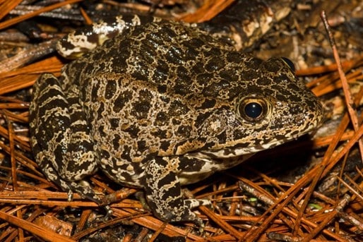
Adult Carolina gopher frog, Lithobates capito. Photograph courtesy of Kevin Stohlgren and Herps of NC.

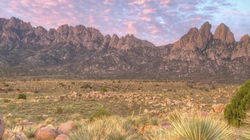
As another April comes to a close, so does another Frog Month celebration. While Frog Month celebrates frogs and toads all around the world, it’s time to bring the celebration back to North Carolina. Therefore, it is only fitting that this month’s edition of North Carolina’s Weird and Wonderful feature an amphibian: the Carolina Gopher Frog, Lithobates capito. This incredibly secretive frog is hard to find in the wild and, in North Carolina, only occurs in the Sandhills and southeastern Coastal Plain. While it shares many physical traits with toads, gopher frogs are considered members of the “true frog” group, Lithobates. This species varies in coloration, ranging from pale gray or tan to even nearly black with many dark spots.

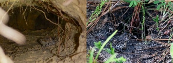
A gopher frog in a gopher tortoise burrow on the left, and a gopher frog resting in front of a stump hole on the right. Left photograph courtesy of Jonathan Mays, right photograph courtesy of Charles Dymock, and both photos courtesy of the Gopher Tortoise Council.

Gopher frogs (or Carolina Gopher frogs, as they’re known here in NC) are rare amphibians to come across. Pine savannas with sandy soils, especially turkey oak-longleaf pine plant communities, are their preferred habitat. Part of what makes this particular ecosystem such a great place for gopher frogs is that it is host to ephemeral ponds from the winter through spring. As these vernal pools are temporary and not connected to other water bodies, they do not contain fish, and thus are perfect, predator-free places in which gopher frogs can breed and lay eggs. The other aspect of pine savannas that makes them the perfect habitat for gopher frogs is the sandy soil, which is great for burrowing. Gopher frogs get their name from the fact that they are fossorial, meaning they live underground. In South Carolina and points south, they inhabit the burrows of gopher tortoises, which also inhabit turkey oak-longleaf pine savanna plant communities further south. In North Carolina, though, gopher tortoises are not present, so our gopher frogs make do with stump holes, crayfish burrows, and burrows made by other animals. 

A gopher frog exhibiting defensive posturing. Photograph courtesy of the Gopher Tortoise Council.

Part of what makes gopher frogs so weird and wonderful is their terrestrial behavior: they only enter water to breed. Thus, their physical attributes are more toad-like to accommodate a less-watery lifestyle: drier skin and prominent warts. The dry skin helps hold in moisture, which is crucial for a fossorial amphibian. When threatened, gopher frogs arch their backs and cover their face with their hands. Researchers hypothesize that this is to protect their face while exposing the toxins that they secrete from their warts. These toxins make them an unpleasant snack for predators that may otherwise be tempted to eat them. While not seen very often, they can be heard calling during the breeding season, which is from mid-February through mid-April. The call is a deep snore or growl, and gopher frogs sometimes emit calls while fully submerged underwater. 

A juvenile gopher frog, raised in a head start program, released into the wild. Photograph courtesy of Gena Lyons and the U.S. Fish and Wildlife Service.

Unfortunately, gopher frogs are threatened or endangered throughout their entire southeastern range. This is due primarily to the destruction of their habitat due to agricultural and development pressures in the region. In addition, severe droughts result in ephemeral pools either not lasting for the full breeding season or not forming at all, denying gopher frogs places to breed. But all is not lost: federal, state, and private organizations, including the U.S. Fish and Wildlife Service, North Carolina Wildlife Resources Commission, North Carolina Aquariums, and the Amphibian Foundation, to name a few, have formed head start programs for gopher frogs. In these programs, gopher frogs are raised from the egg stage to froglet and then released into the habitat their ancestors were collected from, or into brand-new wetland habitat constructed especially for them. Individuals can help by working to conserve turkey oak-longleaf pine savanna habitat and to restore habitat that has been lost. The next time you find yourself in the pine savannas of the southeastern coastal plain, keep your eyes peeled for crayfish burrows and stump holes. You never know, there may be a gopher frog or two hanging out below ground. 

#EarthDay #FrogMonth #CarolinaGopherFrog #AmphibianHeadStartPrograms #USFWS #NCWRC #NCAquariums #AmphibianFoundation #WetlandWednesday #NCWeirdandWonderful #TheSwampSchool