Posted on — Leave a comment

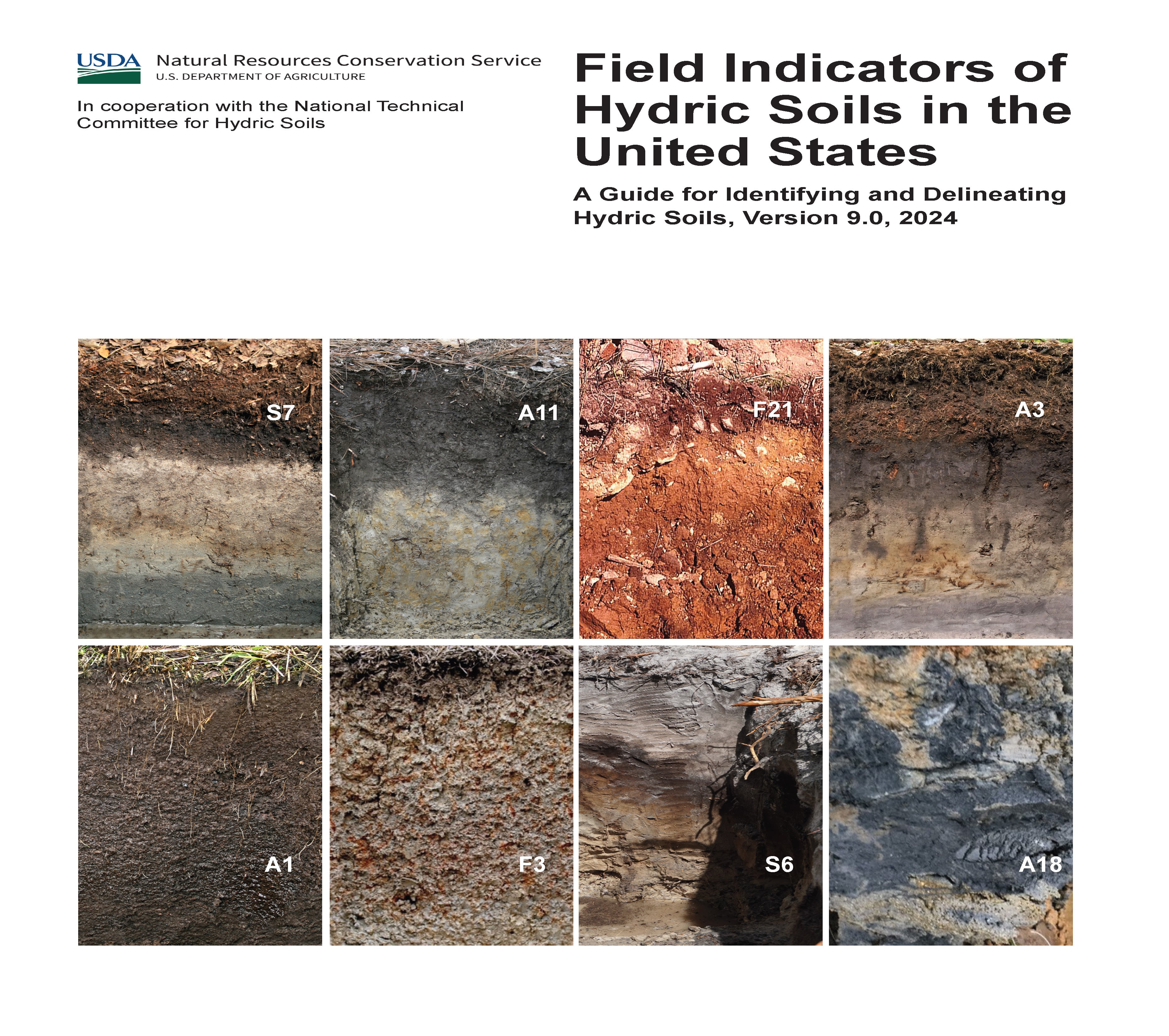
Announcing the Latest Edition of Field Indicators of Hydric Soils in the United States: A Guide for Identifying and Delineating Hydric Soils – Version 9.0

book cover

The Field Indicators of Hydric Soils in the United States guide has been an essential resource for scientists, environmental consultants, and land managers who work to identify and preserve wetlands. Now, with the release of Version 9.0, the USDA’s Natural Resources Conservation Service (NRCS) and the National Technical Committee for Hydric Soils (NTCHS) have expanded and refined this resource, updating essential definitions, indicators, and methodologies. This new edition builds on Version 8.2, introducing new region-specific indicators, refined guidelines for identifying hydric soil features, and some adjustments to the thickness requirements for certain indicators, making it a comprehensive tool for accurate hydric soil identification across the U.S.

Key Enhancements in Version 9.0

Hydric soils play a critical role in wetland ecosystems, serving as indicators of saturated conditions essential for wetland health and biodiversity. The new Version 9.0 introduces essential updates that will improve the accuracy of hydric soil identification, from defining region-specific indicators to refining measurement requirements for certain soil features.

1. Introduction of New Field Indicators for Diverse Regions

The guide has introduced new hydric soil indicators tailored to specific ecological regions, enhancing accuracy in previously challenging areas. For instance, the Alaska Gleyed Pores indicator helps address the unique characteristics of cold-region soils, where gleyed matrix colors occur prominently along root channels and pore linings, essential for identifying anaerobic conditions in these climates. With similar additions for areas with sandy, loamy, and clayey soils, the guide allows scientists to make more reliable hydric soil classifications nationwide.

2. Changes to Feature Thickness Requirements

Version 9.0 includes important updates to the minimum thickness requirements for certain hydric soil indicators. These adjustments aim to better align field practice with evolving soil science research, allowing for more nuanced identification of wetland boundaries. For example, indicators like the Depleted Matrix now include modified minimum thicknesses based on specific depth criteria, improving accuracy for areas with marginal wetland conditions. Such changes enable more precise documentation of soil properties and ensure that professionals can account for subtle variations in hydric soil features across different soil types and landscapes.

3. Expanded Guidelines for Recognizing Redoximorphic Features

Redoximorphic features—characteristics indicating soil areas with fluctuating aerobic and anaerobic states—are essential in defining hydric soils. In this latest edition, redoximorphic guidance is enhanced, particularly for sandy and loamy soils. The new definitions cover specific traits of redox concentrations and depletions, such as iron-manganese masses and gleyed matrices, offering field professionals an improved framework for distinguishing between true hydric soil features and naturally occurring soil variations in complex landscapes.

4. Elimination of Outdated Test Indicators

A major update n Version 9.0 is the elimination of outdated test indicators. Previously, some indicators were included on a trial basis to assess their effectiveness in field identification. These test indicators have now been removed, streamlining the guide and allowing users to focus on scientifically validated indicators that provide reliable results. Concepts from retired indicators, such as Vernal Pools, have been integrated into existing indicators like the Depleted Matrix, enhancing these primary indicators without redundant or untested methods. This change ensures that each indicator in the guide meets rigorous standards, improving overall reliability and usability.

5. Integrated Indicators for Simplicity and Efficiency

Several indicators have been retired in this edition, but their key concepts have been consolidated into other indicators to reduce redundancy. For instance, the concepts previously captured in the Vernal Pools indicator now enhance the Depleted Matrix indicator, making it a more versatile tool for wetland delineation. Similarly, other retired indicators have been merged, keeping the guide efficient and accessible while still scientifically rigorous.

6. Revised Appendices and Glossary for Greater Accessibility

Version 9.0 includes a thoroughly updated glossary and appendices that make it easier for users to apply the guide in specific regions. Expanded definitions cover terms like “gleyed matrix,” “anaerobic conditions,” and “organic bodies,” making the guide more accessible to those new to soil science and field identification. In addition, the appendices now provide a consolidated list of approved indicators organized by Land Resource Regions (LRRs) and Major Land Resource Areas (MLRAs), supporting rapid reference for professionals working in various geographic areas.

Why These Updates Matter for Wetland Management

Identifying hydric soils accurately is essential for maintaining and protecting wetland ecosystems, which serve critical functions in water purification, flood control, and biodiversity preservation. The enhancements in Version 9.0, from modified thickness requirements to expanded redoximorphic feature descriptions, provide environmental consultants, regulators, and wetland scientists with the precision needed to navigate these complex landscapes accurately. Improved indicators for specific regions, like coastal, floodplain, and cold environments, make it easier to manage wetlands under diverse climate and soil conditions.

Practical Applications for Field Professionals

With its focus on detail and accuracy, Version 9.0 offers practical benefits for those conducting soil identification and wetland delineation:

  • Land Development Compliance: Accurate soil classification helps ensure that projects comply with the Clean Water Act (CWA) and other regulations, reducing the risk of costly misclassifications.
  • Restoration and Conservation Efforts: Wetland scientists can apply region-specific indicators and adjusted thickness requirements to design effective conservation and restoration projects, especially in fragile ecosystems like floodplains and coastal areas.
  • Agricultural Land Use: Farmers and agricultural consultants can leverage this updated resource to make informed decisions about hydric soil management, supporting sustainable practices that protect adjacent wetland areas.

Accessing and Using Version 9.0

The Field Indicators of Hydric Soils Version 9.0 is available through the NRCS Distribution Center and on the NRCS website. With this latest edition, professionals have access to cutting-edge tools that support not only accurate soil identification but also sustainable environmental management practices. By integrating the advancements in Version 9.0, field practitioners can confidently approach the intricacies of hydric soil identification, contributing to the protection and sustainability of wetland ecosystems across the United States.

This update ensures that wetland delineation remains a robust science, meeting the challenges posed by changing climates and evolving ecosystems. With Version 9.0 in hand, environmental professionals are now better equipped than ever to work at the forefront of soil science and wetland conservation.

Posted on — Leave a comment

Navigating the Aftermath: What Happens When a Major Storm Destroys a Permitted Stream Mitigation Site

In the wake of a major storm, the challenges faced by wetland and stream mitigation companies can be overwhelming. When these natural events cause significant damage to a permitted mitigation site, the ramifications go beyond just the physical destruction. Companies must navigate complex regulatory obligations under the U.S. Army Corps of Engineers (USACE) compensatory mitigation regulations, which remain in effect despite the unpredictable forces of nature. This blog post explores the key considerations and responsibilities for mitigation companies in the aftermath of such an event and outlines the steps required to stay compliant and protect both environmental and financial interests.

Continued Responsibility for Mitigation Success

One of the most critical aspects of the 2008 Compensatory Mitigation Rule is that it holds the permittee responsible for ensuring the long-term success of the compensatory mitigation project, regardless of external factors such as natural disasters. This means that even after a major storm destroys a mitigation site, the company must ensure that the site still meets the intended ecological functions and complies with performance standards over the specified monitoring period. In practice, this means that simply blaming the storm for the destruction is not enough. The mitigation company must still ensure that the site recovers or that alternative actions are taken to restore its ecological value. This responsibility includes making sure that the site provides the necessary environmental services, such as water quality improvement, habitat provision, and flood control, as outlined in the original permit. Failure to meet these performance standards, even due to natural causes, can result in serious consequences, including legal and financial penalties. For this reason, companies must be prepared to respond quickly and effectively when a storm strikes.

Implementation of Remedial Actions

When a storm destroys a mitigation site, companies must act swiftly to implement remedial actions. The USACE expects permittees to address any deficiencies and restore the site to meet the original objectives outlined in the mitigation plan. There are several potential avenues for remediation, depending on the extent of the damage.

Site Reconstruction

The first and most obvious step is to rebuild or restore the damaged areas of the mitigation site. This may involve re-grading stream banks, replanting vegetation, or reconstructing wetlands to ensure they meet the ecological standards originally required. In many cases, physical restoration is the most direct way to return the site to its intended function. However, site reconstruction is not always straightforward. It can be time-consuming and costly, particularly if the damage is extensive. Companies must also be mindful of how rebuilding efforts align with the original mitigation goals, ensuring that the restored site provides the same ecological benefits as before.

Additional Mitigation

If it is not feasible to fully restore the original site, the company may need to provide supplementary mitigation at an alternative location. This is often referred to as “off-site mitigation.” While it can be a valuable way to meet regulatory requirements when on-site remediation isn’t possible, it presents its own challenges. Additional mitigation must still meet the same rigorous standards of performance and provide comparable ecological benefits to the original project.

Adaptive Management

Another option is adaptive management, which allows for modifications to the mitigation plan in response to changing conditions. After a storm, the ecological landscape may shift, making it difficult to implement the original plan. In such cases, the USACE allows permittees to adjust their strategies while still working towards the overall ecological goals of the project. For example, if erosion caused by a storm has significantly altered a stream channel, the mitigation plan may be adapted to stabilize the new channel rather than attempt to restore it to its pre-storm condition. Adaptive management offers flexibility, but it still requires careful planning and regulatory approval to ensure compliance.

Force Majeure Considerations

While natural disasters like storms are often considered “acts of God,” the USACE does not automatically exempt permittees from their obligations due to such events. Instead, the USACE expects companies to demonstrate due diligence in their mitigation efforts and work closely with regulatory agencies to develop a remediation plan.

Demonstrating Due Diligence

In the context of a storm-damaged mitigation site, due diligence means showing that the company took reasonable steps both before and after the storm to prevent or mitigate damage. For example, was the site designed with resilience to extreme weather events in mind? Did the company act quickly after the storm to assess the damage and begin remediation efforts? By demonstrating that they took proactive measures, companies can improve their standing with regulatory agencies and potentially reduce the risk of penalties.

Engaging with Regulatory Agencies

Open communication with the USACE is essential. Companies must promptly notify the agency of any damage to the mitigation site and work collaboratively to develop an acceptable plan for remediation. This may include updating the mitigation plan to reflect post-storm conditions or requesting modifications to the permit.

Monitoring and Reporting Requirements

Even after a disaster, mitigation companies are still required to meet all monitoring and reporting requirements. In the aftermath of a storm, monitoring should focus on documenting the impact of the storm on the mitigation site and evaluating the effectiveness of any remedial actions. This data will be crucial in demonstrating compliance and showing that the company is actively working to restore the site. Regular updates to the USACE, including detailed reports on the status of the site and any remediation efforts, are vital for maintaining compliance and avoiding enforcement actions.

Financial Assurances

Many mitigation projects require financial assurances, such as performance bonds or escrow accounts, to ensure that there are funds available for restoration in the event of unforeseen issues, including natural disasters. If a storm destroys a site, these financial assurances can be used to fund the necessary remediation efforts. However, failure to adequately restore the site can result in the forfeiture of these assurances, leaving the company financially responsible for completing the restoration without the benefit of the secured funds.

Potential Permit Modifications

In some cases, the USACE may allow for modifications to the permit in response to the storm. This can include extending deadlines to give the company more time to achieve performance standards or adjusting the success criteria to reflect new site conditions. If on-site restoration is no longer feasible, the agency may also approve alternative mitigation options. However, permit modifications are not guaranteed and will require strong justification from the company.

Liability and Enforcement Actions

Failure to adequately address the destruction of a mitigation site can lead to significant legal and financial consequences. The USACE may determine that the company is in violation of its permit conditions, resulting in administrative penalties, fines, or even the suspension or revocation of the permit. This can have long-term impacts on the company’s ability to secure future permits.

Stakeholder Communication

Finally, maintaining open communication with stakeholders, including regulatory agencies, local communities, and clients, is crucial for managing the company’s reputation. Proactive communication can help build trust and foster collaboration, making it easier to navigate the regulatory landscape in the wake of a disaster.

Conclusion

When a major storm destroys a permitted stream mitigation site, the responsibilities of wetland and stream mitigation companies are far from over. The USACE’s compensatory mitigation regulations ensure that companies remain accountable for restoring the site or finding alternative mitigation solutions. By taking proactive steps, demonstrating due diligence, and maintaining open communication with regulatory agencies, companies can successfully navigate these challenges while fulfilling their environmental obligations.

Posted on — Leave a comment

Unveiling WOTUS: How NOHWM and SDAM Define Our Nation’s Waterways

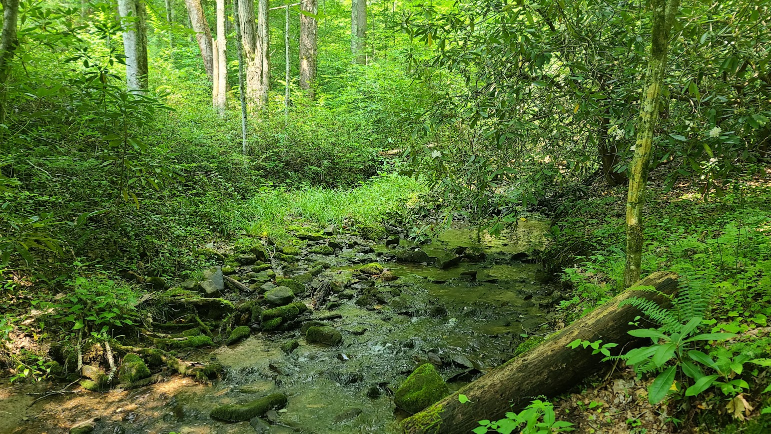
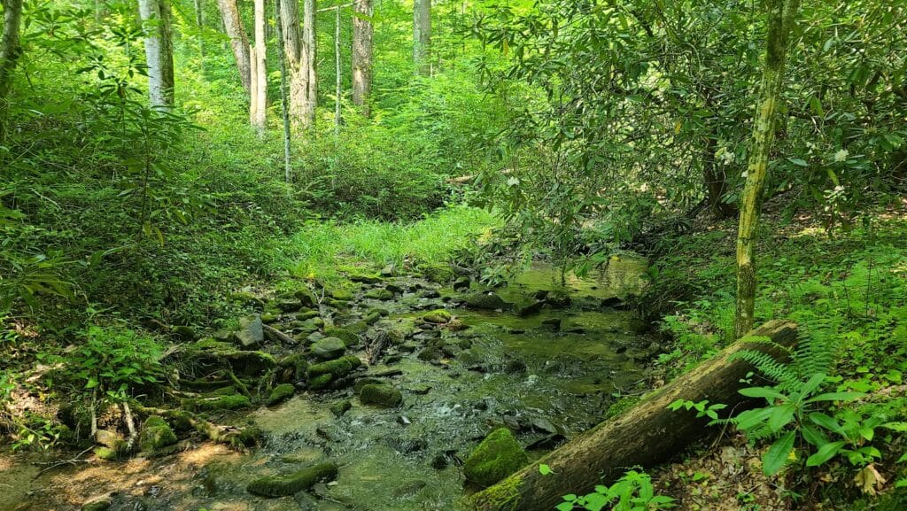
Stream Site

Establishing Jurisdictional Waters of the United States (WOTUS) Using the US Army Corps of Engineers National Ordinary High Water Mark Manual (NOHWM) and Stream Duration Assessment Method (SDAM)

For environmental scientists, the determination of whether a wetland or waterway qualifies as a jurisdictional Water of the United States (WOTUS) is not just a regulatory necessity but a vital step in preserving our nation’s aquatic ecosystems. At the heart of this process are two pivotal tools provided by the US Army Corps of Engineers (USACE): the National Ordinary High Water Mark (NOHWM) Manual and the Stream Duration Assessment Method (SDAM). Together, these methodologies offer a comprehensive, scientific approach to delineating WOTUS, ensuring that critical water resources are effectively protected.

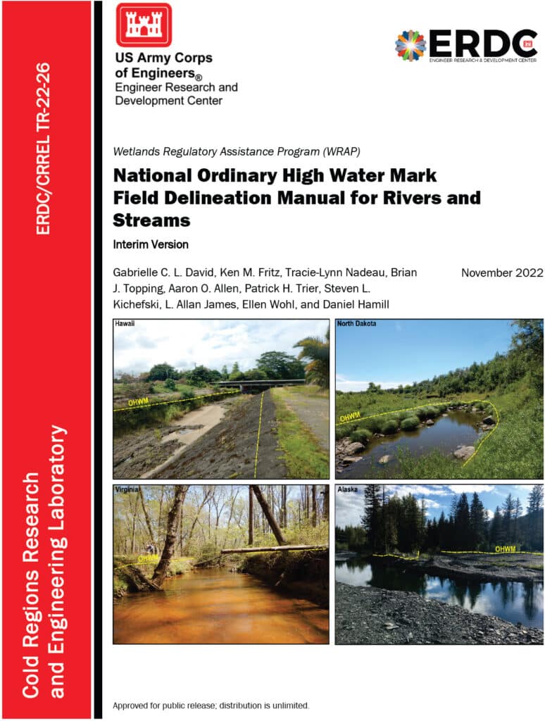
An image of the cover of the National Ordinary High Water Mark Field Delineation Manual for Rivers and Streams.

Diving into the National Ordinary High Water Mark (NOHWM) Manual

The National Ordinary High Water Mark (NOHWM) Manual serves as a detailed guide for environmental professionals to accurately identify the Ordinary High Water Mark (OHWM) in various landscapes. The OHWM represents the boundary between jurisdictional waters and upland areas, making it a crucial concept for environmental assessments.

Key Components of NOHWM:

  1. Physical Characteristics: The manual outlines physical indicators that signify the presence of an OHWM. These include:
  • Clear Natural Line: Look for a visible line on the bank formed by the regular presence of water.
  • Soil Changes: Notice differences in soil color, texture, or composition that indicate historical water presence.
  • Vegetation Patterns: Identify areas where terrestrial vegetation is absent or altered due to frequent inundation.
  • Litter and Debris: Examine the accumulation of organic and inorganic materials deposited by water flow.
  1. Regional Adaptations: The NOHWM Manual acknowledges the diversity of the US landscape, providing region-specific guidelines to account for varying hydrological and geomorphological conditions.
  2. Field Procedures: The manual details systematic field procedures, ensuring consistency and accuracy across assessments. This includes standardized data collection techniques, field forms, and documentation practices.

The Weight of Evidence Approach in NOHWM

A critical concept in the NOHWM approach is the “weight of evidence” (WOE) methodology. This approach ensures that multiple lines of evidence are considered when determining the OHWM, providing a more robust and defensible delineation.

Weight of Evidence Approach:

  1. Multiple Indicators: Instead of relying on a single indicator, the WOE approach integrates various physical, hydrological, and biological indicators. This multi-faceted analysis helps in cross-verifying the presence and extent of OHWM.
  2. Corroborative Evidence: Indicators such as changes in soil, vegetation patterns, and physical markings on the bank are examined together. Consistency among these indicators strengthens the determination of OHWM.
  3. Contextual Analysis: The WOE approach considers the broader landscape and hydrological context, including historical data and regional characteristics, ensuring that the delineation is not only accurate but also contextually relevant.
  4. Documentation and Transparency: Detailed documentation of all evidence and indicators used in the assessment is crucial. This transparency enhances the defensibility of the OHWM determination.
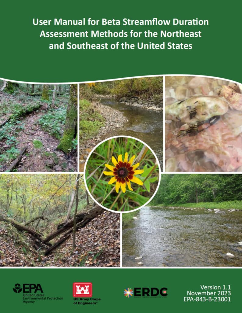
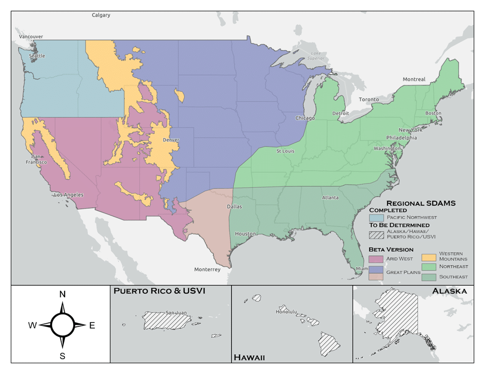
An image of the cover of the User Manual for Beta Streamflow Duration Assessment Methods for the Northeast and Southeast of the United States

Stream Duration Assessment Method (SDAM): A Closer Look

For scientists engaged in stream assessments, the Stream Duration Assessment Method (SDAM) is a game-changer. It allows for precise classification of streams based on their flow duration, which is essential for determining their jurisdictional status.

Stream Classifications:

  1. Ephemeral Streams: These streams flow only during and immediately after precipitation events. As a scientist, identifying ephemeral streams involves recognizing temporary water flow patterns and minimal biological activity.
  2. Intermittent Streams: These streams flow during certain times of the year, such as the wet season, but not continuously. Intermittent streams show clear signs of seasonal aquatic life and sediment patterns.
  3. Perennial Streams: Perennial streams flow year-round and are typically considered jurisdictional. These streams support continuous aquatic habitats and show persistent hydrological and biological indicators.

SDAM Assessment Process:

  1. Field Observations: Conduct site visits to observe physical characteristics like bed and bank features, sediment deposits, and biological indicators such as the presence of aquatic organisms and specific plant species.
  2. Hydrological Data Review: Examine historical flow records, precipitation data, and stream gauge information to understand the stream’s flow regime over time.
  3. Biological Indicators: Identify the presence of certain aquatic organisms and plant species that thrive in continuous or seasonal water flow, offering insights into the stream’s duration and consistency.

Integrating NOHWM and SDAM for WOTUS Determinations

The integration of the NOHWM and SDAM methodologies provides a robust framework for determining whether a water body qualifies as WOTUS. For environmental scientists, this integration involves a meticulous blend of physical, hydrological, and biological assessments.

Determination Process:

  1. Preliminary Assessment: Begin with a thorough desktop review, using maps, aerial photos, and existing hydrological data to identify potential jurisdictional waters.
  2. Field Verification: Conduct on-site inspections to validate preliminary findings. Observe physical indicators of OHWM and perform SDAM assessments to classify stream types accurately.
  3. Data Integration: Combine field observations with historical and current hydrological data. This comprehensive dataset aids in making well-informed determinations of a water body’s jurisdictional status.
  4. Documentation and Reporting: Prepare detailed reports that document findings, methodologies, and justifications for the jurisdictional status. These reports provide transparency and serve as a basis for regulatory decisions.

The Environmental Significance of NOHWM and SDAM

For environmental scientists, the accurate identification of jurisdictional waters is paramount. Here’s why:

  1. Protecting Ecosystems: Correctly delineating WOTUS ensures the preservation of vital aquatic ecosystems, protecting them from pollution and degradation.
  2. Ensuring Compliance: Clear identification helps landowners, developers, and other stakeholders understand their obligations under the Clean Water Act, preventing unauthorized activities that could harm protected waters.
  3. Resource Management: Informed decision-making for water resource management, conservation planning, and habitat restoration efforts becomes possible, benefiting both the environment and the communities that rely on these resources.

Conclusion

The National Ordinary High Water Mark Manual (NOHWM) and the Stream Duration Assessment Method (SDAM) are indispensable tools for environmental scientists working to delineate jurisdictional Waters of the United States (WOTUS). By applying these methodologies, the US Army Corps of Engineers ensures that water bodies deserving of protection under the Clean Water Act are accurately identified and managed. For environmental professionals, mastering these methods is not just about regulatory compliance—it’s about playing a critical role in safeguarding the health and integrity of our nation’s precious water resources. Through diligent application of NOHWM and SDAM, we can continue to protect and sustain our aquatic ecosystems for future generations.

Posted on — Leave a comment

Enhancing Nationwide Wetland Permitting: Integrating the Stream Duration Assessment Model (SDAM) with State-Specific Approaches Across the U.S

The U.S. Army Corps of Engineers (USACE) has developed the Stream Duration Assessment Model (SDAM), a groundbreaking tool that significantly enhances the regulatory oversight and protection of the nation’s water resources. This model plays a critical role in managing and safeguarding streams and wetlands, crucial for maintaining biodiversity, water quality, and flood mitigation. The SDAM is designed to classify streams based on their flow characteristics—perennial, intermittent, or ephemeral—crucial for determining the jurisdictional status of water bodies under the Clean Water Act (CWA). This article explores the integration of state-established models with the SDAM for regulatory purposes and highlights its nationwide applicability for wetland permits.

The SDAM employs a science-based approach, integrating hydrological data, GIS analyses, and field observations to assess stream flow characteristics accurately. This standardized method is vital for delineating the scope of regulatory oversight, ensuring environmental impacts are thoroughly evaluated and mitigated, particularly in the context of Section 404 of the CWA, which governs the discharge of dredged or fill material into waters of the United States.

State-established models of stream flow complement the SDAM by providing detailed insights into the flow regimes of streams within specific geographic areas. These models, developed based on localized data, enhance the precision of the SDAM by incorporating nuanced understandings of stream behavior, reflecting the unique ecological conditions of different regions. Integrating these models involves aligning methodological approaches, standardizing stream type definitions, and harmonizing data analysis techniques to ensure consistency across jurisdictions.

The combined use of the SDAM and state models offers a more nuanced assessment of streams for regulatory purposes. It facilitates more informed decisions regarding wetland permits by identifying streams with significant ecological functions or those critical to maintaining watershed health. This approach supports a more adaptive and responsive regulatory framework, allowing for updates with new data as environmental conditions change, ensuring the relevance and effectiveness of stream assessments.

Nationwide, the applicability of the SDAM, enhanced by state-specific models, encourages collaboration among federal, state, and local agencies. This collaborative approach improves the regulatory process’s efficiency and fosters a shared commitment to protecting water resources. It exemplifies the balance between economic development and environmental stewardship, promoting the sustainable management of aquatic ecosystems.

Furthermore, the integration of state models with the SDAM highlights the USACE’s commitment to using science and technology to improve environmental regulation. It reflects a shift towards data-driven decision-making, setting a precedent for future innovations in water resource management. As the model is refined and updated, its utility for regulatory purposes will continue to improve, ensuring that development and infrastructure projects proceed in an environmentally responsible manner.

The integration of the Stream Duration Assessment Model (SDAM) with state-specific methods, such as the North Carolina (NC) method for assessing stream flows, exemplifies a tailored approach to environmental regulation and water resource management. North Carolina has developed its own methodologies for classifying streams and assessing their ecological significance, which can complement the broader framework of the SDAM.

Example: North Carolina’s Stream Identification Method

North Carolina’s method for stream identification and classification is designed to meet the unique ecological and hydrological conditions of the state, which range from the Appalachian Mountains in the west to the coastal plains in the east. This method involves detailed field assessments, including the examination of physical, chemical, and biological indicators to determine stream types and their jurisdictional status under state and federal regulations.

Key aspects of the NC method include:

  1. Physical Indicators: These include the presence of a well-defined channel, bed and banks, and evidence of flow (e.g., water marks, sediment sorting) to distinguish between perennial, intermittent, and ephemeral streams.
  2. Biological Indicators: The presence of aquatic life, such as fish and macroinvertebrates, which are indicative of perennial or intermittent streams capable of supporting diverse biological communities.
  3. Hydrological Data: Use of historical precipitation, stream gauge data, and other hydrological models to predict flow durations and patterns throughout the state’s diverse landscapes.

Integrating the NC method with the SDAM allows for a comprehensive assessment that leverages local expertise and data while aligning with national standards for water resource management. This integration enhances the precision of stream classifications and the effectiveness of regulatory processes, including permitting for activities that impact water resources.

For example, when a developer proposes a project in North Carolina that may affect waterways, the combined use of the NC method and the SDAM ensures a thorough evaluation of potential impacts on stream flow and aquatic habitats. This dual approach facilitates informed decision-making regarding permit issuance, mitigation measures, and conservation efforts, balancing development needs with environmental protection.

Nationwide Implications

The example of North Carolina illustrates how state-specific methods can enhance the effectiveness of the SDAM in managing water resources across the U.S. By integrating localized approaches with the broader framework of the SDAM, states can ensure that regulatory processes are adapted to their unique environmental conditions, promoting sustainable water resource management and protection at both the state and national levels. This collaborative approach underscores the importance of tailored strategies in addressing the complex challenges of environmental stewardship and water resource regulation.

Posted on — Leave a comment

Wetlands at the Water’s Edge

Navigating the Confluence of WOTUS, SDAM, and OHWM in Ecosystem Assessment

The integration of the Waters of the United States (WOTUS), the Stream Duration Assessment Model (SDAM), and the Ordinary High Water Mark (OHWM) in wetland assessment provides a holistic approach to identifying and protecting these ecologically significant areas. However, this integration is not without its challenges, which stem from the complexity of wetland ecosystems, the nuances of environmental regulation, and the need for precise scientific data. Expanding on these challenges and opportunities reveals the intricacies involved in effective wetland management.

Data Precision and Availability

One of the foremost challenges in integrating WOTUS, SDAM, and OHWM is the need for high-quality, precise data. Wetland assessment requires detailed information on hydrology, soil types, vegetation, and other ecological indicators. The accuracy of this data directly impacts the determination of WOTUS boundaries, the application of SDAM, and the identification of the OHWM. However, obtaining such data can be resource-intensive, requiring extensive field surveys, remote sensing technology, and hydrological modeling. Moreover, the dynamic nature of wetlands, which may change seasonally or due to climate impacts, adds to the complexity of maintaining up-to-date and relevant data.

Interagency Coordination

Effective integration of these assessment tools also depends on robust interagency coordination. The regulatory landscape of wetland protection in the United States involves multiple federal agencies, including the Environmental Protection Agency (EPA), the U.S. Army Corps of Engineers, the U.S. Fish and Wildlife Service, and state and local entities. Each agency may have different mandates, priorities, and methodologies, which can lead to challenges in achieving a unified approach to wetland assessment and protection. Streamlining communication, data sharing, and regulatory processes among these entities is crucial for the effective implementation of WOTUS, SDAM, and OHWM standards.

Dynamic Nature of Wetland Ecosystems

Wetlands are dynamic systems that respond to a variety of environmental factors, including precipitation patterns, river flow regimes, and human activities. The transient nature of these ecosystems poses a significant challenge to the static frameworks used for their assessment and regulation. For instance, the OHWM might shift due to natural sedimentation processes or human-induced changes in water flow, requiring constant monitoring and adjustment of regulatory boundaries. Similarly, the flow characteristics used in SDAM assessments may vary, affecting the classification of water bodies connected to wetlands. Adapting regulatory approaches to account for these dynamic changes is essential for the long-term protection and management of wetland resources.

Legal and Policy Frameworks

The legal and policy frameworks governing wetland protection, particularly the definition and application of WOTUS, have been subject to significant legal challenges and policy shifts over the years. These changes can lead to uncertainty and inconsistency in wetland assessment and protection efforts. For practitioners and stakeholders, staying informed about current regulations and understanding how they apply to different wetland types and situations is a continual challenge. Ensuring that legal frameworks are both scientifically grounded and flexible enough to adapt to new environmental insights is crucial for effective wetland management.

Conclusion

Integrating WOTUS, SDAM, and OHWM in wetland assessment requires navigating complex environmental, regulatory, and technical landscapes. Addressing the challenges of data precision, interagency coordination, the dynamic nature of wetlands, and evolving legal frameworks is essential for creating a coherent and effective approach to wetland protection. Embracing adaptive management strategies, fostering collaboration among stakeholders, and investing in research and monitoring are key steps toward ensuring that wetlands continue to provide their invaluable ecological services for generations to come.

Posted on — 1 Comment

Scout Motors is Filling In a Lot of Wetlands

COLUMBIA, S.C. — Environmental advocates are closely monitoring the developments at the site of the massive electric vehicle plant slated for Blythewood in Richland County, with growing concerns about its impact on the delicate wetlands in the area.

Construction crews are back to work after receiving a permit from the U.S. Army Corps of Engineers, allowing them to resume work that had initially been halted due to worries about wetlands damage.

This project has garnered significant attention, particularly after a report by WIS 10 news suggested that the Scout site could potentially impact a staggering 70,000 acres of wetlands, nearly 40,000 acres of ponds, and approximately 35,000 linear feet of tributaries. However, it’s important to note that this report is highly inaccurate and continues to be the top result in Google news searches related to the project.

While the correct figures are somewhat lower, they are still concerning. The USACOE’s permit will authorize the filling or disturbance of 74 acres of wetlands, 38 acres of ponds, and 7 miles of creek.

The new Scout Plant is situated off Interstate 77 in the northern part of Richland County, but questions and apprehensions loom large regarding its potential environmental impact, and the community is eagerly awaiting answers.

Blythewood Mayor Sloan Griffin shared his thoughts, saying, “It’s scary. Change is always accompanied by uncertainty. There are two sides to every coin – heads and tails. Some are excited, looking forward to the promise of 4,000 jobs and increased business opportunities in Blythewood, thanks to Scout.”

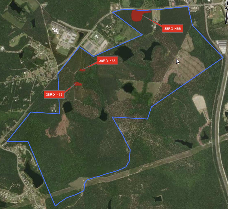
Construction will soon resume on the vast 1,600-acre site in Blythewood, where the Scout Motors manufacturing plant is set to be located.

Last September, Scout had to pause its work following concerns raised by the Environmental Protection Agency (EPA), which had identified evidence of wetlands damage even before the permit was issued.

Additionally, there’s a noteworthy finding indicating that one of the archeological sites, known as 38RD1468, is recommended for inclusion in the National Register of Historic Places (NRHP) under Criterion D. It holds potential for yielding significant insights into the area’s prehistory. However, it’s important to mention that there was not enough data collected during the Phase II investigations to determine its eligibility under other criteria (Criteria A, B, and C).

The Scout Motors project is undeniably intriguing. They are embarking on the production of electric trucks, a technology yet untested in the transportation of goods. This raises questions about the necessity of destroying 75 acres of wetlands for an unproven technology that may or may not compete effectively with traditional trucking methods. While the transition away from fossil fuels is commendable, it’s crucial to ponder whether it should come at the significant cost of our natural environment. Surely, alternative locations with less environmental impact could have been considered for this venture.

Posted on — Leave a comment

A day in the life of a wetland scientist

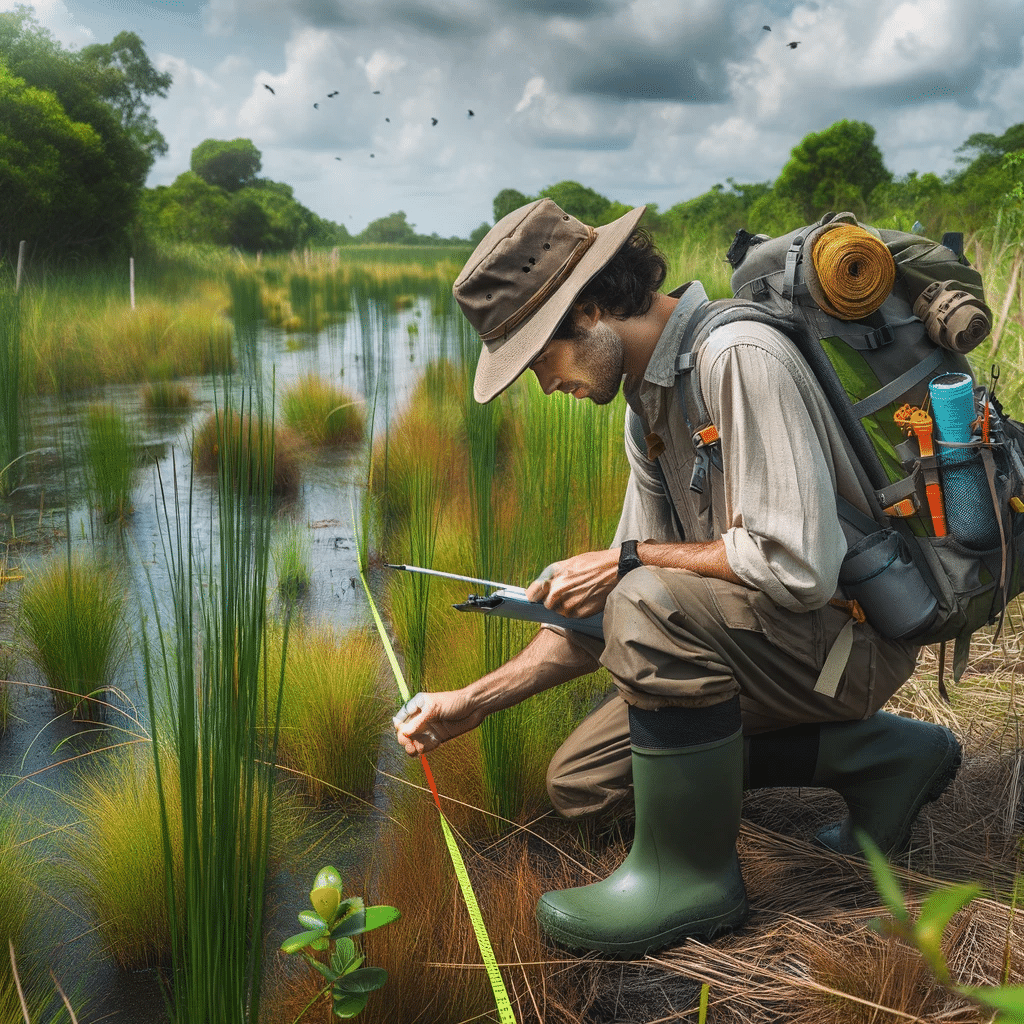
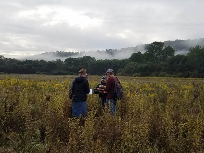
In the field, the wetland scientist engages in a variety of specialized tasks, including soil sampling to identify hydric soils, conducting thorough vegetation surveys, and assessing wetland hydrology through both direct and indirect means. These activities require a keen eye for detail, extensive knowledge of wetland ecosystems, and the ability to work effectively in challenging outdoor conditions. Additionally, the role involves meaningful interactions with local communities, landowners, and regulatory bodies, emphasizing the importance of wetlands in ecological balance and sustainable land use.

The day of a wetland scientist is not just about fieldwork; it also involves critical analysis and documentation back at the office or lab. Here, the scientist delves into data interpretation, report writing, and consultation with environmental experts, ensuring that their findings contribute to broader conservation efforts and comply with environmental regulations. The narrative also emphasizes the importance of continuous learning and professional development in the field of wetland science. This commitment to staying abreast of the latest research, technological advancements, and regulatory changes is vital for effective wetland management and protection.

  • Early Morning Research and Preparation: The scientist’s day begins with reviewing satellite images, wetland delineation protocols, and local environmental regulations. They ensure that all their equipment, including soil coring tools and water quality kits, is ready for the day.
  • Travel to the Wetland Site: The journey to the wetland site might be an adventure, often traversing through less-traveled paths. The scientist plans their route, considering the day’s objectives and the logistics of reaching the site.
  • Initial Site Assessment: Upon arrival at the wetland, the scientist conducts an initial survey, looking for visible indicators of wetland boundaries and making preliminary notes.
  • Detailed Wetland Delineation Work: The morning is spent in intense fieldwork, including soil sampling, vegetation identification, and hydrology assessment, to accurately delineate the wetland boundaries.
  • Fun and Exploratory Lunch Break: By midday, it’s time for a well-deserved break. The scientist often takes this opportunity to explore local eateries, enjoying the chance to discover unique and interesting restaurants in the area. This lunch break becomes a mini-adventure, offering a delightful pause from the fieldwork and a chance to savor the local cuisine.
  • Post-Lunch Delineation and Data Collection: After lunch, the scientist returns to the field, possibly revisiting certain areas for additional verification or moving to new sections for further delineation.
  • Community Interaction and Educational Outreach: The afternoon may also include interactions with local communities, landowners, or educational groups, discussing the day’s findings and the importance of wetland conservation.
  • Return to Base for Analysis and Reporting: Back at their office or lab, the scientist analyzes the collected data, begins processing samples, and starts drafting reports based on the day’s delineation work.
  • Consultations and Collaborations: The scientist might consult with environmental agencies or collaborate with colleagues, ensuring that the delineation aligns with regulatory standards and contributes to broader environmental research.
  • Evening Review, Planning, and Networking: The day concludes with a review of the work done, updating project files, and perhaps participating in professional networking activities, staying connected with the wider scientific community.
  • Continued Learning and Research: The scientist spends time in the evening catching up on the latest research in wetland ecology and planning for future professional development opportunities.
  • Relaxation and Personal Time: Finally, the scientist unwinds, reflecting on the day’s work and the culinary adventure they enjoyed at lunch, recharging for the next day’s challenges.

Posted on — Leave a comment

The 2024 Wetland Scientist Jobs Outlook: Navigating a Critical Ecosystem’s Future

The Rise of Wetland Science as a Career

As global environmental concerns continue to escalate, the field of wetland science has become increasingly significant. The year 2024 projects a fascinating era for wetland scientists, where their expertise is not only sought after but also crucial for the health of our planet. These scientists are on the front lines of conservation, research, and policy-making, dealing with issues from climate change mitigation to habitat protection and biodiversity conservation.

The Demand for Wetland Scientists in 2024

The job outlook for wetland scientists in 2024 remains robust and growing. With a heightened global focus on environmental sustainability and wetland conservation, wetland scientists are in high demand. Their skills are crucial for:

  1. Assessing Wetland Health: Evaluating the conditions of wetlands, identifying stress factors, and implementing conservation strategies.
  2. Regulatory Compliance: Ensuring that construction, development, and land use comply with environmental laws and regulations, particularly those that protect wetland areas.
  3. Climate Change Mitigation: Understanding the role of wetlands in carbon sequestration and their impact on global climate patterns.
  4. Restoration Projects: Working on the restoration of degraded wetland areas to their natural state, a vital component in preserving biodiversity and maintaining ecosystem services.
  5. Research and Education: Conducting research on wetland ecosystems and disseminating knowledge to stakeholders, policymakers, and the public.

Education and Skill Development

The path to becoming a wetland scientist often begins with a degree in environmental science, ecology, biology, or a related field. As the discipline grows, so does the complexity of the skill set required. In 2024, successful wetland scientists will likely need:

  • Advanced degrees for higher-level positions.
  • Strong background in GIS (Geographic Information Systems) and remote sensing technology.
  • Proficiency in data analysis and modeling software.
  • In-depth understanding of local, national, and international environmental laws.
  • Soft skills such as project management, communication, and stakeholder engagement.

Specialization in wetland science through certifications like the Professional Wetland Scientist (PWS) certification by the Society of Wetland Scientists can also enhance job prospects.

Industry Trends Influencing Job Prospects

Several trends are shaping the job market for wetland scientists in 2024:

  1. Green Infrastructure Projects: The push for sustainable development includes the creation of urban wetlands for stormwater management, requiring wetland scientists for design and monitoring.
  2. Policy and Advocacy: International treaties and national policies focusing on wetland preservation are expanding the role of wetland scientists in policy advisement and implementation.
  3. Private Sector Engagement: Increased corporate responsibility and sustainability goals mean more private companies are hiring wetland scientists for environmental impact assessments and sustainability planning.

Geographical Hotspots for Wetland Science Jobs

Certain regions will likely emerge as hotspots for wetland science careers:

  • Coastal areas affected by sea-level rise and increased storm activity.
  • Urban centers implementing green infrastructure initiatives.
  • Countries with significant wetland biodiversity, such as Brazil, Indonesia, and the Congo Basin, where conservation efforts are critical.

Challenges and Opportunities

The road ahead for wetland scientists is not without its challenges:

  • Funding Constraints: Economic downturns and shifting political landscapes can impact funding for environmental initiatives and research.
  • Technological Advancements: Keeping up with rapid technological changes in data collection and analysis is necessary.
  • Interdisciplinary Collaboration: Working with professionals from other fields, such as urban planners and engineers, is essential for comprehensive wetland management.

Conversely, these challenges bring opportunities:

  • Innovative Solutions: There’s a growing need for innovative approaches to wetland conservation and restoration, which can lead to new job roles and specializations.
  • Public Engagement: Increasing public awareness of wetland benefits can lead to more community-based wetland projects, expanding the roles of educators and citizen science coordinators.
  • International Cooperation: As wetlands are a global concern, there are opportunities for work in international conservation and policy.

Conclusion: A Positive Outlook with a Note of Urgency

The job outlook for wetland scientists in 2024 is generally positive. The urgency to address environmental challenges ensures that wetland scientists will remain in demand. However, it’s a field that requires constant learning and adaptability to new research, technologies, and evolving environmental policies.

For those aspiring to enter the field or continue their wetland science careers, the time is ripe for action. As guardians of one of the world’s most precious resources, wetland scientists not only have the opportunity to pursue a career with significant growth prospects but also to make a tangible difference in the health of our planet.

Posted on — Leave a comment

EPA and the Department of the Army issue Amended Final Rule Defining WOTUS

By Rick Savage – Carolina Wetlands Association

On August 29, 2023, the U.S. Environmental Protection Agency (EPA) and the Department of the Army announced a final rule that amends the January 2023 definition of “waters of the United States” (WOTUS). The amendments conform the January 2023 definition to the U.S. Supreme Court’s decision in Sackett and will take effect immediately upon publishing in the Federal Register (likely to happen within two weeks). To read the pre-publication version of the revised final rule, go to Pre-publication Version of the Final Rule – Amendments to the Revised Definition of Waters of the United States (epa.gov). 

While exact details are yet to be digested, the gist of the ruling is becoming clear.  First, the significant nexus rule has been eliminated; so isolated wetlands are not jurisdictional wetlands, meaning they are not protected under the Clean Water Act.  Second, the new rule requires visual evidence of a continuous surface flow between a wetland and navigable water.  This part of the rule can get complicated as to what constitutes visual evidence of continuous surface flow.  I am sure that this will cause a lot of confusion and some developers will say there is no continuous surface flow and impact the wetland with a permit. 

Suffice it to say, this puts wetlands in North and South Carolina in jeopardy. The NC Department of Environmental Quality has estimated about 2.5 million acres of wetland have lost protection in North Carolina and I am sure a similar number in South Carolina.  The NC legislature could have continued to protect these wetlands; however, the recently passed Farm Bill eliminated state protection of isolated wetlands.   

We all need to brace ourselves for a lot of wetland loss and they are the very resource we need to protect our communities from flooding.  I think it is reasonable to expect more communities to get flooded, to have less clean water, and to have reduced climate resilience as well as miss the many other benefits that our wetlands provide. 

So go out an explore a wetland (before it gets developed?).

Posted on — Leave a comment

EPA Admit “Waters of the U.S.” Could Have Been Handled Better

Swamp Stomp

Volume 15, Issue 15

During the National Farmers Union convention in Wichita on March 16, 2015, U.S. Environmental Protection Agency Administrator Gina McCarthy expressed regret about how the EPA handled the controversial “Waters of the U.S.” rules.

Following U.S. Department of Agriculture Secretary Tom Vilsack, McCarthy spent the majority of her 30-minute speech claiming that she wished her agency had done a better job of explaining how EPA defined which bodies of water were regulated under the Clean Water Act.

McCarthy asserted, “I’m really concerned that we weren’t crystal clear out of the gate, not just about what we intended to do but about what we intended not to do, because it left all kinds of room for people to wonder not just what the words said but what we are trying to accomplish.”

Despite her regret over how the effects of rule were communicated, however, McCarthy is adamant that the EPA’s end goal will be met and the final rule be issued.  She said that the rule is currently on its way to the Office of Management and Budget and is expected to be issued this spring.

2105regs

After recent U.S. Supreme Court rulings, EPA is currently rewriting the rule, but McCarthy remains adamant that the need for the rule is clear. However, she did attempt to clarify what the rule would and would not intend to do. She provided the following assurances:

  • In response to numerous criticisms, McCarthy assured the public that EPA would not regulate puddles, land, or Fourth of July fireworks.
  • Addressing the worry that regulating “tributaries” could mean just about anything, McCarthy stated that EPA has established clearer definitions.
  • The rule does not include erosional features.
  • McCarthy claimed that roadside and irrigational ditches are not included, but ditches that are natural and constructed streams that can carry pollution downstream and act like tributaries are included.
  • Waters initially labeled as “other waters”—a term McCarthy conceded was too ill-defined—are in the process of being more narrowly stated by officials using their “best judgment.” However, the results of clarifying vague terms with even vaguer qualifications will most likely do little to quell concerns.

The main message of McCarthy’s speech was that farming and ranching should remain unaffected by the rule. “The exclusions and exemptions for agriculture . . . this rule we will not touch,” she said.

During Vilsack’s address, farm productivity was a major talking point. Farmers today are 12 times more productive then they were in 1950. Subsequently, Americans only spend 10 percent of their income on food, 15 to 20 percent less than many of the other countries in the world.

Vilsack also raised many concerns, including how to best introduce the next generation of farmer to the profession, labeling country origin of beef and pork in supermarkets, and how to best develop tools and support conservation and local agriculture, such as farmers markets.

“This isn’t just about farming. This isn’t just about agriculture. This is about rural life and maintaining the value system alive and well in the rural communities.”

While Vilsack is not forwardly addressing the “Waters of the U.S.” rule, he is assisting McCarthy paint an image of what the rule intends to do. The ambiguity of McCarthy’s speech did little to rid farmers and ranchers of their concerns, and her acknowledgment that the rule was not communicated as well as it could have been is somewhat diminished by “clarifying” points with terms that themselves are ambiguous.