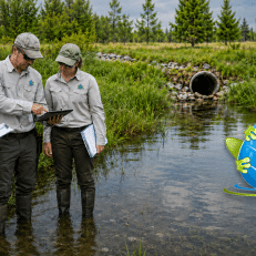
WOTUS Field Decisions: Documenting Continuous Surface Connections and Jurisdictional Risk
A practical 90-minute paid webinar for wetland, stream, permitting, and environmental professionals who need to make better field decisions and support defensible Clean Water Act documentation.
Wetland jurisdiction decisions are becoming more dependent on clear field observations, strong documentation, and a practical understanding of how surface water connections are evaluated. This webinar will include discussion of the 2025 EPA/Army guidance on implementing the continuous surface connection requirement for adjacent wetlands following Sackett v. EPA.
Participants will learn how to evaluate continuous surface connections, wetland boundaries, hydrologic breaks, ditches, swales, culverts, berms, uplands, and other common field conditions that can influence jurisdictional risk.
This session is ideal for consultants, project managers, field scientists, permitting specialists, agency staff, and environmental professionals who need practical guidance for documenting wetland and waters decisions in the field under the current Clean Water Act jurisdictional framework.
Webinar Details
Date
Wednesday, July 8, 2026
Time
1:00 PM Eastern
Length
90 Minutes
Format
Live Online Webinar
Rebroadcast Access
Audience
Environmental Professionals
Bonus Materials Included
Practical field tools you can use after the webinar
This webinar includes a downloadable Continuous Surface Connection Field Data Form designed to help organize field observations, document direct abutment, identify separation features, and support a recommended CSC finding.
Also included: a special CSC Data Collection Presentation that walks through each section of the field form and explains how to complete it in the field.
These materials are built for wetland scientists, consultants, project managers, and staff preparing documentation for project records or ARDR packages.
Bonus materials include: the CSC field form, a section-by-section form overview, and practical guidance for documenting the field basis for continuous surface connection.
Why This Webinar Matters
Field staff and project managers are often asked to make fast decisions about wetland boundaries, surface water connections, and potential jurisdictional risk. With the 2025 EPA/Army guidance placing renewed attention on how continuous surface connections are identified and documented, clear field notes, photographs, maps, and observations are more important than ever.
This webinar focuses on practical field documentation strategies that help professionals better explain what they saw, why it matters, and how those observations may affect Clean Water Act jurisdiction, permitting decisions, project schedules, and client risk.
What You Will Learn
- 2025 EPA/Army Guidance
Understand how the latest guidance addresses continuous surface connections for adjacent wetlands and why documentation matters.
- Surface Connection Clues
Recognize field evidence that may support or weaken a continuous surface connection.
- Hydrologic Breaks
Evaluate uplands, berms, roads, culverts, ditches, pipes, and other breaks in surface flow.
- Wetland Boundary Support
Use vegetation, soils, hydrology, photos, maps, and field notes to support delineation decisions.
- Jurisdictional Risk Notes
Learn how to describe uncertainty and communicate project risk more clearly.
- Defensible Field Documentation
Improve notes, photographs, maps, and field records before regulatory or client questions arise.
Who Should Attend
This webinar is designed for professionals who work with wetland delineation, waters evaluations, permitting, environmental planning, due diligence, compliance, or project risk.
Wetland Scientists
Environmental Consultants
Project Managers
Permitting Specialists
Field Staff
Agency Staff
Engineers and Planners
Group Enrollment Available
Training a team? Group enrollment options are available for firms, agencies, utilities, and project teams that want multiple staff members to attend the webinar together.
Group registration is a good option for companies that want project managers, field staff, permitting specialists, and environmental team members to hear the same guidance and apply it consistently across active projects.
Team Access
Enroll multiple staff members
Shared Guidance
Build consistent project practices
Easy Setup
We will collect your roster
After purchase, Swamp School will contact you to collect participant names and email addresses so your team can be registered for the webinar.
Need to Register More Than 10 People?
Custom group rates are available for larger teams, agencies, firms, and organizations that need to enroll more than 10 participants.
Contact Swamp School for a custom group registration option, and we will help coordinate enrollment for your full team.
Improve Your Field Documentation Before Questions Arise
Register now and learn how to better document surface connections, wetland boundaries, and jurisdictional risk during active field season.