Product Description
Step into the realm of proficient wetland assessment with our all-encompassing “USACE Wetland Delineation with Regional Supplements” certification course. Tailored to accommodate professionals from varied environmental fields, this course presents the flexibility to choose from online, in-person, or a blended learning format, catering to different learning preferences and schedules. Designed for environmental consultants, regulatory personnel, land developers, and scientists, this certification offers rigorous training in accordance with the standards set by the U.S. Army Corps of Engineers (USACE).
Key Features:
- Multi-Format Learning: Opt for the fully online version for convenience, attend in-person sessions for hands-on experience, or combine both approaches with our blended learning option.
- Curriculum Excellence: Engage with modules that meticulously cover the 1987 USACE Wetlands Delineation Manual alongside the crucial insights provided by regional supplements for a comprehensive understanding.
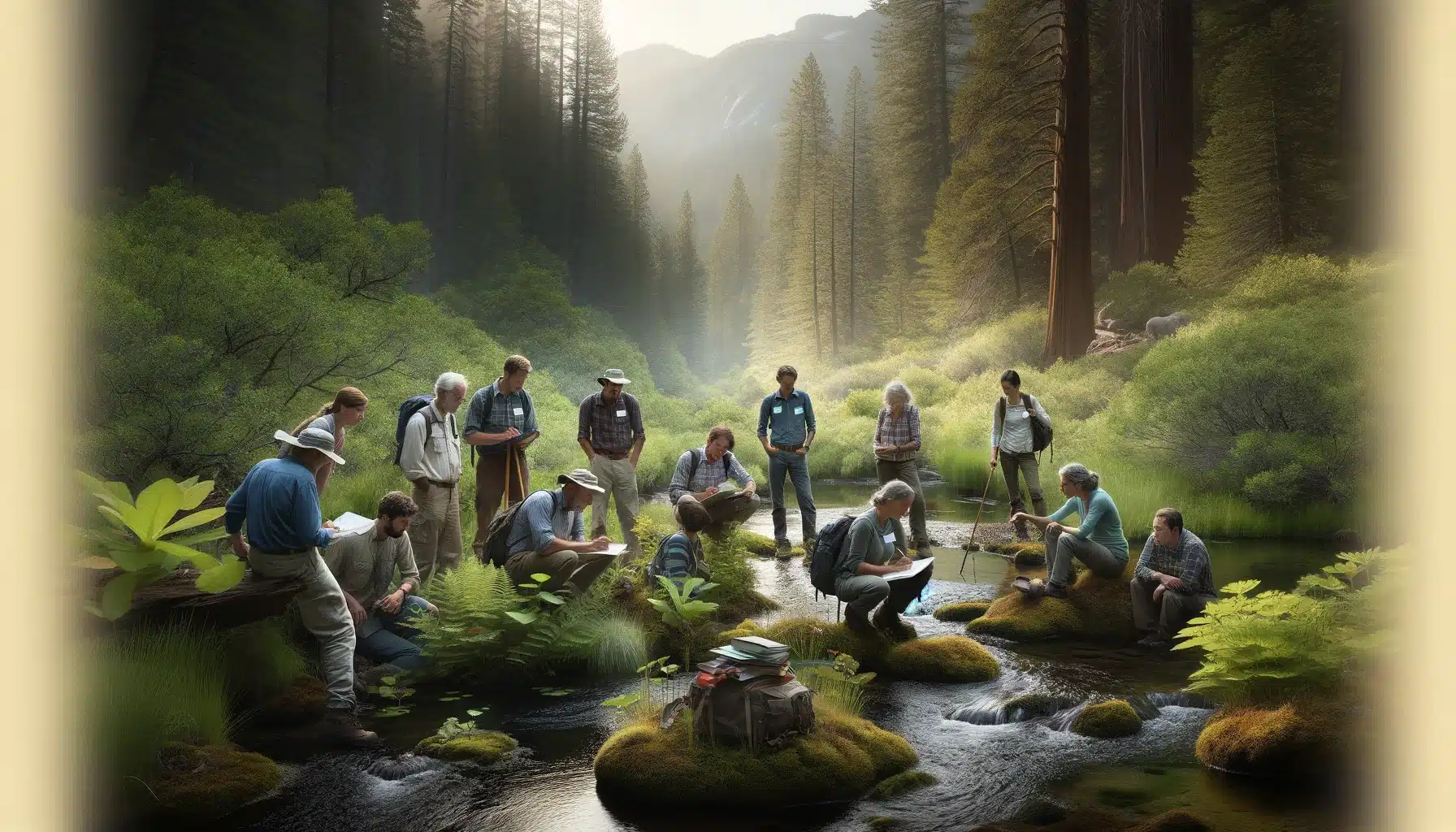
- Practical Field Techniques: Apply your knowledge in the field with in-person training sessions (available in the blended and in-person formats) led by experienced wetland professionals.
- Dynamic Online Resources: Access a wealth of digital resources, including video tutorials, virtual field trips, interactive case studies, and real-time webinars.
- Expert Instruction: Benefit from the wisdom of seasoned wetland delineators and environmental scientists who bring their real-world expertise to the classroom and the field.
- Professional Network Building: Join a community of like-minded professionals and foster connections that go beyond the course.
- Accredited Certification: Achieve a recognized certification that verifies your expertise in USACE wetland delineation, complete with the knowledge of how to effectively apply regional supplements.
- Continuing Education Recognition: Earn CEUs or PDHs that contribute to your professional development and credentials in environmental science and policy.
Learning Outcomes:
Course graduates will be equipped to:
- Conduct wetland delineations with precision using the USACE manual and understand the specific considerations required by regional supplements.
- Recognize and document critical wetland indicators, adapting to different regional ecosystems as guided by the supplements.
- Navigate the legal and practical elements of wetland regulation for project planning and compliance.
- Create detailed reports and documentation suitable for submission to regulatory agencies.
Who This Course Is For:
This comprehensive certification is ideal for professionals seeking to either gain new skills or update existing expertise in wetland delineation. It serves environmental consultants, government regulators, land-use planners, and ecological researchers who must ensure that their work aligns with current environmental regulations and best practices.
Choose your preferred course format and join our “USACE Wetland Delineation with Regional Supplements” certification to secure your status as a proficient and knowledgeable wetland professional. Whether through the convenience of online learning, the tangible experience of in-person classes, or the integrated approach of a blended format, you will emerge as a trusted expert in wetland delineation.
Online:
-
With the Swamp School Wetland Delineation training online, you can earn your certification in 16 weeks or less. The course includes foundational knowledge in wetland identification, which is crucial for further wetland delineation training. The workshop covers standard wetland training and includes the 1987 US Army Corps of Engineers (USACE) Wetlands Manual, and you can choose any or all of the 10 Regional Supplements to get trained on. We cover the conceptual framework of the wetland indicators as well as the regulatory context, court decisions, and related laws. Students can complete the 12 modules at their own pace and can coordinate the fieldwork with their instructor. The class concludes with a review of your fieldwork and a final exam. The online class includes an additional section on winter wetland delineation tips and tricks.
Hybrid:
- This course provides the convenience of taking the class online while providing in-person field training with our instructors. Students will complete the video lectures online and then join us for a 2-day hands-on training workshop at our field office in North Carolina.
In-Person:
-
This training includes a 4-day field and classroom workshop. The course covers various aspects of wetland science, including wetland identification, delineation, and ecology, underscoring its practical and academic importance. In the classroom, we will present the specific refinements to the 1987 Wetland Delineation Manual. The first two days in the classroom will consist of lectures discussing the wetland delineation methodology. During the field portion of the class, we will complete several data points using the new Regional Supplement data forms. Sites have been selected to focus on the appropriate Regional Supplements and the local environmental conditions.
Swamp Field Kit Included!
Locations:
North Carolina Location: Swamp School Wetland Training Center, 315 S Salem St., Suite 310, Apex, NC 27502
Pennsylvania Location: Beaver County Conservation District, 156 Cowpath Rd, Aliquippa, PA 15001
Georgia Location: Newman Wetland Center, 2755 Freeman Rd, Hampton, GA 30228
Texas Location: Brazos Bend State Park, 21901 FM 762, Needville, TX 77461
Overview of Wetland Delineation
Wetland delineation is the meticulous process of identifying and mapping the boundaries of wetlands, which are areas where water saturation is the primary factor influencing the soil and plant life. This process is crucial for environmental conservation and management, as it helps protect these sensitive ecosystems and the diverse species that depend on them. Professional wetland scientists typically perform wetland delineation using a combination of field observations, laboratory analysis, and remote sensing techniques. By accurately delineating wetlands, these experts ensure that these vital areas are preserved and managed sustainably.
Benefits of Wetland Delineation Training
Wetland delineation training equips individuals with the essential knowledge and skills to accurately identify and map wetland boundaries. This training is invaluable for a range of professionals, including environmental consultants, government agency personnel, and wetland scientists. By completing this training, participants gain a deeper understanding of wetland ecology and the critical role wetlands play in environmental health. Additionally, the training enhances one’s ability to conduct thorough wetland assessments and provide expert consultations in both public and private sectors. This expertise is crucial for ensuring compliance with environmental regulations and promoting sustainable wetland management.
What is Wetland Delineation?
Wetland delineation is the meticulous process of identifying and mapping the boundaries of wetlands, which are areas where water saturation is the primary factor influencing the soil and plant life. This process is crucial for environmental conservation and management, as it helps protect these sensitive ecosystems and the diverse species that depend on them. Professional wetland scientists typically perform wetland delineation using a combination of field observations, laboratory analysis, and remote sensing techniques. By accurately delineating wetlands, these experts ensure that these vital areas are preserved and managed sustainably.
Army Corps of Engineers Wetland Delineation Guidelines
The Army Corps of Engineers (USACE) plays a pivotal role in regulating wetlands under the Clean Water Act and the Rivers and Harbors Act. The USACE has established comprehensive guidelines for wetland delineation, providing a structured approach to identifying and mapping wetland boundaries. These guidelines incorporate the use of regional supplements, which offer tailored guidance for different regions across the United States. The USACE guidelines emphasize the importance of using a combination of field indicators, such as vegetation, soils, and hydrology, to accurately determine the presence and boundaries of wetlands. Adhering to these guidelines ensures that wetland delineation is conducted consistently and in accordance with federal regulations.
Wetland Delineation Methods
Several methods are employed in wetland delineation to ensure accuracy and comprehensiveness:
- Field Observations: Wetland scientists conduct thorough field observations to identify key wetland indicators, such as hydric soil indicators, wetland plants, and wetland hydrology. These indicators provide essential clues about the presence and extent of wetlands.
- Laboratory Analysis: Soil and plant samples collected from the field are analyzed in laboratories to confirm the presence of wetland indicators. This step is crucial for verifying field observations and ensuring the accuracy of the delineation.
- Remote Sensing: Technologies like aerial photography and satellite imagery are utilized to identify wetland boundaries and monitor changes in wetland conditions over time. This method allows for large-scale analysis and helps in tracking environmental changes.
- GIS Mapping: Geographic Information Systems (GIS) are used to create detailed maps of wetland boundaries and analyze spatial data. GIS mapping provides a visual representation of wetlands, aiding in better understanding and management.
Plant Identification and Soil Science
Plant identification and soil science are fundamental to wetland delineation. Wetland plants, or hydrophytes, are specially adapted to thrive in saturated conditions and serve as reliable indicators of wetland presence. Hydric soil indicators, such as the presence of iron oxide and manganese, are also critical in identifying wetland soils. Professional soil scientists and botanists bring their expertise to the table, meticulously identifying the plants and soils in a given area to determine whether they signify a wetland. Their knowledge is indispensable in ensuring accurate and reliable wetland delineation.
Data Analysis and Reporting
Data analysis and reporting are pivotal components of the wetland delineation process. Wetland scientists analyze data gathered from field observations, laboratory analysis, and remote sensing to delineate wetland boundaries accurately. This data is then compiled into detailed reports and maps that document the location and extent of wetlands. These reports and maps are essential tools for environmental consultants, regulatory agencies, and other stakeholders, enabling them to make informed decisions about wetland management and conservation. Accurate reporting ensures that wetlands are protected and managed in accordance with environmental regulations and best practices.
Regional Supplements and Variations
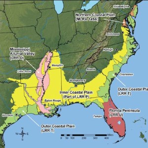
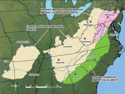
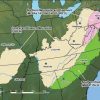
Regional supplements and variations play a significant role in wetland delineation. The Army Corps of Engineers has developed regional supplements to the 1987 Wetland Delineation Manual, providing tailored guidance for different regions across the country. These supplements consider regional variations in wetland types, plant communities, and soil characteristics, ensuring that delineation methods are adapted to local conditions. Wetland scientists must be well-versed in the regional supplements relevant to their area of work to accurately identify and map wetland boundaries. Understanding these regional nuances is crucial for precise and effective wetland delineation, ensuring that all unique regional characteristics are accounted for in the delineation process.
Who Should Attend Wetland Delineation Training?
Wetland delineation training is designed for a diverse audience of professionals who work with wetlands, including environmental consultants, government agency personnel, and wetland scientists. This training is also highly beneficial for individuals aspiring to pursue careers in wetland science or conservation. Additionally, professionals such as land developers, landscape architects, and others who need to navigate the regulations and guidelines surrounding wetland conservation will find this training invaluable. By attending wetland delineation training, participants can enhance their understanding of wetland ecosystems and improve their ability to contribute to wetland preservation and management efforts.
Materials Needed for Class:
You will need to provide the following items for this class:
- Munsell Soil Color Chart
- Soil auger or spade
- Local plant field guides
- Digital camera
Instructor:
These classes are taught by different instructors.
- Online:
- Walt Milowic & Lori Reese
- In-Person:
- Marc Seelinger
- Greg Price
- Blended:
- Lori Reese, Reina Kornmayer, & Marc Seelinger
Professional Wetland Scientist (PWS) Pre-Approval:
This course has been pre-approved by the Society of Wetland Scientists Professional Certification Program (SWSPCP) as meeting standards for content and instruction and, upon successful completion, has been judged to be immediately eligible to receive credits and/or points toward SWSPCP Professional Certification or SWSPCP Professional.
Basic Wetland Delineation Training
The Basic Wetland Delineation Training is designed to provide students with a comprehensive understanding of the fundamental principles and techniques of wetland delineation. This training program is ideal for environmental consultants, government agency personnel, and individuals seeking to develop their skills in wetland identification and delineation.
The training covers the technical guidelines for wetland delineations, field indicators of hydrophytic vegetation, hydric soils, and wetland hydrology. Students will learn how to apply the 1987 Wetland Delineation Manual and Regional Supplements to identify and map wetland boundaries. The training also includes methods for making jurisdictional determinations and methods to apply in difficult situations.
Upon successful completion of the training, students will receive a certificate of completion and will be eligible to apply for continuing education hours. The training is offered as a hybrid course with online lectures followed by a 2-day field practicum.


