Webinar Description
💻 A Practical Two-Hour Overview of the New WOTUS Rule, 2025 USACE Technical Reports & Wetland Workforce Trends
Wetland science and regulatory practice continue to evolve at a rapid pace. In 2024–2025, the U.S. Army Corps of Engineers (USACE) released a wide range of influential scientific and technical reports, while simultaneously expanding and modernizing the tools and methodologies used in jurisdictional determinations.
This two-hour webinar provides a practical overview of the most important changes affecting wetland delineation, aquatic resource assessments, flow determination, and federal permitting in 2026.
Designed for: Wetland delineators • Environmental consultants • Planners • Engineers • Attorneys • Surveyors • Regulators and all professionals who must stay current with USACE expectations.
1. 🏛️ Proposed 2025 WOTUS Rule: Field-Focused Overview
This segment provides a clear and applicable understanding of the proposed rule, including:
- Continuous surface connection
- Relatively permanent flow
- Wet-season hydrology
- Treatment of ephemeral drainages, ditches, and PCC
- Post–Sackett v. EPA limitations and documentation expectations
The focus is on how these criteria affect fieldwork, data collection, and jurisdictional documentation.
2. 🛠️ Core Technical Framework Used in 2026: How Old & New Tools Work Together
USACE determinations continue to rely on the established 1987 Corps of Engineers Wetlands Delineation Manual and the Regional Supplements, which remain the controlling methodology for identifying hydrophytic vegetation, hydric soils, and wetland hydrology.
This webinar explains how those foundational documents now operate in an integrated framework with the major new tools and manuals:
1987 Wetlands Delineation Manual (Y-87-1)
Still required for all federal wetland delineations, providing the backbone for vegetation, soil, and hydrology evaluation.
Regional Supplements (All Regions)
Used for indicator selection, hydrology interpretation, problematic situations, and vegetation/hydric soil determinations.
Antecedent Precipitation Tool (APT v3.0)
Antecedent Precipitation Tool Version 3.0: Technical & User Guide
-
-
- Determines precipitation normalcy
- Evaluates streamflow normalcy for flow classification
- Required for climatic-context interpretation in wetland hydrology
-
Streamflow Duration Assessment Method (SDAM)
-
- Uses geomorphic, hydrologic, and biological indicators
- Supports classification of ephemeral, intermittent, and perennial flow
- Integrated with APT output and OHWM analysis
National OHWM Manual (ERDC/CRREL TR-25-1)
National Ordinary High Water Mark Field Delineation Manual for Rivers and Streams
-
-
-
- National weight-of-evidence approach
- Lidar, DEM, StreamStats, and USGS gage integration
-
-
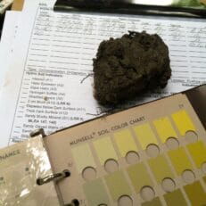
Hydric Soil Indicators (Version 9.2)
Field Indicators of Hydric Soils in the United States
-
-
- Updated A-, S-, and F-series
- Expanded FeS and reduced-matrix indicators
-
ARDR Minimum Standards & RSS Submittal Requirements
-
-
- GNSS accuracy specifications
- GIS layer requirements and metadata formatting
- Electronic submission standards
- Requires multidisciplinary expertise
-
This segment demonstrates how legacy manuals + modern tools form the complete 2026 JD workflow.
3. 📚 2026 Status & Trends Spotlight: Key USACE Reports
USACE produced over 500 environmental and water-resources technical reports during 2024–2025. This webinar highlights the most impactful titles for wetland science, aquatic resource assessment, restoration planning, regulatory science, and climate resilience.
Engineering With Nature® (EWN) & Nature-Based Solutions
-
- ERDC/EL MP-25-11 — Applying the Working with Nature Philosophy to Navigation Infrastructure Projects
- ERDC/TN EWN-25-6 — EWN Compass: Implementation Toolbox for Natural and Nature-Based Features
- ERDC/EL SR-25-4 — Developing an Inventory of USACE Nature-Based Infrastructure Projects
- ERDC TR-25-15 — Engineering Practice Guide for Floodplain Benching: A Natural Infrastructure Approach for Riverine Systems
- ERDC/EL SR-25-2 — Engineering With Nature: Integrating Plant Communities into Engineering Practices (Book 2)
- ERDC/EL TR-25-6 — Living Shoreline in USACE Projects: A Review
Wetland Monitoring, Mapping & Remote Sensing
-
- ERDC/EL SR-25-5 — Monitoring of Understudied Wetlands: State of Knowledge
- ERDC/TN EMRRP-RQ-5 — Remote Sensing Data Acquisition for Understudied Wetland Vegetation Metrics
- ERDC/EL SR-25-3 — Review of Remote-Sensing Methods for Mapping Riparian and Submerged Aquatic Vegetation
- ERDC TR-25-19 — Trade-offs Between Field and Remote Geomorphic Monitoring of Coastal Marsh Restoration Sites
Restoration Science, Ecosystem Recovery & Soil Carbon
-
- ERDC/EL TR-25-14 — USACE Aquatic Restoration Monitoring for Ecosystem Recovery (ARMER) Network
- ERDC/EL MP-25-8 — Evaluating Permanganate Oxidizable Carbon (POXC) in Wetland Soils
Threatened, Endangered & Sensitive Species
-
- ERDC/EL SR-25-6 — Review of Threatened and Endangered Plant Species Potentially Impacting USACE Mission Areas
Dredging, Water Quality & Aquatic Health
-
- ERDC/EL TR-25-17 — Effects of Suspended Sediment on Aquatic Organisms: Literature Review & Database
Modeling, Data Analysis & Decision Support
-
- ERDC MP-25-7 — Cracking the Code: Modeling & Coding Practices for New Ecological Modelers
Wetland Delineation, OHWM & Regulatory Science
-
- ERDC/CRREL TR-25-1 — National Ordinary High Water Mark Field Delineation Manual for Rivers and Streams
- ERDC/EL TR-25-16 — Planning-Level Wetland Delineation for the Little Traverse Bay Band of Odawa Indians
- ERDC TR-24-26 (2024) — Assessing the Validity and Accuracy of Wetland Indicator Status Ratings for Eight Species in Alaska Subregions
4. 🪖 2026 USACOE Nationwide Permits Overview
Issued on January 8, 2026, the final 2026 Nationwide Permits will be briefly reviewed during this segment through the following high level topics.
- Brief overview of the 2026 Nationwide Permits and key effective dates
- Summary of major themes and clarifications in the final Nationwide Permit rule
- High level explanation of Florida’s status under Nationwide Permit 24
- Discussion of how Nationwide Permits fit into broader wetland regulatory trends
- Preview of topics that will be covered in greater detail in the February 19, 2026 Nationwide Permits webinar
5. 👷🏻♀️Wetlands Jobs Outlook for 2026 (Openings & Growth Trends)
Demand for qualified wetland professionals continues to increase nationwide due to:
- Growth in federally funded resilience and restoration projects
- Rising technical requirements for JDs and ARDR submissions
- Increased regulatory scrutiny following Sackett
- Expansion of nature-based infrastructure programs
- Retirement turnover in environmental science roles
📈 Key Workforce Indicators:
- Environmental scientists and specialists: projected 4% growth from 2024–2034 with approximately 8,500 openings per year.
- Hydrology and watershed science roles: approximately 500 openings per year from turnover, demand, and expanded project work.
- “Green jobs” growth analyses show ecological and restoration-focused roles increasing faster than average through 2032 due to climate and infrastructure investment.
💡 Conclusion:
Professionals who understand the 1987 Manual, Regional Supplements, APT v3.0, SDAM, the National OHWM Manual, Hydric Soil Indicators, and ARDR standards will be among the most competitive candidates in the 2026 wetland workforce.