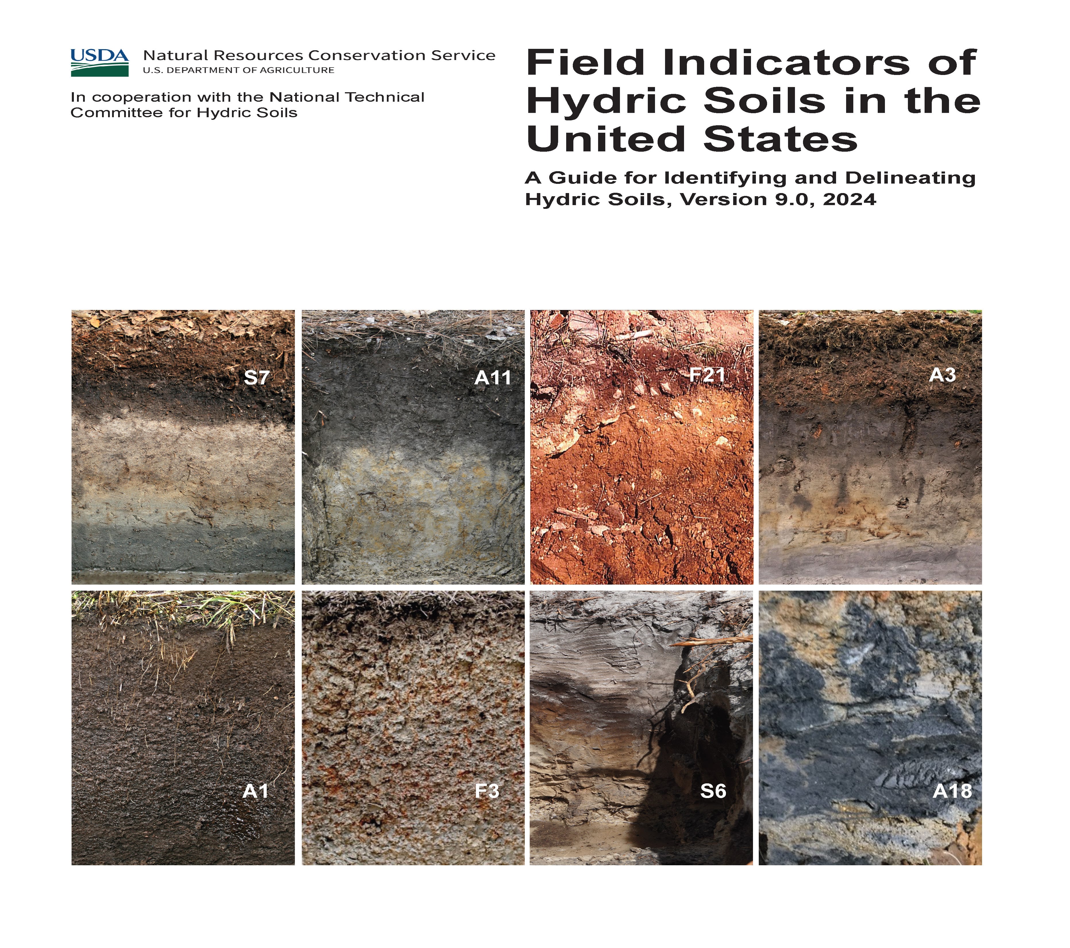
Maximize Your Success: Advanced Wetland Mitigation Banking Strategies for Environmental and Financial Gains

Wetland mitigation banking has emerged as a critical tool in environmental conservation, offering a unique approach to offsetting the impacts of development on wetland ecosystems. For environmental consultants and land developers, mastering the advanced techniques in wetland mitigation banking not only ensures compliance with environmental regulations but also maximizes financial returns. In this article, we’ll explore the key strategies for successful wetland mitigation banking and how they can lead to both ecological and economic success.

Understanding Wetland Mitigation Banking

Wetland mitigation banking involves the restoration, creation, enhancement, or preservation of wetlands to compensate for losses incurred by development projects. These efforts generate credits that can be sold to developers who need to offset their environmental impacts. The demand for mitigation credits has been steadily rising, making wetland mitigation banking a profitable venture for those who can navigate its complexities.

Why is Wetland Mitigation Banking Important?

Wetlands play a crucial role in maintaining biodiversity, regulating water flow, and improving water quality. However, these ecosystems are often at risk due to urbanization and agricultural expansion. Mitigation banking ensures that when wetlands are impacted by development, new or restored wetlands replace their ecological functions, providing a net benefit to the environment.

Advanced Site Selection Strategies

The success of a wetland mitigation bank starts with selecting the right site. Not all sites are created equal, and choosing the best location requires careful consideration of various factors.

Key Considerations for Site Selection:

  • Hydrology: The water source and flow are the lifeblood of any wetland. Ensure that the site has a reliable water source, whether from surface water, groundwater, or a combination of both.
  • Soil Quality: The soil must support the wetland vegetation and provide the necessary conditions for water retention. Conduct thorough soil testing to determine its suitability.
  • Proximity to Impacted Areas: Ideally, the site should be located near the areas where development impacts are occurring. This increases the value of the credits generated and makes the bank more appealing to potential buyers.

Selecting a site with these characteristics not only enhances the ecological success of the mitigation bank but also boosts its market value. Sites with optimal conditions are more likely to generate higher-quality credits, which can be sold at a premium.

Designing and Planning the Mitigation Bank

Once a site is selected, the next step is designing and planning the mitigation bank. This phase involves creating a detailed mitigation plan that outlines the goals, objectives, and success criteria for the bank.

Essential Elements of a Mitigation Plan:

  • Hydrological Modeling: Use advanced hydrological models to predict water flow and ensure the wetland will function as intended. This modeling is crucial for designing water control structures and vegetation zones.
  • Vegetation Planning: Select plant species that are native to the area and well-suited to the site’s hydrological conditions. Proper vegetation planning is key to establishing a resilient wetland ecosystem.
  • Regulatory Compliance: Ensure that the mitigation plan meets all regulatory requirements. Work closely with agencies like the U.S. Army Corps of Engineers to secure the necessary permits and approvals.

A well-designed mitigation bank not only fulfills regulatory obligations but also maximizes the ecological and financial outcomes of the project.

Implementation and Construction Best Practices

The implementation and construction phase is where the mitigation plan comes to life. This stage involves grading the land, installing water control structures, and planting vegetation.

Best Practices for Implementation:

  • Grading and Excavation: Carefully shape the land to create the desired hydrological conditions. This may involve removing excess soil, creating channels, or building berms.
  • Water Control Structures: Install weirs, culverts, and other structures to manage water flow and maintain the appropriate water levels within the wetland.
  • Planting and Seeding: Use native plants and seeds to establish vegetation. Consider timing the planting to coincide with the wet season to increase the chances of successful establishment.

Proper execution during this phase ensures that the wetland will develop as planned, providing the necessary ecological functions and generating high-quality mitigation credits.

Monitoring, Management, and Maximizing Financial Returns

Long-term monitoring and management are essential for the success of a wetland mitigation bank. Regular monitoring helps track the progress of the wetland and allows for adaptive management if issues arise.

Key Monitoring Activities:

  • Water Quality Testing: Regularly test the water quality to ensure that the wetland is functioning as intended.
  • Vegetation Surveys: Conduct surveys to monitor the health and diversity of the plant community.
  • Wildlife Monitoring: Track the presence of key species to gauge the success of the wetland as a habitat.

Effective management not only maintains the ecological health of the wetland but also ensures that the mitigation credits remain valuable in the marketplace.

Maximizing Financial Returns:

  • Credit Pricing: Set competitive prices for credits based on market demand and the quality of the mitigation provided.
  • Marketing and Sales: Build relationships with developers and regulatory agencies to increase the visibility and attractiveness of your mitigation bank.

Conclusion

Wetland mitigation banking offers a win-win scenario for both the environment and developers. By mastering the advanced techniques of site selection, design, implementation, and management, you can create a successful mitigation bank that delivers significant ecological benefits while maximizing financial returns. As demand for mitigation credits continues to grow, those who excel in this field will find themselves well-positioned for long-term success.

Take the next step in your wetland mitigation banking success—register now to secure your spot in our essential webinar on wetland mitigation banking on October 24, 2024.

North Carolina’s Weird and Wonderful: Little Brown Jug

Photograph of a little brown jug plant with one stalk, one leaf, and one flower.

Many gardeners out there are entering their busy season, as fall is the perfect time to install new vegetation in gardens and natural landscapes. Utilizing species native to a particular area and making sure they are the appropriate ecotype of that species is increasing in popularity amongst gardeners. Native plant gardens tend to exhibit large and/or colorful species of flowers, shrubs, and vines, while overlooking some of the less-flashy plants present in our state. One such North Carolina plant is Hexastylis arifolia, otherwise known as the little brown jug. This low-to-the-ground herbaceous perennial is often overlooked on woodland hikes, as the flowers are not particularly eye-catching. Those that notice it may confuse this species with wild ginger, Asarum canadense, which is in the same family, but has deciduous leaves, whereas little brown jug is an evergreen. 

Photographs of the foliage and flower of Hexastylis arifolia by Reina Kornmayer

Little brown jug has triangular to arrow-shaped leaves that are leathery in texture and release a spicy odor when torn. This species was used as a ginger substitute by early settlers, and local indigenous tribes used extracts and infusions from the leaves and roots to treat respiratory ailments and heart problems. This plant gets its name from its flowers, which are jugs often hidden beneath the leaf litter due to their short stems and rhizomes. These small, urn-shaped flowers grow to be about an inch long, are in bloom from March through May, and can be brown, green-brown, or purple-brown on the outside and a dark purple-brown on the inside. If the flowers are right at ground level, and they are not brightly colored, how is this species pollinated? Well, that is where the weirdness begins! 

Can you find the jug in the above image? Photograph of Hexastylis arifolia by Reina Kornmayer.

It was previously thought that both the Asarum genus and the Hexastylis genus were pollinated by carrion flies and fungus gnats. On the surface, this makes sense: the flowers of both genera are on the ground and are flesh-colored, matching the preferred foods of those groups of insects. However, research performed on wild ginger, Asarum canadense, since the 1980s has gathered evidence supporting the hypothesis that this species is self-pollinating. Fascinating information, you are probably thinking, but wasn’t this article about the little brown jug, and not its distant relative? Subsequent research on the Hexastylis genera has demonstrated that the distance between their anthers and stigmas in each flower is too great for self-pollination on their own. They need a little assistance, namely an insect one.

While wild ginger does not produce an odor, Hexastylis arifolia releases a very faint odor that resembles rotting flesh. Now, I have personally attempted to smell this odor on little brown jugs in the wild, and it is very hard to detect. You must get your nose at the right spot to smell the mild odor of decay. It is now thought that little brown jugs are pollinated by various species of carrion beetles. This group of beetle species spends its time on the forest floor searching for decaying flesh and poop in which to lay eggs; thus, the flowers of little brown jug would be easy to access. As these species excel at following scent trails to rotting refuse, they can easily locate these flowers. It is hypothesized that, once inside of the flower, the beetles move the pollen from the anther to the stigma while they scramble around, assisting the self-pollination process. So next spring, when you are taking a hike through a North Carolina forest, pay attention to the herbaceous plants along the forest floor. Chances are that the little brown jug is among them, waiting for a beetle to come along and pollinate one of their flowers. That, my friends, is one weird and wonderful plant! 

Restoring the Klamath River: A Journey of Cultural Revival and Environmental Healing

The following blog post is a summary of the article “Anything that can be built can be taken down”: The largest dam removal in U.S. history is complete — what happens next? by Lucy Sherriff, published by the BBC on September 3, 2024. To read the original article, click here.

Brook Thompson, a member of the Karuk and Yurok tribes from Northern California, has been fishing on the Klamath River since childhood, where fishing was a way of life. To her and her family, the river was not just a resource but a vital part of their culture and identity. However, in 2002, a massive fish die-off devastated the river, marking a turning point for her community. Thompson recalls how, at seven years old, she witnessed thousands of dead salmon along the shore, an event that had never been recorded in the tribe’s history. This tragedy was linked to low water flow from the Iron Gate Dam, which highlighted the detrimental effects of the dams on the Klamath River ecosystem and the tribe’s livelihood.

The Yurok and Karuk tribes have long opposed the dams, seeing their removal as essential to their survival. The dams blocked fish migration, severely diminishing salmon populations. The tribes’ deep cultural and spiritual connection to the river made the decline of salmon particularly painful. After years of activism and negotiations, the largest dam removal project in U.S. history was completed in 2024, opening over 400 miles of the river. This was a monumental victory for the tribes, as they had been told their demands were impossible. The return of the river’s natural flow brings hope for the recovery of fish populations and the tribe’s cultural practices.

The Klamath River basin, once one of the most productive salmon rivers on the West Coast, had suffered severely due to the dams. Salmon populations plummeted, and the tribes were forced to import fish for their cultural ceremonies. The dams also caused toxic algae growth, further damaging the water quality. The removal of the dams began in 2023, and although the water released downstream was initially dirty, the river has already begun to heal. Tribal members expect fish populations to recover significantly over the coming decades, with predictions estimating an 81% recovery by 2061.

Restoring the land exposed by the drained reservoirs is an ongoing challenge. The tribes, along with environmental organizations, have been working since 2011 to prepare for this restoration, collecting seeds from native plants to reestablish vegetation in the area. These efforts have involved hand-collecting seeds from hundreds of species, including culturally significant plants such as oak trees. The process has been complex, involving careful planning to ensure the genetic suitability of the plants for the local ecosystem. Despite challenges such as wildfires and drought, the restoration team has seen promising results, with wildlife beginning to return to the newly planted areas.

For Thompson and her community, the restoration of the river and the land represents more than just environmental recovery; it is also about healing their connection to their ancestral lands. The removal of the dams symbolizes the reclaiming of their role as stewards of the land, a responsibility passed down through generations. It offers hope not only for the future of the river’s health but for the survival of their cultural traditions tied to the salmon and the ecosystem. Thompson views this restoration as a forward-looking process, blending traditional ecological knowledge with modern scientific practices. While the river may never return to exactly what it once was, the tribes are committed to ensuring its future health for generations to come, believing that they can create a better, more sustainable future for their people.

Beavers as Ecosystem Engineers: Transforming the Landscape in Devon, England for Flood and Drought Resistance

The following blog is a summary of the article Research backs beavers in fight against flooding and droughts by the Devon Wildlife Trust, published online on May 29, 2024. To read the full article, click here.

A decade-long study conducted by the University of Exeter and Devon Wildlife Trust has highlighted the positive impact of beavers on flood and drought management in Devon, England. After being hunted to extinction 400 years ago, beavers were rediscovered living on the East Devon River Otter in 2014. It is unclear how the beavers found their way back, but their legal right to stay was granted in 2020. Forming close-knit family groups, these beavers now inhabit 20 family territories along the river. Beavers are also known as “ecosystem engineers”, as they reshape the landscape to suit their needs by constructing dams. These dams inevitably result in the creation of wetlands, which are prime habitat for the beavers, and an excellent form of flood control for humans. Why? Well, wetlands are able to store large amounts of water, which decreases flooding risks for the surrounding areas.

The research, which combined drone imagery with water depth monitoring, revealed that beaver-created wetlands in four territories stored over 24 million liters of water, equivalent to around 10 Olympic-sized swimming pools. These wetlands help mitigate flooding by reducing storm flows by 30% during heavy rainfall, offering protection to flood-prone communities downstream. Moreover, during droughts, such as the one in 2022, beaver wetlands released stored water slowly, maintaining river flows and creating “green oases” that support various wildlife species.

To further support the benefits of beavers, Devon Wildlife Trust is advocating for the expansion of beaver habitats and is working with two local, East-Devon based landowners through the Department of Environment, Food, and Rural Affairs (Defra)-administered Farming in Protected Landscapes Grant Scheme. Surrendering farmland to the beavers results in a loss of income for farmers, as they lose precious grazing and crop space. This initiative provides financial assistance to farmers, compensating them for that loss. The Farming in Protected Landscapes Grant Scheme is currently only working with Clinton Devon Estates and Bicton College, who are making space for beaver wetlands on their land. The resulting wetlands not only support diverse wildlife but also offer unique learning opportunities for students, as seen at Bicton College, where portions of their working dairy farm were turned into beaver habitat.

Devon Wildlife Trust next goal is to make this innovative “green finance” approach available to more farmers and landowners who are open to transitioning some of their land to wetland habitat. Ed Parrish, the Director of Land-based Operations at Bicton College, supports that goal, stating ” We would like to see this type of funding expanded so that other landowners can be rewarded for the benefits they are providing to the environment when they allow beavers to create wetland habitats.” Dr. Holly Barclay, the Trust’s Green Finance Officer, emphasized the importance of these natural solutions in addressing climate-related challenges such as increasing floods and droughts. The Devon Wildlife Trust aims to develop new funding streams that reward land managers for the societal benefits provided by beaver wetlands, highlighting the cost-effectiveness of these nature-based solutions in mitigating the effects of severe climate events.

North Carolina’s Weird and Wonderful: House Centipede

Illustration of house centipede

Here in North Carolina, we experienced a hint of the season to come with a week of pleasantly cool temperatures. If one has been paying attention to store shelves, the news, and social media recently, then it should be apparent that the fall season is being celebrated now. Halloween decor has been for sale for months, and autumnal beverages and foods have premiered at nationwide chains. According to the internet, this trend of celebrating Halloween and fall in the middle of summer is known as “Augtober”. In that spirit, I have decided to write this month’s weird and wonderful blog about a small critter that often elicits screams and thoroughly freaks many people out: the house centipede.

Now, wait a minute, some myriapodologists out there may be saying, the house centipede is not actually native to North Carolina, or even to the North American continent. Yes, you got me. However, since this species has spread throughout the world, and can be readily found in North Carolina homes, I am hoping that you, dear readers of my blogs, will indulge me. Well, if it is not native to the Carolinas, or to North American, where is it from? House centipedes, Scutigera coleoptrata, are thought to be indigenous to the Mediterranean region of the world. Accidentally introduced to the Southeastern U.S., this species is now common throughout the country, and has also spread to Australia, Europe, and Asia. They are still a rare occurrence in the United Kingdom, as a recent BBC article explained.

Photo of Scutigera coleoptrata courtesy of The Pennsylvania State University Extension

For some, the house centipedes are the stuff of nightmares. They have a cylindrical body that can be an inch to an inch-and-a-half in length, attached to which are 15 pairs of very slender, banded legs. These pairs of legs increase in length as you progress towards the back end of the animal, with the final pair on adult females being almost twice the length of their body. While most other centipede species lack easily discernable eyes, house centipedes actually have well-developed, faceted eyes. In addition to their unsettling outward appearance, house centipedes are incredibly fast; when people happen upon one, they often witness it scuttling across the floor, looking for a dark, damp place to hide until nightfall. At night, house centipedes hunt small arthropods, including carpet beetles, cockroaches, and silverfish.

Unsettling outward appearance? Check. Seemingly unnatural speed? Check. Predatory? Check. See what I mean about the stuff of nightmares? Take some time to recover from what you have just learned, and then focus on the last sentence of the previous paragraph. House centipedes are hunters, and their prey are common household pests. Thus, while many people have no qualms about squashing this superficially vile creature, others let them live, because they would rather have a home with a guardian house centipede then a home full of cockroaches and silverfish (species which also haunt people’s dreams). House centipedes, weird and wonderful animals that they are, may not be easy on the eye, but you can rest assured knowing that any cockroach that dares cross your threshold will meet a swift end at the hands (well, really prehensors) of a house centipede. Now, granted, if there appears to be a large population of house centipedes in your home, that means there is plenty of food to go around, which in turn means you may have to invest in some pest management against all household arthropods. That unfortunate situation aside, if you happen to come across a house centipede this summer and fall, regain your composure, cease wondering what that sound was that just emerged from your lips, and consider letting it go on its merry way. You never know, it might just have a cockroach to foil.

Michigan Dairy Farm Ordered to Restore Wetlands After Violating Environmental Laws

The following blog is a summary of the article Farm must restore wetlands, by Eric Levine, published in the Sanilac County News on August 7, 2024. To read the full article, click here.

In a recent legal ruling, a Sanilac County dairy farm, Weaverland Farms, was fined and ordered to restore 69 acres of wetlands that were illegally destroyed. The case was adjudicated by 30th Circuit Judge Wanda Stokes on July 26, 2024, who ruled in favor of the Michigan Department of Great Lakes, Environment and Energy (EGLE). This decision marks a significant moment in the ongoing enforcement of environmental regulations in Michigan.

Background of the Case

The lawsuit against Weaverland Farms and its owners, Nelson, Connie, Arnold, and Ethan Weaver, was initiated by EGLE in October 2022. The agency accused the farm of unlawfully clearing 69 acres of wetlands, which were then converted into a cornfield to support the farm’s dairy operations. The wetlands were also reportedly used as a site to spread manure. This activity came to light during an EGLE investigation into a separate violation concerning the farm’s Concentrated Animal Feeding Operation (CAFO) permit. During this investigation, EGLE discovered that the farm had expanded a manure disposal field, encroaching into the protected wetland area.

Legal Findings and Rulings

Judge Stokes granted summary disposition in favor of EGLE, meaning the case was decided without a full trial because the judge found that there were no significant facts in dispute. The judge ordered Weaverland Farms to restore the 69 acres of wetlands immediately and imposed a $10,000 fine on the farm. In her ruling, Judge Stokes emphasized that the farm’s actions were clear violations of Part 303 of the Natural Resources and Environmental Protection Act (NREPA), which governs the protection of wetlands in Michigan. She noted that the farm, led by Connie and Nelson Weaver, had collectively used the cleared land for their dairy farming activities, despite being aware of its protected status.

Defense Arguments and Court’s Rebuttal

Weaverland Farms presented several defenses, all of which were dismissed by the court. One key argument was that the lawsuit should be dismissed because EGLE allegedly failed to provide a written notice detailing the specific violations before initiating the lawsuit. However, the judge found that EGLE had fulfilled its pre-suit requirements by providing a detailed statement of facts to the defendants, including the location and nature of the violations, and offering to meet with the farm to discuss the issues. The farm also argued that EGLE’s enforcement actions violated the Michigan Right to Farm Act, which protects farmers from nuisance lawsuits if they follow generally accepted agricultural practices. However, Judge Stokes clarified that the Right to Farm Act does not preempt state or federal environmental regulations, such as those under Part 303 of the NREPA. Therefore, the Right to Farm Act did not apply in this case. Another defense put forward by Weaverland Farms was that the required restoration and fine constituted an unconstitutional regulatory taking. The farm claimed that the economic impact of these requirements would render the property worthless, which they argued was contrary to their investment-backed expectations. However, the judge rejected this argument, stating that there was no evidence to support the claim that the enforcement actions constituted an unlawful taking of property.

Conclusion

The ruling underscores the court’s firm stance on the protection of wetlands in Michigan, highlighting the importance of compliance with environmental regulations. Judge Stokes concluded that there was no factual dispute that the wetlands existed on Weaverland Farms’ property and that the farm had indeed violated Part 303 of the NREPA. The judge’s decision to grant summary disposition in favor of EGLE and deny the farm’s motion for summary disposition indicates that the court found the evidence overwhelmingly supported the state’s case. This case serves as a reminder to agricultural operations in Michigan and beyond that environmental regulations must be strictly followed, and violations can result in significant legal and financial consequences. The restoration of the wetlands by Weaverland Farms is not only a legal obligation but also a critical step in preserving the environmental integrity of the region. The decision also reinforces the authority of EGLE and other regulatory bodies to enforce environmental laws and protect natural resources from unlawful exploitation. Despite attempts by Weaverland Farms to challenge the enforcement actions, the court’s ruling affirms the importance of environmental stewardship and the role of the judiciary in upholding laws designed to protect natural resources. The outcome of this case will likely serve as a precedent for future environmental enforcement actions in Michigan and may influence how similar cases are handled in other states.

The North Carolina Salt Marsh Action Plan

Last week we discussed Executive Order No. 305 and how that would, hopefully, lead to more wetland habitats being protected in North Carolina. The North Carolina Salt Marsh Action Plan, or NCSMAP, was briefly mentioned as a positive step forward in preserving, maintaining, and restoring the salt marshes along our state’s coast. Today we are going to delve into NCSMAP, which was released in May of this year. This action plan was initiated by the North Carolina Coastal Federation, or NCCF, as means of developing a guide for how the state could accomplish the goals set out in the South Atlantic Salt Marsh Initiative (SASMI) Plan, which was published in May of 2023. There are approximately 1 million acres of salt marsh in the South Atlantic region, which extends from North Carolina through Florida. This unique ecosystem provides habitat for over 75% of the species important in the fisheries industry, which in turn supports approximately 39,000 jobs. Salt marshes harbor other wildlife species, and, due to their ability to absorb large volumes of water, provide protection from flooding for the communities, military installations, and infrastructure present along the coast.

Despite the clear benefits to having salt marshes, this particular ecosystem is under threat from both sides. On the one side, they are under threat of being destroyed for development; on the other, they are at risk of dying off due to rising sea levels. While the vegetation within this ecosystem can tolerate inundation for long periods, they do require access to air at some point; salt marsh vegetation that is permanently submerged under the sea cannot survive. Thus, the SASMI Plan proposes adaptive measures that can help save this critical habitat, not only for the wildlife, flood control, and water filtration benefits, but for the benefit of the human populations that have called the area home for centuries. One such community is the Gullah/Geechee Nation, which was officially established in 2000 but has a rich history extending back to the 18th century. Their communities are spread along The Gullah Geechee National Heritage Corridor, which stretches from Jacksonville, North Carolina to Jacksonville, Florida. The Gullah/Geechee people’s ancestors were slaves and freedmen who settled in the region, and in 1861 and 1862 they were able to purchase lots of land, ranging in size from 10 to 40 acres. Unfortunately, it is projected that about 25% of the land in this corridor, throughout all four states, will be flooded/inundated due to the rising sea levels.

The SASMI Plan states that tackling sea level rise is outside of their scope, but what is within their scope is determining methods for salt marsh protection and migration that can be implemented, with state and local needs in mind, to keep these 1 million acres intact. Now wait a minute, you may be thinking, did you just say “salt marsh migration“? Yes! One of the strategies that is being proposed is to ensure that salt marshes can shift inland as sea levels rise. If the conditions are right, salt marsh vegetation will migrate inland, or landward, to escape the rising water levels. For this to work there has to be space available into which the salt marsh can move; the slope cannot be too steep; and there cannot be any physical barriers, such as roads, hardened shorelines, and urban areas. The SASMI Plan stresses that, while there are large areas of low-lying inlands along the whole South Atlantic region where the salt marsh can thrive, the migration must be executed carefully in order to avoid impacts to abutting freshwater and estuarine ecosystems and cultural resources. For North Carolina specifically, lower elevations of the northern coastal region offer more potential marsh migration space than the higher elevations of the southern coastal region.

NCSMAP proposes three strategies to protecting the salt marsh ecosystem in the state. Strategy #1 is to preserve what salt marsh areas are already in existence, through conservation and restoration efforts. By minimizing impacts of landward stressors, promoting and advancing their restoration, protection, and conservation, expanding the usage of living shorelines, and facilitating salt marsh research, the salt marsh habitats currently in place will continue and be able to migrate. The second strategy is to facilitate this migration wherever possible through conserving migration corridors and researching and assessing potential areas for migration. In addition, making sure that salt marsh migration is a priority when it comes to infrastructure planning is critical for the survival of the salt marsh. Finally, incorporating crosscutting approaches is the third strategy. This involves more research, pursuing funding, encouraging policy and management adjustments, and, perhaps most importantly, taking the time to communicate, engage with, and educate target communities and audiences. Without public awareness and support, the conservation and protection of the salt marsh ecosystem in North Carolina, and the South Atlantic region as a whole, will not be very effective.

NCSMAP is a great start for protecting salt marsh wetlands in our state, but it is going to take some time before all of these strategies pick up speed. In the meantime, education and community outreach will be the best way to learn about the issues and determine the methods that work for people and nature. Recognizing this, the North Carolina Salt Marsh Steering Committee (SMSC) established a Stakeholder Advisory Panel, consisting of over 100 public and private stakeholders, to provide guidance and feedback on how the actions proposed by SASMI and NCSMAP are doing in our state. By working together, the salt marsh habitats, and all of the natural and cultural resources they contain, can be preserved for years to come.

New Protections for North Carolina Wetlands

Wetland habitats in North Carolina have been getting the short end of the stick lately, what with the North Carolina Farm Act being passed on the heels of the U.S. Supreme Court Sackett V EPA decision. Combined, those two events resulted in a significant number of our state’s wetlands losing legal protection, as explained in our “NC Wetlands at Risk” blog article. Despite these challenges, a glimmer of hope emerged earlier this year when Governor Roy Cooper signed Executive Order No. 305, which outlined new goals to protect and restore natural resources in the state. By 2040, North Carolina public and private partners should work together to 1) permanently conserve 1 million new acres of forest and wetlands; 2) restore 1 million new acres of forests and wetlands; and 3) plant 1 million new trees in urban areas. As Governor Cooper put it, this will “leave our state better than we found it for generations to come.”

As is explained in the executive order, wetlands are much more than dirty, swampy mush-pits. Wetlands provide flood control, wildfire risk reduction, and filtration of water pollutants for our communities. This has become especially important as North Carolina has been getting hit more frequently with high-intensity hurricanes. Coastal wetlands absorb a lot of the force of these storms, and coastal and inland wetlands soak in a ton of water, which decreases flooding. However, as existing wetlands are drained for development and agricultural use, the amount of water that can be absorbed also shrinks, resulting in ever-increasing flood levels. The next time you feel the urge to bulldoze a wetland in order to build a beach house, remember that you will be removing a major form of flood control from that location. Unless the beach house is a houseboat, that decision will probably end poorly for the home’s occupants.

In addition to contributing to flood control in North Carolina, coastal marshes play an important role in our seafood industry. More than 90% of all commercially harvested fishery landings in the state are comprised of species that are dependent upon estuarine ecosystems. In addition, over 60% of fish harvested recreationally are species that need salt marsh habitats to survive. If all of the coastal marsh lands were to go away, North Carolina would lose a significant source of income. The value of these natural spaces is being recognized: in May of this year the North Carolina Salt Marsh Action Plan (NC SMAP) was released. This state plan was enacted in order to ensure that salt marshes would be protected and restored for generations to come.

The good news is, while wetlands in North Carolina are still under siege, more and more people are recognizing the value in letting them stick around. Executive Order No. 305 and NC SMAP are a great start but are hopefully not the end of wetland protections. Spend some time getting to know the wetland habitats in your community, and hit the road to see wetlands across the state, such as the Dismal Swamp State Park, or the Pocosin Lakes National Wildlife Refuge. They might look dark, muddy, and spooky, but they are playing a very important role in making sure North Carolinians thrive for years to come.

North Carolina’s Weird and Wonderful: Green Anole

There are eleven lizard species that call North Carolina home. Well, thirteen, if you include the two introduced species, the Mediterranean gecko and the Texas horned lizard. This month’s weird and wonderful focus is on the Green Anole, Anolis carolinensis. This lizard ranges throughout the coastal plain, piedmont, and foothills of the state and can be green, brown, or green and brown in color. Many lizards found in the brown form have a lighter stripe that runs down their back, and a few individuals may even have a crest or ridgeline along their neck and back. Green anoles can be found on the ground, along fences, on structures, and even in trees, as they have sticky toe pads that help their grip.

Males of this species are highly territorial: when approached by a rival, a male green anole will extend his bright pink dewlap, or throat fan, and bob his head up and down. If that is not enough to frighten away the intruder, a fight may ensue. One male’s territory can be as small as 1 cubic meter, but it can overlap with the home ranges of 2 to 3 females, whom he courts by bobbing his head up and down. The sight of a male performing his head bobbing sets off a domino effect of physiological responses in the female, which eventually leads to her laying an egg, one at a time, throughout the spring and summer months. The eggs are laid in shallow depressions of sand, rotting wood, leaf litter, and other similar substrate; when the baby lizards hatch after 7 weeks, they are only around 2 ½ inches long. As the days shorten towards the end of summer, the reproductive organs of both the males and females become smaller in size. Adults and juveniles feast on small invertebrates, such as crickets, grasshoppers, and flies, but nectar has also been recorded as a source of food.

So…green anoles are like any other lizard in North Carolina? Wrong! Take another look at the first paragraph of this post, where it says, “Many lizards found in the brown form…” and mentioned that they can also come in the color green. Green anoles are weird and wonderful because they can change color from bright green to brown and vice versa! They are the only color-changing lizards that we have in our state. Their physiological color change is due to specialized cells called chromatophores. Chromatophores contain pigments and/or nanostructures that, when rearranged, result in a rapid color change. There are many different kinds of chromatophores: green anoles have melanophores, which contain organelles called melanosomes. Melanosomes exclusively hold melanin, and the ones present in dermal melanophores determine the color. Specifically, the larger an area (aka distribution) of melanosomes means more light is absorbed, resulting in a darker color being produced. Alright, so what triggers a green anole to decide to change from one color to another? That is less understood, though we know that temperature can affect how quickly chromatophores can rearrange their internal nanostructures and pigments. Thus, it has been hypothesized that these lizards change colors to control whether they absorb or reflect heat. It has also been suggested that they change color in response to social behavioral cues from other members of their species. Regardless, we North Carolinians are fortunate that these small jewels of the lizard world grace our state.

Transforming Wetland Delineation: The Power of AI and Chat Assistants

Wetlands are some of the most ecologically significant and sensitive habitats on Earth. They provide essential services such as water filtration, flood protection, and habitat for countless species. However, their complexity and the dynamic nature of wetland ecosystems pose significant challenges for environmental consultants tasked with delineating and assessing these areas. Traditional methods of wetland delineation, while effective, are often labor-intensive, time-consuming, and subject to human error. Enter artificial intelligence (AI) and chat assistants—technologies that promise to revolutionize wetland delineation by enhancing accuracy, efficiency, and accessibility.

The Role of AI in Environmental Consulting

Artificial intelligence has made significant strides in various fields, and environmental consulting is no exception. AI systems excel at processing vast amounts of data quickly and accurately, identifying patterns, and making predictions that can significantly aid decision-making processes. In the context of wetland delineation, AI can be utilized in several ways:

  1. Data Analysis:
    • AI can process large datasets, such as satellite imagery, soil samples, and hydrological data, to identify wetland boundaries and characteristics with high precision. Machine learning algorithms can be trained to recognize specific features and indicators of wetlands, reducing the time required for manual analysis.
  2. Predictive Modeling:
    • AI models can forecast environmental changes based on historical data, helping consultants anticipate how wetlands might evolve under different scenarios. This capability is particularly useful for understanding the impacts of climate change, land use changes, and water management practices on wetland ecosystems.
  3. Automation:
    • Many of the repetitive and routine tasks involved in wetland delineation, such as data entry and initial assessments, can be automated using AI. This automation not only speeds up the process but also minimizes the risk of human error.

Practical Applications of AI in Wetland Delineation

AI applications in wetland delineation are diverse and powerful. Here are a few examples:

  • Species Identification: Using AI to recognize plant and animal species from images is a game-changer. Models trained on large datasets of labeled images can accurately identify species based on features such as shape, color, and texture. This capability is invaluable for monitoring biodiversity and detecting the presence of rare or endangered species within wetlands.
  • Habitat Suitability Analysis: AI can analyze environmental variables such as soil type, water availability, and temperature to predict suitable habitats for different species. This analysis helps in planning conservation efforts and ensuring that habitats are protected and managed effectively.
  • Climate Impact Modeling: Predicting how climate change will affect wetland ecosystems is critical for developing adaptive management strategies. AI models can integrate various climatic and environmental factors to forecast changes in wetland areas, helping policymakers and conservationists make informed decisions.

Introduction to Chat Assistants in Environmental Consulting

Chat assistants, or chatbots, leverage natural language processing (NLP) to interact with users in a conversational manner. These AI-powered tools can provide quick answers to common questions, assist with data entry, and perform initial analyses, making complex AI models more accessible.

How Chat Assistants Work:

  • Natural Language Processing (NLP): Chat assistants use NLP to understand and respond to human language, allowing users to interact with AI models without needing to know technical details. This interaction simplifies the process of obtaining information and insights from AI systems.
  • User Interaction: By providing a user-friendly interface, chat assistants make it easy for users to input data, ask questions, and receive detailed responses. This ease of use is particularly beneficial for environmental consultants who may not have extensive technical backgrounds.

Applications in Environmental Consulting:

  • Customer Support: Chat assistants can answer frequently asked questions about environmental regulations, project timelines, and data requirements, providing quick and accurate responses to clients and stakeholders.
  • Data Collection: Guiding users through the process of entering environmental data ensures that information is collected correctly and consistently. Chat assistants can standardize data entry, reducing variability and improving data quality.
  • Preliminary Analysis: Performing initial assessments based on user inputs allows chat assistants to provide quick insights and recommendations, helping consultants prioritize tasks and focus on more complex analyses.

The Importance of Prompt Engineering

Prompt engineering is the process of designing prompts to effectively communicate with AI models. In wetland delineation, this involves creating specific instructions or questions that guide the AI to provide relevant and accurate responses.

Key Aspects of Prompt Engineering:

  • Designing Effective Prompts: Prompts must be clear, concise, and contextually relevant to ensure the AI model understands the specific task at hand. For instance, a prompt like “Analyze the soil data and classify the area as wetland or non-wetland” directs the AI to focus on relevant soil characteristics.
  • Contextual Awareness: The AI model must understand the context of wetland delineation, including the specific indicators of wetlands and the regulatory criteria used to classify these areas. This contextual awareness is achieved through training the model on relevant datasets and continuously refining the prompts.
  • Iterative Process: Prompt engineering is an iterative process where prompts are tested and refined based on the AI’s performance. This continuous improvement ensures that the model’s responses become more accurate and relevant over time.

Example Prompts:

  • Data Input: “Based on the following soil sample data, is this area classified as a wetland?”
  • Species Identification: “Identify the plant species in this image and determine if it is a wetland indicator species.”
  • Predictive Modeling: “Predict the impact of a 10% increase in rainfall on the wetland area over the next year.”

Case Study: Everglades Water Management

The Everglades, a vast and complex wetland ecosystem in southern Florida, presents a unique set of challenges for water management. Traditional methods often struggle to predict the complex interactions between hydrology and ecology. To address this, an AI model named was developed to simulate various water management scenarios using historical data on precipitation, water flow, and ecological responses.

How it Works:

  1. Data Collection and Preparation: The Ai gathers data from weather stations, hydrological sensors, and ecological surveys. This data is cleaned and preprocessed to ensure accuracy and consistency.
  2. Machine Learning Algorithms: The Ai employs supervised learning, neural networks, random forests, and support vector machines (SVM) to model complex relationships and make robust predictions.
  3. Training the AI Model: The training process involves splitting the data into training and testing sets, performing feature engineering, and iterating on the model to optimize performance.
  4. Running Simulations: Managers input scenarios such as changes in rainfall patterns or water release schedules, and the Ai simulates the impact on the ecosystem, including predicting water levels, flood risks, and habitat conditions.
  5. Insights and Decision Support: The Ai provides detailed reports on the predicted outcomes, helping managers make informed decisions that balance ecological and human needs.

Results and Insights: The Ai’s simulations have proven invaluable in optimizing water flow, improving habitat conditions for wildlife, and ensuring sustainable water use. By identifying optimal water release schedules and predicting potential flooding or drought conditions, Ai helps manage the delicate balance of the Everglades ecosystem.

Benefits and Challenges of AI in Wetland Delineation

While AI and chat assistants offer numerous benefits, there are also challenges to consider.

Benefits:

  • Increased Efficiency: Automating data analysis and routine tasks saves time and resources.
  • Improved Accuracy: AI models can process large datasets and identify patterns that might be missed by human analysts.
  • Scalability: AI systems can handle large volumes of data, making them suitable for extensive project areas.
  • Enhanced Decision-Making: AI provides data-driven insights that support informed decision-making.

Challenges:

  • Data Quality: The accuracy of AI models depends on the quality and completeness of the data.
  • Complexity: Developing and maintaining AI models requires technical expertise.
  • Cost: Implementing AI solutions can involve significant initial investment.
  • Ethical Considerations: Ensuring that AI systems are transparent and do not reinforce biases is crucial.

Join Our Webinar to Learn More

To delve deeper into these topics and explore how AI and chat assistants can transform wetland delineation, join our webinar on August 29, 2024, at 1 PM ET. This 90-minute session will provide valuable insights, practical applications, and a live demonstration of AI in action. Don’t miss this opportunity to stay ahead in the rapidly evolving field of environmental consulting. Register now to secure your spot.

For more details and/or to register, visit our Webinar Registration Page.