Wetlands in Crisis: How Agriculture, Policy Changes, and Climate Threats Endanger Vital Ecosystems in the Upper Midwest

The following blog post is a summary of the report Wetlands in Peril by Stacy Woods, published on December 4, 2024, in Union of Concerned Scientists. To read the report online and access a downloadable copy, click here.

The report Wetlands in Peril examines the ongoing destruction of wetlands in the Upper Midwest due to industrial agriculture and weakened federal protections. Wetlands provide essential environmental benefits, including flood mitigation, biodiversity support, and water purification, yet recent changes to the Clean Water Act in 2023 have left them increasingly vulnerable. The Upper Midwest contains over 30 million acres of wetlands, which provide nearly $23 billion annually in flood mitigation benefits. If preserved, these wetlands could prevent between $323 billion and $754 billion in long-term flood damages. The report underscores the urgency of protecting these ecosystems, particularly for marginalized communities that face disproportionate flooding risks.

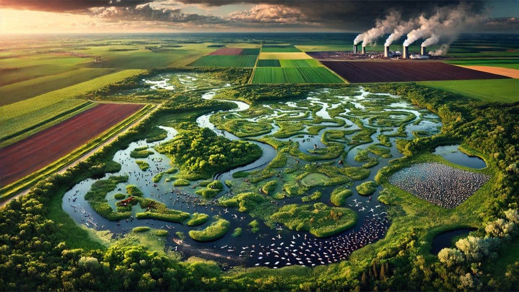
Wetlands are critical for maintaining ecological balance and supporting biodiversity. They provide habitats for 40 percent of the world’s plant and animal species, including many endangered ones. Additionally, wetlands play a significant role in supporting the U.S. commercial seafood industry and offer recreational opportunities such as fishing and bird-watching. Beyond their ecological value, wetlands act as natural pollution filters by trapping sediments and chemicals from agricultural runoff, preventing toxic buildup in water bodies. In the Upper Midwest, where large-scale farming dominates, this filtration is essential for maintaining water quality and preventing dead zones in aquatic ecosystems.

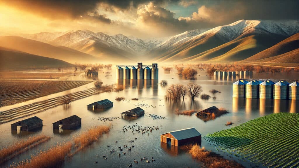
The report highlights industrial agriculture as the primary driver of wetland destruction. Expanding farmland often leads to wetland drainage and pollution from pesticides and fertilizers, significantly impairing water quality and reducing flood protection. Since 1780, the U.S. has lost half of its wetlands, with agriculture being the leading cause of this decline. The Prairie Pothole Region, which spans parts of the Upper Midwest, has experienced a 95 percent loss of wetlands due to agricultural expansion. This loss not only increases flood risks but also releases stored carbon into the atmosphere, exacerbating climate change.

The loss of wetlands has severe economic and environmental justice consequences. Flooding is becoming more frequent and severe due to climate change, and wetlands serve as natural barriers against these disasters. Marginalized communities, particularly in states like Michigan, suffer the most from wetland loss due to historical inequities in housing policies and disaster recovery efforts. The financial burden of flood damages and rising insurance costs disproportionately affects low-income households, making wetland conservation an essential tool for social and environmental resilience. Indigenous communities have led conservation efforts by restoring wetland habitats, showcasing successful models of ecological stewardship.

The report calls for urgent policy reforms in the upcoming farm bill to enhance wetland protections. Recommendations include restoring the Conservation Reserve Program’s original 45-million-acre cap, increasing funding for wetland conservation programs, and linking crop insurance subsidies to sustainable farming practices. The report also emphasizes the need for greater equity in conservation funding, ensuring that historically underserved farmers receive adequate resources. By implementing these measures, policymakers can safeguard wetlands from further destruction, reinforcing their role in flood mitigation, water purification, and climate change resilience.

Bridging Nature and Infrastructure: The Netherlands’ Wildlife Crossings

The following blog post is a summary of the article “Wildlife Crossings Can Mend a Landscape” by Anne Pinto-Rodrigues, published on February 21, 2024, in Sierra magazine. To read the original article, click here.

The Netherlands has made significant advancements in wildlife conservation through the development of wildlife crossings, such as the Zanderij Crailoo Nature Bridge, the longest of its kind in the world. These overpasses and underpasses allow animals to move freely between fragmented habitats without the risk of becoming roadkill. For over three decades, the country has prioritized reducing habitat fragmentation by constructing nearly 3,000 crossings, which cater to various species, from large mammals like deer and wild boars to smaller animals such as otters and hedgehogs. These crossings are crucial for species survival, providing access to food, mates, and new habitats, especially for endangered species. As one of the most densely populated nations, the Netherlands has been forced to address the severe impact of roads and railways on wildlife movement.

The country’s commitment to wildlife crossings began in 1974 with the construction of a badger tunnel and escalated with the 1990 Nature Policy Plan, followed by the 2005 nationwide defragmentation initiative known as the Meerjarenprogramma Ontsnippering (MJPO). The MJPO systematically assessed problematic locations and led to the construction of hundreds of crossing structures. Research by Dutch ecologists has demonstrated the effectiveness of these measures, with studies showing that roadkill of large mammals decreased by 83% when crossings were combined with fencing. Legal mandates, such as the requirement for environmental impact assessments (EIAs) in infrastructure projects, further ensure that wildlife protection remains a priority. Additionally, proper maintenance of these structures, such as clearing badger tunnels of water or trimming vegetation for butterfly-friendly overpasses, is essential for their continued effectiveness.

Other countries, including the United States, are beginning to adopt similar strategies, though progress has been slow. The U.S. passed legislation in 2021 allocating $350 million for a Wildlife Crossings Pilot Program, funding state and tribal authorities to develop habitat connectivity projects. However, experts like Marcel Huijser argue that defragmentation is not yet a priority in the country’s transportation planning. Unlike the Netherlands, where ecological concerns are institutionalized, many U.S. mitigation efforts have only succeeded due to legal battles or political power dynamics. A case in Montana, where tribal authorities halted a highway expansion until wildlife crossings were included, highlights the challenges of integrating ecological concerns into infrastructure projects. While progress is being made, experts emphasize the need for systematic planning and stronger commitments to wildlife conservation in the U.S.

The 2025 Wetland Delineation Job Market: 5 Key Things You Need to Know

If you’re looking for a job in wetland delineation, you’re stepping into a field that is experiencing both opportunities and uncertainties in 2025. With regulatory shifts, increased environmental concerns, and advancements in technology, the demand for skilled professionals is growing—but so is the competition.

Whether you’re a recent graduate, an environmental consultant, or a career switcher, understanding the current job market is crucial to landing the best opportunities. Here are the five most important things you need to know about the 2025 wetland delineation job market and how to set yourself up for success.

1. Increased Demand Due to Regulatory Uncertainty

One of the biggest drivers of wetland delineation work in 2025 is uncertainty around wetland regulations. With the new administration under President Trump, the Waters of the United States (WOTUS) rule is expected to change again, potentially rolling back federal wetland protections.

This uncertainty has caused an increase in delineation requests from:

  • Landowners and developers who want to understand if their wetlands will still be protected or if they can proceed with construction.
  • Municipalities and environmental organizations who need expert opinions on wetland boundaries before regulatory changes take effect.
  • Engineering and consulting firms that need wetland delineators to keep up with new permit requirements.

In short, business is booming for wetland delineators, but you need to be prepared to navigate shifting regulations and advise clients accordingly.

2. Expanding Opportunities in Private Consulting

While federal agencies like the U.S. Army Corps of Engineers (USACE) and the Environmental Protection Agency (EPA) are still key players in wetland permitting, much of the hiring in 2025 is happening in private environmental consulting firms.

Companies specializing in:
Wetland permitting and mitigation banking
Environmental impact assessments (EIAs)
Stormwater and land development projects

… are all actively seeking wetland delineators to help clients navigate both federal and state wetland regulations.

Additionally, many states are implementing their own wetland protections, even if federal rules are relaxed. This means state agencies and local environmental groups are also hiring more wetland professionals to ensure compliance.

3. Advanced Technical Skills Are in High Demand

Gone are the days when basic fieldwork skills were enough to get hired as a wetland delineator. Employers now expect candidates to have a strong background in:

  • GIS and Remote Sensing – Digital mapping is now a standard part of wetland delineation. Experience with ArcGIS, Google Earth, and drone imagery analysis gives you an edge.
  • Hydric Soil Analysis – Delineators with a deep understanding of soil chemistry, redoximorphic features, and wetland soil classifications are in high demand.
  • Macroinvertebrate Sampling – With the Clean Water Act still playing a role in wetland jurisdiction, companies want scientists who can assess water quality using macroinvertebrate sampling techniques.

If you lack these skills, consider taking specialized courses in GIS, soil science, and biological assessments to strengthen your résumé.

4. State-Level Regulations Are Driving Workloads

Even if federal wetland protections weaken, many states are stepping up their own regulations. States like California, New York, and those in the Chesapeake Bay watershed have strengthened wetland protection laws, ensuring a steady demand for wetland delineation services at the state level.

For job seekers, this means:
Understanding state-specific wetland regulations can make you a more valuable candidate.
➡ Jobs are increasingly available with state agencies, local governments, and conservation organizations.
➡ If you’re flexible on location, consider moving to states with strong wetland laws where demand for delineators is highest.

If you’re unsure how state regulations affect job availability, check with state Department of Environmental Protection (DEP) offices or look for state-specific wetland training courses.

5. Certifications Give You a Competitive Edge

Certifications can make a huge difference when applying for wetland delineation jobs. Employers prefer candidates with credentials that demonstrate field experience and regulatory knowledge.

Consider pursuing:
🎓 Professional Wetland Scientist (PWS) – The most respected certification in the field. This credential boosts credibility and is required for senior-level positions.
🎓 USACE Wetland Delineation Training – Completing a USACE Methods wetland delineation course is often required for government contracts.
🎓 GIS and Remote Sensing Certifications – Since digital mapping skills are highly valued, adding a GIS certification (such as from ESRI or a university program) can set you apart.

If you’re new to wetland delineation, consider entry-level certifications like the Wetland Professional in Training (WPIT) designation.


How to Get Hired in the 2025 Wetland Delineation Job Market

If you’re looking for a job in wetland delineation, here’s a step-by-step action plan to increase your chances of getting hired:

🔹 Stay Updated on Regulations – Follow WOTUS developments, Clean Water Act changes, and state wetland laws.

🔹 Upgrade Your Skills – Take online courses or workshops in GIS, hydric soils, and macroinvertebrate assessments.

🔹 Get Certified – Invest in a PWS certification, USACE training, or GIS credential to stand out from other applicants.

🔹 Network with Industry Professionals – Attend wetland conferences, webinars, and local environmental events to connect with potential employers.

🔹 Tailor Your Resume – Highlight your technical skills, field experience, and regulatory knowledge to match what hiring managers are looking for.

The wetland delineation job market in 2025 is full of opportunities, but success depends on staying informed, developing key technical skills, and earning the right certifications. By taking these steps, you’ll be well on your way to a rewarding and stable career in wetland science.


💡 Looking to boost your wetland delineation skills? Check out our on-demand courses on wetland delineation, wetland botany for environmental professionals, and hydric soil analysis to get ahead in your career!

North Carolina’s Weird and Wonderful: Eastern Tiger Salamander

Ambystoma tigrinum, Eastern Tiger Salamander. Photograph courtesy of Jeff Beane and The Pilot.

As you, dear readers, have learned from my blogs over the past few months, there are many weird and wonderful creatures that call North Carolina home. Today I will be discussing yet another member of that club, the Eastern Tiger Salamander. One of the wonderfully weird things about our state is that it is home to more salamander species than any other place in world. What makes this particular salamander stand out from the pack, you may be wondering? Well, the Eastern Tiger Salamander, or Ambystoma tigrinum, is the largest terrestrial salamander in the world. This heavy-bodied amphibian can come in base shades of dark brown or black, with large, irregular yellow, yellow-brown, or olive spots that more closely resemble blotchy stripes, hence its name. Eastern Tiger Salamanders can reach lengths of 11-12 inches, though there have been reports of some reaching 13 inches in length.

Ambystoma tigrinum, Eastern Tiger Salamander. Photo courtesy of Todd Pierson and Herps of NC.

In North Carolina, these salamanders are rarely seen, as they spend most of their time in burrows they dig themselves in the coastal plain and portions of the piedmont region. You may be fortunate enough to see one during their breeding season during the fall and winter months. Males emerge from their burrows before the females, heading to small, fishless bodies of water, such as vernal pools and small ponds. Females lay egg clusters consisting of anywhere from 15 to 200 eggs, attaching the gelatinous egg mass to submerged sticks. Once they hatch, the larval form feed on aquatic invertebrates and other amphibian larvae. In anywhere from 10 weeks to 6 months, the Eastern Tiger Salamander larvae metamorphose into the adult form.

Ambystoma tigrinum, Eastern Tiger Salamander. Photo courtesy of Kevin Stohlgren and Herps of NC.

Adult Eastern Tiger Salamanders are predators, and they will eat anything they can catch and swallow. Their diet ranges from insects to crayfish, other salamanders, and even small mammals, such as mice and shrews. While being poached for the pet trade has had its negative effects on their population, habitat loss is the primary reason for their population decline. The pine savanna habitat they rely on for soft, sandy soil for burrows and shallow ponds for breeding has decreased in acreage due to the clearing of land for farms. However, there is good news to be had for these weird and wonderful salamanders. The North Carolina Wildlife Resources Commission has been steadily working to restore and manage isolated wetlands throughout this species’ historic range. Just two weeks ago staff from the NC Zoo and the Three Rivers Land Trust rescued egg masses from a pond at risk of drying up. The eggs were taken to the zoo, where they will be cared for until the young salamanders are strong enough to be released back into the wild. So the next time you stumble across a small wetland habitat in the coastal plain of North Carolina, take a closer look. You might just catch a glimpse of an Eastern Tiger Salamander. 

Balancing Beauty and Biodiversity: Maine’s Efforts to Combat Invasive Plant Species

The following blog post is a summary of the article “What to do when a plant is invasive but also serves a purpose” by Kea Krause, published on July 24th, 2023 in Sierra magazine. To read the original article, click here.

Rosa rugosa, commonly known as the beach rose, has become a symbol of Maine’s coastal landscapes, though it is not native to the region. Originally from Asia, the plant has spread rapidly, outcompeting native species and becoming a dominant presence along the shore. Recognizing its invasive nature, the Maine State Terrestrial Invasive Plant Stakeholder Committee considered adding the beach rose to its list of banned plants in 2022. However, because of its ability to thrive in high-salinity environments where other plants struggle, the committee designated it as an “invasive terrestrial plant species of special concern” rather than fully prohibiting its sale. This classification reflects Maine’s nuanced approach to invasive species management, balancing ecological concerns with the practical uses of certain plants.

Maine has been proactive in tackling invasive species through plant bans, despite the challenges of enforcement. The committee reviewed 273 plant species in its five-year reassessment, ultimately doubling the number of prohibited plants. The state has taken an aggressive stance on mitigation, recognizing the importance of maintaining biodiversity, particularly in its forests, which cover 90% of the state. Conservationists emphasize that invasive plants threaten native ecosystems by crowding out essential understory vegetation, which is crucial for forest regeneration. While some skeptics argue that plant bans are ineffective due to ongoing sales in retail stores nationwide, Maine has supplemented its bans with educational outreach and a watch list of potential future threats.

Despite these efforts, climate change poses a persistent challenge by facilitating the spread of invasive species through extreme weather events. Heavy rains and flooding in Maine illustrate how plant material can be transported over long distances, undermining human attempts at control. State horticulturist Gary Fish advocates for further advancements, such as DNA testing technology, to better monitor invasive species. While plant bans are not a perfect solution, they serve as an essential tool for slowing the spread of harmful species rather than eliminating them outright. The next stakeholder review in 2027 will assess progress, and experts remain optimistic that continued collaboration with plant sellers and the public will strengthen Maine’s ecological resilience.

Monarch Butterflies Face Threatened Species Listing Amid Declining Populations and Habitat Loss

The following blog post is a summary of the article “Monarch butterflies will get federal protections as a threatened species” by The Associated Press published on December 10, 2024. To read the original article, click here.

U.S. wildlife officials have proposed listing monarch butterflies as a threatened species under the Endangered Species Act, citing declining populations due to climate change and habitat loss. The U.S. Fish and Wildlife Service plans to finalize the listing by the end of 2025 after a public comment period. This status would prohibit killing or transporting the butterflies without exceptions but would still allow some activities, like removing milkweed or incidental vehicle strikes. Critical habitats for the monarch, such as 4,395 acres in coastal California, have also been designated for protection. Conservationists see this move as a necessary step to safeguard a species that serves as a symbol of ecological health.

Monarch populations have declined sharply in recent years, with reports indicating dramatic losses in overwintering areas. For instance, in Mexico, monarchs occupied only 2.2 acres of their traditional groves in 2023-24, a 59% decrease from the previous year. Similarly, along the California coast, the Xerces Society has observed an 81% drop in monarch counts over the past 25 years. Experts attribute the decline to climate change, agricultural expansion, and the widespread use of herbicides that diminish milkweed growth, a critical food source for monarch caterpillars. The Convention on Migratory Species has also warned that warming temperatures could alter migration patterns and reduce breeding times, further endangering the species.

Despite the monarch’s grim outlook, the Fish and Wildlife Service has opted for a “threatened” rather than “endangered” designation, as the species is not yet at immediate risk of extinction across its range. Monarch populations east of the Rockies, which make up 90% of the total U.S. population, face a 57-74% probability of extinction by 2080, while those west of the Rockies face a 95% chance. Environmentalists and agricultural groups are closely watching the proposal’s impact on voluntary conservation efforts and land-use practices. Meanwhile, the public comment period offers an opportunity for stakeholders to weigh in before the final decision is made.

Embracing WVWRAM 3.0: A New Era for West Virginia Wetlands Training

The future of stream and wetland management in West Virginia is about to undergo a transformative shift. Beginning April 15, 2025, all applicants submitting projects involving stream and wetland evaluations must use the newly updated West Virginia Wetland Rapid Assessment Method (WVWRAM) 3.0. This upgrade to the West Virginia Stream and Wetland Valuation Metric (WV SWVM) promises a more robust, transparent, and effective approach to managing impacts on aquatic resources.

The Swamp School is honored to announce that it is officially approved by the state of West Virginia to provide training in WVWRAM 3.0. With this distinction, we are prepared to equip professionals with the knowledge and skills they need to succeed during this critical transition. Whether you are an environmental consultant, engineer, or regulatory professional, mastering WVWRAM 3.0 will be essential for ensuring compliance and achieving sustainability in aquatic resource management.


What is WVWRAM 3.0?

WVWRAM 3.0 is more than just a tool; it’s a comprehensive framework for assessing the health and functionality of West Virginia’s wetlands and streams. Developed through collaboration between the U.S. Army Corps of Engineers (USACE), the West Virginia Department of Environmental Protection (WVDEP), and other state and federal agencies, this latest version builds upon years of refinement and experience.

Some of the key features of WVWRAM 3.0 include:

  1. Enhanced User Interface and Experience
    Updates to WVWRAM 3.0 include clearer instructions, data validation checks, and default values for stream chemical and biological indicators. These improvements make the tool more accessible and user-friendly, even for those new to wetland assessments.
  2. Comprehensive Functional Assessments
    WVWRAM 3.0 integrates physical, chemical, and biological metrics to evaluate streams and wetlands holistically. It analyzes factors such as sediment retention, nutrient cycling, pollutant removal, and habitat quality, providing a more accurate picture of aquatic ecosystem health.
  3. GIS Integration
    The updated tool employs Geographic Information System (GIS) technology for mapping wetlands and tracking their baseline conditions. This feature streamlines data collection and enhances spatial analysis capabilities, enabling users to make better-informed decisions.
  4. Support for Mitigation Planning
    WVWRAM 3.0 generates scores that quantify the functional lift achieved through mitigation efforts. By aligning these scores with regional data and ecological targets, it ensures that mitigation projects are not only compliant but also environmentally beneficial.

Why is WVWRAM 3.0 Important?

Wetlands and streams are among West Virginia’s most vital natural resources, providing critical ecosystem services such as flood control, water purification, and wildlife habitat. However, these resources face significant pressures from development, climate change, and pollution. Tools like WVWRAM 3.0 are essential for balancing economic growth with environmental conservation.

Under the Clean Water Act Section 404, the USACE requires compensatory mitigation to offset unavoidable impacts to aquatic resources. WVWRAM 3.0 ensures a transparent, science-based process for evaluating these impacts and determining appropriate mitigation measures. By adopting this tool, professionals can contribute to the long-term health and resilience of West Virginia’s wetlands and streams.


Why Training Matters

The mandatory use of WVWRAM 3.0 starting April 2025 means that professionals must familiarize themselves with its functionalities and requirements. Proper training is critical to ensure accurate assessments and compliance with regulatory standards. The Swamp School’s WVWRAM 3.0 training program is designed to help participants:

  • Understand the Tool: Learn the purpose and scope of WVWRAM 3.0, including its integration into the WV SWVM framework.
  • Navigate the Interface: Gain hands-on experience with the Microsoft Access database and GIS components.
  • Perform Assessments: Conduct field evaluations and input data to generate scores for stream and wetland conditions.
  • Apply Results: Use WVWRAM outputs to guide project planning, permitting, and mitigation.

The Swamp School Advantage

The Swamp School has a long-standing reputation for excellence in environmental training. As an approved provider of WVWRAM instruction, we bring unparalleled expertise to the table. Our courses are tailored to the needs of busy professionals, offering flexible learning options and real-world applications.

Participants in our WVWRAM training program will benefit from:

  • Expert Instruction: Learn from experienced practitioners who understand the complexities of stream and wetland management.
  • Interactive Learning: Engage in practical exercises and case studies that simulate real-world scenarios.
  • Regulatory Insights: Stay up to date on the latest requirements and best practices for using WVWRAM 3.0.
  • Supportive Community: Join a network of like-minded professionals dedicated to protecting West Virginia’s aquatic resources.

Prepare for April 2025

As the implementation date for WVWRAM 3.0 approaches, the time to act is now. Don’t wait until the last minute to familiarize yourself with this essential tool. The Swamp School’s training program offers a clear path to readiness, equipping you with the knowledge and confidence to excel in your field.

By mastering WVWRAM 3.0, you won’t just be meeting regulatory requirements—you’ll be making a meaningful contribution to the conservation of West Virginia’s wetlands and streams. Together, we can ensure these invaluable ecosystems remain healthy and productive for generations to come.


Enroll Today

Ready to take the next step? Enroll in the Swamp School’s WVWRAM training program and become a leader in aquatic resource management. Whether you’re a seasoned professional or just starting your career, our courses provide the tools and support you need to succeed.

Let’s shape the future of West Virginia’s wetlands and streams—one assessment at a time.

North Carolina’s Weird and Wonderful: Elk

Merry Christmas and Happy Hanukkah everyone! For today’s weird and wonderful focus, I have decided to write about a large, hoofed creature: elk! I know, I know, I probably should have written about reindeer, but elk are really cool too, and North Carolina is home to a growing population of them! Also called Wapiti, which is a Shawnee word meaning “white deer”, elk once roamed throughout what is now the continental U.S., including the mountains of Western North Carolina and perhaps even the northwestern piedmont region of the state. During the 1800s elk became extirpated from most of the country east of the Rocky Mountains, mainly due to hunting pressure and habitat loss. Today, the largest populations are out in the western half of the U.S., but there are a few small populations in the eastern half, including the one in Great Smoky Mountain National Park. 

There are a few subspecies of elk: the Rocky Mountain Elk is probably the most widely known, with its pale, cream-colored body (hence the name “Wapiti”) and dark head, neck, and legs. The Roosevelt Elk, named after Theodore Roosevelt, the 26th President of the United States, is found in the Pacific Northwest; the population in North Carolina is the Manitoban subspecies, Cervus elaphus manitobensis, as the Eastern Elk species, Cervus elaphus canadensis, is extinct. This subspecies has a dark head, neck, and dark legs, with the body ranging in color from deep copper to light tan or beige. While they are sometimes mistaken for white-tailed deer, they are much larger, measuring about five feet high at the shoulder for a full-grown bull elk and weighing around 700 pounds. It surpasses the black bear in size and is the largest mammal in our state. 

Bugling bull elk, Cervus elaphus. Photograph courtesy of the North Carolina Wildlife Resources Commission.

A bull elk can have harems of up to 60 cows, making this species the most polygamous of all the deer species in North America. Bulls will sound a bugle call to warn competing males to stay away, and to assert their dominance over the cows in their harem. This call begins as a bellow, transitions to a whistle or a noise described as a scream, and ends with a series of grunts; the whistle or scream portion is what carries over long distances. Both bulls and cows will mark their territory by stripping the bark from seedlings, and during the breeding season, bulls will dig wallows. Wallows are depressions in the ground that they make with their hooves and antlers, into which they urinate and defecate to create a strong odor. Bulls will roll in the resulting, stinky mud, which is either a way to attract cows, a way to intimidate other bulls, or may serve both purposes. Either way, I feel confident in listing this species as one of the weird and wonderful animals that call our state home.

The elk herd at the North Carolina Zoo in Asheboro, NC. Photograph courtesy of the author.

There have been a handful of attempts to reintroduce elk into North Carolina: the first attempts, during the first half of the 20th century, failed. However, the project was initiated again in 2001 by the National Park Service, with 52 individuals of the Manitoban subspecies introduced over a period of two years into the Cataloochee Valley region of the Great Smoky Mountain National Park. Some of the elk wandered outside of the park’s boundaries and established populations in neighboring counties. The NPS is responsible for the elk within the park, and the North Carolina Wildlife Resources Commission manages all of the populations outside of the park’s boundaries. Today it is estimated that around 200 elk are living within the state on national, state, local, and privately held land. So, the next time you take a road trip through Great Smoky Mountain National Park, consider driving along the road through Cataloochee Valley. From your vehicle you may be fortunate enough to see some members of this weird and wonderful species amongst the trees or in the fields. During late September through early October, you may even be able to hear the famous elk bugle call. Alternatively, consider stopping by the North Carolina Zoo: amongst their animal residents, which are over one thousand creatures and counting, is an elk herd. In whatever form you choose to view this impressive species, take some time to appreciate its resilience, beauty, and yes, its dash of weirdness. 

Rediscovering the Giants: Restoring and Protecting the Northeast’s Last Old-Growth Forests

The following blog post is a summary of the article “The Northeast Has Unexpected Old-Growth Forests That Survived Colonial Axes” by Krista Langlois, published in Sierra on June 10, 2024. To read the original article, click here.

Erik Danielson, a self-taught botanist and big-tree hunter, discovered a massive eastern white pine he named “Bigfoot” during a bushwhacking expedition into New York’s Adirondack Mountains. This 151-foot-tall giant stood in a rare, untouched 550-acre old-growth forest, a remnant of what once covered the region before European colonization. Before colonial exploitation, eastern white pines, some soaring to 230 feet, played key ecological and cultural roles, including inspiring the Haudenosaunee Confederacy’s Tree of Peace. However, these majestic trees were heavily harvested, particularly by European settlers and the Royal Navy, drastically altering the Northeast’s landscape. Over centuries, more than 99% of the region’s forests were cleared multiple times for agriculture, timber, and industry.

Despite massive deforestation, northeastern forests have regrown, but most consist of relatively young, uniform trees lacking the complexity of old-growth ecosystems. Ecologists stress that old-growth forests are uniquely valuable due to their rich biodiversity, resilient soil, and role in carbon storage and climate regulation. In places like New Hampshire’s Pisgah State Park, even storm-ravaged “horizontal old growth” highlights how old, decomposing wood provides critical habitats and seeds for future growth. Such ecosystems also offer vital opportunities to study natural forest dynamics, revealing insights into tree longevity and the complex relationships between plants, fungi, and soil organisms. For ecologists and conservationists, identifying and protecting these remaining old-growth pockets is critical for both ecological and historical preservation.

Conservationists envision expanding these forests by protecting adjacent lands, fostering the recovery of young forests, and allowing them to mature into old-growth-like ecosystems. Methods to accelerate forest recovery include mimicking natural processes, such as creating canopy gaps or leaving deadwood to enrich the soil, as advocated by experts like Paul Catanzaro. Others, like David Foster, argue that leaving forests untouched is the best way to restore old growth, pointing to initiatives like Wildlands. Wildlands’ goal is to permanently protect forested lands from human interference. While approaches vary, the shared goal is to transform fragmented landscapes into contiguous corridors of healthy, mature forests, aiding climate resilience and restoring lost biodiversity.

The resurgence of interest in old-growth forests has sparked efforts to identify and map these remaining areas, which remain under-documented despite their ecological significance. Forests like the Adirondacks and Catskills, protected for over a century, provide hope for conservation. However, privately owned old growth remains vulnerable without permanent safeguards. Efforts to connect protected lands, such as linking the Adirondacks with Canada’s Algonquin Park, demonstrate a regional push toward large-scale forest recovery. Conservationists believe that protecting and expanding these rare forests can help recreate ecosystems resembling the Northeast’s pre-colonial woodlands, fostering resilience in the face of environmental challenges.

Ultimately, northeastern forests are slowly recovering, driven by a growing movement of scientists, conservationists, and individuals passionate about rewilding the region. Though this recovery may span centuries, the forests’ natural processes—leaf decomposition, soil formation, and fungal growth—will heal the land over time. With careful protection and stewardship, the Northeast could see future old-growth forests, echoing the grandeur of Bigfoot and other towering giants. This restoration offers hope for a rewilded landscape, reconnecting the region to its ecological and cultural roots while addressing modern environmental concerns like biodiversity loss and climate change.

The Ghost Lake Returns: Tulare Lake’s Resurgence and the Clash between Nature and Human Intervention

This blog post is a summary of the article “California’s ‘ghost lake’ re-emerges after 130 years, drowning 94,000 acres of farmland” by Caitlin McCormack published in The New York Post on December 2, 2024. To read the original article, click here.

The reappearance of California’s Tulare Lake after 130 years marks the dramatic return of a “ghost lake” that disappeared in the 19th century due to human intervention. Once the largest freshwater body west of the Mississippi River, Tulare Lake spanned over 100 miles long and 30 miles wide before drying up entirely around 1890 as settlers redirected its water for agriculture. This transformation, achieved through extensive irrigation systems, devastated the local ecosystem and displaced the indigenous Tachi Yokut people, who had called the lake “Pa’ashi.” The lake’s 2023 resurgence, fueled by massive winter storms and snowmelt from the Sierra Nevada, has inundated 94,000 acres of farmland, reviving ecological dynamics but causing significant disruption to modern land use.

The lake’s return has begun to rejuvenate the San Joaquin Valley’s ecosystem, welcoming ducks, other waterfowl, and even frogs to its shores for the first time in decades. However, this ecological renewal comes at a steep cost, as fertile farmland and critical infrastructure have been submerged under rising waters. Despite the ecological benefits, the flooding has also caused environmental hazards by immersing storage sheds containing harmful materials like fertilizer and electrical wiring. Researchers and locals alike are grappling with the complexities of the lake’s revival, which offers a stark reminder of the region’s historic relationship with water and land use.

Historically, Tulare Lake’s draining was incentivized by policies granting ownership of reclaimed land, spurring settlers to construct irrigation canals that effectively eliminated the lake. Its cyclical reappearances since 1890 reveal a pattern of environmental flux driven by extreme weather events. The lake’s latest resurgence underscores the tension between natural processes and human attempts to control them. While its return has reignited hope for ecological restoration, concerns persist about the sustainability of these changes and the risk of the lake vanishing once more, highlighting the fragile balance between nature and human intervention.