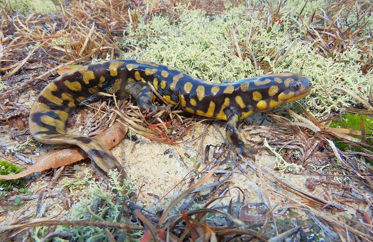
North Carolina’s Weird and Wonderful: Two-Toed Amphiuma

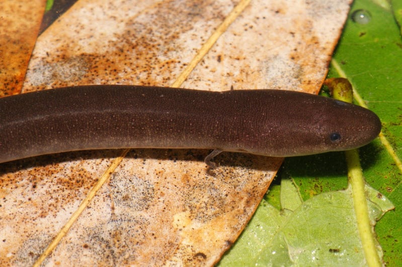
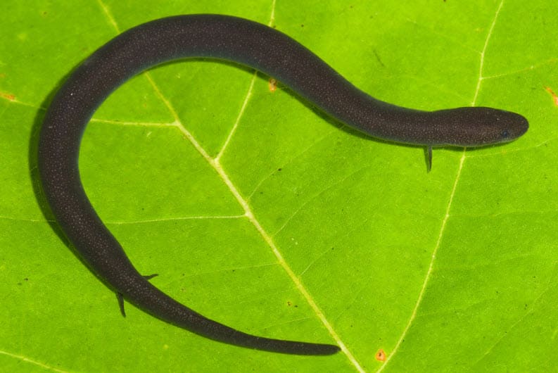
Photograph of Amphiuma means, the two-toed amphiuma, courtesy of Kevin Stohlgren and Amphibians and Reptiles of North Carolina

Well, Halloween is finally upon us. A holiday favorite of mine, tis the season for pumpkin carving, for plastic skeletons arranged in tableaus, and for viewing classic seasonal films. One such film that I enjoy all year round is from 1954, The Creature from the Black Lagoon. One of the original “monster movies” from the midcentury, the story focuses on a group of scientists on an expedition to capture and study a strange creature living in an Amazonian lagoon. What could possibly go wrong? In that spirit, this month’s weird and wonderful focus is on one of North Carolina’s own mysterious, aquatic creatures: the two-toed amphiuma. 

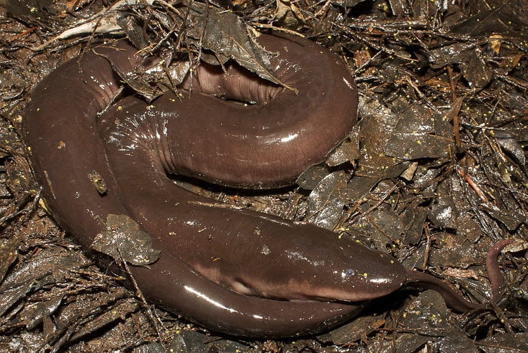
Chances are good that you have never heard of this animal, let alone seen it. It is highly elusive, being primarily nocturnal in nature and occupying shallow ponds, ditches, and abandoned rice fields in the Coastal Plain and adjacent Piedmont regions of the Carolinas. As for what it actually is, well, that is where the weirdness begins. It is an eel-like salamander that has the honor of being North America’s longest amphibian, ranging in size between 18 inches to almost 4 feet in length. This species gets its name from the fact that it has two tiny pairs of legs, each with two tiny toes. Its underside is typically a light gray color, with the top portion being a uniform black, dark gray, or dark brown. 

Photograph of Amphiuma means, the two-toed amphiuma, courtesy of Kevin Stohlgren and Amphibians and Reptiles of North Carolina

Primarily aquatic, it is hypothesized that two-toed amphiumas may travel between wetlands during heavy rains, crossing over land to get from place to place. Seeing a darkly colored, slimy, eel-like creature emerge from a swamp at night in the rain is probably a scary sight, if you don’t know that what you are watching is just your friendly neighborhood amphibian roaming about the landscape. Well, friendly is probably not an apt description; amphiumas are carnivorous and have the sharp teeth necessary for that dietary lifestyle. They may bite defensively if they feel threatened, and the chompers on large adults can cause some serious wounds. So, if you are fortunate enough to see one of these weird and wonderful animals in the wild, it is best to enjoy the view, but do not touch the amphiuma. 

Photograph of Amphiuma means, the two-toed amphiuma, courtesy of Todd Pierson and Amphibians and Reptiles of North Carolina

Herpetologists (scientists who study reptiles and amphibians) do not know a whole lot about two-toed amphiumas. What is known is that females deposit long strings of eggs, ranging anywhere from 10 eggs to over 300, underneath logs, boards, and other objects in moist or wet areas during the winter months. These strings have been described as “rosary-like” and have been found in some unusual places, including alligator nests. Once a female has laid her eggs, she remains with them until they hatch into aquatic larvae around five months later. These tiny larvae are, on average, around 2.2 inches long, and once they transform into the adult stage, they are around 2.75 inches long. The next time you take a stroll through the hardwood forests and pine savannas of North Carolina’s coastal plains, pay attention to any wetlands you see. They just might house our state’s very own creature from the black lagoon. 

USACE APT Tool Temporarily Down: Hurricane Helene Shuts Down the National Centers for Environmental Information Headquarters in Asheville, NC

The recent devastation in Western North Carolina, wrought by Hurricane Helene last month, has had far-reaching consequences. NOAA’s National Centers for Environmental Information (NCEI) headquarters in Asheville have been affected, and as a result of the damage, the data center is shut down. Since the network service provider for the NCEI headquarters is also not functioning, the USACE Antecedent Precipitation Tool (APT) is offline. As a result, wetland delineators and other environmental professionals across the country are unable to access the decades-worth of NOAA data stored on those servers. The U.S. Army Corps of Engineers, in their press release, advises that practitioners “may use the manual procedures described in Chapter 5 of the Regional Supplements to the Corps of Engineers Wetland Delineation Manual and Chapter 19 of NRCS’ Engineering Field Handbook.”

Chapter 5 of the Regional Supplements addresses the challenges of identifying wetlands in difficult situations. Some wetlands lack typical indicators like hydrophytic vegetation, hydric soils, or wetland hydrology due to natural processes or disturbances. This chapter outlines approaches for making wetland determinations in problematic areas and atypical situations, such as those affected by human activities or natural events. It includes guidelines for agricultural and silvicultural lands, problematic vegetation and soils, wetlands that lack hydrology indicators, and wetland/non-wetland mosaics. The procedures emphasize the importance of professional judgment and the use of available data sources to make informed determinations. Field inspectors are encouraged to investigate indicators like volunteer vegetation, undisturbed reference sites, and historical data to determine if wetland conditions exist.

The NRCS Engineering Field Handbook Chapter 19 provides detailed guidance on using hydrology tools for wetland identification and analysis in the Prairie Pothole Region (PPR) states, which include Iowa, Minnesota, North Dakota, and South Dakota. It outlines the procedures to determine lateral effect distances for wetland drainage systems, utilizing data from the National Soil Information System (NASIS). A key component of the chapter is the hydrogeomorphic (HGM) classification system, which categorizes wetlands based on landscape position, water source, and water movement. The handbook emphasizes the importance of accurately assessing these soil types when calculating lateral effect distances, which is critical for proper drainage system planning. Both of these chapters, while providing great supplemental information, are unable to provide historic data on par with that of the APT tool.

We have learned a lot as a result of Hurricane Helene, not the least of which is that climate disasters can happen anywhere, anytime. Bodies of water, even at high elevations, can overflow and devastate local communities, with the added risk of landslides, due to the steep slopes. What we have also learned is that the APT tool, which is used by thousands of environmental professionals, research scientists, and hydrologic engineers across the country, only works when the NCEI servers in Asheville are functioning. Why should people care and pay attention about this, especially when they are struggling to recover and rebuild? Well, the APT tool is crucial for assessing flood risk by considering the amount of precipitation that has fallen over a specific period before a significant weather event. It helps engineers and planners understand the soil’s saturation level, which influences how much additional rain could lead to flooding. By evaluating this antecedent moisture condition, the APT provides better predictive capabilities for water management decisions. This tool is especially important for managing reservoirs, flood control systems, and other water infrastructure. Ultimately, the APT aids in preventing damage from extreme weather events by improving the accuracy of flood forecasting.

Hopefully the above helps people understand why the APT tool is so important. What Hurricane Helene has highlighted is the issue that the APT code is written in such a way that it is hard linked to the NCEI servers: it cannot get NOAA’s data from anywhere else. So this begs the question, is all of that data housed only in Asheville, NC? If so, are there any back-ups, and could the APT tool code be re-written to allow for it to access that back-up data? It seems to me that the APT tool is going to be critical in the coming months and years when it comes to not only redesigning the basic infrastructure, but also to redesigning and rebuilding entire neighborhoods to be more resilient to flood events. It would behoove us all to have the USACE Antecedent Precipitation Tool built back more resilient as well.

North Carolina’s Weird and Wonderful: Little Brown Jug

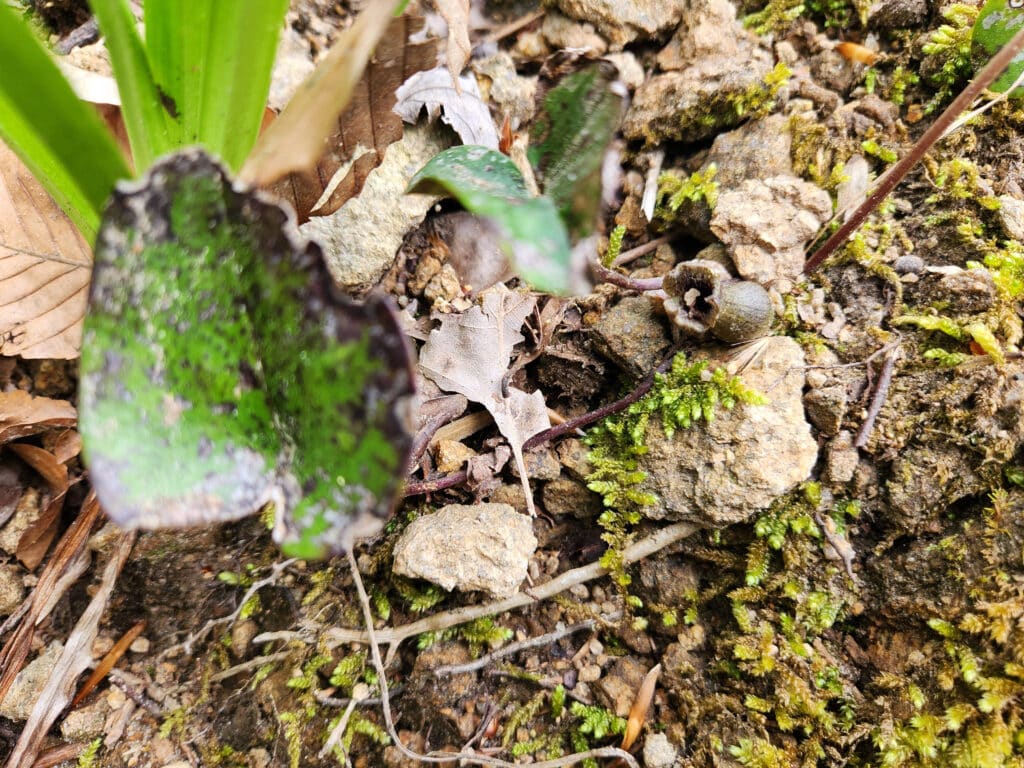
Photograph of a little brown jug plant with one stalk, one leaf, and one flower.

Many gardeners out there are entering their busy season, as fall is the perfect time to install new vegetation in gardens and natural landscapes. Utilizing species native to a particular area and making sure they are the appropriate ecotype of that species is increasing in popularity amongst gardeners. Native plant gardens tend to exhibit large and/or colorful species of flowers, shrubs, and vines, while overlooking some of the less-flashy plants present in our state. One such North Carolina plant is Hexastylis arifolia, otherwise known as the little brown jug. This low-to-the-ground herbaceous perennial is often overlooked on woodland hikes, as the flowers are not particularly eye-catching. Those that notice it may confuse this species with wild ginger, Asarum canadense, which is in the same family, but has deciduous leaves, whereas little brown jug is an evergreen. 

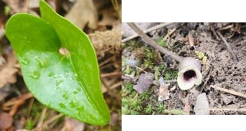
Photographs of the foliage and flower of Hexastylis arifolia by Reina Kornmayer

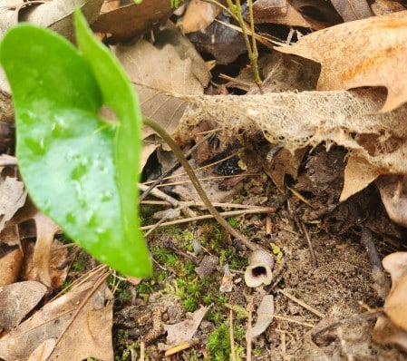
Little brown jug has triangular to arrow-shaped leaves that are leathery in texture and release a spicy odor when torn. This species was used as a ginger substitute by early settlers, and local indigenous tribes used extracts and infusions from the leaves and roots to treat respiratory ailments and heart problems. This plant gets its name from its flowers, which are jugs often hidden beneath the leaf litter due to their short stems and rhizomes. These small, urn-shaped flowers grow to be about an inch long, are in bloom from March through May, and can be brown, green-brown, or purple-brown on the outside and a dark purple-brown on the inside. If the flowers are right at ground level, and they are not brightly colored, how is this species pollinated? Well, that is where the weirdness begins! 

Can you find the jug in the above image? Photograph of Hexastylis arifolia by Reina Kornmayer.

It was previously thought that both the Asarum genus and the Hexastylis genus were pollinated by carrion flies and fungus gnats. On the surface, this makes sense: the flowers of both genera are on the ground and are flesh-colored, matching the preferred foods of those groups of insects. However, research performed on wild ginger, Asarum canadense, since the 1980s has gathered evidence supporting the hypothesis that this species is self-pollinating. Fascinating information, you are probably thinking, but wasn’t this article about the little brown jug, and not its distant relative? Subsequent research on the Hexastylis genera has demonstrated that the distance between their anthers and stigmas in each flower is too great for self-pollination on their own. They need a little assistance, namely an insect one.

While wild ginger does not produce an odor, Hexastylis arifolia releases a very faint odor that resembles rotting flesh. Now, I have personally attempted to smell this odor on little brown jugs in the wild, and it is very hard to detect. You must get your nose at the right spot to smell the mild odor of decay. It is now thought that little brown jugs are pollinated by various species of carrion beetles. This group of beetle species spends its time on the forest floor searching for decaying flesh and poop in which to lay eggs; thus, the flowers of little brown jug would be easy to access. As these species excel at following scent trails to rotting refuse, they can easily locate these flowers. It is hypothesized that, once inside of the flower, the beetles move the pollen from the anther to the stigma while they scramble around, assisting the self-pollination process. So next spring, when you are taking a hike through a North Carolina forest, pay attention to the herbaceous plants along the forest floor. Chances are that the little brown jug is among them, waiting for a beetle to come along and pollinate one of their flowers. That, my friends, is one weird and wonderful plant! 

North Carolina’s Weird and Wonderful: House Centipede

Illustration of house centipede

Here in North Carolina, we experienced a hint of the season to come with a week of pleasantly cool temperatures. If one has been paying attention to store shelves, the news, and social media recently, then it should be apparent that the fall season is being celebrated now. Halloween decor has been for sale for months, and autumnal beverages and foods have premiered at nationwide chains. According to the internet, this trend of celebrating Halloween and fall in the middle of summer is known as “Augtober”. In that spirit, I have decided to write this month’s weird and wonderful blog about a small critter that often elicits screams and thoroughly freaks many people out: the house centipede.

Now, wait a minute, some myriapodologists out there may be saying, the house centipede is not actually native to North Carolina, or even to the North American continent. Yes, you got me. However, since this species has spread throughout the world, and can be readily found in North Carolina homes, I am hoping that you, dear readers of my blogs, will indulge me. Well, if it is not native to the Carolinas, or to North American, where is it from? House centipedes, Scutigera coleoptrata, are thought to be indigenous to the Mediterranean region of the world. Accidentally introduced to the Southeastern U.S., this species is now common throughout the country, and has also spread to Australia, Europe, and Asia. They are still a rare occurrence in the United Kingdom, as a recent BBC article explained.

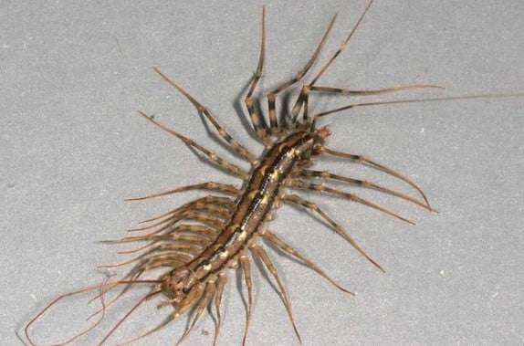
Photo of Scutigera coleoptrata courtesy of The Pennsylvania State University Extension

For some, the house centipedes are the stuff of nightmares. They have a cylindrical body that can be an inch to an inch-and-a-half in length, attached to which are 15 pairs of very slender, banded legs. These pairs of legs increase in length as you progress towards the back end of the animal, with the final pair on adult females being almost twice the length of their body. While most other centipede species lack easily discernable eyes, house centipedes actually have well-developed, faceted eyes. In addition to their unsettling outward appearance, house centipedes are incredibly fast; when people happen upon one, they often witness it scuttling across the floor, looking for a dark, damp place to hide until nightfall. At night, house centipedes hunt small arthropods, including carpet beetles, cockroaches, and silverfish.

Unsettling outward appearance? Check. Seemingly unnatural speed? Check. Predatory? Check. See what I mean about the stuff of nightmares? Take some time to recover from what you have just learned, and then focus on the last sentence of the previous paragraph. House centipedes are hunters, and their prey are common household pests. Thus, while many people have no qualms about squashing this superficially vile creature, others let them live, because they would rather have a home with a guardian house centipede then a home full of cockroaches and silverfish (species which also haunt people’s dreams). House centipedes, weird and wonderful animals that they are, may not be easy on the eye, but you can rest assured knowing that any cockroach that dares cross your threshold will meet a swift end at the hands (well, really prehensors) of a house centipede. Now, granted, if there appears to be a large population of house centipedes in your home, that means there is plenty of food to go around, which in turn means you may have to invest in some pest management against all household arthropods. That unfortunate situation aside, if you happen to come across a house centipede this summer and fall, regain your composure, cease wondering what that sound was that just emerged from your lips, and consider letting it go on its merry way. You never know, it might just have a cockroach to foil.

The North Carolina Salt Marsh Action Plan

Last week we discussed Executive Order No. 305 and how that would, hopefully, lead to more wetland habitats being protected in North Carolina. The North Carolina Salt Marsh Action Plan, or NCSMAP, was briefly mentioned as a positive step forward in preserving, maintaining, and restoring the salt marshes along our state’s coast. Today we are going to delve into NCSMAP, which was released in May of this year. This action plan was initiated by the North Carolina Coastal Federation, or NCCF, as means of developing a guide for how the state could accomplish the goals set out in the South Atlantic Salt Marsh Initiative (SASMI) Plan, which was published in May of 2023. There are approximately 1 million acres of salt marsh in the South Atlantic region, which extends from North Carolina through Florida. This unique ecosystem provides habitat for over 75% of the species important in the fisheries industry, which in turn supports approximately 39,000 jobs. Salt marshes harbor other wildlife species, and, due to their ability to absorb large volumes of water, provide protection from flooding for the communities, military installations, and infrastructure present along the coast.

Despite the clear benefits to having salt marshes, this particular ecosystem is under threat from both sides. On the one side, they are under threat of being destroyed for development; on the other, they are at risk of dying off due to rising sea levels. While the vegetation within this ecosystem can tolerate inundation for long periods, they do require access to air at some point; salt marsh vegetation that is permanently submerged under the sea cannot survive. Thus, the SASMI Plan proposes adaptive measures that can help save this critical habitat, not only for the wildlife, flood control, and water filtration benefits, but for the benefit of the human populations that have called the area home for centuries. One such community is the Gullah/Geechee Nation, which was officially established in 2000 but has a rich history extending back to the 18th century. Their communities are spread along The Gullah Geechee National Heritage Corridor, which stretches from Jacksonville, North Carolina to Jacksonville, Florida. The Gullah/Geechee people’s ancestors were slaves and freedmen who settled in the region, and in 1861 and 1862 they were able to purchase lots of land, ranging in size from 10 to 40 acres. Unfortunately, it is projected that about 25% of the land in this corridor, throughout all four states, will be flooded/inundated due to the rising sea levels.

The SASMI Plan states that tackling sea level rise is outside of their scope, but what is within their scope is determining methods for salt marsh protection and migration that can be implemented, with state and local needs in mind, to keep these 1 million acres intact. Now wait a minute, you may be thinking, did you just say “salt marsh migration“? Yes! One of the strategies that is being proposed is to ensure that salt marshes can shift inland as sea levels rise. If the conditions are right, salt marsh vegetation will migrate inland, or landward, to escape the rising water levels. For this to work there has to be space available into which the salt marsh can move; the slope cannot be too steep; and there cannot be any physical barriers, such as roads, hardened shorelines, and urban areas. The SASMI Plan stresses that, while there are large areas of low-lying inlands along the whole South Atlantic region where the salt marsh can thrive, the migration must be executed carefully in order to avoid impacts to abutting freshwater and estuarine ecosystems and cultural resources. For North Carolina specifically, lower elevations of the northern coastal region offer more potential marsh migration space than the higher elevations of the southern coastal region.

NCSMAP proposes three strategies to protecting the salt marsh ecosystem in the state. Strategy #1 is to preserve what salt marsh areas are already in existence, through conservation and restoration efforts. By minimizing impacts of landward stressors, promoting and advancing their restoration, protection, and conservation, expanding the usage of living shorelines, and facilitating salt marsh research, the salt marsh habitats currently in place will continue and be able to migrate. The second strategy is to facilitate this migration wherever possible through conserving migration corridors and researching and assessing potential areas for migration. In addition, making sure that salt marsh migration is a priority when it comes to infrastructure planning is critical for the survival of the salt marsh. Finally, incorporating crosscutting approaches is the third strategy. This involves more research, pursuing funding, encouraging policy and management adjustments, and, perhaps most importantly, taking the time to communicate, engage with, and educate target communities and audiences. Without public awareness and support, the conservation and protection of the salt marsh ecosystem in North Carolina, and the South Atlantic region as a whole, will not be very effective.

NCSMAP is a great start for protecting salt marsh wetlands in our state, but it is going to take some time before all of these strategies pick up speed. In the meantime, education and community outreach will be the best way to learn about the issues and determine the methods that work for people and nature. Recognizing this, the North Carolina Salt Marsh Steering Committee (SMSC) established a Stakeholder Advisory Panel, consisting of over 100 public and private stakeholders, to provide guidance and feedback on how the actions proposed by SASMI and NCSMAP are doing in our state. By working together, the salt marsh habitats, and all of the natural and cultural resources they contain, can be preserved for years to come.

New Protections for North Carolina Wetlands

Wetland habitats in North Carolina have been getting the short end of the stick lately, what with the North Carolina Farm Act being passed on the heels of the U.S. Supreme Court Sackett V EPA decision. Combined, those two events resulted in a significant number of our state’s wetlands losing legal protection, as explained in our “NC Wetlands at Risk” blog article. Despite these challenges, a glimmer of hope emerged earlier this year when Governor Roy Cooper signed Executive Order No. 305, which outlined new goals to protect and restore natural resources in the state. By 2040, North Carolina public and private partners should work together to 1) permanently conserve 1 million new acres of forest and wetlands; 2) restore 1 million new acres of forests and wetlands; and 3) plant 1 million new trees in urban areas. As Governor Cooper put it, this will “leave our state better than we found it for generations to come.”

As is explained in the executive order, wetlands are much more than dirty, swampy mush-pits. Wetlands provide flood control, wildfire risk reduction, and filtration of water pollutants for our communities. This has become especially important as North Carolina has been getting hit more frequently with high-intensity hurricanes. Coastal wetlands absorb a lot of the force of these storms, and coastal and inland wetlands soak in a ton of water, which decreases flooding. However, as existing wetlands are drained for development and agricultural use, the amount of water that can be absorbed also shrinks, resulting in ever-increasing flood levels. The next time you feel the urge to bulldoze a wetland in order to build a beach house, remember that you will be removing a major form of flood control from that location. Unless the beach house is a houseboat, that decision will probably end poorly for the home’s occupants.

In addition to contributing to flood control in North Carolina, coastal marshes play an important role in our seafood industry. More than 90% of all commercially harvested fishery landings in the state are comprised of species that are dependent upon estuarine ecosystems. In addition, over 60% of fish harvested recreationally are species that need salt marsh habitats to survive. If all of the coastal marsh lands were to go away, North Carolina would lose a significant source of income. The value of these natural spaces is being recognized: in May of this year the North Carolina Salt Marsh Action Plan (NC SMAP) was released. This state plan was enacted in order to ensure that salt marshes would be protected and restored for generations to come.

The good news is, while wetlands in North Carolina are still under siege, more and more people are recognizing the value in letting them stick around. Executive Order No. 305 and NC SMAP are a great start but are hopefully not the end of wetland protections. Spend some time getting to know the wetland habitats in your community, and hit the road to see wetlands across the state, such as the Dismal Swamp State Park, or the Pocosin Lakes National Wildlife Refuge. They might look dark, muddy, and spooky, but they are playing a very important role in making sure North Carolinians thrive for years to come.

North Carolina’s Weird and Wonderful: Green Anole

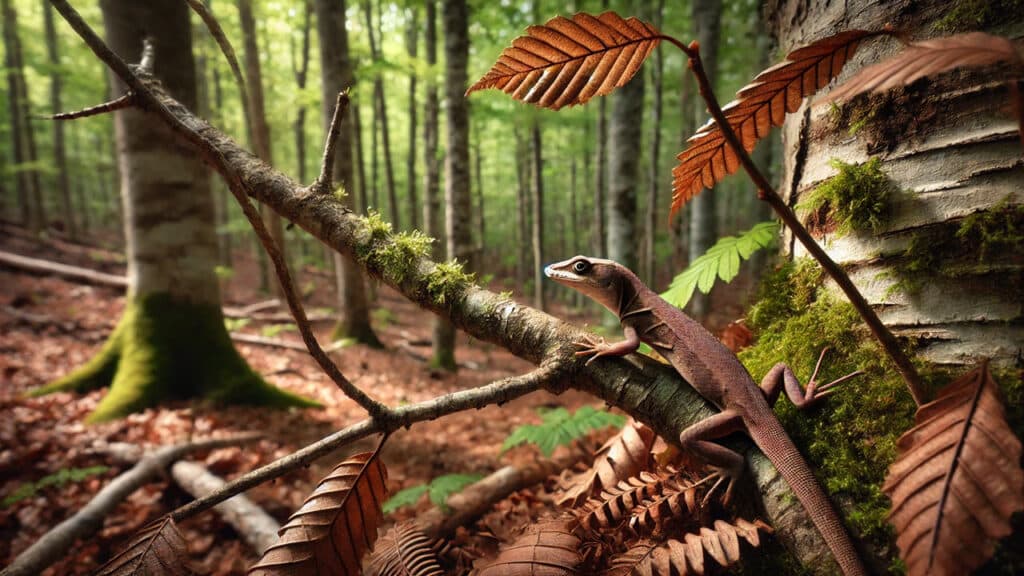
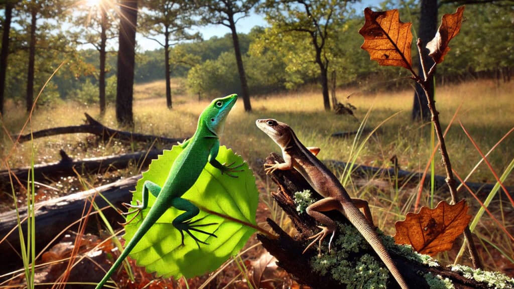
There are eleven lizard species that call North Carolina home. Well, thirteen, if you include the two introduced species, the Mediterranean gecko and the Texas horned lizard. This month’s weird and wonderful focus is on the Green Anole, Anolis carolinensis. This lizard ranges throughout the coastal plain, piedmont, and foothills of the state and can be green, brown, or green and brown in color. Many lizards found in the brown form have a lighter stripe that runs down their back, and a few individuals may even have a crest or ridgeline along their neck and back. Green anoles can be found on the ground, along fences, on structures, and even in trees, as they have sticky toe pads that help their grip.

Males of this species are highly territorial: when approached by a rival, a male green anole will extend his bright pink dewlap, or throat fan, and bob his head up and down. If that is not enough to frighten away the intruder, a fight may ensue. One male’s territory can be as small as 1 cubic meter, but it can overlap with the home ranges of 2 to 3 females, whom he courts by bobbing his head up and down. The sight of a male performing his head bobbing sets off a domino effect of physiological responses in the female, which eventually leads to her laying an egg, one at a time, throughout the spring and summer months. The eggs are laid in shallow depressions of sand, rotting wood, leaf litter, and other similar substrate; when the baby lizards hatch after 7 weeks, they are only around 2 ½ inches long. As the days shorten towards the end of summer, the reproductive organs of both the males and females become smaller in size. Adults and juveniles feast on small invertebrates, such as crickets, grasshoppers, and flies, but nectar has also been recorded as a source of food.

So…green anoles are like any other lizard in North Carolina? Wrong! Take another look at the first paragraph of this post, where it says, “Many lizards found in the brown form…” and mentioned that they can also come in the color green. Green anoles are weird and wonderful because they can change color from bright green to brown and vice versa! They are the only color-changing lizards that we have in our state. Their physiological color change is due to specialized cells called chromatophores. Chromatophores contain pigments and/or nanostructures that, when rearranged, result in a rapid color change. There are many different kinds of chromatophores: green anoles have melanophores, which contain organelles called melanosomes. Melanosomes exclusively hold melanin, and the ones present in dermal melanophores determine the color. Specifically, the larger an area (aka distribution) of melanosomes means more light is absorbed, resulting in a darker color being produced. Alright, so what triggers a green anole to decide to change from one color to another? That is less understood, though we know that temperature can affect how quickly chromatophores can rearrange their internal nanostructures and pigments. Thus, it has been hypothesized that these lizards change colors to control whether they absorb or reflect heat. It has also been suggested that they change color in response to social behavioral cues from other members of their species. Regardless, we North Carolinians are fortunate that these small jewels of the lizard world grace our state.

North Carolina’s Weird and Wonderful: Eastern Screech Owl

Illustration of an eastern screech owl sitting on a fallen log in a forest.

North Carolina is fortunate to have several owl species. Today, we will be discussing the Eastern Screech Owl, Megascops asio. Historically this species has been called many names, among them the Ghost Owl, the Squinch Owl, and Le Petit-Duc De L’est, or the Little Duke of the East, as reported in the beautifully illustrated volume The Owls of North America by Allan W. Eckert and Karl E. Karalus. Whatever you call it, this small, feathered predator weighs, on average, a mere 7.1 ounces and can come in red and gray varieties. Strictly nocturnal, their coloring provides excellent camouflage, making them difficult to spot in the wild, but if you are fortunate enough to catch a glimpse, you might have noticed their distinctive ear tufts. Many people, though, experience these birds’ calls without ever laying eyes on the birds themselves. While Eastern Screech Owls can produce some hair-raising screeches, their common calls are an even-pitched trill, or tremolo, and a shrill, descending whinny. Favoring open forest habitat, these small owls can be just as common in suburban areas as they are in the woods, taking shelter in tree hollows, building cavities, and constructed screech owl boxes.

Illustration of an eastern screech owl sitting in a tree hollow in a forest.

Come February, male owls will court the females with their calls while bobbing and swiveling their head at the same time. A tree hollow is found as the nest site, and the pair will not make any improvements to its condition, adding only the eggs they lay, the remains of food, regurgitated pellets, and droppings. While nests containing a whopping eight eggs have been reported, a female Eastern Screech Owl typically lays a clutch of five over a period of several days in March. Her mate will incubate the eggs while she leaves to drink water; if she is killed and never returns, the male will continue incubating the clutch and raise the baby owls until they are able to fend for themselves. Usually, though, the female does the majority of the incubating, with her mate bringing her food. The chicks, once they hatch, are covered in very fine, snowy white down; by the end of their second day out of the egg, they will begin to shiver uncontrollably, contributing to another moniker for this species, the Shivering Owl. It has been hypothesized that the young birds shiver because their downy fluff is not enough to keep the chill of the outside air out. The shivering lessens and eventually ceases by the end of their second week of life, by which time they are covered in thicker downy plumage that is either red or gray, signaling what color phase the young owls will be. At around four to five weeks old, the young owls begin to leave the nest, hanging out on close by branches and practicing their hunting techniques. By the end of August, the young strike out on their own, establishing their own territories a distance away.

Illustration of three fluffy, baby eastern screech owls in a tree hollow in a forest.

Due to their size, Eastern Screech Owls often fall prey to larger owls, including the Great Horned Owl (aka the Le Grand-Duc de L’est, or the Grand Duke of the East) and the Northern Barred Owl. Occasionally a screech owl may choose a snake for food that is too large, and in the ensuing conflict, the predator may end up becoming the prey. These weird and wonderful owls feast on small rodents, amphibians, and insects, with an occasional fish or aforementioned reptile rounding out their diet. These owls have been seen swooping in to catch moths drawn to streetlights; sadly, many are hit by cars as they dive in front of vehicles to catch prey. Humans are the main threat to Eastern Screech Owls, whether it be through vehicular collisions or through the destruction of habitats. This species of owl does use nesting boxes, so their numbers can be improved through the installation and maintenance of boxes. So, purchase one, or build your own, and set it up in your backyard. You might be fortunate enough to have a family of Eastern Screech Owls move in, serenading you with their tremolos, whinnies, and occasional screeches.

Illustration of a screech owl swooping in on a mouse in the foreground.

North Carolina’s Weird and Wonderful: Eastern Narrow-mouthed Toad

Illustration of several toad species resting on a log by a temporary wetland in a lush forest.

North Carolina is home to many amphibians, but unfortunately for all you Order Caudata fans out there, this article will not be about a salamander (our state is home to over 60 species, making it the place for salamander diversity in the world). No, today we are going to focus on the Eastern Narrow-mouthed toad. This small, somewhat tear-dropped shaped creature more closely resembles a frog: they have smooth, moist skin and lack warts. Their name comes from the tiny, inconspicuous mouth that they have on their small, pointy heads. Narrow-mouthed toads come in a variety of colors, ranging from gray to brown and reddish brown, but all tend to have a lighter-colored band along each side of their body. A fold of skin stretches across the back of their head, putting the finishing touch on these weird little toads.

Close-up photograph of a darker-colored Eastern Narrow-mouthed Toad.

Close-up photo of Gastrophryne carolinensis, Eastern Narrow-mouthed Toad, by Todd Pierson. Courtesy of Herps of NC

Small, plump, and nocturnal, these toads are often hard to spot in the wild, though their call, a nasally, lamb-like bleat, is distinctive. If you are in the Mountain or upper Piedmont regions of the Carolinas and Virginia, you probably will not hear them; but if you travel to the lower Piedmont and the Coastal Plain areas, there is a good chance you will start to hear their call beginning in April and continuing all the way into October. Narrow-mouthed toads (due to their, well, narrow mouths) cannot eat very large prey items. They can, and do, spend their nights feasting on small ants and termites, often being spotted near anthills, if they are spotted at all. Their skin secretions protect them from the ants and, as an added bonus, are also irritating to the eyes and mucous membranes of humans. During the day, these weird and wonderful animals stay put, hiding in moist areas under logs, leaf litter, and rocks.

Close-up photograph of a lighter-colored Eastern Narrow-mouthed Toad.

Close-up photo by Kevin Stohlgren. Courtesy of Herps of NC.

Breeding for this species occurs from April through the fall on warm nights, usually during or after heavy rains. Narrow-mouthed toads tend to gather around temporary wetlands, such as ditches, puddles, and flooded fields. Black-and-white eggs are laid in packets on the water’s surface, with each packet containing around 850 eggs. Once they hatch, the tadpoles will metamorphose into tiny toads in anywhere from three to ten weeks. Narrow-mouthed toads are not an endangered or threatened species in North Carolina; however, they are vulnerable to the same pressures facing other amphibian species in the state. Protecting natural spaces where temporary pools of water can form will aid many amphibians. In order to ensure that the narrow-mouthed toad remains in existence for many years to come, we need to exercise good stewardship of the numerous wetland ecosystems found within our wonderfully species-diverse, amphibian-rich state.

Regulatory Changes and the Future of Wetland Protection in Virginia

The following blog post is a summary of the article State Rolling Back Regulations for Wetland Delineators under Youngkin Directive by Charlie Paullin, published in the Virginia Mercury on April 29, 2024. You can read the original article here.

Image of a wetland alongside a Virginia roadway.

Wetlands along highways and properties, often mistaken for mere puddles or swamps, are significant natural resources that offer a myriad of environmental benefits, such as wildlife habitat and flood protection. These areas are assessed and categorized by professional wetland delineators, specialists who have undergone rigorous training and acquired years of experience to gain certification. However, recent legislative actions in Virginia have sparked concern regarding the potential dilution of these stringent certification standards. Virginia’s legislative body recently amended some requirements for professional wetland delineators, triggering concerns among current professionals about the potential degradation of certification quality. These professionals worry that the changes could undermine efforts to preserve these crucial natural environments, already at risk from various threats. Eli Wright, a notable environmental scientist, emphasized that the existing stringent requirements were essential to ensure high-quality, accurate delineations crucial for maintaining the integrity of wetland boundaries and for regulatory compliance.

Governor Glenn Youngkin has initiated these regulatory changes under Executive Order 19, aiming for a 25% reduction in state regulations. This broader initiative has affected various sectors, including cosmetology licensing and housing and community development standards. The administration argues that these reductions are part of a strategy to streamline regulations, claiming that a thorough economic analysis will precede any regulatory change to ensure the benefits outweigh the costs while maintaining essential public protections. However, these proposed changes have not been universally welcomed. Critics like Mary-Carson Stiff, head of the environmental non-profit Wetlands Watch, argue that reducing certification standards risks the quality of wetland delineations, potentially jeopardizing the environment and regulatory compliance. The legislative adjustments include reducing the required years of experience and educational prerequisites for delineators, a move opposed by many professionals who believe that extensive experience is crucial for accurate wetland identification and navigating the complex regulatory landscape.

Thaddeus J. Kraska, an environmental services director, noted that the variety of wetlands in Virginia, from coastal plains to mountainous terrains, presents unique challenges that require in-depth knowledge and experience to manage effectively. He highlighted that reducing educational and experience requirements could lead to poorer quality delineations, adversely affecting wetland conservation efforts and compliance with environmental regulations. In addition to professional concerns, the regulatory changes have practical implications for the development sector. Following a recent U.S. Supreme Court decision, Virginia’s Department of Environmental Quality has implemented a policy that prioritizes applications accompanied by delineations from certified professionals, emphasizing the importance of maintaining high standards in professional certification to expedite regulatory processes.

Despite some resistance, the Virginia Board of Professional Soil, Wetland Delineators, and Geologists is considering further regulatory reductions. These include modifying the requirements for references in certification applications, which some argue could weaken the mentorship and training aspects essential for high-quality professional development. The stakes are high, as wetlands are not only critical for environmental stability but also for regulatory and development processes. As the climate changes and sea levels rise, the accurate delineation of wetlands becomes increasingly vital. Wetlands are dynamic ecosystems, and their preservation is crucial not just for environmental health but also for reducing legal and financial risks associated with development. The ongoing regulatory changes in Virginia concerning professional wetland delineators are at the center of a significant debate. These changes could potentially lower the barriers to certification, risking the quality of wetland delineation, with far-reaching consequences for environmental protection, regulatory compliance, and development within the state.