The Swamp School WOTUS Rule

Personal Statement: Why We Need the Swamp School WOTUS Rule

As a professional who has dedicated over 40 years to working with wetlands, I have had a front-row seat to the evolution—and at times, the decay—of the WOTUS program. I’ve watched policies shift from stringent federal control to more localized approaches, and I’ve seen the impacts these changes have had on our wetlands and waterways, our communities, and our economy. I’ve worked with landowners who are uncertain about their responsibilities, developers who are frustrated by regulatory delays, and conservationists who are determined to protect our water resources amidst shifting policies. This journey has reinforced my conviction that it is time for us to take matters into our own hands and build a WOTUS framework that is fair, responsible, and sustainable.

Throughout my career, I have witnessed both the strengths and weaknesses of federal oversight. There is no doubt that the Clean Water Act has played a vital role in protecting critical water resources and improving water quality across the country. However, as the regulatory landscape has changed, so too have the complexities and challenges of defining and enforcing WOTUS. Too often, jurisdictional determinations have become bottlenecks, with regulatory uncertainty leading to delays, increased costs, and growing frustration for everyone involved. The current system, while well-intentioned, has become a maze that is difficult to navigate, often leaving landowners, businesses, and environmental professionals at odds over water resources that are vital to all of us.

The Swamp School WOTUS Rule represents a new way forward, one that is rooted in my decades of experience and in the lessons I have learned from working directly with the land and water. This rule acknowledges the critical role of federal protections for key water resources, but it also respects the sovereignty and expertise of states to manage waters that fall outside federal jurisdiction. By reserving isolated, ephemeral, and other local waters for state management, we create a framework that empowers states to act in ways that make sense for their own unique landscapes, communities, and economies.

One of the most critical aspects of the Swamp School WOTUS Rule is the privatized jurisdictional determination process. Over the years, I have come to believe that water resources are best understood by those who have specialized training and on-the-ground experience. That’s why this rule calls for Certified WOTUS Determination Professionals (CWDPs) to lead the jurisdictional determination process. These trained professionals will make responsible, accurate, and timely determinations based on consistent criteria, backed by both federal and state oversight. By empowering certified professionals to assess jurisdiction, we streamline the process, reduce delays, and ensure that decisions are informed by real-world expertise.

I am also a firm believer in the principles of cooperative federalism, which have been woven into the very fabric of the Clean Water Act since its inception. The Swamp School WOTUS Rule builds on these principles by creating a partnership between federal agencies and the states, and between certified professionals and government regulators. This collaborative approach will give rise to a more efficient, accountable, and responsive WOTUS program that serves the needs of all Americans.

For me, the Swamp School WOTUS Rule is not just another regulation; it is a culmination of my life’s work and a commitment to the sustainable stewardship of our water resources. It’s a blueprint for a balanced approach that protects our most critical waters, respects the rights of states, and empowers trained professionals to do what they do best. This rule reflects decades of knowledge, and it embodies a vision for the future that is fair, sustainable, and grounded in the belief that effective water management must be practical, science-based, and adaptable to our changing world.

Of course, as much as I’d like to think we could officially call it the Swamp School WOTUS Rule, I’m pretty sure the powers-that-be will come up with something a little less colorful! I can almost hear it now: “The Clean Waters Collaborative Determination Act” or maybe “The Federated Waters Determination Framework.” But whatever name they choose, the heart of the rule will remain the same—protecting our water resources in a way that’s both responsible and sustainable. And hey, as long as they remember where it came from, they can call it whatever they like!

In closing, my hope is that the Swamp School WOTUS Rule will help foster a new era of water management—one that can evolve with the times while remaining steadfast in its commitment to responsible stewardship. This is more than a policy; it’s a promise to future generations that we are committed to protecting our waters with integrity, respect, and a deep understanding of their vital role in our lives. – Marc Seelinger, SPWS

The Swamp School WOTUS Rule

Purpose: The Swamp School WOTUS Rule offers a comprehensive and efficient approach to defining Waters of the United States (WOTUS), balancing federal oversight with enhanced state autonomy. It privatizes the jurisdictional determination process through a certification program for professionals authorized to assess water bodies as either federally or state-regulated. This rule focuses federal jurisdiction on waters essential to interstate commerce and environmental health, while empowering states to manage other water resources through state-specific programs.


Key Provisions of the Swamp School WOTUS Rule

1. Jurisdictional Waters Under Federal Authority

The rule focuses federal jurisdiction on water bodies with continuous, significant connections to traditional navigable waters (TNWs). These core water resources are critical for interstate commerce and ecological connectivity, making them subject to federal oversight under the Clean Water Act.

  • Traditional Navigable Waters (TNWs): Large rivers, lakes, bays, and tidal waters that are currently or historically used in interstate or foreign commerce.
  • Interstate Waters: Waters crossing or forming state boundaries with continuous surface connections to TNWs.
  • Relatively Permanent Tributaries: Perennial or intermittent streams, rivers, and other natural channels that flow into TNWs or interstate waters.
  • Adjacent Wetlands with Continuous Surface Connections: Wetlands directly abutting TNWs or relatively permanent tributaries, without natural or artificial barriers.
  • Impoundments of Jurisdictional Waters: Dams, reservoirs, or other impoundments that maintain a direct hydrological connection to a jurisdictional water.

2. Non-Jurisdictional Waters Reserved for State Management

Certain waters that do not meet federal criteria fall under state jurisdiction. States are empowered to manage these waters according to local priorities, creating unique regulations and programs tailored to specific environmental and economic needs. State jurisdiction covers:

  • Ephemeral Streams and Temporary Channels: Features that flow only after rainfall and lack continuous flow to TNWs.
  • Isolated Wetlands and Non-Continuous Interstate Waters: Wetlands without direct surface connections to TNWs or other jurisdictional waters.
  • Ditches and Man-Made Water Features Not Functioning as WOTUS: Non-navigable ditches, canals, and artificial features disconnected from WOTUS.
  • Groundwater: All groundwater remains outside the scope of federal jurisdiction.
  • Prior Converted Cropland and Certain Artificial Water Bodies: Agricultural lands and water bodies, such as irrigation ponds, disconnected from jurisdictional waters.

3. Certified WOTUS Determination Professionals (CWDPs) for Federal Determinations

The Swamp School WOTUS Rule establishes a privatized jurisdictional determination process through a network of Certified WOTUS Determination Professionals (CWDPs). CWDPs are authorized to conduct official WOTUS determinations and to classify water features as either federally regulated or state-regulated, based on the Swamp School WOTUS Rule.

  • Certification Process:
    • CWDPs complete rigorous training in federal WOTUS standards, hydrology, wetland science, and water law.
    • Certification requires passing a written exam and completing a field practicum demonstrating real-world skills in assessing water features.
    • Certified professionals must maintain credentials through continuing education to stay current with updates in regulation and environmental science.
  • Authority and Oversight:
    • CWDPs’ determinations are binding and subject to periodic review by the EPA and the U.S. Army Corps of Engineers for quality assurance.
    • Determinations are documented in reports that include data, maps, and justification, ensuring transparency and consistency.
  • Transparency and Documentation: CWDPs submit detailed determination reports accessible to federal and state agencies, providing accountability and clarity for stakeholders.

4. State Jurisdictional Determination Program

In addition to the federal determination program, the Swamp School WOTUS Rule establishes a State Jurisdictional Determination Program. Under this system, each state has its own certification and licensing requirements for professionals conducting state-level jurisdictional determinations, similar to professional licensing in fields like law or medicine. This program ensures that individuals working in a particular state are qualified to make jurisdictional determinations in alignment with state-specific water management standards.

  • State-Specific Certification:
    • Each state will develop its own certification program for jurisdictional determinations, with specific training and licensure requirements tailored to regional priorities.
    • State-certified professionals must meet standards similar to CWDPs, with state-administered exams and field practicums relevant to local hydrology and environmental considerations.
    • Continuing education will be required to maintain state certification, ensuring that professionals remain knowledgeable about both state and federal changes.
  • Distinct Licensing Requirements: State-certified professionals will be licensed in their respective states, much like attorneys, to ensure they have in-depth knowledge of regional water management standards, ecosystems, and regulatory frameworks.
  • Collaborative Standards and Support: Federal agencies will provide resources and technical support to help states establish and maintain rigorous certification programs, promoting consistency and high standards nationwide.

5. Federal Oversight and Cooperative Federalism

The Swamp School WOTUS Rule emphasizes cooperative federalism, recognizing that water management is best achieved through collaboration between federal, state, and private sectors. Federal agencies support the certified professional network and work alongside states to maintain consistent, high standards in water resource management.

  • Federal Guidance and Resources: The EPA and Army Corps of Engineers will provide training materials, tools, and technical resources to support CWDPs and state certification programs.
  • Grant Programs for State Initiatives: States can apply for federal grants to support water management projects, including conservation, restoration, and water quality initiatives.
  • Interstate Collaboration: For shared water resources, federal agencies will facilitate cooperation between states, helping to harmonize water quality standards and regulatory approaches.

Benefits of The Swamp School WOTUS Rule

  1. Enhanced Efficiency and Consistency: By delegating jurisdictional determinations to certified professionals, the rule accelerates decision-making and reduces regulatory bottlenecks, benefiting landowners, developers, and conservationists.
  2. Increased Professional Accountability: Certified WOTUS Determination Professionals (CWDPs) and state-certified professionals bring high levels of expertise and accountability, ensuring reliable and accurate water assessments nationwide.
  3. Empowered State Management and Local Control: States gain primary responsibility over non-jurisdictional waters, allowing them to regulate based on regional needs and priorities, fostering innovation in water management.
  4. Transparent and Predictable Process: The rule creates a clear, predictable process for determining jurisdiction, with transparent documentation and accessible reports, which benefit all stakeholders by reducing uncertainty.
  5. Balanced Federal Protection for Key Waters: Federal jurisdiction is focused on core water resources that impact interstate commerce, downstream health, and ecological stability, while states retain autonomy over isolated and ephemeral waters.

Conclusion: A Balanced and Modern Approach to Water Management

The Swamp School WOTUS Rule represents a forward-thinking solution to defining Waters of the United States, blending federal protections with state rights and privatizing the jurisdictional determination process to increase efficiency and accuracy. By empowering a network of certified professionals and recognizing state-specific licensing, this rule fosters a cooperative approach that respects both national interests and local autonomy. It is a sustainable, balanced framework designed to ensure the protection and responsible management of America’s water resources, addressing the needs of today while paving the way for future generations.

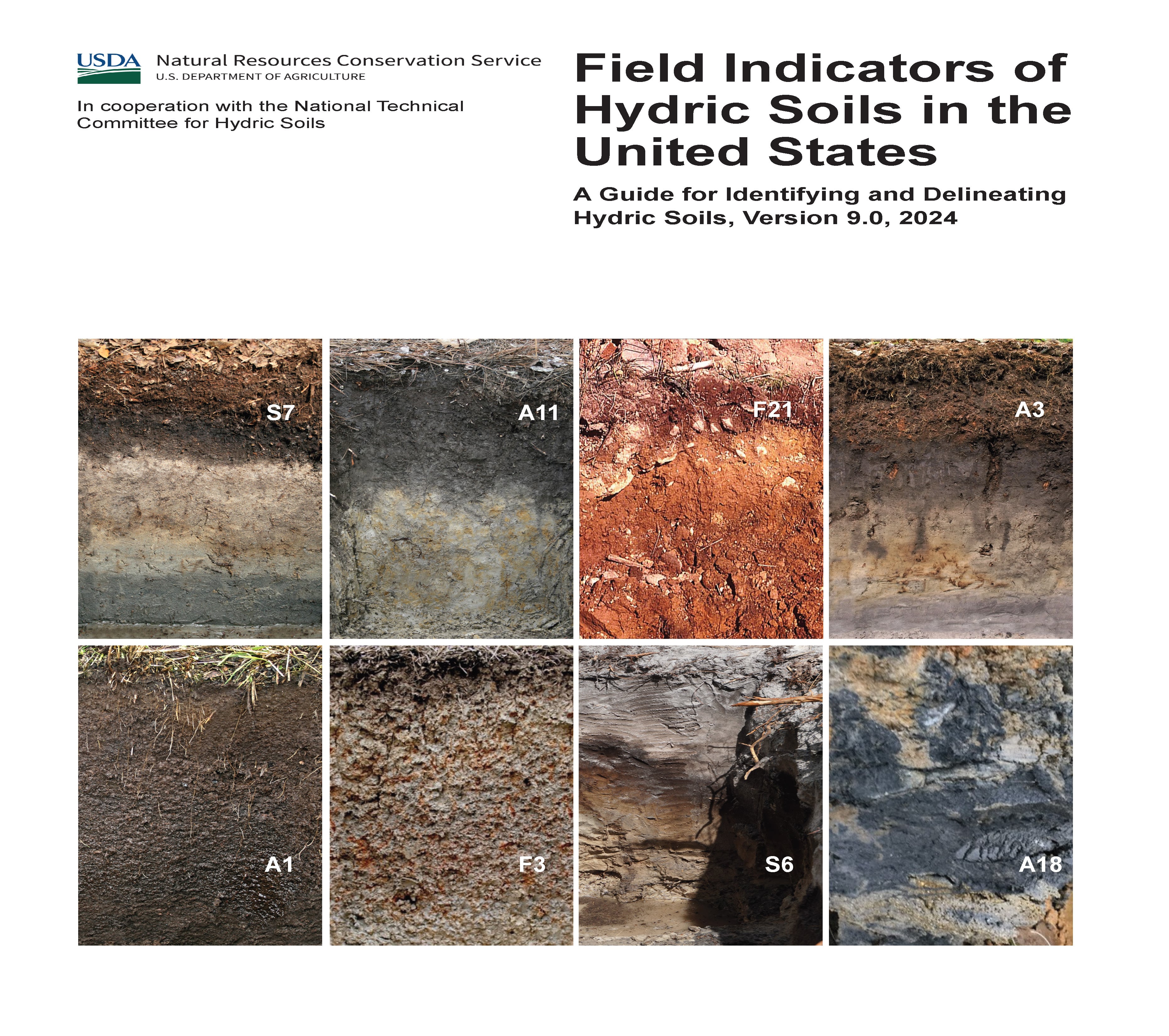
Announcing the Latest Edition of Field Indicators of Hydric Soils in the United States: A Guide for Identifying and Delineating Hydric Soils – Version 9.0

book cover

The Field Indicators of Hydric Soils in the United States guide has been an essential resource for scientists, environmental consultants, and land managers who work to identify and preserve wetlands. Now, with the release of Version 9.0, the USDA’s Natural Resources Conservation Service (NRCS) and the National Technical Committee for Hydric Soils (NTCHS) have expanded and refined this resource, updating essential definitions, indicators, and methodologies. This new edition builds on Version 8.2, introducing new region-specific indicators, refined guidelines for identifying hydric soil features, and some adjustments to the thickness requirements for certain indicators, making it a comprehensive tool for accurate hydric soil identification across the U.S.

Key Enhancements in Version 9.0

Hydric soils play a critical role in wetland ecosystems, serving as indicators of saturated conditions essential for wetland health and biodiversity. The new Version 9.0 introduces essential updates that will improve the accuracy of hydric soil identification, from defining region-specific indicators to refining measurement requirements for certain soil features.

1. Introduction of New Field Indicators for Diverse Regions

The guide has introduced new hydric soil indicators tailored to specific ecological regions, enhancing accuracy in previously challenging areas. For instance, the Alaska Gleyed Pores indicator helps address the unique characteristics of cold-region soils, where gleyed matrix colors occur prominently along root channels and pore linings, essential for identifying anaerobic conditions in these climates. With similar additions for areas with sandy, loamy, and clayey soils, the guide allows scientists to make more reliable hydric soil classifications nationwide.

2. Changes to Feature Thickness Requirements

Version 9.0 includes important updates to the minimum thickness requirements for certain hydric soil indicators. These adjustments aim to better align field practice with evolving soil science research, allowing for more nuanced identification of wetland boundaries. For example, indicators like the Depleted Matrix now include modified minimum thicknesses based on specific depth criteria, improving accuracy for areas with marginal wetland conditions. Such changes enable more precise documentation of soil properties and ensure that professionals can account for subtle variations in hydric soil features across different soil types and landscapes.

3. Expanded Guidelines for Recognizing Redoximorphic Features

Redoximorphic features—characteristics indicating soil areas with fluctuating aerobic and anaerobic states—are essential in defining hydric soils. In this latest edition, redoximorphic guidance is enhanced, particularly for sandy and loamy soils. The new definitions cover specific traits of redox concentrations and depletions, such as iron-manganese masses and gleyed matrices, offering field professionals an improved framework for distinguishing between true hydric soil features and naturally occurring soil variations in complex landscapes.

4. Elimination of Outdated Test Indicators

A major update n Version 9.0 is the elimination of outdated test indicators. Previously, some indicators were included on a trial basis to assess their effectiveness in field identification. These test indicators have now been removed, streamlining the guide and allowing users to focus on scientifically validated indicators that provide reliable results. Concepts from retired indicators, such as Vernal Pools, have been integrated into existing indicators like the Depleted Matrix, enhancing these primary indicators without redundant or untested methods. This change ensures that each indicator in the guide meets rigorous standards, improving overall reliability and usability.

5. Integrated Indicators for Simplicity and Efficiency

Several indicators have been retired in this edition, but their key concepts have been consolidated into other indicators to reduce redundancy. For instance, the concepts previously captured in the Vernal Pools indicator now enhance the Depleted Matrix indicator, making it a more versatile tool for wetland delineation. Similarly, other retired indicators have been merged, keeping the guide efficient and accessible while still scientifically rigorous.

6. Revised Appendices and Glossary for Greater Accessibility

Version 9.0 includes a thoroughly updated glossary and appendices that make it easier for users to apply the guide in specific regions. Expanded definitions cover terms like “gleyed matrix,” “anaerobic conditions,” and “organic bodies,” making the guide more accessible to those new to soil science and field identification. In addition, the appendices now provide a consolidated list of approved indicators organized by Land Resource Regions (LRRs) and Major Land Resource Areas (MLRAs), supporting rapid reference for professionals working in various geographic areas.

Why These Updates Matter for Wetland Management

Identifying hydric soils accurately is essential for maintaining and protecting wetland ecosystems, which serve critical functions in water purification, flood control, and biodiversity preservation. The enhancements in Version 9.0, from modified thickness requirements to expanded redoximorphic feature descriptions, provide environmental consultants, regulators, and wetland scientists with the precision needed to navigate these complex landscapes accurately. Improved indicators for specific regions, like coastal, floodplain, and cold environments, make it easier to manage wetlands under diverse climate and soil conditions.

Practical Applications for Field Professionals

With its focus on detail and accuracy, Version 9.0 offers practical benefits for those conducting soil identification and wetland delineation:

  • Land Development Compliance: Accurate soil classification helps ensure that projects comply with the Clean Water Act (CWA) and other regulations, reducing the risk of costly misclassifications.
  • Restoration and Conservation Efforts: Wetland scientists can apply region-specific indicators and adjusted thickness requirements to design effective conservation and restoration projects, especially in fragile ecosystems like floodplains and coastal areas.
  • Agricultural Land Use: Farmers and agricultural consultants can leverage this updated resource to make informed decisions about hydric soil management, supporting sustainable practices that protect adjacent wetland areas.

Accessing and Using Version 9.0

The Field Indicators of Hydric Soils Version 9.0 is available through the NRCS Distribution Center and on the NRCS website. With this latest edition, professionals have access to cutting-edge tools that support not only accurate soil identification but also sustainable environmental management practices. By integrating the advancements in Version 9.0, field practitioners can confidently approach the intricacies of hydric soil identification, contributing to the protection and sustainability of wetland ecosystems across the United States.

This update ensures that wetland delineation remains a robust science, meeting the challenges posed by changing climates and evolving ecosystems. With Version 9.0 in hand, environmental professionals are now better equipped than ever to work at the forefront of soil science and wetland conservation.

Navigating the Aftermath: What Happens When a Major Storm Destroys a Permitted Stream Mitigation Site

In the wake of a major storm, the challenges faced by wetland and stream mitigation companies can be overwhelming. When these natural events cause significant damage to a permitted mitigation site, the ramifications go beyond just the physical destruction. Companies must navigate complex regulatory obligations under the U.S. Army Corps of Engineers (USACE) compensatory mitigation regulations, which remain in effect despite the unpredictable forces of nature. This blog post explores the key considerations and responsibilities for mitigation companies in the aftermath of such an event and outlines the steps required to stay compliant and protect both environmental and financial interests.

Continued Responsibility for Mitigation Success

One of the most critical aspects of the 2008 Compensatory Mitigation Rule is that it holds the permittee responsible for ensuring the long-term success of the compensatory mitigation project, regardless of external factors such as natural disasters. This means that even after a major storm destroys a mitigation site, the company must ensure that the site still meets the intended ecological functions and complies with performance standards over the specified monitoring period. In practice, this means that simply blaming the storm for the destruction is not enough. The mitigation company must still ensure that the site recovers or that alternative actions are taken to restore its ecological value. This responsibility includes making sure that the site provides the necessary environmental services, such as water quality improvement, habitat provision, and flood control, as outlined in the original permit. Failure to meet these performance standards, even due to natural causes, can result in serious consequences, including legal and financial penalties. For this reason, companies must be prepared to respond quickly and effectively when a storm strikes.

Implementation of Remedial Actions

When a storm destroys a mitigation site, companies must act swiftly to implement remedial actions. The USACE expects permittees to address any deficiencies and restore the site to meet the original objectives outlined in the mitigation plan. There are several potential avenues for remediation, depending on the extent of the damage.

Site Reconstruction

The first and most obvious step is to rebuild or restore the damaged areas of the mitigation site. This may involve re-grading stream banks, replanting vegetation, or reconstructing wetlands to ensure they meet the ecological standards originally required. In many cases, physical restoration is the most direct way to return the site to its intended function. However, site reconstruction is not always straightforward. It can be time-consuming and costly, particularly if the damage is extensive. Companies must also be mindful of how rebuilding efforts align with the original mitigation goals, ensuring that the restored site provides the same ecological benefits as before.

Additional Mitigation

If it is not feasible to fully restore the original site, the company may need to provide supplementary mitigation at an alternative location. This is often referred to as “off-site mitigation.” While it can be a valuable way to meet regulatory requirements when on-site remediation isn’t possible, it presents its own challenges. Additional mitigation must still meet the same rigorous standards of performance and provide comparable ecological benefits to the original project.

Adaptive Management

Another option is adaptive management, which allows for modifications to the mitigation plan in response to changing conditions. After a storm, the ecological landscape may shift, making it difficult to implement the original plan. In such cases, the USACE allows permittees to adjust their strategies while still working towards the overall ecological goals of the project. For example, if erosion caused by a storm has significantly altered a stream channel, the mitigation plan may be adapted to stabilize the new channel rather than attempt to restore it to its pre-storm condition. Adaptive management offers flexibility, but it still requires careful planning and regulatory approval to ensure compliance.

Force Majeure Considerations

While natural disasters like storms are often considered “acts of God,” the USACE does not automatically exempt permittees from their obligations due to such events. Instead, the USACE expects companies to demonstrate due diligence in their mitigation efforts and work closely with regulatory agencies to develop a remediation plan.

Demonstrating Due Diligence

In the context of a storm-damaged mitigation site, due diligence means showing that the company took reasonable steps both before and after the storm to prevent or mitigate damage. For example, was the site designed with resilience to extreme weather events in mind? Did the company act quickly after the storm to assess the damage and begin remediation efforts? By demonstrating that they took proactive measures, companies can improve their standing with regulatory agencies and potentially reduce the risk of penalties.

Engaging with Regulatory Agencies

Open communication with the USACE is essential. Companies must promptly notify the agency of any damage to the mitigation site and work collaboratively to develop an acceptable plan for remediation. This may include updating the mitigation plan to reflect post-storm conditions or requesting modifications to the permit.

Monitoring and Reporting Requirements

Even after a disaster, mitigation companies are still required to meet all monitoring and reporting requirements. In the aftermath of a storm, monitoring should focus on documenting the impact of the storm on the mitigation site and evaluating the effectiveness of any remedial actions. This data will be crucial in demonstrating compliance and showing that the company is actively working to restore the site. Regular updates to the USACE, including detailed reports on the status of the site and any remediation efforts, are vital for maintaining compliance and avoiding enforcement actions.

Financial Assurances

Many mitigation projects require financial assurances, such as performance bonds or escrow accounts, to ensure that there are funds available for restoration in the event of unforeseen issues, including natural disasters. If a storm destroys a site, these financial assurances can be used to fund the necessary remediation efforts. However, failure to adequately restore the site can result in the forfeiture of these assurances, leaving the company financially responsible for completing the restoration without the benefit of the secured funds.

Potential Permit Modifications

In some cases, the USACE may allow for modifications to the permit in response to the storm. This can include extending deadlines to give the company more time to achieve performance standards or adjusting the success criteria to reflect new site conditions. If on-site restoration is no longer feasible, the agency may also approve alternative mitigation options. However, permit modifications are not guaranteed and will require strong justification from the company.

Liability and Enforcement Actions

Failure to adequately address the destruction of a mitigation site can lead to significant legal and financial consequences. The USACE may determine that the company is in violation of its permit conditions, resulting in administrative penalties, fines, or even the suspension or revocation of the permit. This can have long-term impacts on the company’s ability to secure future permits.

Stakeholder Communication

Finally, maintaining open communication with stakeholders, including regulatory agencies, local communities, and clients, is crucial for managing the company’s reputation. Proactive communication can help build trust and foster collaboration, making it easier to navigate the regulatory landscape in the wake of a disaster.

Conclusion

When a major storm destroys a permitted stream mitigation site, the responsibilities of wetland and stream mitigation companies are far from over. The USACE’s compensatory mitigation regulations ensure that companies remain accountable for restoring the site or finding alternative mitigation solutions. By taking proactive steps, demonstrating due diligence, and maintaining open communication with regulatory agencies, companies can successfully navigate these challenges while fulfilling their environmental obligations.

Transforming Wetland Delineation: The Power of AI and Chat Assistants

Wetlands are some of the most ecologically significant and sensitive habitats on Earth. They provide essential services such as water filtration, flood protection, and habitat for countless species. However, their complexity and the dynamic nature of wetland ecosystems pose significant challenges for environmental consultants tasked with delineating and assessing these areas. Traditional methods of wetland delineation, while effective, are often labor-intensive, time-consuming, and subject to human error. Enter artificial intelligence (AI) and chat assistants—technologies that promise to revolutionize wetland delineation by enhancing accuracy, efficiency, and accessibility.

The Role of AI in Environmental Consulting

Artificial intelligence has made significant strides in various fields, and environmental consulting is no exception. AI systems excel at processing vast amounts of data quickly and accurately, identifying patterns, and making predictions that can significantly aid decision-making processes. In the context of wetland delineation, AI can be utilized in several ways:

  1. Data Analysis:
    • AI can process large datasets, such as satellite imagery, soil samples, and hydrological data, to identify wetland boundaries and characteristics with high precision. Machine learning algorithms can be trained to recognize specific features and indicators of wetlands, reducing the time required for manual analysis.
  2. Predictive Modeling:
    • AI models can forecast environmental changes based on historical data, helping consultants anticipate how wetlands might evolve under different scenarios. This capability is particularly useful for understanding the impacts of climate change, land use changes, and water management practices on wetland ecosystems.
  3. Automation:
    • Many of the repetitive and routine tasks involved in wetland delineation, such as data entry and initial assessments, can be automated using AI. This automation not only speeds up the process but also minimizes the risk of human error.

Practical Applications of AI in Wetland Delineation

AI applications in wetland delineation are diverse and powerful. Here are a few examples:

  • Species Identification: Using AI to recognize plant and animal species from images is a game-changer. Models trained on large datasets of labeled images can accurately identify species based on features such as shape, color, and texture. This capability is invaluable for monitoring biodiversity and detecting the presence of rare or endangered species within wetlands.
  • Habitat Suitability Analysis: AI can analyze environmental variables such as soil type, water availability, and temperature to predict suitable habitats for different species. This analysis helps in planning conservation efforts and ensuring that habitats are protected and managed effectively.
  • Climate Impact Modeling: Predicting how climate change will affect wetland ecosystems is critical for developing adaptive management strategies. AI models can integrate various climatic and environmental factors to forecast changes in wetland areas, helping policymakers and conservationists make informed decisions.

Introduction to Chat Assistants in Environmental Consulting

Chat assistants, or chatbots, leverage natural language processing (NLP) to interact with users in a conversational manner. These AI-powered tools can provide quick answers to common questions, assist with data entry, and perform initial analyses, making complex AI models more accessible.

How Chat Assistants Work:

  • Natural Language Processing (NLP): Chat assistants use NLP to understand and respond to human language, allowing users to interact with AI models without needing to know technical details. This interaction simplifies the process of obtaining information and insights from AI systems.
  • User Interaction: By providing a user-friendly interface, chat assistants make it easy for users to input data, ask questions, and receive detailed responses. This ease of use is particularly beneficial for environmental consultants who may not have extensive technical backgrounds.

Applications in Environmental Consulting:

  • Customer Support: Chat assistants can answer frequently asked questions about environmental regulations, project timelines, and data requirements, providing quick and accurate responses to clients and stakeholders.
  • Data Collection: Guiding users through the process of entering environmental data ensures that information is collected correctly and consistently. Chat assistants can standardize data entry, reducing variability and improving data quality.
  • Preliminary Analysis: Performing initial assessments based on user inputs allows chat assistants to provide quick insights and recommendations, helping consultants prioritize tasks and focus on more complex analyses.

The Importance of Prompt Engineering

Prompt engineering is the process of designing prompts to effectively communicate with AI models. In wetland delineation, this involves creating specific instructions or questions that guide the AI to provide relevant and accurate responses.

Key Aspects of Prompt Engineering:

  • Designing Effective Prompts: Prompts must be clear, concise, and contextually relevant to ensure the AI model understands the specific task at hand. For instance, a prompt like “Analyze the soil data and classify the area as wetland or non-wetland” directs the AI to focus on relevant soil characteristics.
  • Contextual Awareness: The AI model must understand the context of wetland delineation, including the specific indicators of wetlands and the regulatory criteria used to classify these areas. This contextual awareness is achieved through training the model on relevant datasets and continuously refining the prompts.
  • Iterative Process: Prompt engineering is an iterative process where prompts are tested and refined based on the AI’s performance. This continuous improvement ensures that the model’s responses become more accurate and relevant over time.

Example Prompts:

  • Data Input: “Based on the following soil sample data, is this area classified as a wetland?”
  • Species Identification: “Identify the plant species in this image and determine if it is a wetland indicator species.”
  • Predictive Modeling: “Predict the impact of a 10% increase in rainfall on the wetland area over the next year.”

Case Study: Everglades Water Management

The Everglades, a vast and complex wetland ecosystem in southern Florida, presents a unique set of challenges for water management. Traditional methods often struggle to predict the complex interactions between hydrology and ecology. To address this, an AI model named was developed to simulate various water management scenarios using historical data on precipitation, water flow, and ecological responses.

How it Works:

  1. Data Collection and Preparation: The Ai gathers data from weather stations, hydrological sensors, and ecological surveys. This data is cleaned and preprocessed to ensure accuracy and consistency.
  2. Machine Learning Algorithms: The Ai employs supervised learning, neural networks, random forests, and support vector machines (SVM) to model complex relationships and make robust predictions.
  3. Training the AI Model: The training process involves splitting the data into training and testing sets, performing feature engineering, and iterating on the model to optimize performance.
  4. Running Simulations: Managers input scenarios such as changes in rainfall patterns or water release schedules, and the Ai simulates the impact on the ecosystem, including predicting water levels, flood risks, and habitat conditions.
  5. Insights and Decision Support: The Ai provides detailed reports on the predicted outcomes, helping managers make informed decisions that balance ecological and human needs.

Results and Insights: The Ai’s simulations have proven invaluable in optimizing water flow, improving habitat conditions for wildlife, and ensuring sustainable water use. By identifying optimal water release schedules and predicting potential flooding or drought conditions, Ai helps manage the delicate balance of the Everglades ecosystem.

Benefits and Challenges of AI in Wetland Delineation

While AI and chat assistants offer numerous benefits, there are also challenges to consider.

Benefits:

  • Increased Efficiency: Automating data analysis and routine tasks saves time and resources.
  • Improved Accuracy: AI models can process large datasets and identify patterns that might be missed by human analysts.
  • Scalability: AI systems can handle large volumes of data, making them suitable for extensive project areas.
  • Enhanced Decision-Making: AI provides data-driven insights that support informed decision-making.

Challenges:

  • Data Quality: The accuracy of AI models depends on the quality and completeness of the data.
  • Complexity: Developing and maintaining AI models requires technical expertise.
  • Cost: Implementing AI solutions can involve significant initial investment.
  • Ethical Considerations: Ensuring that AI systems are transparent and do not reinforce biases is crucial.

Join Our Webinar to Learn More

To delve deeper into these topics and explore how AI and chat assistants can transform wetland delineation, join our webinar on August 29, 2024, at 1 PM ET. This 90-minute session will provide valuable insights, practical applications, and a live demonstration of AI in action. Don’t miss this opportunity to stay ahead in the rapidly evolving field of environmental consulting. Register now to secure your spot.

For more details and/or to register, visit our Webinar Registration Page.

Understanding Jurisdictional Determinations: Pipes and Swales as Continuous Surface Connections

Background

The U.S. Environmental Protection Agency (EPA) and the Office of the Assistant Secretary of the Army for Civil Works (OASACW) recently issued a joint memorandum addressing the jurisdictional determination (JD) for NAP-2023-01223. This memorandum clarifies the criteria for wetlands to be considered “waters of the United States” (WOTUS) under the Clean Water Act (CWA), following the Supreme Court decision in Sackett v. EPA. This decision is pivotal in determining when wetlands are jurisdictional, requiring a continuous surface connection to navigable waters or other recognized WOTUS.

Summary

The joint memorandum returned the draft approved JD to the Philadelphia District for revisions, ensuring alignment with the Supreme Court’s Sackett decision. The Sackett ruling specifies that wetlands must have a continuous surface connection to waters recognized as WOTUS to fall under CWA protection. This blog post will delve into the critical role of pipes and swales in maintaining this continuous surface connection, thus impacting the jurisdictional status of wetlands.

Assessment of Adjacent Wetlands Consistent with Sackett

The Sackett decision mandates that adjacent wetlands must have a continuous surface connection with traditionally navigable waters or other WOTUS. This standard, first established in the Rapanos plurality opinion, does not require the wetlands and waters to be visually indistinguishable but emphasizes a clear, physical connection. It is important to note that the term “indistinguishable” in this context does not imply a visual similarity; instead, it refers to the physical and hydrologic connection that allows the wetland to function as part of the broader aquatic ecosystem.

Pipes as Continuous Surface Connections

Context and Application

Infrastructure Role: Pipes and culverts are essential for maintaining hydrologic connectivity across roadways, preventing flooding and erosion. They ensure a continuous flow of water between aquatic resources on either side of the road.

Jurisdictional Determination: During storm events and high water flow periods, these pipes help maintain a physical connection between wetlands and relatively permanent waters, supporting their jurisdictional status under the CWA.

Case Example: Wetlands Area #6

Location: Camden Wyoming, Delaware.
Connection: Wetlands Area #6 connects to Red House Branch via a 70-foot pipe under Willow Grove Road.
Hydrologic Role: This pipe ensures continuous surface water flow from Wetlands Area #6 to Red House Branch, meeting the criteria for an adjacent wetland.

Swales as Continuous Surface Connections

Context and Application

Natural and Constructed Features: Swales, which can be natural or constructed, convey water from surrounding uplands and wetlands. They often carry low-frequency and low-volume flows, which can be crucial for maintaining jurisdictional connectivity.

Evidence of Flow: Observations of water flow in swales, especially following precipitation events, provide critical evidence of a continuous surface connection between wetlands and relatively permanent waters.

Case Example: Wetlands Area #8

Location: Camden Wyoming, Delaware.
Connection: Wetlands Area #8 connects to Waters Area #2, a relatively permanent impoundment, via a 350-foot swale.
Hydrologic Role: Observations of water flow in the swale after rain events demonstrate the physical connection necessary for jurisdictional status.

Legal and Regulatory Framework

Clean Water Act (CWA) Provisions: Regulations at 33 CFR 328.3(a)(4) and 40 CFR 120.2(a)(4) outline the conditions under which wetlands are considered adjacent and thus jurisdictional.

Supreme Court Decisions: The Sackett and Rapanos rulings provide the judicial framework for the continuous surface connection requirement, emphasizing the importance of physical and hydrologic connectivity.

Factors Considered in Assessments:

  • Physical Indicators of Flow: Evidence such as surface water flow during storm events and physical connections like pipes and swales.
  • Length and Nature of Connection: The physical characteristics of the connection, such as length and whether it is manmade or natural.

Practical Implications

Recognizing pipes and swales as continuous surface connections has several practical implications:

  • Infrastructure Design: Encourages designs that maintain hydrologic connectivity, supporting wetland preservation.
  • Regulatory Compliance: Assists regulatory bodies and stakeholders in making informed jurisdictional determinations consistent with the CWA and Supreme Court rulings.
  • Environmental Protection: Ensures that connected wetlands receive appropriate regulatory protections, contributing to broader water quality and ecosystem health goals.

Conclusion

The joint memorandum provides detailed guidance on when pipes and swales can meet the continuous surface connection requirement for wetlands, emphasizing context-specific assessments. By examining physical connections and hydrologic evidence, regulatory agencies can make informed determinations that align with the legal standards established in Sackett and Rapanos. This approach ensures that wetlands that truly function as part of the broader aquatic ecosystem are appropriately regulated and protected under the CWA.

Keywords: jurisdictional determination, Clean Water Act, wetlands, continuous surface connection, Sackett v. EPA, Rapanos, pipes, swales, hydrologic connectivity, WOTUS, environmental protection, EPA.

The Chevron Overturn: A New Era for Environmental Law and Consulting

Chevron Blog

The recent decision by the U.S. Supreme Court to overturn the Chevron doctrine marks a significant shift in administrative law, with profound implications for environmental regulation. This landmark ruling will notably impact the workload of environmental consultants, who will find themselves at the forefront of navigating the new legal landscape.

Background on the Chevron Doctrine

The Chevron doctrine, established in the 1984 case Chevron U.S.A., Inc. v. Natural Resources Defense Council, Inc., has been a foundational principle in administrative law. It mandated that courts defer to federal agencies’ interpretations of ambiguous statutes within their regulatory domain, provided those interpretations were reasonable. This deference allowed agencies like the Environmental Protection Agency (EPA) considerable leeway in enforcing complex regulations such as those under the Clean Water Act, including the contentious Waters of the United States (WOTUS) rule​ (Home | Holland & Knight)​​ (Politico)​.

Increased Litigation and Regulatory Challenges

With the Chevron doctrine overturned, courts will no longer defer to agency interpretations of ambiguous statutes. Instead, they will exercise independent judgment. This shift is expected to trigger a wave of legal challenges against existing and new environmental regulations. Environmental consultants will play a crucial role in these legal battles, providing expert testimony, preparing detailed environmental impact assessments, and supporting legal teams in understanding and contesting regulatory interpretations​ (SCOTUSblog)​​ (Politico)​.

The legal uncertainty following the end of Chevron deference means that many regulations previously upheld under this doctrine are now open to re-evaluation. This scenario will likely lead to an increased demand for consultants to help navigate the evolving legal landscape and ensure compliance with regulatory requirements.

Need for Detailed Compliance Analysis

Without Chevron deference, the clarity on what constitutes compliance with environmental statutes will diminish. Companies and developers will require more comprehensive and rigorous analyses to ensure they meet the new standards set by independent judicial interpretations. Environmental consultants will need to conduct detailed investigations and provide robust documentation to demonstrate compliance with environmental laws, particularly those related to water quality and land use​ (Politico)​.

For instance, WOTUS regulations, which define the scope of waters protected under the Clean Water Act, could see significant reinterpretations. Environmental consultants will need to stay abreast of these changes and provide accurate assessments to help clients navigate compliance issues.

Policy Interpretation and Guidance

Environmental consultants will be essential in interpreting new court rulings and understanding their implications for existing regulations. The overturning of Chevron deference means that regulatory guidance from agencies may no longer carry the same weight, placing greater responsibility on consultants to interpret legal requirements and advise clients accordingly​ (SCOTUSblog)​.

This role will involve staying updated on the latest legal developments and providing clients with clear, actionable insights on how changes in the law affect their operations. Consultants will need to be adept at translating complex legal decisions into practical compliance strategies for their clients.

Updating Environmental Management Practices

Organizations will need to update their environmental management practices to align with the new legal landscape. This process involves revising standard operating procedures, training staff on new compliance requirements, and ensuring all practices meet the latest interpretations of environmental laws. Environmental consultants will be instrumental in guiding organizations through these updates, ensuring that all aspects of their operations are compliant with the new regulatory environment​ (Home | Holland & Knight)​​ (Politico)​.

The Supreme Court’s decision may lead to more stringent judicial scrutiny of agency regulations, requiring consultants to provide more detailed and scientifically robust analyses to support compliance efforts. This increased scrutiny will necessitate higher standards of environmental documentation and reporting.

Permitting and Project Delays

The process for obtaining environmental permits is likely to become more complex and time-consuming. Without the deference previously afforded under Chevron, agencies may face more challenges in implementing and defending their regulatory decisions. This complexity will extend to the permitting process, where more rigorous and detailed applications will be required. Environmental consultants will be essential in navigating these processes, ensuring that all necessary documentation and environmental impact analyses are thorough and meet the new legal standards​ (Home | Holland & Knight)​​ (Politico)​.

In summary, the Supreme Court’s decision to overturn the Chevron doctrine represents a significant shift in administrative law that will substantially increase the workload for environmental consultants. They will be required to provide more detailed compliance analysis, interpret new legal standards, update environmental management practices, and navigate a more complex permitting process. As the legal landscape evolves, the expertise and guidance of environmental consultants will be more critical than ever in ensuring that organizations remain compliant with environmental regulations.

Unveiling WOTUS: How NOHWM and SDAM Define Our Nation’s Waterways

Stream Site

Establishing Jurisdictional Waters of the United States (WOTUS) Using the US Army Corps of Engineers National Ordinary High Water Mark Manual (NOHWM) and Stream Duration Assessment Method (SDAM)

For environmental scientists, the determination of whether a wetland or waterway qualifies as a jurisdictional Water of the United States (WOTUS) is not just a regulatory necessity but a vital step in preserving our nation’s aquatic ecosystems. At the heart of this process are two pivotal tools provided by the US Army Corps of Engineers (USACE): the National Ordinary High Water Mark (NOHWM) Manual and the Stream Duration Assessment Method (SDAM). Together, these methodologies offer a comprehensive, scientific approach to delineating WOTUS, ensuring that critical water resources are effectively protected.

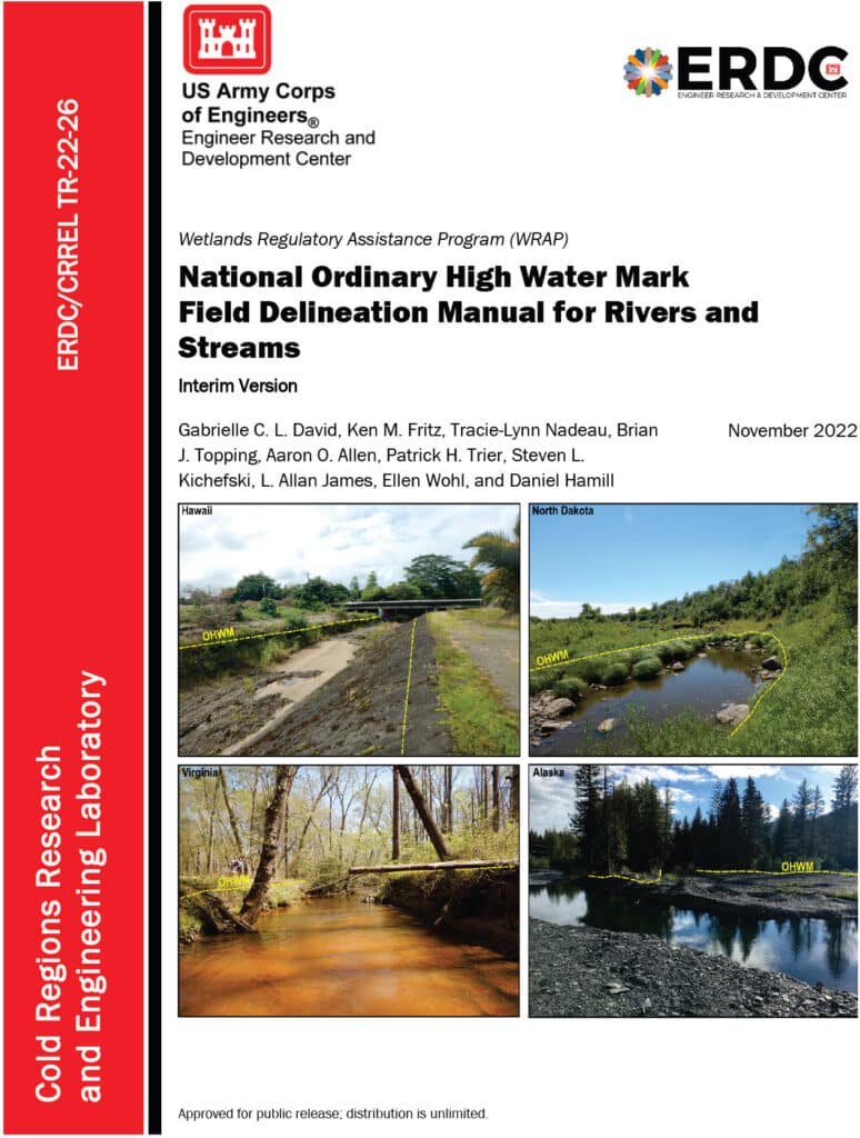
An image of the cover of the National Ordinary High Water Mark Field Delineation Manual for Rivers and Streams.

Diving into the National Ordinary High Water Mark (NOHWM) Manual

The National Ordinary High Water Mark (NOHWM) Manual serves as a detailed guide for environmental professionals to accurately identify the Ordinary High Water Mark (OHWM) in various landscapes. The OHWM represents the boundary between jurisdictional waters and upland areas, making it a crucial concept for environmental assessments.

Key Components of NOHWM:

  1. Physical Characteristics: The manual outlines physical indicators that signify the presence of an OHWM. These include:
  • Clear Natural Line: Look for a visible line on the bank formed by the regular presence of water.
  • Soil Changes: Notice differences in soil color, texture, or composition that indicate historical water presence.
  • Vegetation Patterns: Identify areas where terrestrial vegetation is absent or altered due to frequent inundation.
  • Litter and Debris: Examine the accumulation of organic and inorganic materials deposited by water flow.
  1. Regional Adaptations: The NOHWM Manual acknowledges the diversity of the US landscape, providing region-specific guidelines to account for varying hydrological and geomorphological conditions.
  2. Field Procedures: The manual details systematic field procedures, ensuring consistency and accuracy across assessments. This includes standardized data collection techniques, field forms, and documentation practices.

The Weight of Evidence Approach in NOHWM

A critical concept in the NOHWM approach is the “weight of evidence” (WOE) methodology. This approach ensures that multiple lines of evidence are considered when determining the OHWM, providing a more robust and defensible delineation.

Weight of Evidence Approach:

  1. Multiple Indicators: Instead of relying on a single indicator, the WOE approach integrates various physical, hydrological, and biological indicators. This multi-faceted analysis helps in cross-verifying the presence and extent of OHWM.
  2. Corroborative Evidence: Indicators such as changes in soil, vegetation patterns, and physical markings on the bank are examined together. Consistency among these indicators strengthens the determination of OHWM.
  3. Contextual Analysis: The WOE approach considers the broader landscape and hydrological context, including historical data and regional characteristics, ensuring that the delineation is not only accurate but also contextually relevant.
  4. Documentation and Transparency: Detailed documentation of all evidence and indicators used in the assessment is crucial. This transparency enhances the defensibility of the OHWM determination.
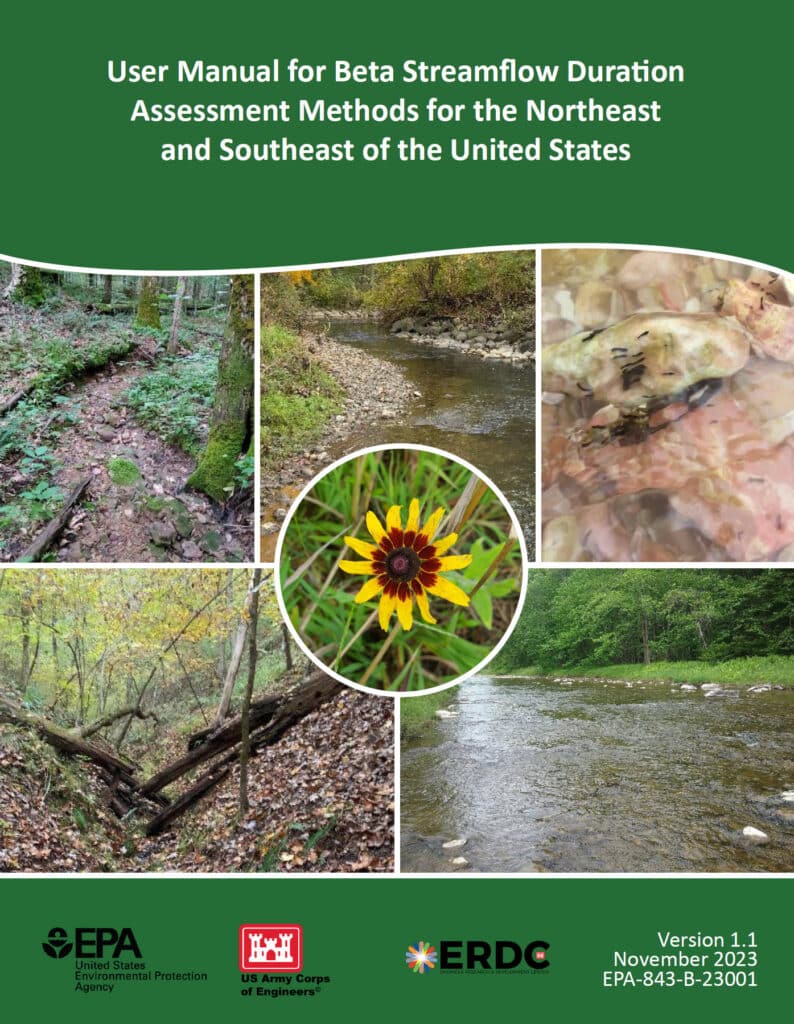
An image of the cover of the User Manual for Beta Streamflow Duration Assessment Methods for the Northeast and Southeast of the United States

Stream Duration Assessment Method (SDAM): A Closer Look

For scientists engaged in stream assessments, the Stream Duration Assessment Method (SDAM) is a game-changer. It allows for precise classification of streams based on their flow duration, which is essential for determining their jurisdictional status.

Stream Classifications:

  1. Ephemeral Streams: These streams flow only during and immediately after precipitation events. As a scientist, identifying ephemeral streams involves recognizing temporary water flow patterns and minimal biological activity.
  2. Intermittent Streams: These streams flow during certain times of the year, such as the wet season, but not continuously. Intermittent streams show clear signs of seasonal aquatic life and sediment patterns.
  3. Perennial Streams: Perennial streams flow year-round and are typically considered jurisdictional. These streams support continuous aquatic habitats and show persistent hydrological and biological indicators.

SDAM Assessment Process:

  1. Field Observations: Conduct site visits to observe physical characteristics like bed and bank features, sediment deposits, and biological indicators such as the presence of aquatic organisms and specific plant species.
  2. Hydrological Data Review: Examine historical flow records, precipitation data, and stream gauge information to understand the stream’s flow regime over time.
  3. Biological Indicators: Identify the presence of certain aquatic organisms and plant species that thrive in continuous or seasonal water flow, offering insights into the stream’s duration and consistency.

Integrating NOHWM and SDAM for WOTUS Determinations

The integration of the NOHWM and SDAM methodologies provides a robust framework for determining whether a water body qualifies as WOTUS. For environmental scientists, this integration involves a meticulous blend of physical, hydrological, and biological assessments.

Determination Process:

  1. Preliminary Assessment: Begin with a thorough desktop review, using maps, aerial photos, and existing hydrological data to identify potential jurisdictional waters.
  2. Field Verification: Conduct on-site inspections to validate preliminary findings. Observe physical indicators of OHWM and perform SDAM assessments to classify stream types accurately.
  3. Data Integration: Combine field observations with historical and current hydrological data. This comprehensive dataset aids in making well-informed determinations of a water body’s jurisdictional status.
  4. Documentation and Reporting: Prepare detailed reports that document findings, methodologies, and justifications for the jurisdictional status. These reports provide transparency and serve as a basis for regulatory decisions.

The Environmental Significance of NOHWM and SDAM

For environmental scientists, the accurate identification of jurisdictional waters is paramount. Here’s why:

  1. Protecting Ecosystems: Correctly delineating WOTUS ensures the preservation of vital aquatic ecosystems, protecting them from pollution and degradation.
  2. Ensuring Compliance: Clear identification helps landowners, developers, and other stakeholders understand their obligations under the Clean Water Act, preventing unauthorized activities that could harm protected waters.
  3. Resource Management: Informed decision-making for water resource management, conservation planning, and habitat restoration efforts becomes possible, benefiting both the environment and the communities that rely on these resources.

Conclusion

The National Ordinary High Water Mark Manual (NOHWM) and the Stream Duration Assessment Method (SDAM) are indispensable tools for environmental scientists working to delineate jurisdictional Waters of the United States (WOTUS). By applying these methodologies, the US Army Corps of Engineers ensures that water bodies deserving of protection under the Clean Water Act are accurately identified and managed. For environmental professionals, mastering these methods is not just about regulatory compliance—it’s about playing a critical role in safeguarding the health and integrity of our nation’s precious water resources. Through diligent application of NOHWM and SDAM, we can continue to protect and sustain our aquatic ecosystems for future generations.

Unlocking Wetland Potential: Your Guide to USDA’s Wetland Mitigation Banking Program

farm near wetland

Introduction to the USDA Wetland Mitigation Banking Program (WMBP)

Illustration of a farm adjacent to a wetland.

The U.S. Department of Agriculture (USDA) has allocated nearly $5 million in grants to support the Wetland Mitigation Banking Program (WMBP). This funding enhances the restoration, creation, or enhancement of wetlands to offset impacts from other locations. Since 2016, over $12.4 million has been awarded to partners in 11 states, leading to the establishment of 21 wetland bank sites.

The USDA recently presented a webinar focused on the Wetland Mitigation Banking Program (WMBP), which supports the development of mitigation banks to restore, create, or enhance wetlands. The webinar provided detailed insights into the process and requirements for establishing a wetland mitigation bank, covering topics such as program overview, application process, site selection, interagency review, Mitigation Banking Instrument (MBI), monitoring and management, credit release and sales, and case studies.

Webinar Summary

The WMBP Applicant Webinar provides detailed insights into the process and requirements for establishing a wetland mitigation bank. The following key topics are covered:

1. Program Overview

Wetland mitigation banking is a market-based approach that involves restoring, creating, enhancing, or preserving wetlands to compensate for unavoidable impacts on wetlands elsewhere. The program aims to ensure no net loss of wetland functions and values. Mitigation banks offer credits to developers and other entities needing to offset their environmental impacts.

2. Application Process

The application process involves several critical steps:

  • Project Proposal: Outline the purpose, need, and benefits of the proposed mitigation bank.
  • Site Plan: Provide detailed plans including maps, design specifications, and ecological goals.
  • Financial Assurances: Demonstrate financial capability to complete the project and manage the site long-term.

3. Site Selection and Design

Selecting an appropriate site is crucial. Key criteria include:

  • Ecological Viability: The site should support the target wetland type and functions.
  • Hydrology and Soils: The site must have suitable hydrological and soil conditions.
  • Connectivity: Proximity to other wetlands or protected areas can enhance ecological benefits.

Design considerations involve creating a site plan that outlines:

  • Grading and Hydrologic Modifications: Ensure proper water flow and retention.
  • Vegetation Plans: Use native species to establish a resilient wetland ecosystem.

4. Interagency Review

The Interagency Review Team (IRT) plays a pivotal role in evaluating and approving mitigation bank proposals. The IRT typically includes representatives from:

  • USDA: Provides guidance on agricultural and conservation practices.
  • USACE: Oversees compliance with the Clean Water Act.
  • EPA: Ensures environmental protection standards are met.
  • State and Local Agencies: Address regional environmental concerns and regulations.

5. Mitigation Banking Instrument (MBI)

The MBI is a detailed agreement that outlines the terms and conditions of the mitigation bank, including:

  • Objectives: Clear goals for wetland restoration or creation.
  • Site Plans: Detailed maps and design specifications.
  • Credit Release Schedule: Timeline for when credits become available based on performance milestones.
  • Long-Term Management: Plans for ongoing maintenance and monitoring to ensure sustainability.

Public notice and comment are integral to the MBI approval process, allowing stakeholders to review and provide feedback.

6. Monitoring and Management

Continuous monitoring is essential to track the bank’s progress and ensure it meets ecological performance standards. Key aspects include:

  • Monitoring Plan: Outlines methods for assessing vegetation, hydrology, and wildlife.
  • Adaptive Management: Strategies to address unforeseen issues and make necessary adjustments to management practices.

7. Credit Release and Sales

Credits represent the restored or enhanced wetland functions and are released in phases as performance milestones are met. The process involves:

  • Performance Milestones: Specific ecological benchmarks that must be achieved.
  • Credit Sales: Developers and other entities purchase credits to offset their environmental impacts, providing financial support for the bank.

8. Case Studies

The webinar highlights several successful wetland mitigation banks to illustrate best practices and lessons learned. These examples showcase innovative approaches to site selection, design, and management that have led to successful restoration and long-term sustainability.

Conclusion

Setting up a wetland mitigation bank with the USDA involves detailed planning, interagency coordination, and commitment to long-term ecological monitoring and management. Adhering to these steps ensures the success and sustainability of wetland mitigation banks. For more information, watch the full webinar here.

North Carolina’s Weird and Wonderful: Eastern Narrow-mouthed Toad

Illustration of several toad species resting on a log by a temporary wetland in a lush forest.

North Carolina is home to many amphibians, but unfortunately for all you Order Caudata fans out there, this article will not be about a salamander (our state is home to over 60 species, making it the place for salamander diversity in the world). No, today we are going to focus on the Eastern Narrow-mouthed toad. This small, somewhat tear-dropped shaped creature more closely resembles a frog: they have smooth, moist skin and lack warts. Their name comes from the tiny, inconspicuous mouth that they have on their small, pointy heads. Narrow-mouthed toads come in a variety of colors, ranging from gray to brown and reddish brown, but all tend to have a lighter-colored band along each side of their body. A fold of skin stretches across the back of their head, putting the finishing touch on these weird little toads.

Close-up photograph of a darker-colored Eastern Narrow-mouthed Toad.

Close-up photo of Gastrophryne carolinensis, Eastern Narrow-mouthed Toad, by Todd Pierson. Courtesy of Herps of NC

Small, plump, and nocturnal, these toads are often hard to spot in the wild, though their call, a nasally, lamb-like bleat, is distinctive. If you are in the Mountain or upper Piedmont regions of the Carolinas and Virginia, you probably will not hear them; but if you travel to the lower Piedmont and the Coastal Plain areas, there is a good chance you will start to hear their call beginning in April and continuing all the way into October. Narrow-mouthed toads (due to their, well, narrow mouths) cannot eat very large prey items. They can, and do, spend their nights feasting on small ants and termites, often being spotted near anthills, if they are spotted at all. Their skin secretions protect them from the ants and, as an added bonus, are also irritating to the eyes and mucous membranes of humans. During the day, these weird and wonderful animals stay put, hiding in moist areas under logs, leaf litter, and rocks.

Close-up photograph of a lighter-colored Eastern Narrow-mouthed Toad.

Close-up photo by Kevin Stohlgren. Courtesy of Herps of NC.

Breeding for this species occurs from April through the fall on warm nights, usually during or after heavy rains. Narrow-mouthed toads tend to gather around temporary wetlands, such as ditches, puddles, and flooded fields. Black-and-white eggs are laid in packets on the water’s surface, with each packet containing around 850 eggs. Once they hatch, the tadpoles will metamorphose into tiny toads in anywhere from three to ten weeks. Narrow-mouthed toads are not an endangered or threatened species in North Carolina; however, they are vulnerable to the same pressures facing other amphibian species in the state. Protecting natural spaces where temporary pools of water can form will aid many amphibians. In order to ensure that the narrow-mouthed toad remains in existence for many years to come, we need to exercise good stewardship of the numerous wetland ecosystems found within our wonderfully species-diverse, amphibian-rich state.

Understanding the 2023 Revised WOTUS Rule: Aligning Federal Water Regulations with Supreme Court Guidance

A beautifully illustrated waterway

The revised rule defining “Waters of the United States” (WOTUS) under the Clean Water Act was significantly influenced by the Supreme Court’s decision in the case of Sackett v. EPA. This 2023 amendment refines the scope of waters that are federally regulated, emphasizing the necessity for them to have more permanent, physical connections to traditional navigable waters.

Key Elements of the Revised WOTUS Rule:

  1. Narrowed Definition: The new rule focuses on waters that are:
    • Traditionally navigable waters, including oceans and large rivers.
    • Perennial and intermittent tributaries that contribute flow to traditional navigable waters.
    • Certain lakes, ponds, and impoundments of jurisdictional waters.
    • Wetlands adjacent to other jurisdictional waters that meet specific criteria for a direct hydrological surface connection.
  2. Exclusions: The rule specifically excludes:
    • Features that only contain water in response to rainfall.
    • Groundwater.
    • Many ditches, including most roadside and farm ditches.
    • Prior converted cropland.
    • Waste treatment systems.
  3. Implementation Status: As mentioned, the implementation of this rule is currently mixed due to ongoing litigation:
    • In 23 states, plus the District of Columbia and U.S. Territories, the 2023 rule is in effect.
    • In 27 other states, authorities continue to use the pre-2015 regulatory definitions pending further court decisions.
  4. Legal and Regulatory Framework: The rule is designed to align with the Supreme Court’s narrower interpretation which limits federal jurisdiction to those waters with a significant nexus to navigable waters.
  5. Impact on Regulatory Practices: This revision affects how businesses and landowners manage their land and water resources, particularly concerning permits for development and land use changes.

The practical application of these changes means that permit requirements may vary significantly depending on the state and the nature of the water bodies involved. This complexity underscores the need for ongoing legal guidance and compliance strategies for those affected by these regulations.

For complete details on the regulatory definitions and implications, you can view the official documentation and additional resources provided by the EPA on their WOTUS Rule Information Page.