Product Description
The most widely used methodology for collecting data for the purposed of determining the presence of a hydrophytic plant community is the visual estimation of percent cover by strata. This method is quick but it is also highly inaccurate. A 2015 study by The Food and Agriculture Organization of The United Nations entitled, “Testing field methods for assessing the forest protective function for soil and water” was conducted to assess four different field sampling methods including the visual assessment method used by the Corps. The conclusion of this study is that the visual assessment method is the method is, “not really precise, very subjective evaluation, not very quantifiable.”
We at the Swamp School have observed similar results. In separate studies we have observed as much as a 70% variance (error) between one individual and another observing the same plant community. This hold true for new delineators and experienced delineators. The only benefit to experienced delineators was that they tended to be more consistent from site to site, yet the variance between users remained high.
The problem is that vegetation data collected in the field needs to be consistent between the consultant and the US Army Corps. Two individuals looking at the same vegetation plot should be able to be within a few percent of each other in the description of the vegetation community. Given the recent Supreme Court ruling (USACOE v. Hawkes) that Jurisdictional Determinations are final agency actions that can be appealed in court, would you want to present your visual guess in a court of law?
Fortunately, the US Army Corps of Engineers Wetland Delineation Regional Supplements contain a solution to this dilemma. Appendix B of the Supplements includes a little used but highly accurate Point Intercept Sampling Procedure for Determining Hydrophytic Vegetation. This method was also assessed in the UN study and was the “most accurate, least expensive, and most easily applied among the four methods tests. This method is scientifically accurate and records forest canopy and floor cover as a set.
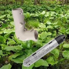
To help you get started the Swamp School is sponsoring an online workshop using the Corps’ Point Intercept Sampling Procedure for Determining Hydrophytic Vegetation. You will learn how to will set up study plots and collect data using a wetland densiometer. Each student will be provided with their own Wetland Densiometer as part of the tuition. Special wetland point intercept data forms will also be provided as well as a written procedure and formula for determining if the plant community is hydrophytic.

It is important to note that this “new” methodology is not actually new. It has been published in the Corps wetland regional supplements for years and can be used at any time.
One other shocking aspect of the point intercept method is that in addition to being more accurate it turns out to be much quicker than the traditional visual estimation methods.
Online Workshop Includes:
- Wetland Densiometer (Please allow 2 weeks shipping)
- 90 days access to all workshop materials including:
- Video presentation
- Data form printable handouts
- Downloadable instruction guide
- Links to other resource materials
- Direct access to instructor for questions and support
Continuing Education Credit Hours: 2 (Certificate of Training will be provided and can be used for SWS certification).

